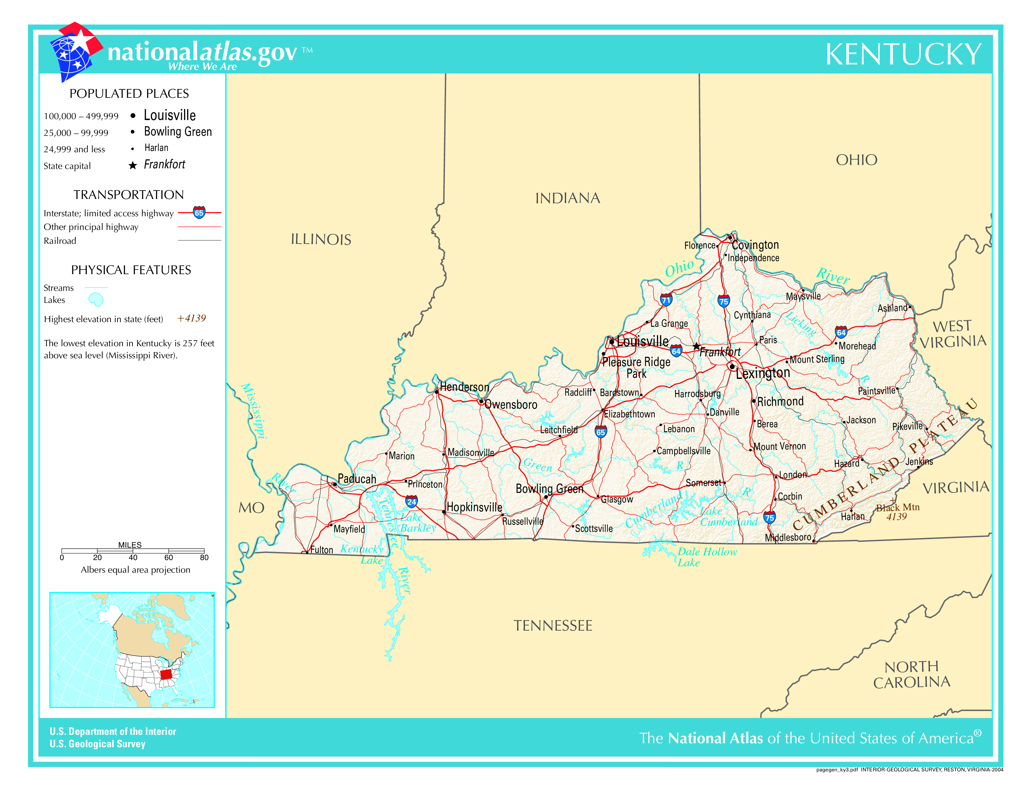
The map of Kentucky above and the maps below are part of the US government’s now closed NationalAtlas.gov project.
However, they are too good to be lost forever so I’ve preserved them here.
You can learn more about the project and why it was closed down here.
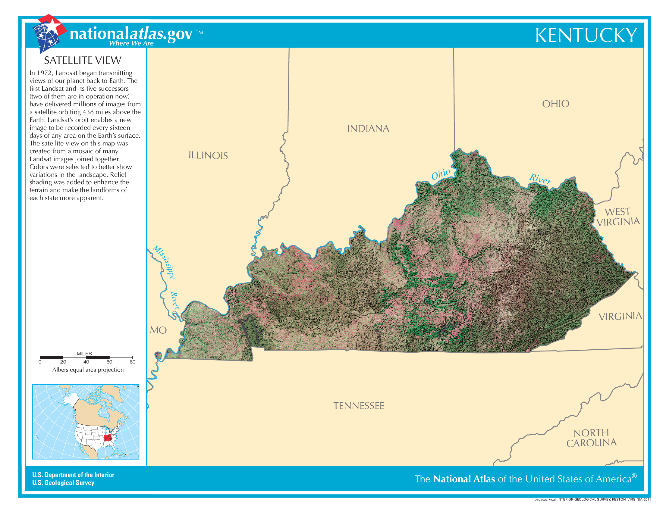
Satellite Map Of Kentucky
General Kentucky State Facts
Demonym: Kentuckian
State Abbreviation: KY
Year Admitted To US: 1792
State Number (Out of 50): 15th
State Capital: Frankfort
Total Area: 40,408 sq mi (104,656 km2)
State Area Ranking (Out of 50): 37th
Highest Point: Black Mountain – 4,139 ft (1262 m)
Lowest Point: 257 ft (78 m)
State Website: https://kentucky.gov/
List of Interstate Highways In Kentucky
- I-24
- I-64
- I-65
- I-69
- I-71
- I-75
- I-165
- I-264
- I-265
- I-169
- I-369
- I-275
- I-471
List of US Highways In Kentucky
- US 119
- US 123
- US 143
- US 150
- US 168
- US 227
- US 241
- US 25
- US 42
- US 431
- US 460
- US 641
- US 68
- US 79
List of Toll Roads In Kentucky
- Kennedy Bridge
- Lewis and Clark Bridge
- Lincoln Bridge
Did you known Route 80 is the longest road in Kentucky at 464.936 mi (748.242 km).
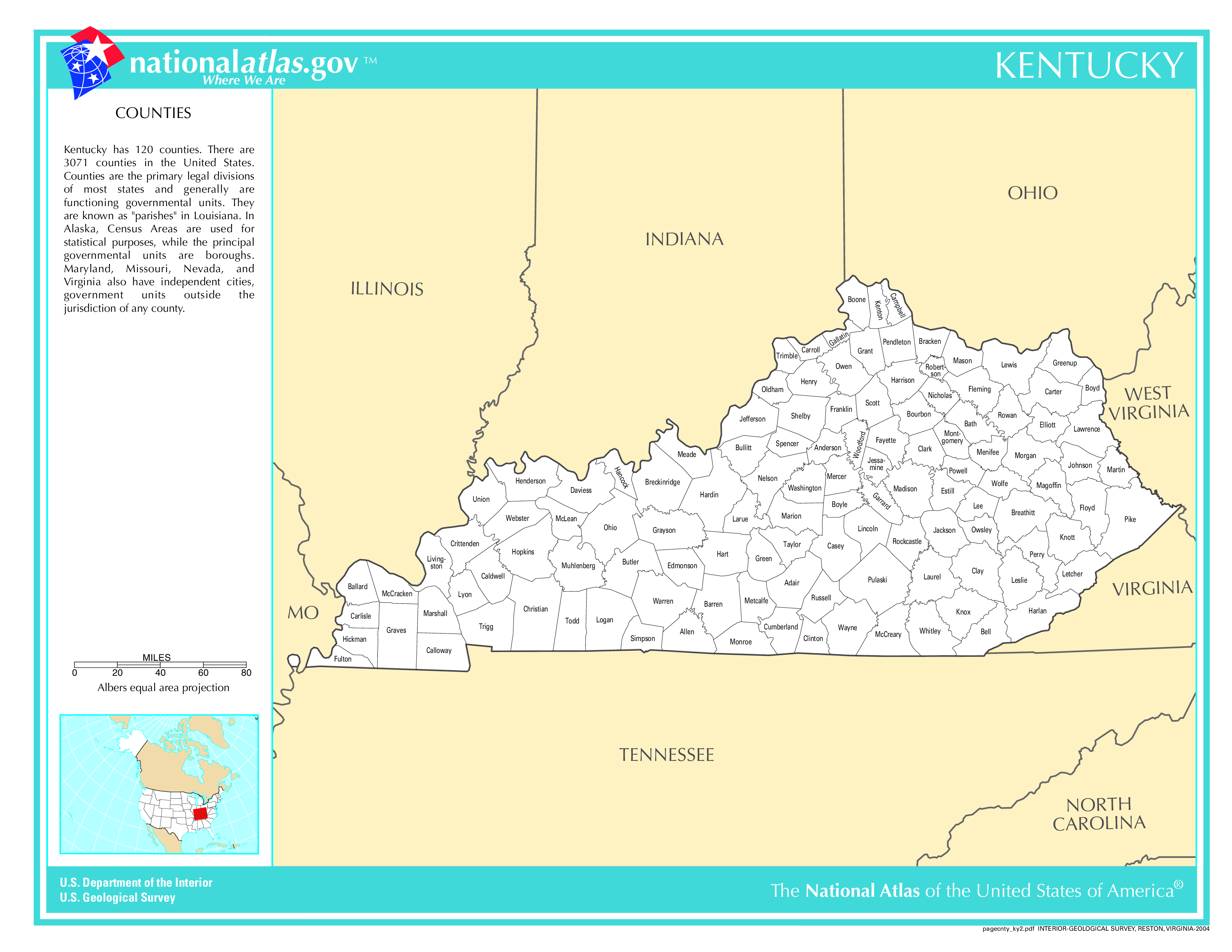
Kentucky County Map
Kentucky County Map With Important Cities & Towns
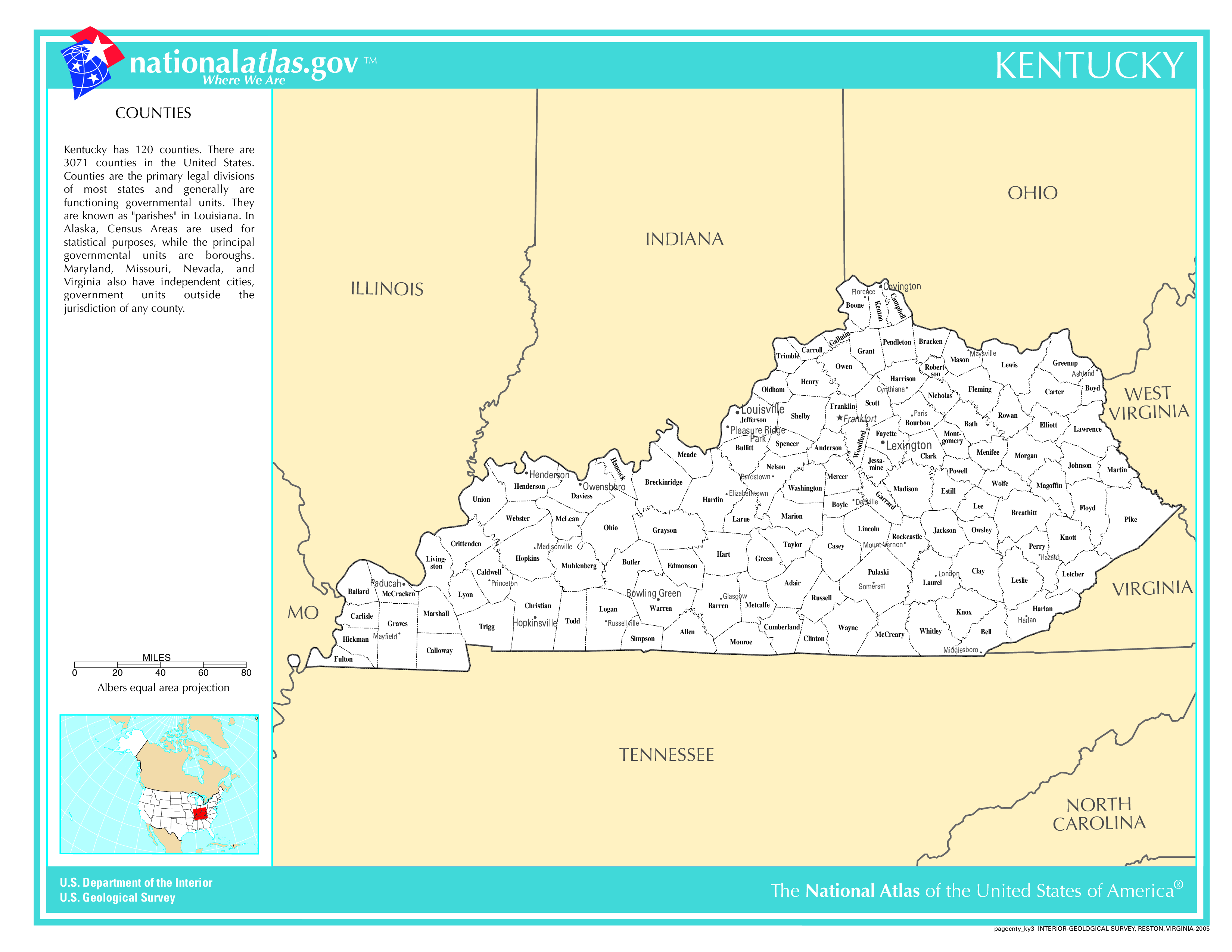
You can see more Kentucky county maps here.
Kentucky Population Density Map
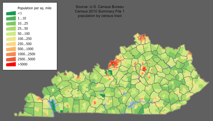
Kentucky Population Facts
State Population: 4,526,154
State Population Rank (out of 50): 26th
Population Density: 115/sq mi (44/km2)
Population Density Rank (out of 50): 24th
Top 10 Cities In Kentucky
- Louisville: 622,981
- Lexington-Fayette urban county: 320,154
- Bowling Green: 76,212
- Owensboro: 60,140
- Covington: 40,972
- Georgetown: 39,462
- Richmond: 37,206
- Elizabethtown: 32,978
- Florence: 32,917
- Nicholasville: 32,425
Kentucky Income & Taxes
Median Household Income: 55,880
Household Income Rank (out of 50): 47th
Top Marginal State Income Tax Rate: 4.00%
Average Sales Tax Rate*: 6.00%
Average Property Tax Rate*: 0.83%
* Note theses vary from city to city within the state.
Map of Kentucky Lakes & Rivers
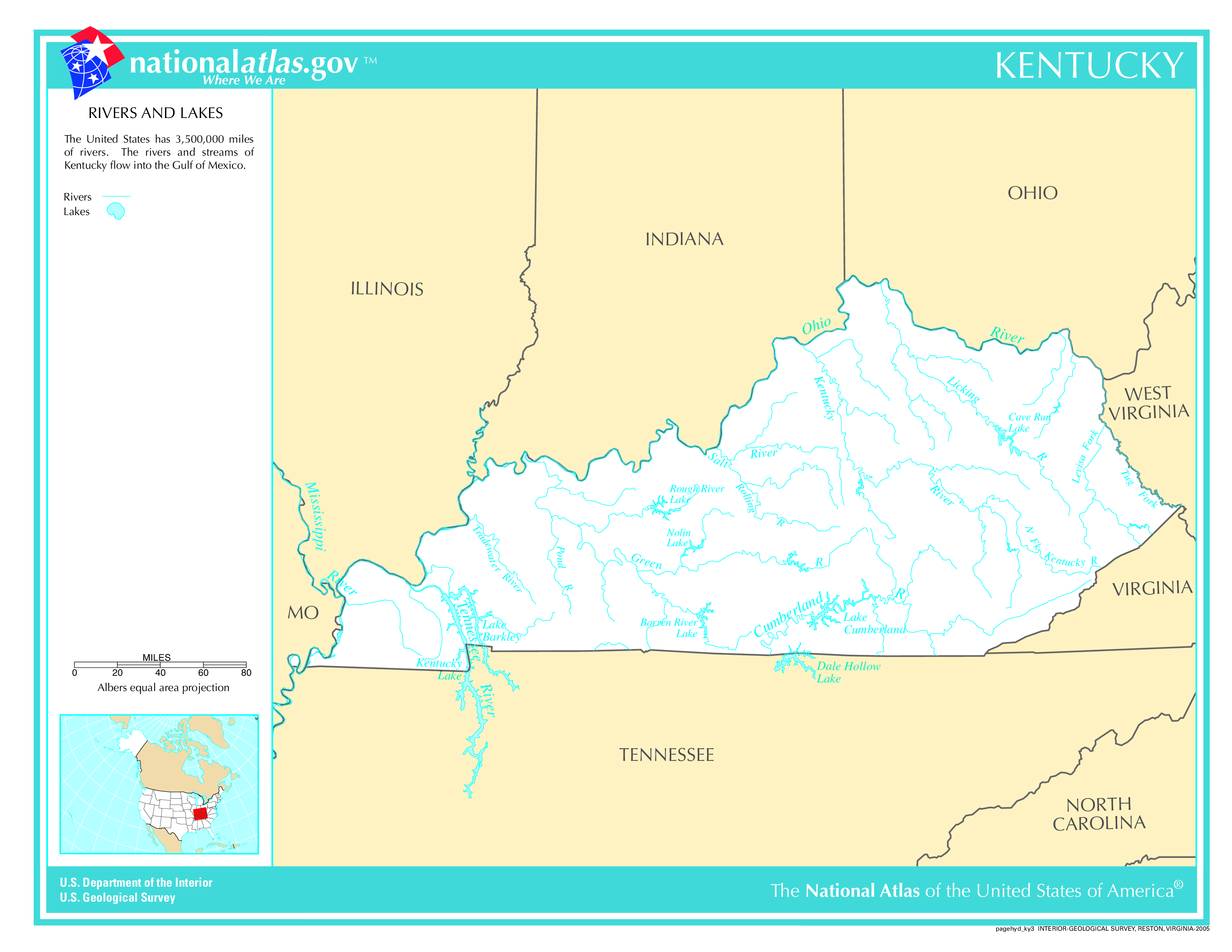
Largest Lake In Kentucky: Lake Cumberland 102 (sq mi)
Longest River In Kentucky: Mississippi River 2,320 miles (3,730 km)
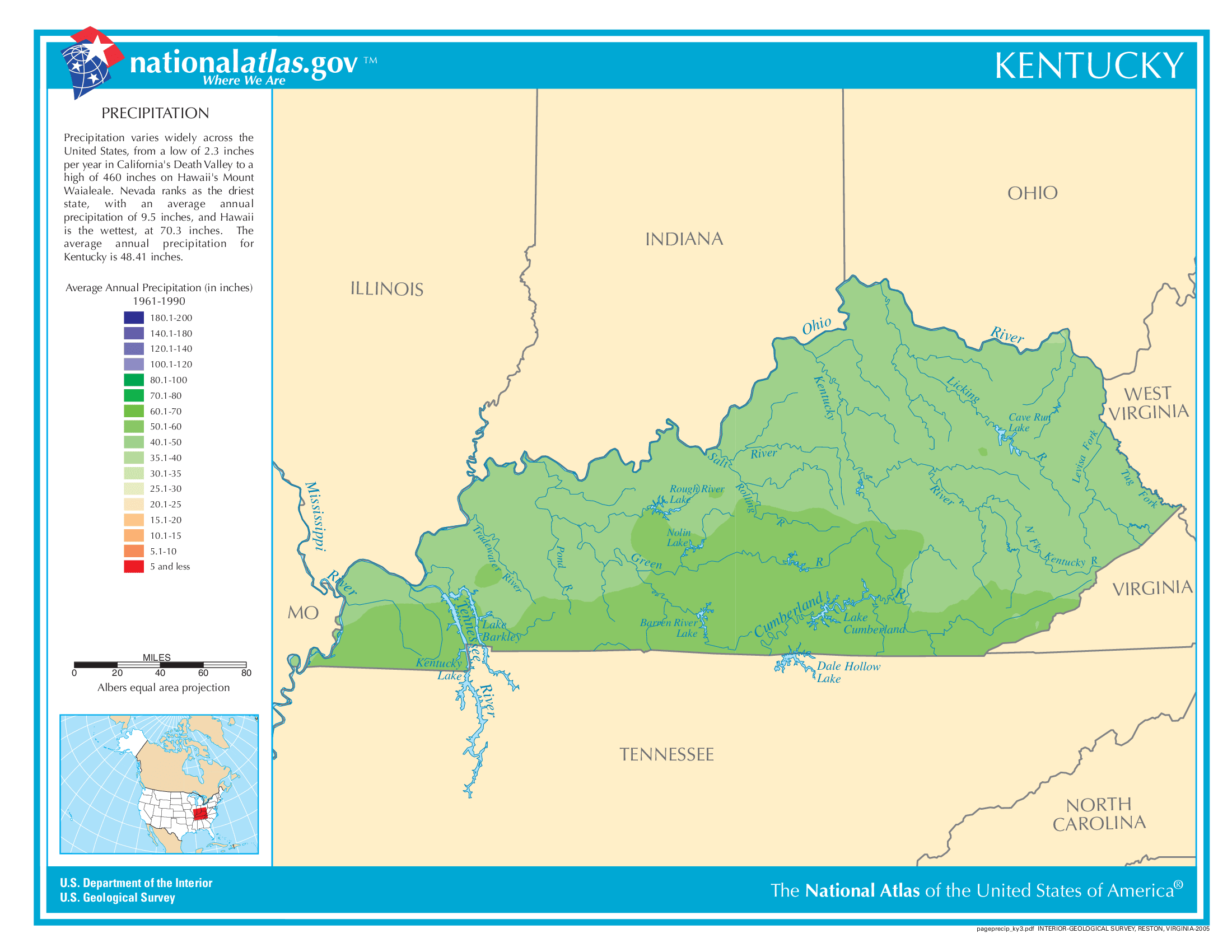
Kentucky Annual Precipitation Map
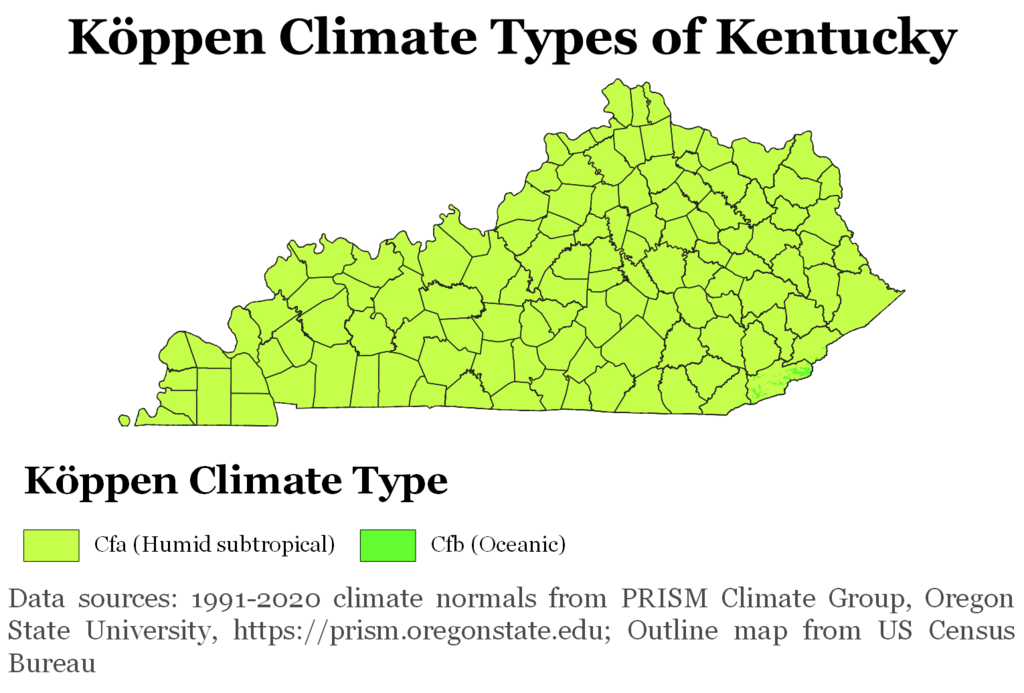
Kentucky Köppen Climate Map
How To Find Kentucky On A Map Of The United States
