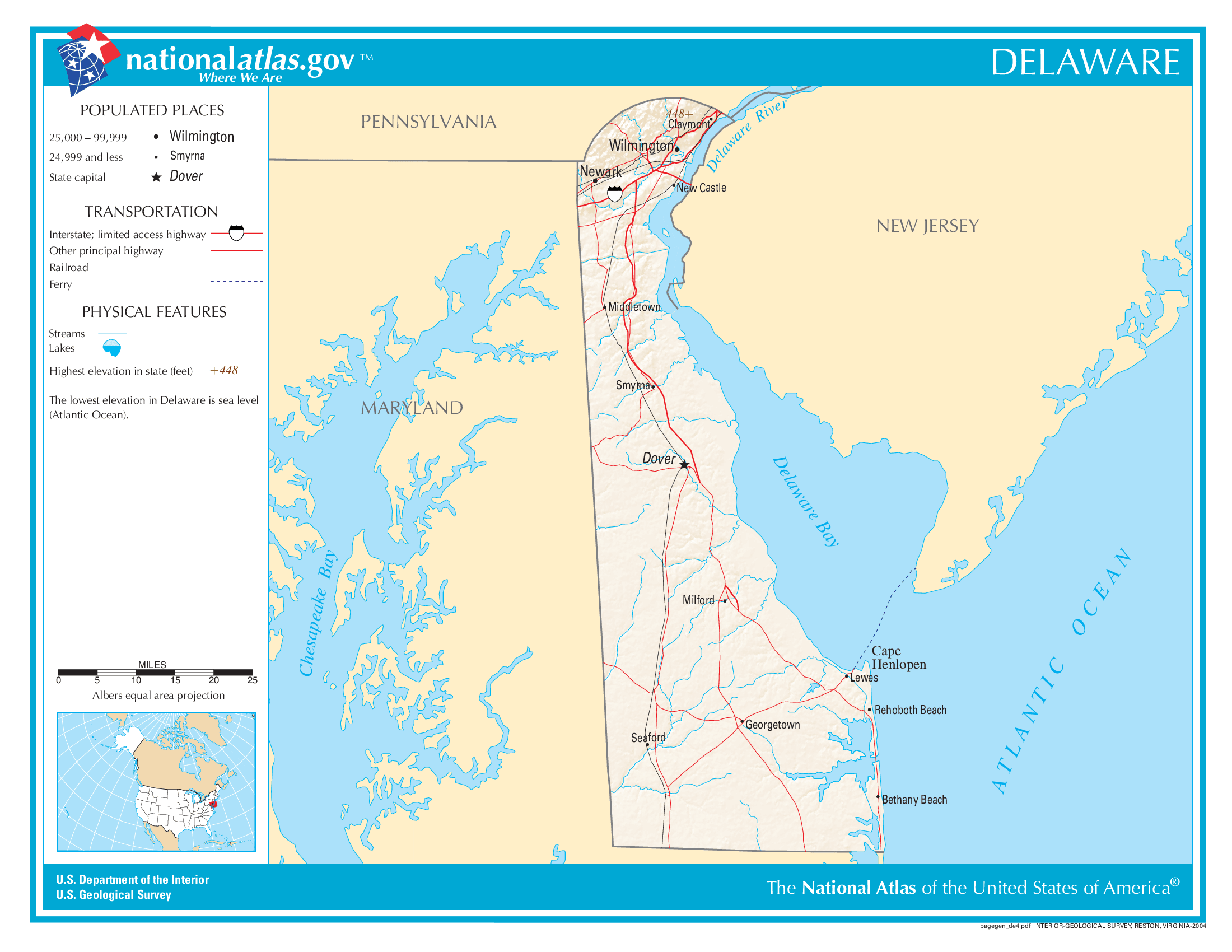
The map of Delaware above and the maps below are part of the US government’s now closed NationalAtlas.gov project.
However, they are too good to be lost forever so I’ve preserved them here.
You can learn more about the project and why it was closed down here.
General Delaware State Facts
Demonym: Delawarean
State Abbreviation: DE
Year Admitted To US: 1787
State Number (Out of 50): 1st
State Capital: Dover
Total Area: 2,489 sq mi (6,446 km2)
State Area Ranking (Out of 50): 49th
Highest Point: Near the Ebright Azimuth – 449 ft (137 m)
Lowest Point: 0 ft (0 m)
State Website: https://www.delaware.gov/
List of Interstate Highways In Delaware
- I-95
- I-295
- I-495
List of US Highways In Delaware
- US 113
- US 122
- US 202
- US 301
- US 9
List of Toll Roads In Delaware
- I-95 / Delaware Turnpike
- DE 1 (Korean War Veterans Highway)
- US 301 (First Responders Memorial Highway)
Did you known Route 1 is the longest road in Delaware at 103.02 mi (165.79 km).
Delaware County Map
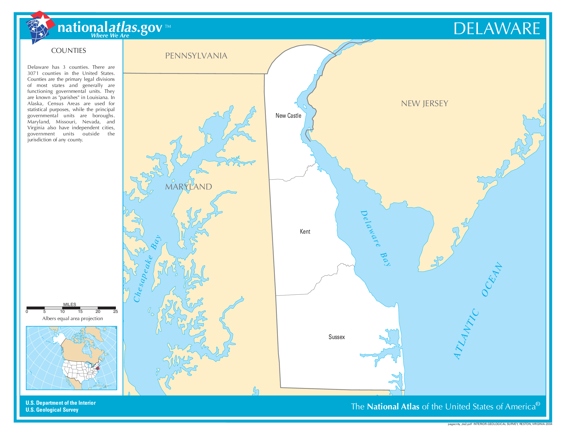
Delaware County Map With Important Cities & Towns

You can see more Delaware county maps here.
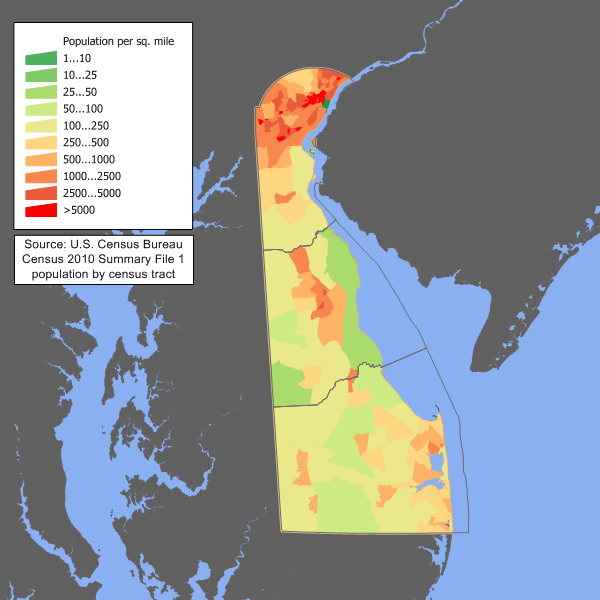
Delaware Population Density Map
Delaware Population Facts
State Population: 1,031,890
State Population Rank (out of 50): 45th
Population Density: 529/sq mi (204/km2)
Population Density Rank (out of 50): 6th
Top 10 Cities In Delaware
- Wilmington: 71,675
- Dover: 39,894
- Newark: 30,169
- Middletown: 25,022
- Milford: 13,289
- Smyrna town: 13,277
- Seaford: 8,735
- Georgetown town: 7,873
- Millsboro town: 7,637
- Elsmere town: 6,157
Delaware Income & Taxes
Median Household Income: 80,750
Household Income Rank (out of 50): 15th
Top Marginal State Income Tax Rate: 6.60%
Average Sales Tax Rate*: 0.00%
Average Property Tax Rate*: 0.61%
* Note theses vary from city to city within the state.
Map of Delaware Lakes & Rivers
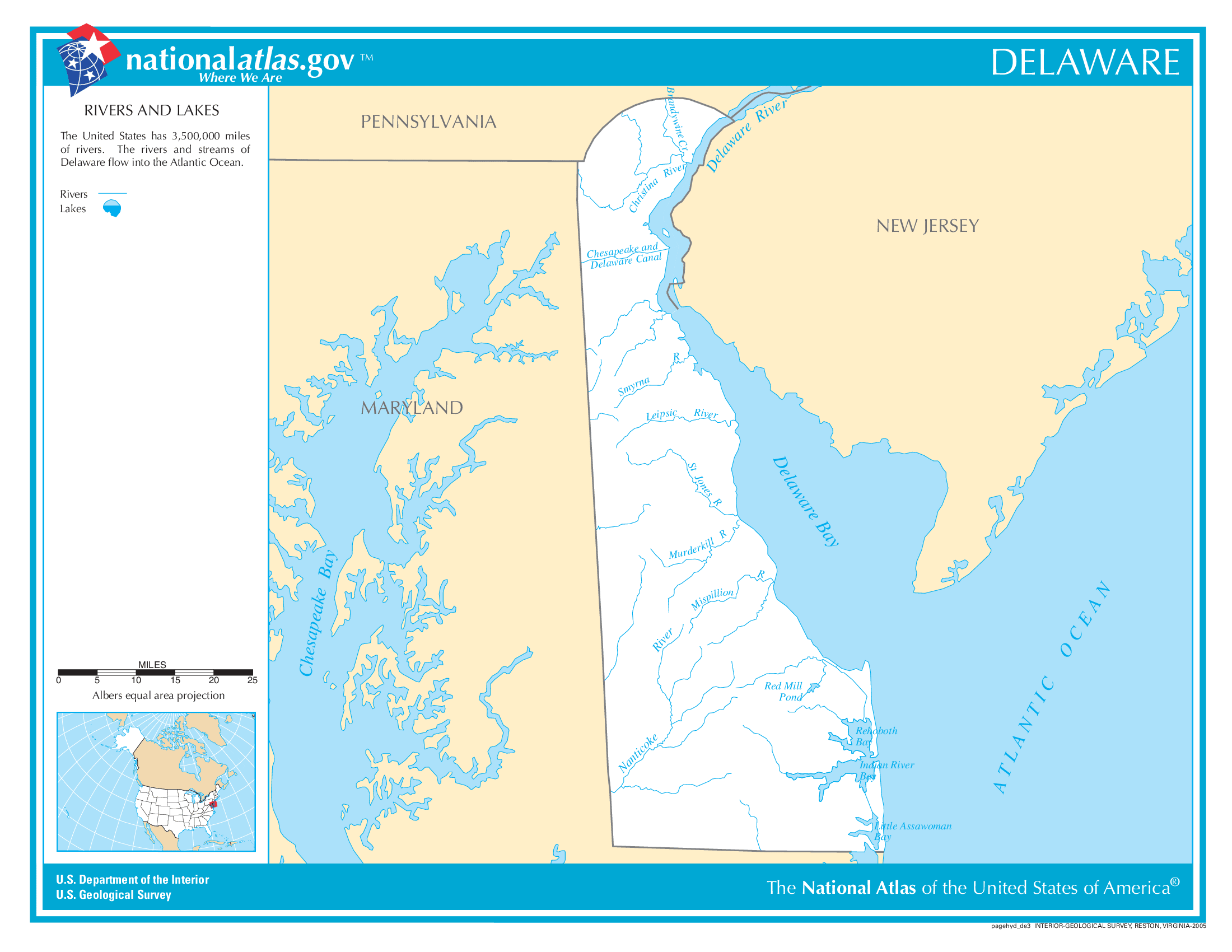
Largest Lake In Delaware: Lums Pond 0.31 (sq mi)
Longest River In Delaware: Delaware River 301 miles (484 km)
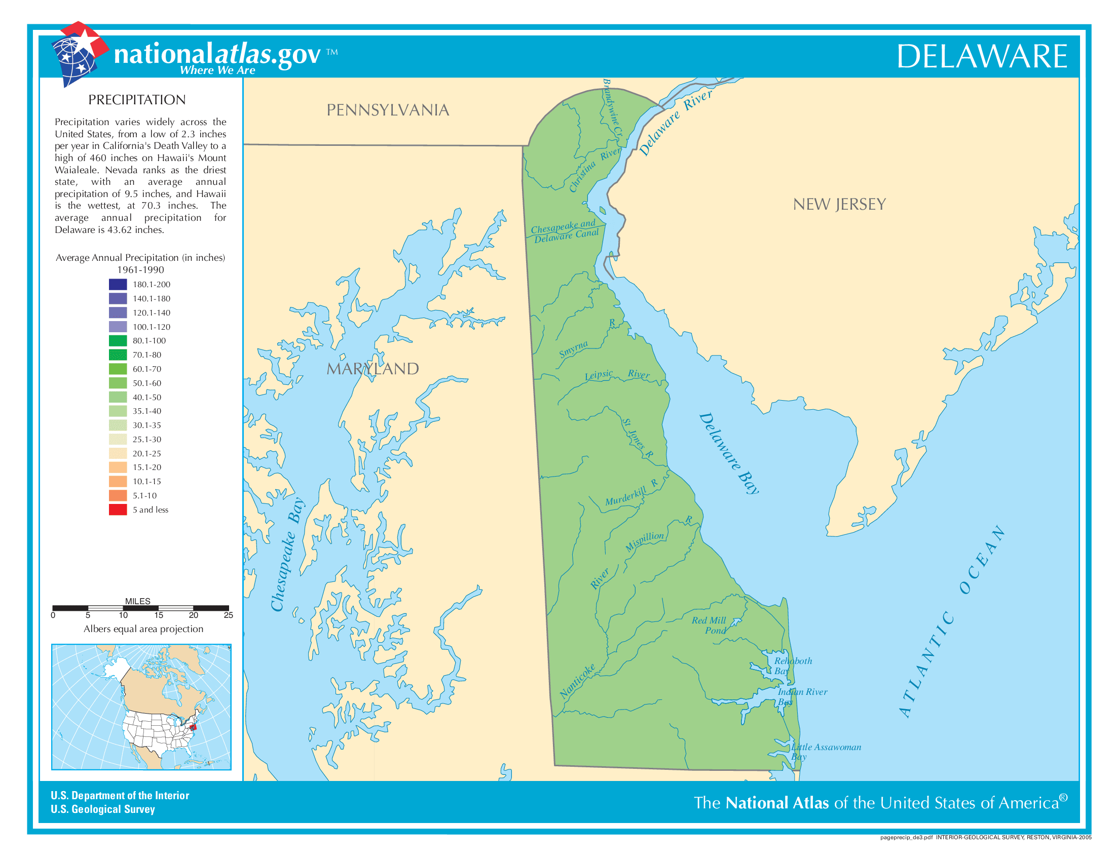
Delaware Annual Precipitation Map
Delaware Köppen Climate Map
