The map of South Carolina above and the maps below are part of the US government’s now closed NationalAtlas.gov project.
However, they are too good to be lost forever so I’ve preserved them here.
You can learn more about the project and why it was closed down here.
Satellite Map Of South Carolina

General South Carolina State Facts
Demonym: South Carolinian
State Abbreviation: SC
Year Admitted To US: 1788
State Number (Out of 50): 8th
State Capital: Columbia
Total Area: 32,020 sq mi (82,933 km2)
State Area Ranking (Out of 50): 40th
Highest Point: Sassafras Mountain – 3,554 ft (1083 m)
Lowest Point: 0 ft (0 m)
State Website: https://www.sc.gov/
List of Interstate Highways In South Carolina
- I-20
- I-26
- I-73
- I-74
- I-77
- I-85
- I-95
- I-126
- I-326
- I-520
- I-526
- I-185
- I-385
- I-585
List of US Highways In South Carolina
- US 123
- US 15
- US 176
- US 178
- US 21
- US 217
- US 276
- US 278
- US 321
- US 378
- US 401
- US 501
- US 52
- US 521
- US 601
- US 701
- US 78
List of Toll Roads In South Carolina
- I-185 (Southern Connector)
Did you known Highway 9 is the longest road in South Carolina at 257 mi (414 km).
South Carolina County Map

South Carolina County Map With Important Cities & Towns

You can see more South Carolina county maps here.
South Carolina Population Density Map

South Carolina Population Facts
State Population: 5,373,555
State Population Rank (out of 50): 23rd
Population Density: 179/sq mi (69/km2)
Population Density Rank (out of 50): 18th
Top 10 Cities In South Carolina
- Charleston: 155,369
- Columbia: 142,416
- North Charleston: 121,469
- Mount Pleasant: 95,232
- Rock Hill: 75,654
- Greenville: 72,824
- Summerville town: 51,884
- Goose Creek: 49,249
- Greer: 44,387
- Sumter: 42,766
South Carolina Income & Taxes
Median Household Income: 61,770
Household Income Rank (out of 50): 43rd
Top Marginal State Income Tax Rate: 6.40%
Average Sales Tax Rate*: 7.50%
Average Property Tax Rate*: 0.57%
* Note theses vary from city to city within the state.
Map of South Carolina Lakes & Rivers

Largest Lake In South Carolina: Lake Marion 174 (sq mi)
Longest River In South Carolina: Savannah River 301 miles (484 km)
South Carolina Annual Precipitation Map

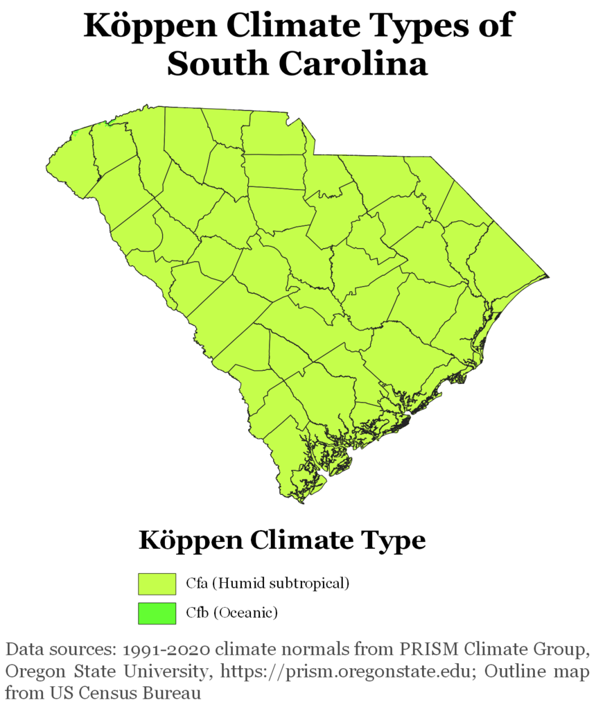
South Carolina Köppen Climate Map