The map of Nebraska above and the maps below are part of the US government’s now closed NationalAtlas.gov project.
However, they are too good to be lost forever so I’ve preserved them here.
You can learn more about the project and why it was closed down here.
Satellite Map Of Nebraska

General Nebraska State Facts
Demonym: Nebraskan
State Abbreviation: NE
Year Admitted To US: 1867
State Number (Out of 50): 37th
State Capital: Lincoln
Total Area: 77,348 sq mi (200,330 km2)
State Area Ranking (Out of 50): 16th
Highest Point: Panorama Point – 5,432 ft (1656 m)
Lowest Point: 840 ft (256 m)
State Website: https://www.nebraska.gov/
List of Interstate Highways In Nebraska
- I-76
- I-80
- I-129
- I-180
- I-480
- I-580
- I-680
List of US Highways In Nebraska
- US 136
- US 138
- US 26
- US 275
- US 283
- US 38
- US 383
- US 73
List of Toll Roads In Nebraska
- The Bellevue Bridge
- The Plattsmouth Bridge
Did you known Highway 92 is the longest road in Nebraska at 489.08 mi (787.1 km).
Nebraska County Map

Nebraska County Map With Important Cities & Towns

You can see more Nebraska county maps here.
Nebraska Population Density Map

Nebraska Population Facts
State Population: 1,978,379
State Population Rank (out of 50): 37th
Population Density: 26/sq mi (10/km2)
Population Density Rank (out of 50): 43rd
Top 10 Cities In Nebraska
- Omaha: 483,335
- Lincoln: 294,757
- Bellevue: 63,922
- Grand Island: 52,622
- Kearney: 34,362
- Fremont: 27,602
- Norfolk: 26,147
- Hastings: 24,896
- Columbus: 24,464
- Papillion: 23,791
Nebraska Income & Taxes
Median Household Income: 78,360
Household Income Rank (out of 50): 18th
Top Marginal State Income Tax Rate: 5.84%
Average Sales Tax Rate*: 6.97%
Average Property Tax Rate*: 1.63%
* Note theses vary from city to city within the state.
Map of Nebraska Lakes & Rivers

Largest Lake In Nebraska: Lake McConaughy 56 (sq mi)
Longest River In Nebraska: Missouri River 2,340 miles (3,770 km)
Nebraska Annual Precipitation Map

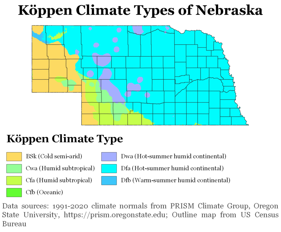
Nebraska Köppen Climate Map
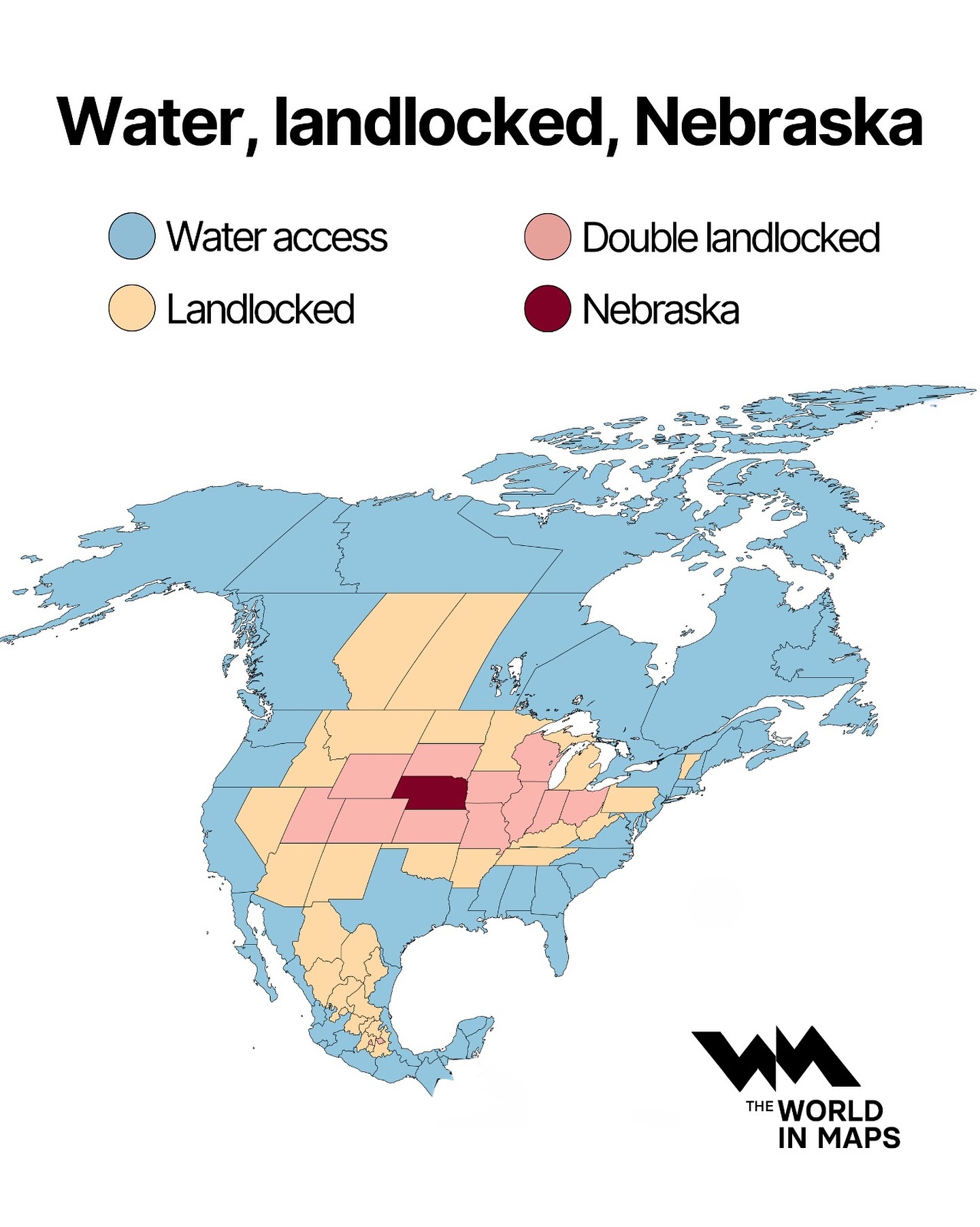
Water, Landlocked, Nebraska