
However, they are too good to be lost forever so I’ve preserved them here.
You can learn more about the project and why it was closed down here.
Satellite Map Of Wisconsin

General Wisconsin State Facts
Demonym: Wisconsinite
State Abbreviation: WI
Year Admitted To US: 1848
State Number (Out of 50): 30th
State Capital: Madison
Total Area: 65,496 sq mi (169,635 km2)
State Area Ranking (Out of 50): 23rd
Highest Point: Timms Hill – 1,951 ft (595 m)
Lowest Point: 579 ft (176 m)
State Website: https://www.wisconsin.gov/
List of Interstate Highways In Wisconsin
- I-39
- I-41
- I-43
- I-90
- I-94
- I-535
- I-794
- I-894
List of US Highways In Wisconsin
- US 110
- US 118
- US 141
- US 151
- US 18
- US 51
- US 53
- US 63
List of Toll Roads In Wisconsin
None
Did you known Highway 35 is the longest road in Wisconsin at 412.15 mi (663.29 km).
Wisconsin County Map

Wisconsin County Map With Important Cities & Towns

Wisconsin Population Density Map

Wisconsin Population Facts
State Population: 5,910,955
State Population Rank (out of 50): 20th
Population Density: 109/sq mi (42/km2)
Population Density Rank (out of 50): 25th
Top 10 Cities In Wisconsin
- Milwaukee: 561,385
- Madison: 280,305
- Green Bay: 105,744
- Kenosha: 98,211
- Racine: 76,602
- Appleton: 74,719
- Eau Claire: 70,542
- Waukesha: 70,446
- Oshkosh: 66,184
- Janesville: 66,102
Wisconsin Income & Taxes
Median Household Income: 73,330
Household Income Rank (out of 50): 25th
Top Marginal State Income Tax Rate: 7.65%
Average Sales Tax Rate*: 5.70%
Average Property Tax Rate*: 1.61%
* Note theses vary from city to city within the state.
Map of Wisconsin Lakes & Rivers

Longest River In Wisconsin: Mississippi River 2,320 miles (3,730 km)
Wisconsin Annual Precipitation Map

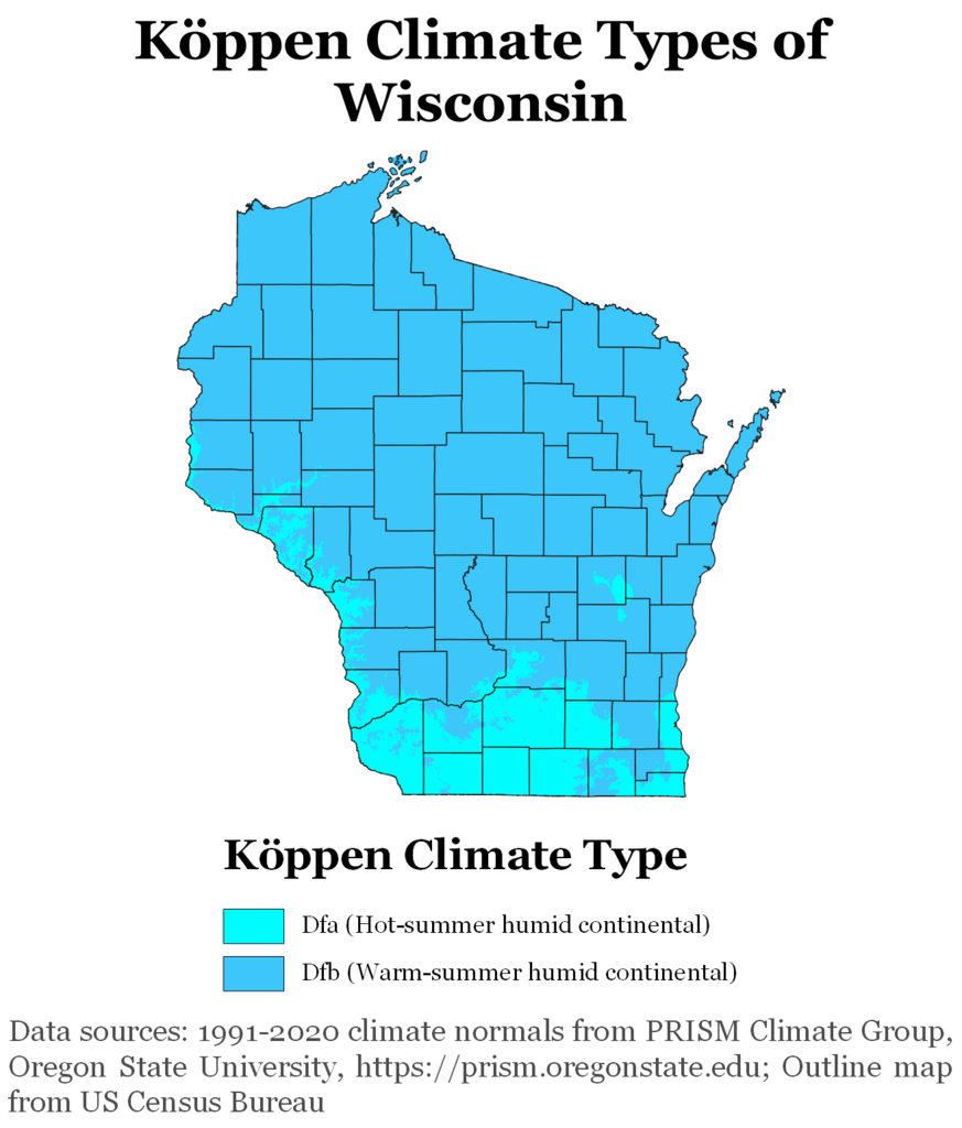
Wisconsin Köppen Climate Map
More Maps Of US States The Government Doesn’t Want You To See
Finally see our Free Moving To Wisconsin (WI) Cost Calculator.