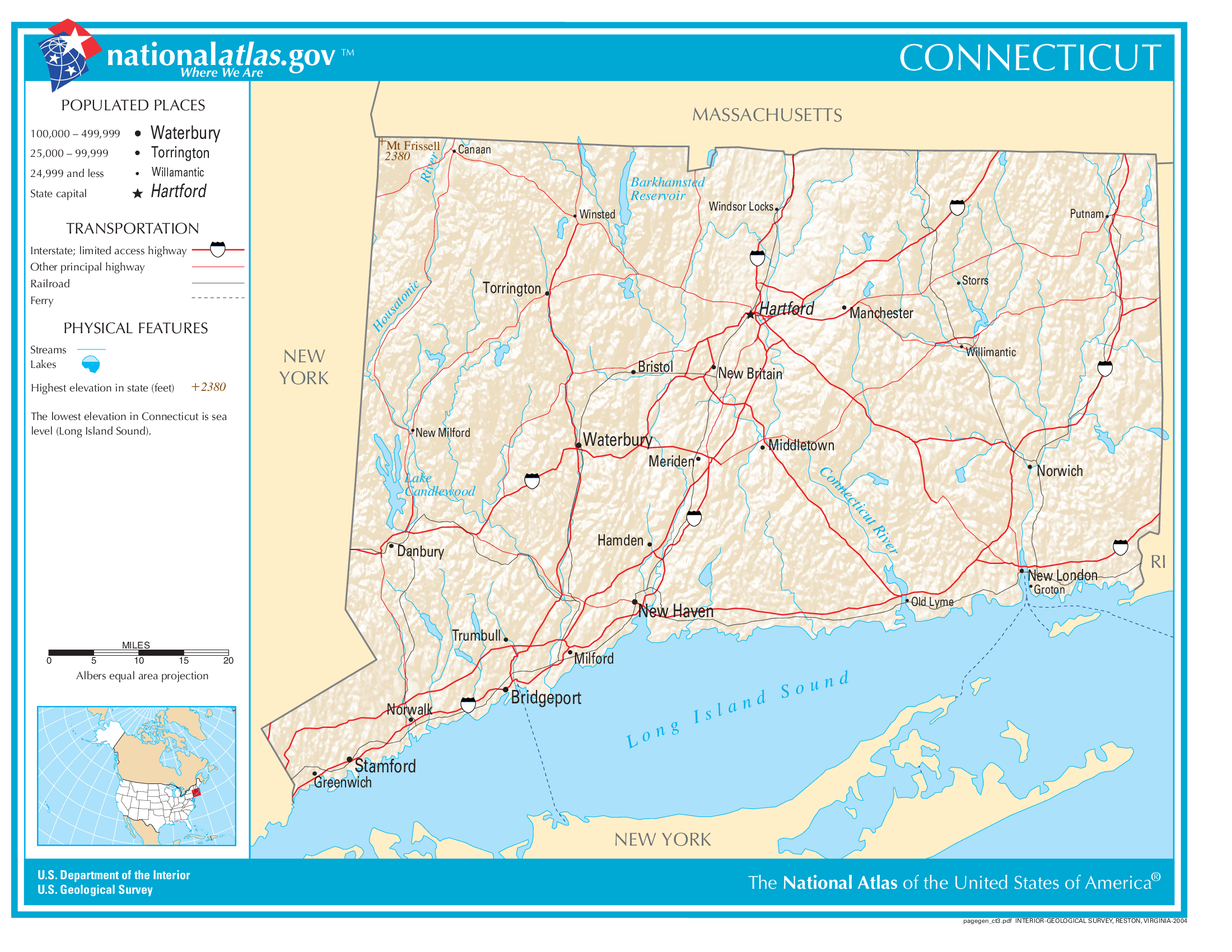
The map of Connecticut above and the maps below are part of the US government’s now closed NationalAtlas.gov project.
However, they are too good to be lost forever so I’ve preserved them here.
You can learn more about the project and why it was closed down here.
General Connecticut State Facts
Demonym: Numegger
State Abbreviation: CT
Year Admitted To US: 1788
State Number (Out of 50): 5th
State Capital: Hartford
Total Area: 5,543 sq mi (14,357 km2)
State Area Ranking (Out of 50): 48th
Highest Point: Southern slope of Mount Frissell at Massachusetts border – 2,386 ft (727 m)
Lowest Point: 0 ft (0 m)
State Website: https://www.ct.gov/
List of Interstate Highways In Connecticut
- I-84
- I-91
- I-95
- I-384
- I-684
- I-291
- I-691
- I-395
List of US Highways In Connecticut
- US 5
- US 7
List of Toll Roads In Connecticut
No
Did you known Route 15 is the longest road in Connecticut at 83.53 mi (134.43 km).
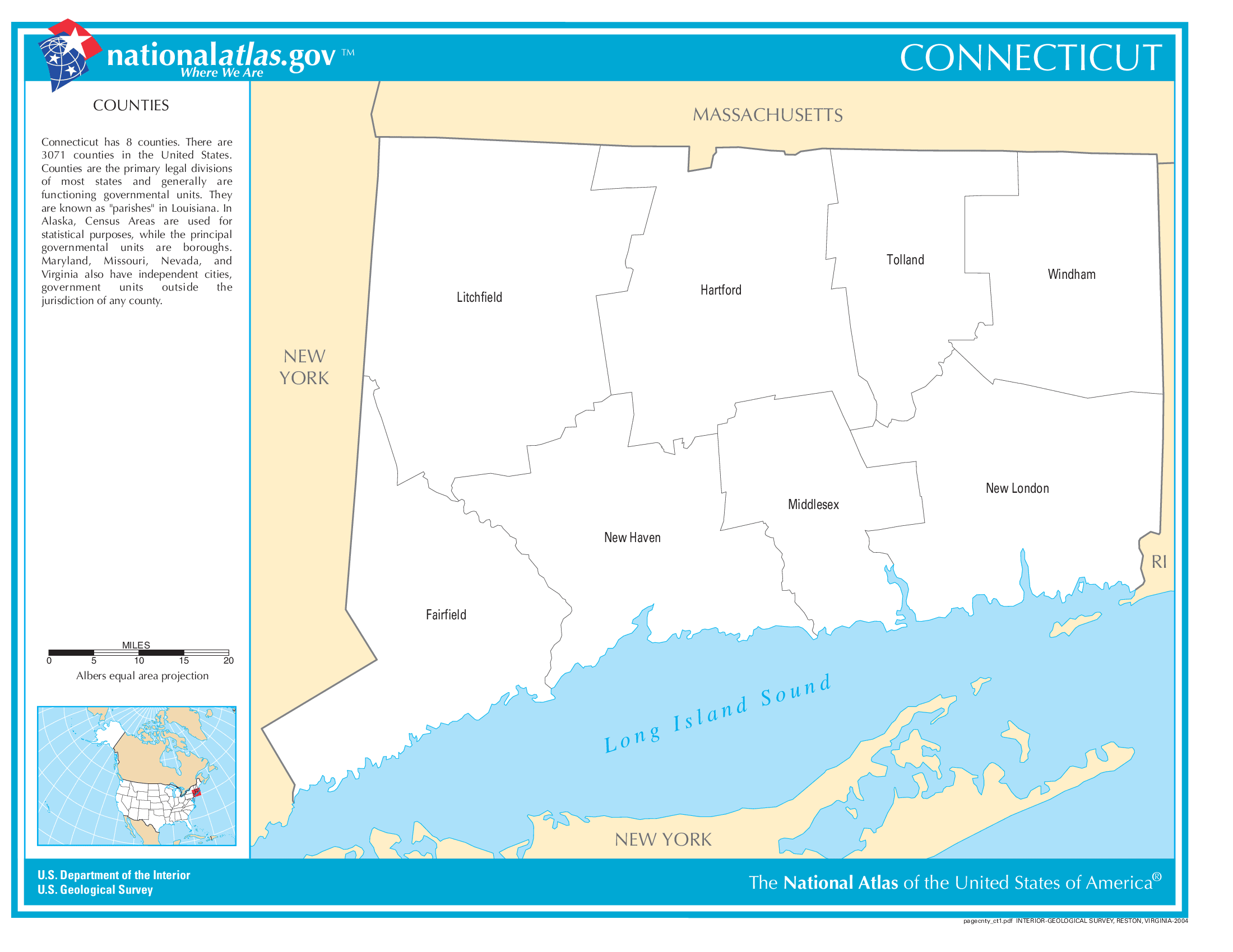
Connecticut County Map
Connecticut County Map With Important Cities & Towns
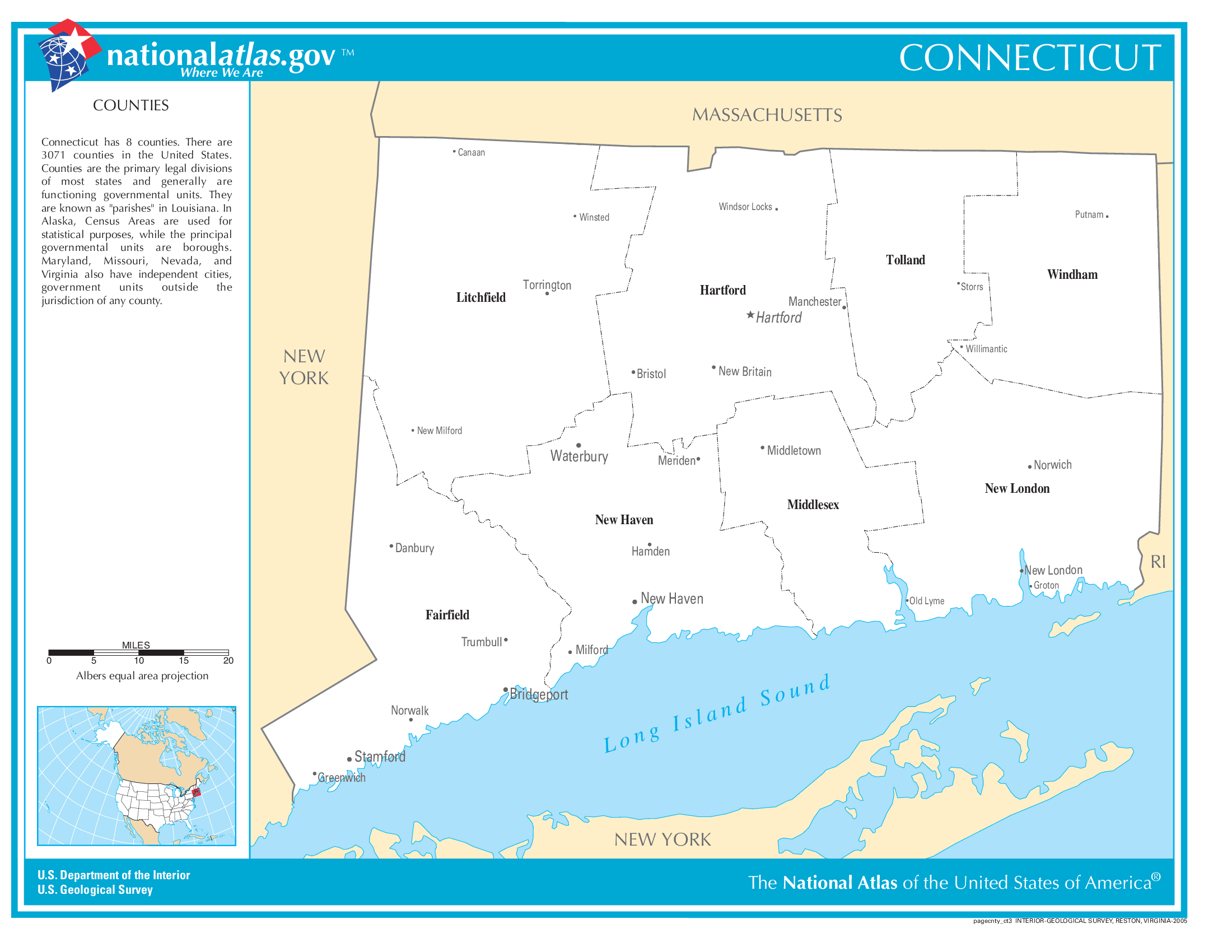
You can see more Connecticut county maps here.
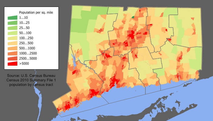
Connecticut Population Density Map
Connecticut Population Facts
State Population: 3,617,176
State Population Rank (out of 50): 29th
Population Density: 747/sq mi (288/km2)
Population Density Rank (out of 50): 4th
Top 10 Cities In Connecticut
- Bridgeport: 148,028
- Stamford: 136,226
- New Haven: 135,319
- Hartford: 119,669
- Waterbury: 114,990
- Norwalk: 92,458
- Danbury: 86,124
- New Britain: 74,080
- Bristol: 61,601
- Meriden: 60,111
Connecticut Income & Taxes
Median Household Income: 90,730
Household Income Rank (out of 50): 6th
Top Marginal State Income Tax Rate: 6.99%
Average Sales Tax Rate*: 6.35%
Average Property Tax Rate*: 1.79%
* Note theses vary from city to city within the state.
Map of Connecticut Lakes & Rivers
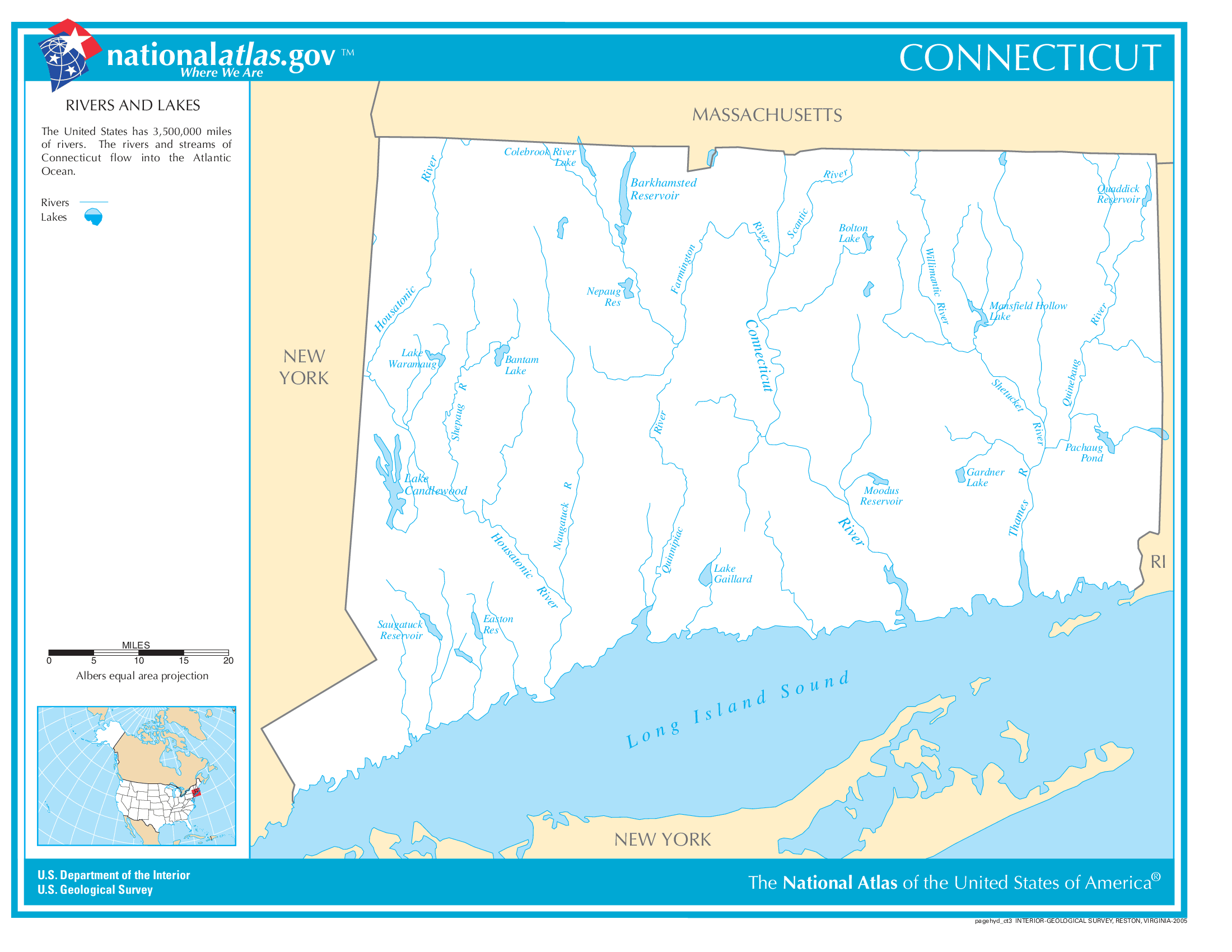
Largest Lake In Connecticut: Candlewood Lake 8.4 (sq mi)
Longest River In Connecticut: Connecticut River 407 miles (655 km)
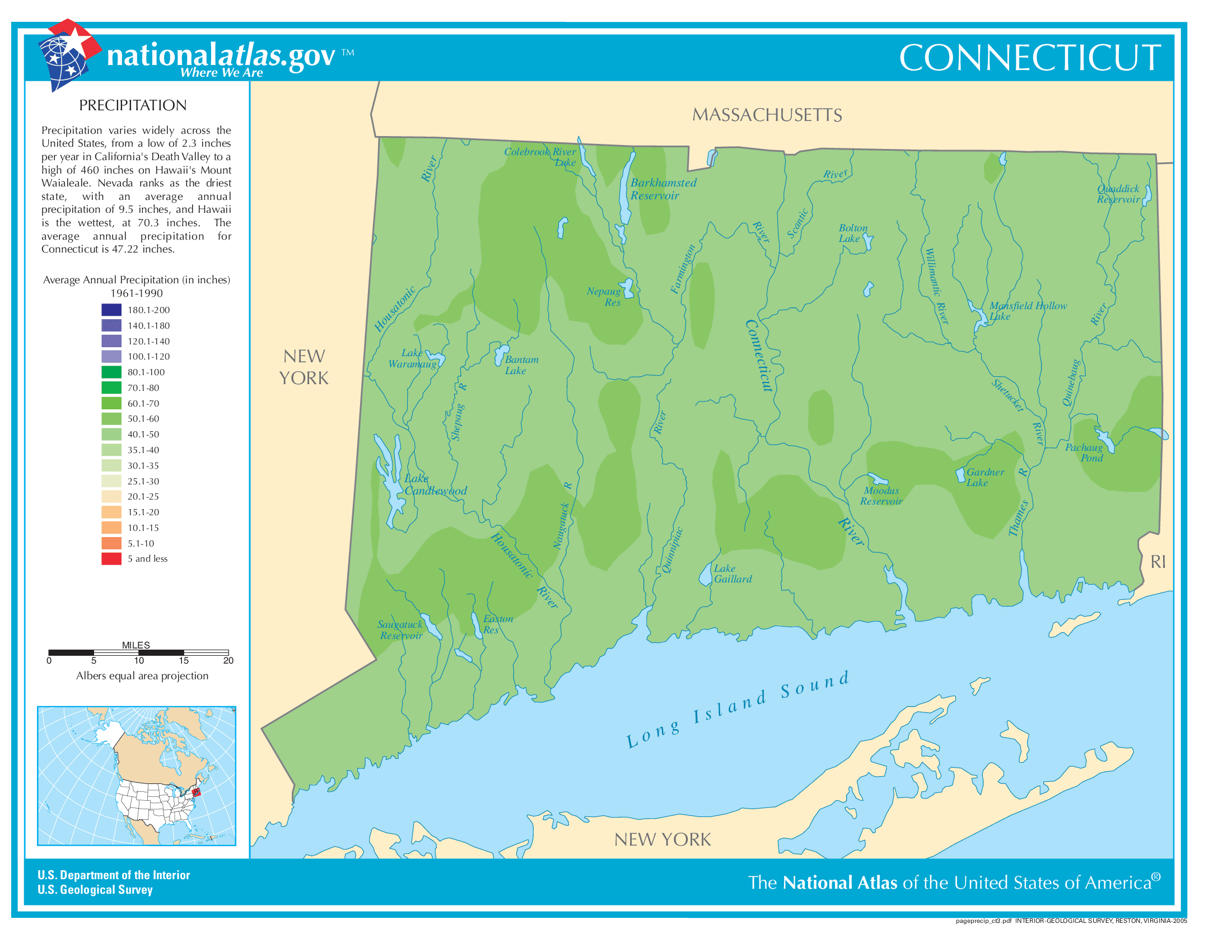
Connecticut Annual Precipitation Map
Connecticut Köppen Climate Map
