
However, they are too good to be lost forever so I’ve preserved them here.
You can learn more about the project and why it was closed down here.
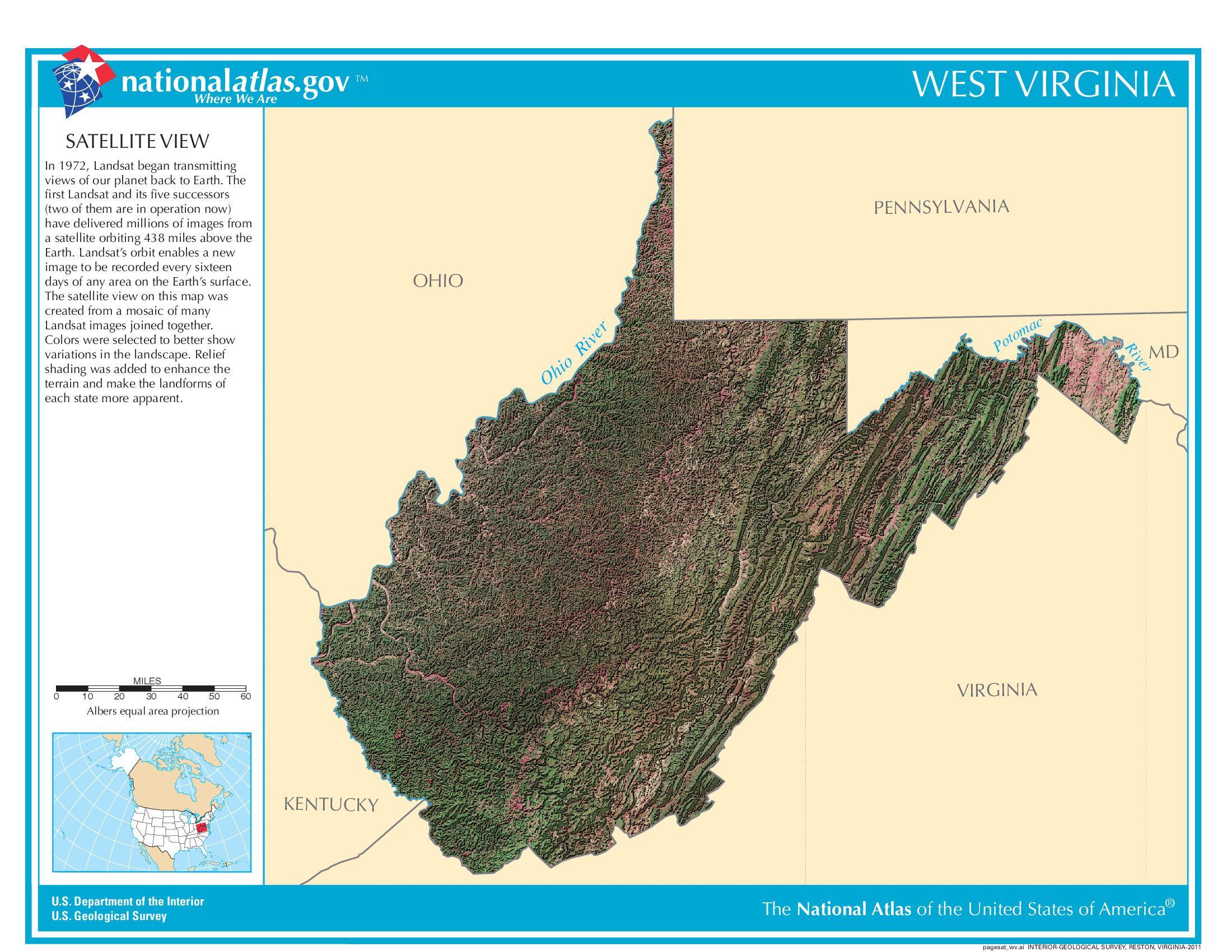
Satellite Map Of West Virginia
General West Virginia State Facts
Demonym: West Virginian
State Abbreviation: WV
Year Admitted To US: 1863
State Number (Out of 50): 35th
State Capital: Charleston
Total Area: 24,230 sq mi (62,756 km2)
State Area Ranking (Out of 50): 41st
Highest Point: Spruce Knob – 4,862 ft (1482 m)
Lowest Point: 240 ft (73 m)
State Website: https://www.wv.gov/
List of Interstate Highways In West Virginia
- I-64
- I-66
- I-68
- I-70
- I-73
- I-77
- I-79
- I-470
List of US Highways In West Virginia
- US 121
- US 35
- US 48
List of Toll Roads In West Virginia
- I-64 / I-77 (West Virginia Turnpike)
Did you known Route 20 is the longest road in West Virginia at 262.1 mi (421.8 km).
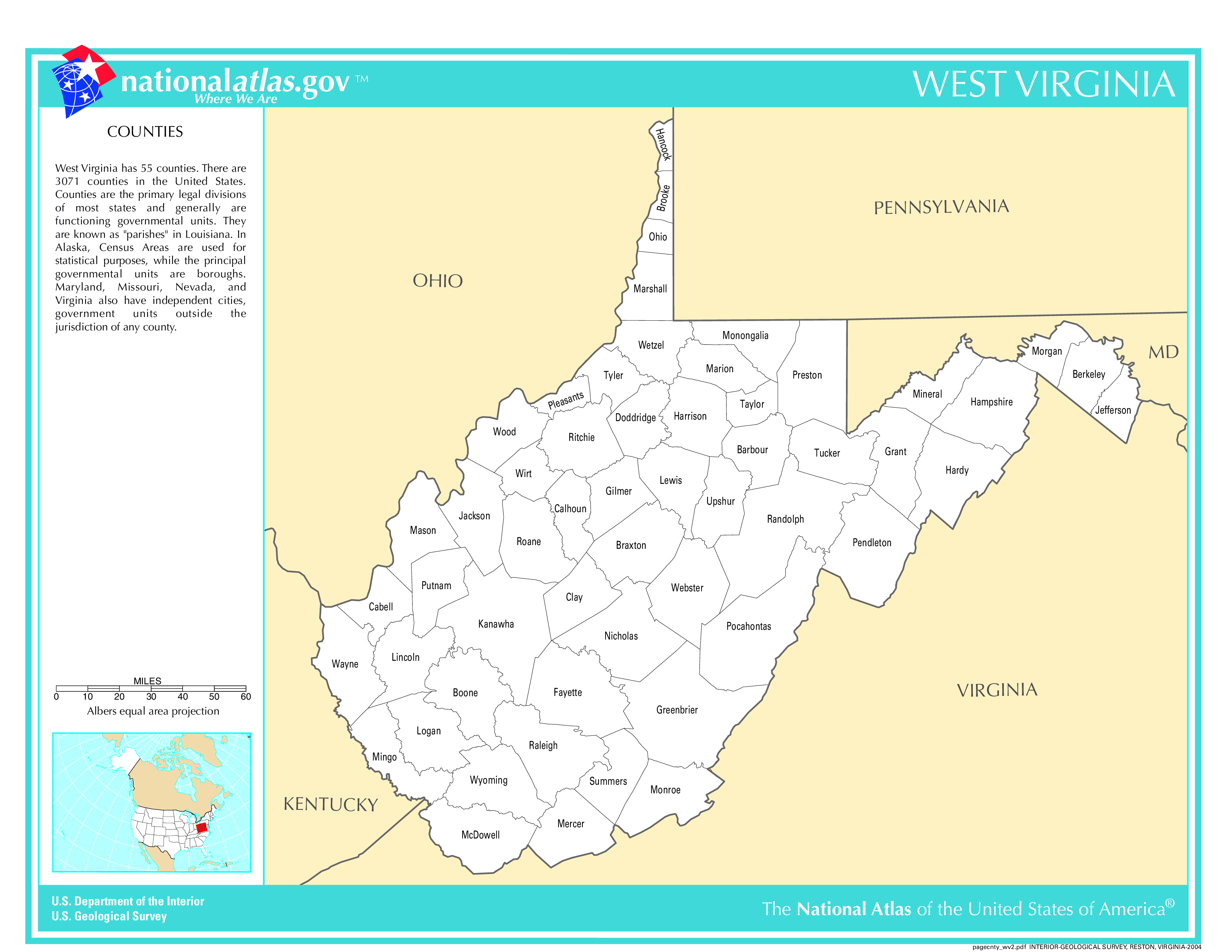
West Virginia County Map
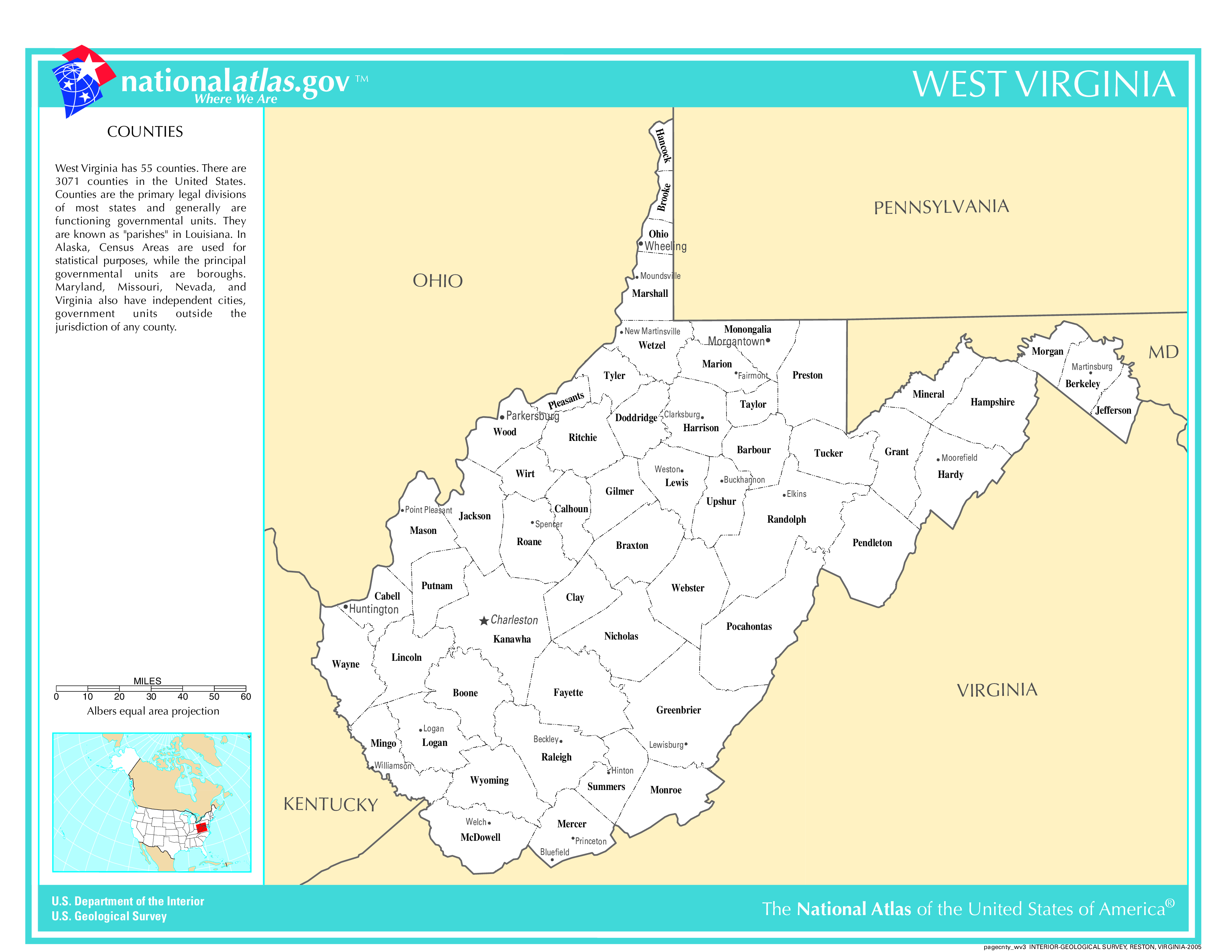
West Virginia County Map With Important Cities & Towns
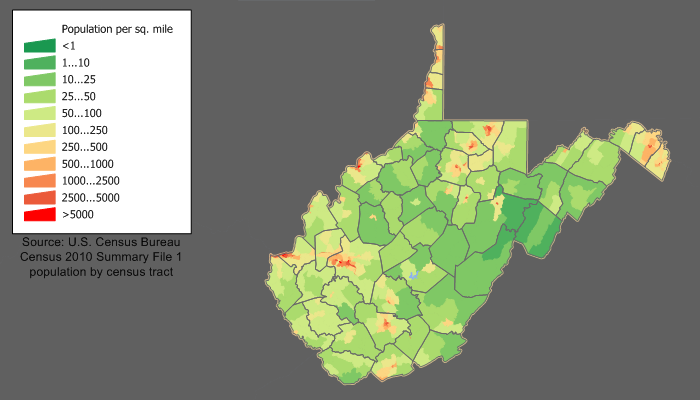
West Virginia Population Density Map
West Virginia Population Facts
State Population: 1,770,071
State Population Rank (out of 50): 39th
Population Density: 74/sq mi (28/km2)
Population Density Rank (out of 50): 29th
Top 10 Cities In West Virginia
- Charleston: 46,838
- Huntington: 45,325
- Morgantown: 30,429
- Parkersburg: 29,025
- Wheeling: 26,208
- Martinsburg: 18,935
- Weirton: 18,386
- Fairmont: 18,155
- Beckley: 16,576
- Clarksburg: 15,489
West Virginia Income & Taxes
Median Household Income: $52,460
Household Income Rank (out of 50): 49th
Top Marginal State Income Tax Rate: 5.12%
Average Sales Tax Rate*: 6.57%
Average Property Tax Rate*: 0.57%
* Note theses vary from city to city within the state.
Map of West Virginia Lakes & Rivers
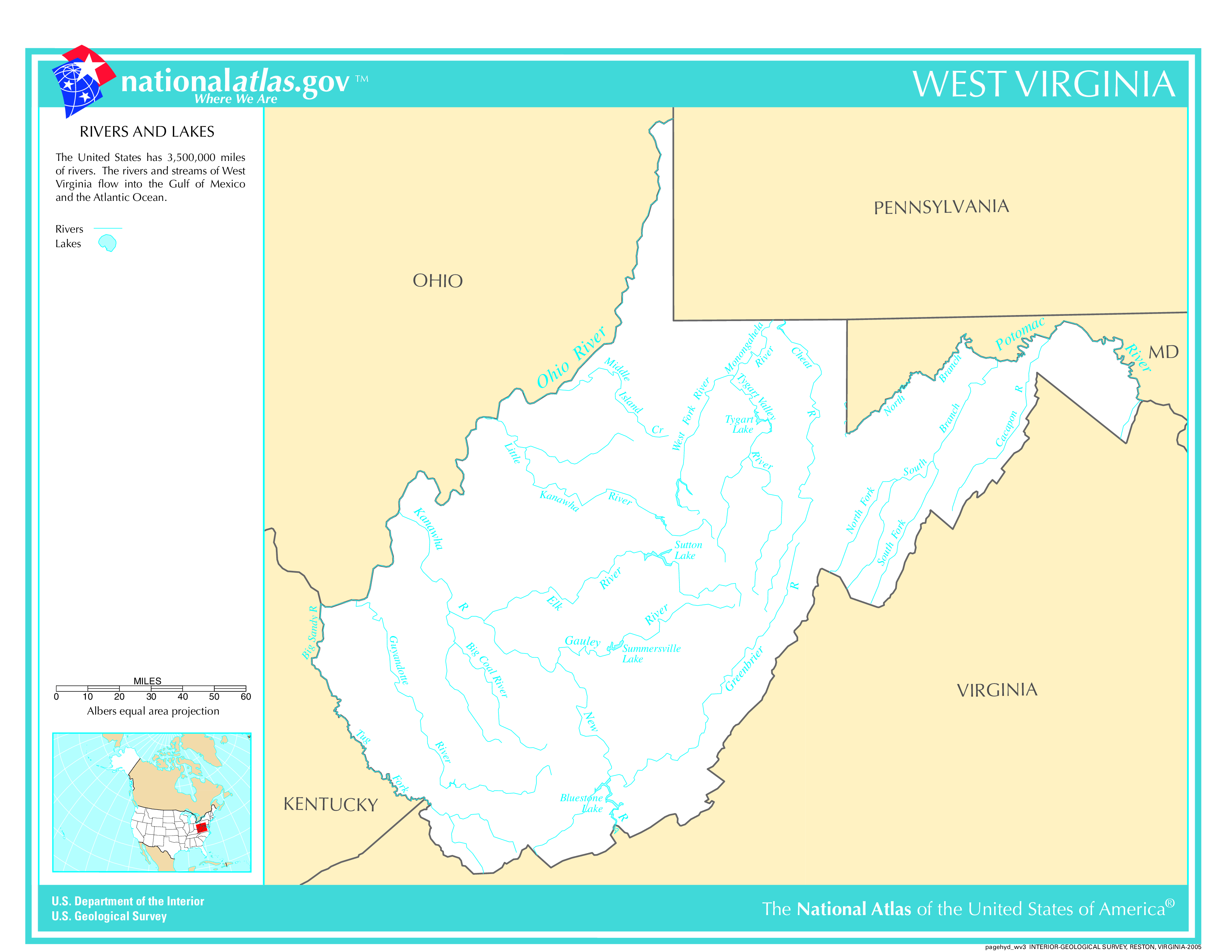
Longest River In West Virginia: Ohio River 981 miles (1,579 km)
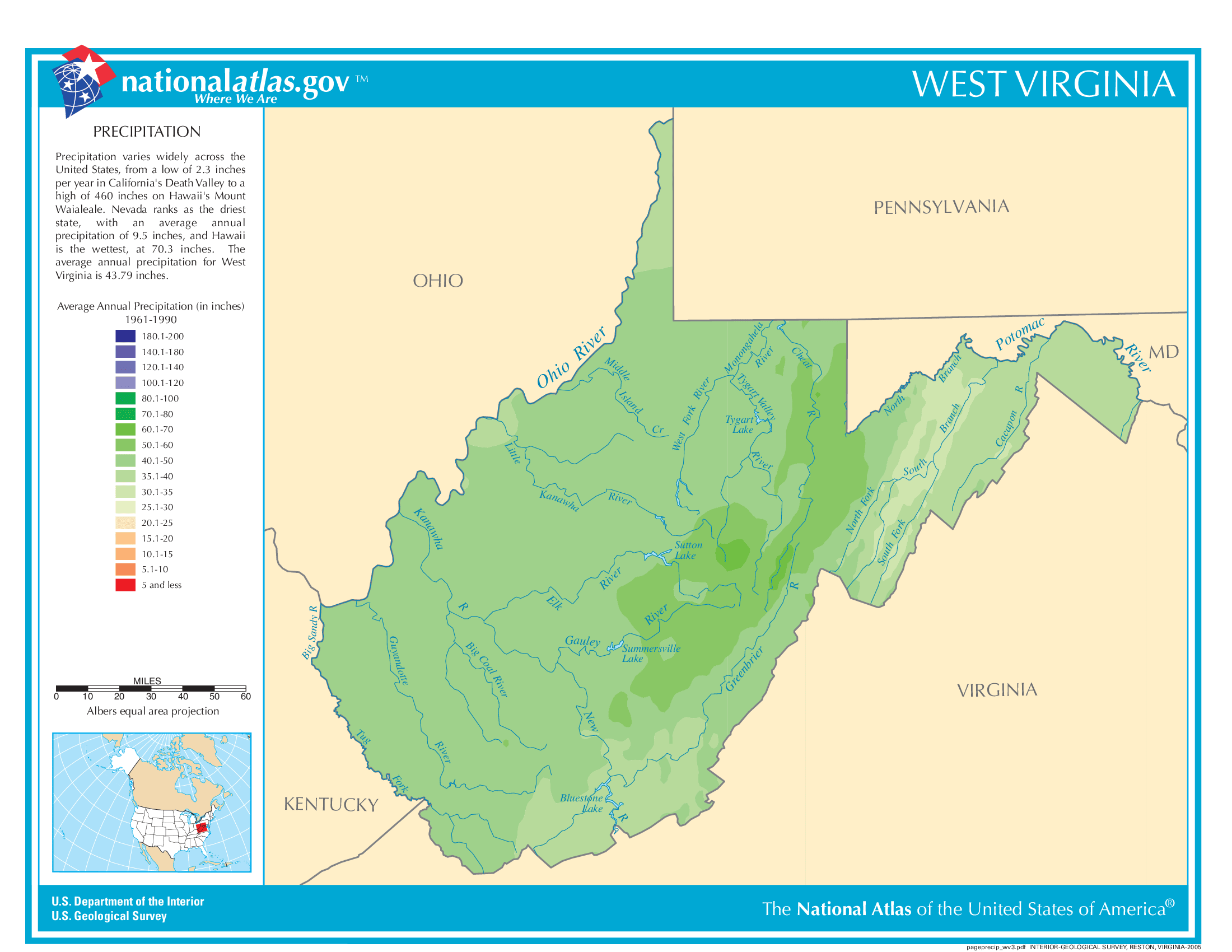
West Virginia Annual Precipitation Map
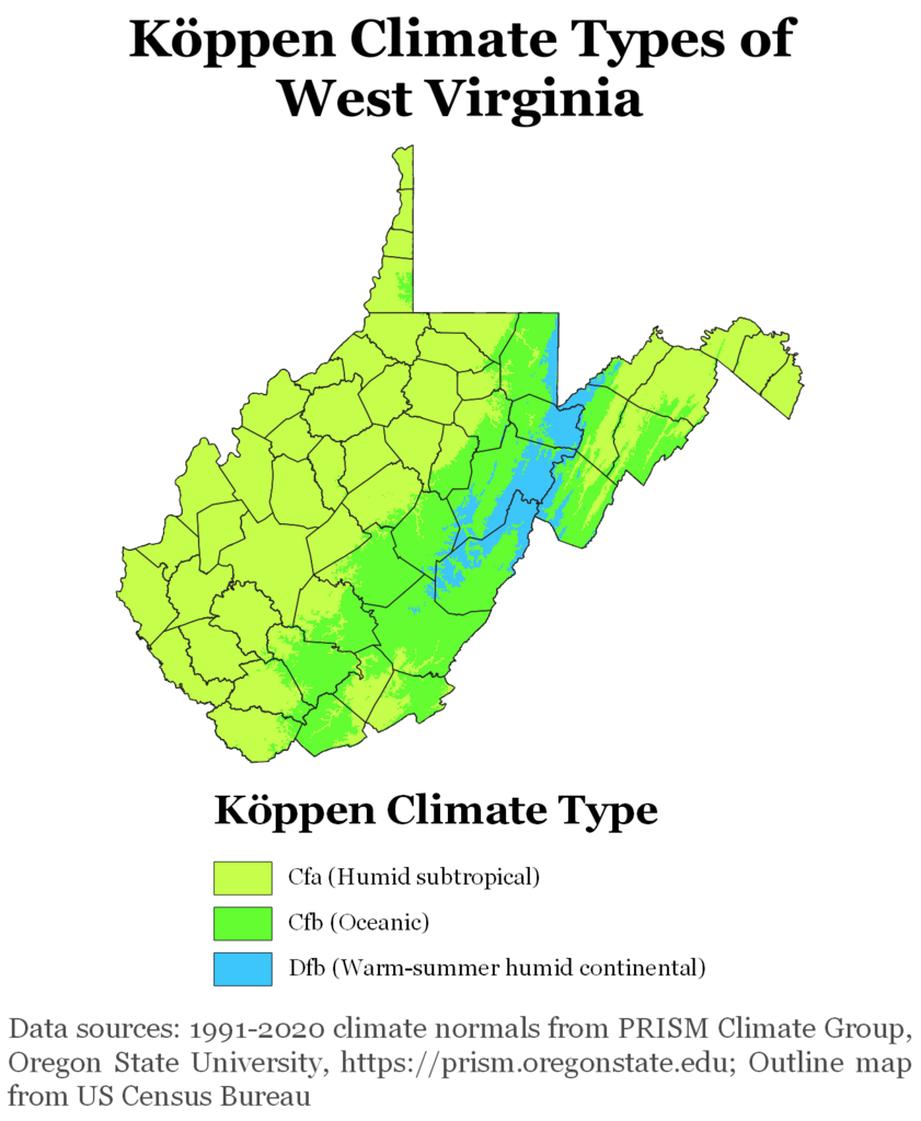
West Virginia Köppen Climate Map
10 Fun Facts About West Virginia
- Only State Formed During the Civil War: West Virginia separated from Virginia and became a state on June 20, 1863, making it the only state formed by splitting off from a Confederate state during the Civil War.
- Bridge Day Festival: Every year, thousands attend “Bridge Day,” where thrill-seekers BASE jump or rappel off the New River Gorge Bridge, the third-highest bridge in the U.S.
- Mother’s Day Originated Here: Mother’s Day was first celebrated in Grafton, West Virginia, in 1908, thanks to Anna Jarvis, who campaigned to establish the national holiday.
- Largest Sycamore Tree: West Virginia was home to the world’s largest sycamore tree, located near the Elk River in Webster County.
- Golden Delicious Apples Originated Here: The Golden Delicious apple was discovered in Clay County, West Virginia, in the early 1900s and is now the official state fruit.
- Oldest and Largest Indian Burial Mound: The Grave Creek Mound in Moundsville, West Virginia, is the largest conical burial mound in North America and dates back to around 250–150 BC.
- Outdoor Paradise: West Virginia is often called the “Mountain State” due to its rugged Appalachian terrain, offering exceptional opportunities for hiking, rafting, fishing, skiing, and rock climbing.
- No Major Professional Sports Teams: West Virginia is one of the few states without a major professional sports franchise, leading to strong support and pride for its college sports teams, especially the West Virginia Mountaineers.
- Pepperoni Roll Capital: West Virginia is famous for pepperoni rolls, a delicious snack invented by Italian coal miners as a convenient lunch option. It’s now considered the state’s unofficial food.
- First Rural Free Mail Delivery: In 1896, West Virginia became the first state to implement Rural Free Delivery (RFD) mail service, helping rural residents stay connected.