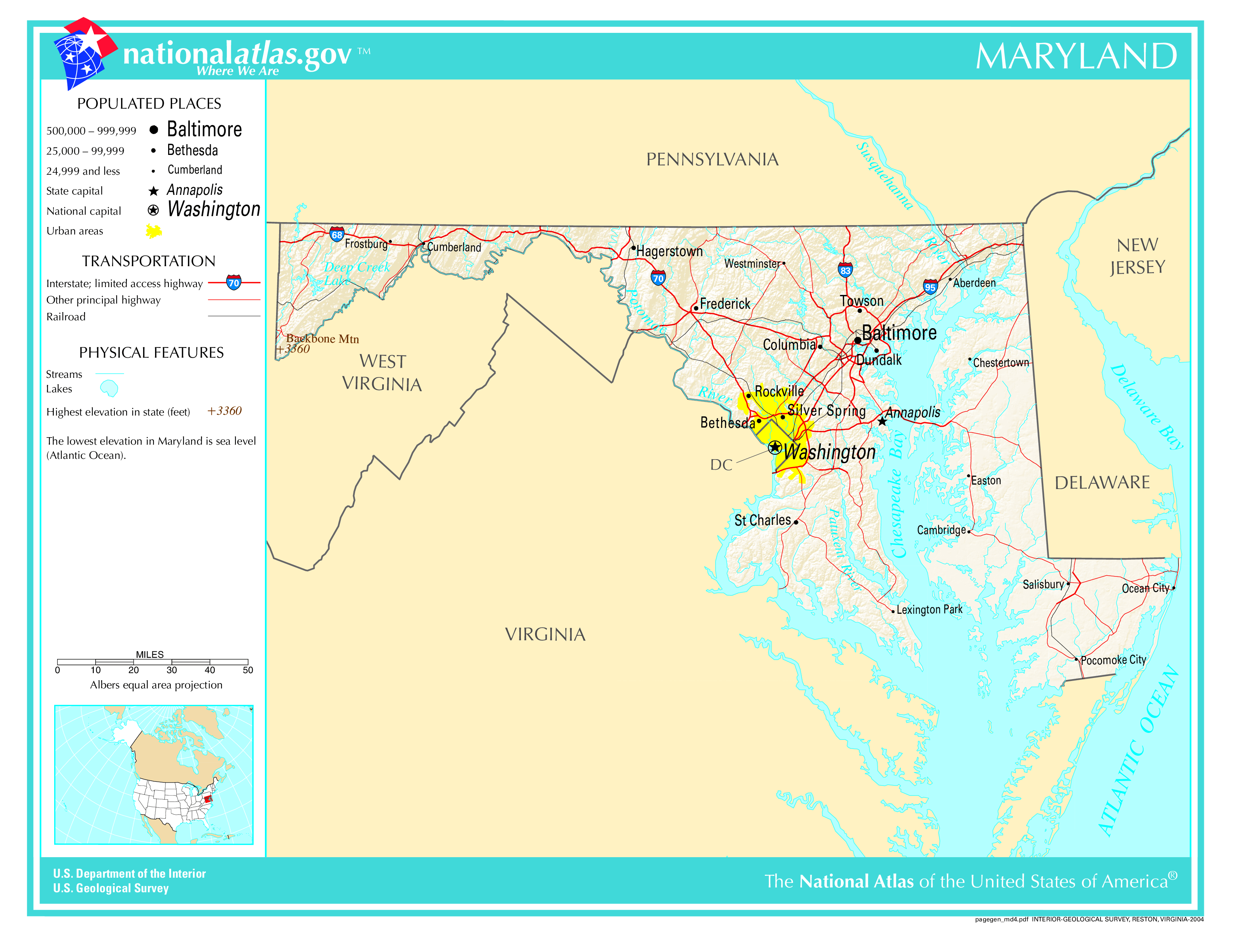
The map of Maryland above and the maps below are part of the US government’s now closed NationalAtlas.gov project.
However, they are too good to be lost forever so I’ve preserved them here.
You can learn more about the project and why it was closed down here.
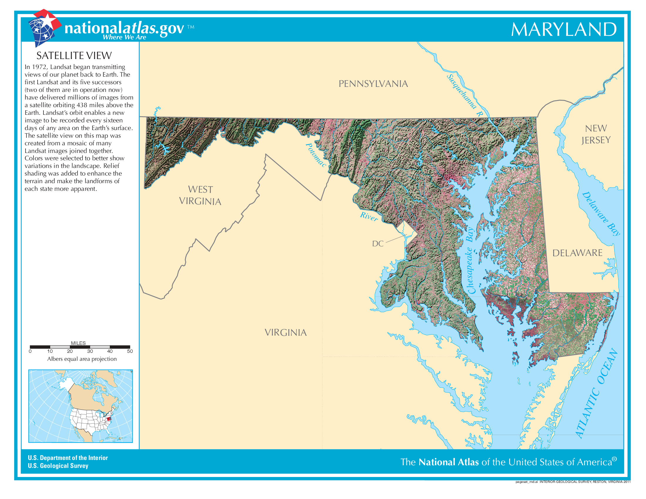
Satellite Map Of Maryland
General Maryland State Facts
Demonym: Marylander
State Abbreviation: MD
Year Admitted To US: 1788
State Number (Out of 50): 7th
State Capital: Annapolis
Total Area: 12,406 sq mi (32,131 km2)
State Area Ranking (Out of 50): 42nd
Highest Point: Hoye-Crest – 3,370 ft (1027 m)
Lowest Point: 0 ft (0 m)
State Website: https://www.maryland.gov/
List of Interstate Highways In Maryland
- I-68
- I-70
- I-81
- I-83
- I-95
- I-97
- I-170
- I-270
- I-370
- I-195
- I-295
- I-395
- I-495
- I-595
- I-695
- I-795
- I-895
List of US Highways In Maryland
- US 111
- US 113
- US 140
- US 213
- US 222
- US 29
- US 340
- US 48
- US 50
- US 622
List of Toll Roads In Maryland
- MD 200 (Intercounty Connector)
- I-895 (Harbor Tunnel Thruway)
- I-95 (Express Lanes)
Did you known Route 2 is the longest road in Maryland at 79.24 mi (127.52 km).
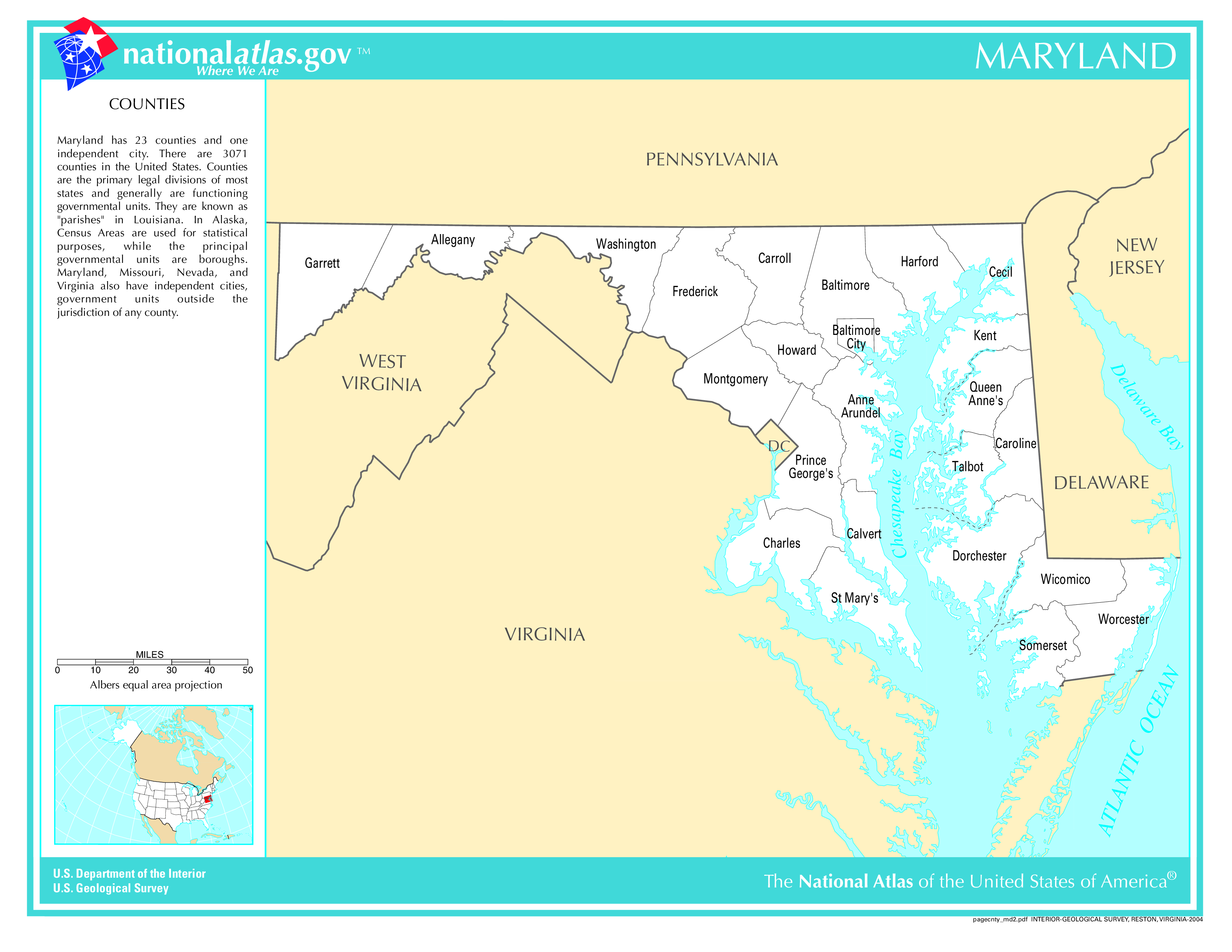
Maryland County Map
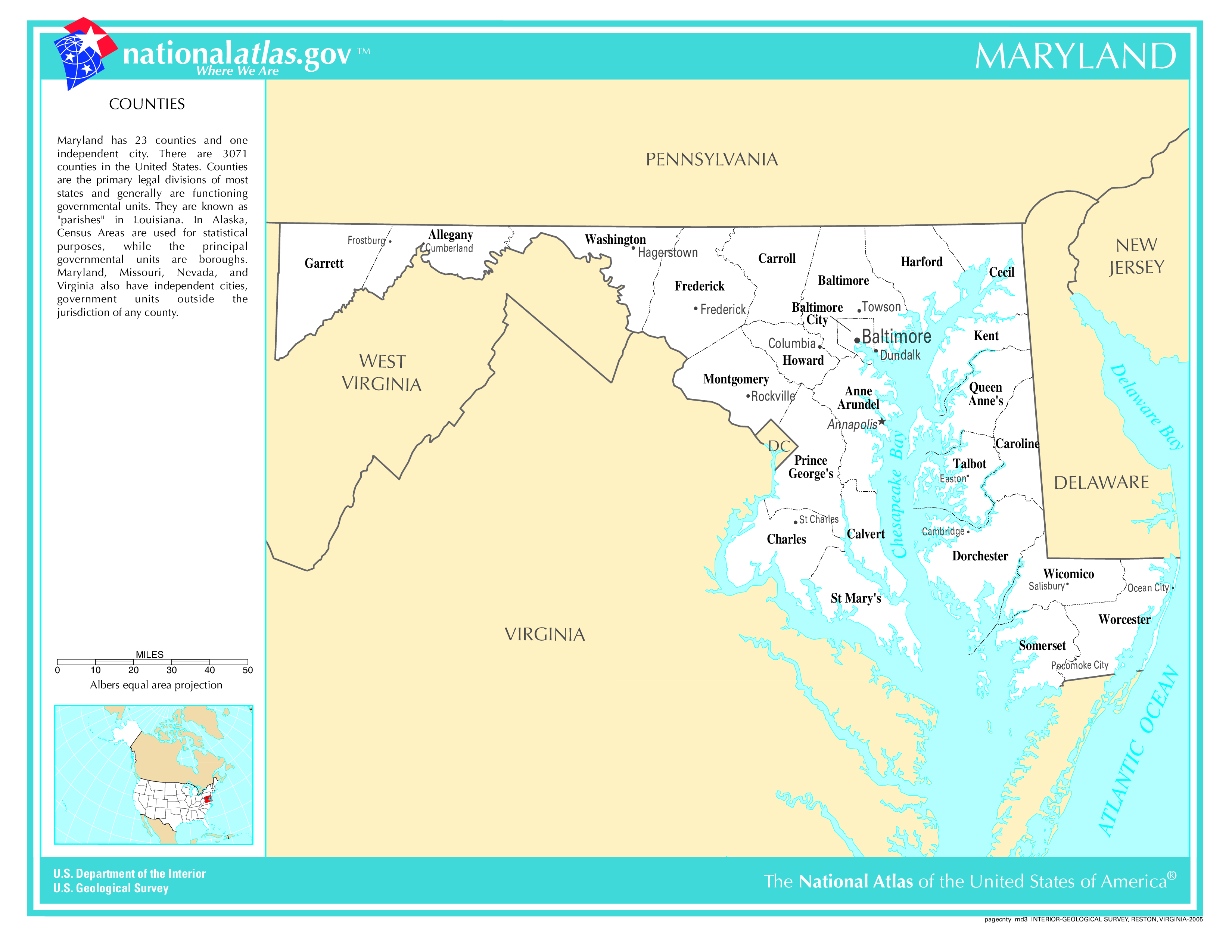
Maryland County Map With Important Cities & Towns
You can see more Maryland county maps here.
Maryland Population Density Map
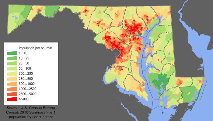
Maryland Population Facts
State Population: 6,180,253
State Population Rank (out of 50): 19th
Population Density: 637/sq mi (246/km2)
Population Density Rank (out of 50): 5th
Top 10 Cities In Maryland
- Baltimore: 565,239
- Frederick: 85,793
- Gaithersburg: 69,563
- Rockville: 67,297
- Bowie: 57,254
- Hagerstown: 43,553
- Annapolis: 40,552
- College Park: 34,187
- Salisbury: 33,159
- Laurel: 29,400
Maryland Income & Taxes
Median Household Income: 108,200
Household Income Rank (out of 50): 1st
Top Marginal State Income Tax Rate: 5.75%
Average Sales Tax Rate*: 6.00%
Average Property Tax Rate*: 1.05%
* Note theses vary from city to city within the state.
Map of Maryland Lakes & Rivers
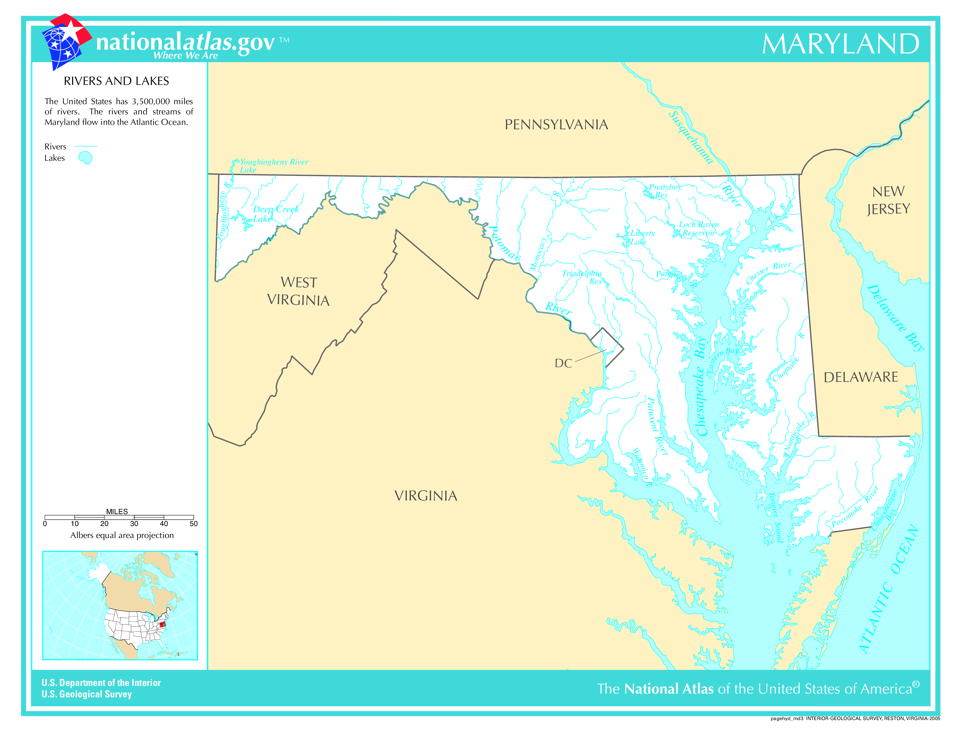
Largest Lake In Maryland: Deep Creek Lake 6.1 (sq mi)
Longest River In Maryland: Susquehanna River 444 miles (715 km)
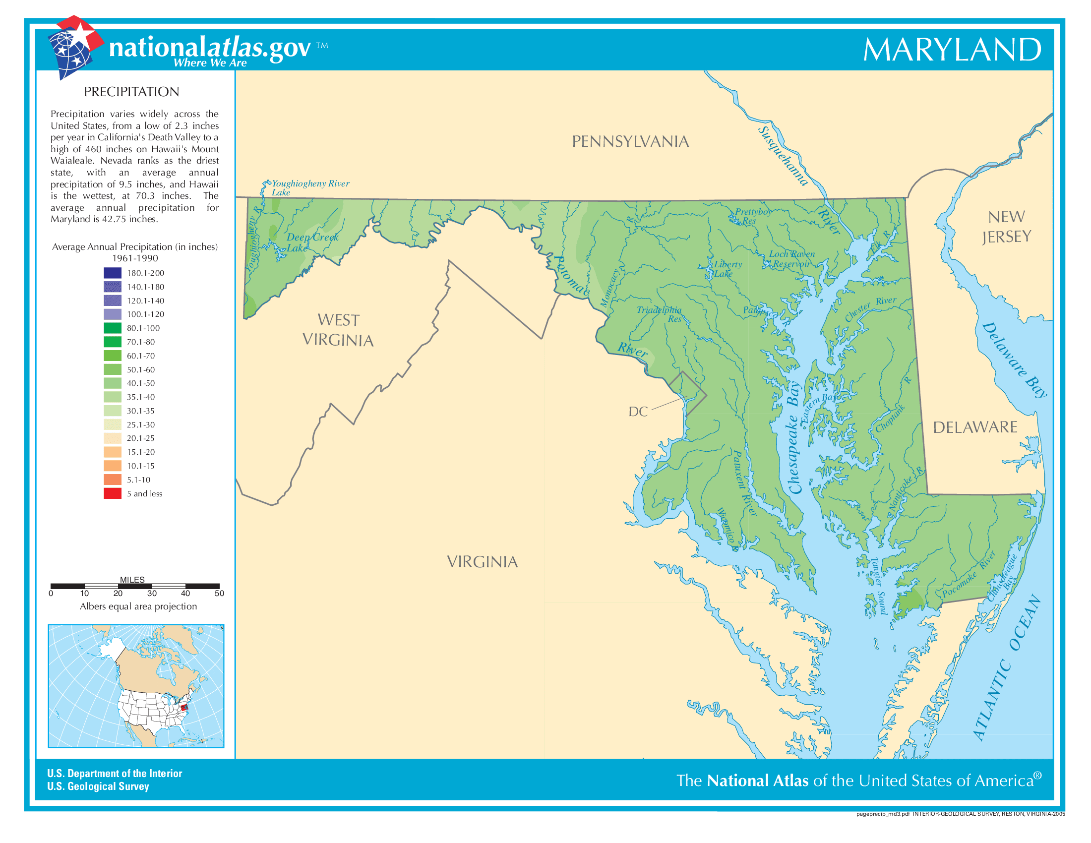
Maryland Annual Precipitation Map
Maryland Köppen Climate Map
