The map of Rhode Island above and the maps below are part of the US government’s now closed NationalAtlas.gov project.
However, they are too good to be lost forever so I’ve preserved them here.
You can learn more about the project and why it was closed down here.
General Rhode Island State Facts
Demonym: Rhode Islander
State Abbreviation: RI
Year Admitted To US: 1790
State Number (Out of 50): 13th
State Capital: Providence
Total Area: 1,545 sq mi (4,001 km2)
State Area Ranking (Out of 50): 50th
Highest Point: Jerimoth Hill – 811 ft (247 m)
Lowest Point: 0 ft (0 m)
State Website: https://www.ri.gov/
List of Interstate Highways In Rhode Island
- I-95
- I-195
- I-295
List of US Highways In Rhode Island
- US 1
- US 6
- US 44
List of Toll Roads In Rhode Island
- I-95
- I-195
- I-295
- US 6
- Route 146
Did you known Route 138 is the longest road in Rhode Island at 48.3 mi (77.7 km).
Rhode Island County Map

Rhode Island County Map With Important Cities & Towns

You can see more Rhode Island county maps here.
Rhode Island Population Density Map

Rhode Island Population Facts
State Population: 1,095,962
State Population Rank (out of 50): 44th
Population Density: 1060/sq mi (409/km2)
Population Density Rank (out of 50): 2nd
Top 10 Cities In Rhode Island
- Providence: 190,792
- Warwick: 82,999
- Cranston: 82,635
- Pawtucket: 75,321
- East Providence: 46,900
- Woonsocket: 43,135
- Newport: 24,717
- Central Falls: 22,543
- Westerly: 17,842
- Valley Falls: 11,548
Rhode Island Income & Taxes
Median Household Income: 80,650
Household Income Rank (out of 50): 16th
Top Marginal State Income Tax Rate: 5.99%
Average Sales Tax Rate*: 7.00%
Average Property Tax Rate*: 1.40%
* Note theses vary from city to city within the state.
Map of Rhode Island Lakes & Rivers

Largest Lake In Rhode Island: Ninigret Pond 2.4 (sq mi)
Longest River In Rhode Island: Blackstone River 48 miles (77 km)
Rhode Island Annual Precipitation Map

Rhode Island Köppen Climate Map

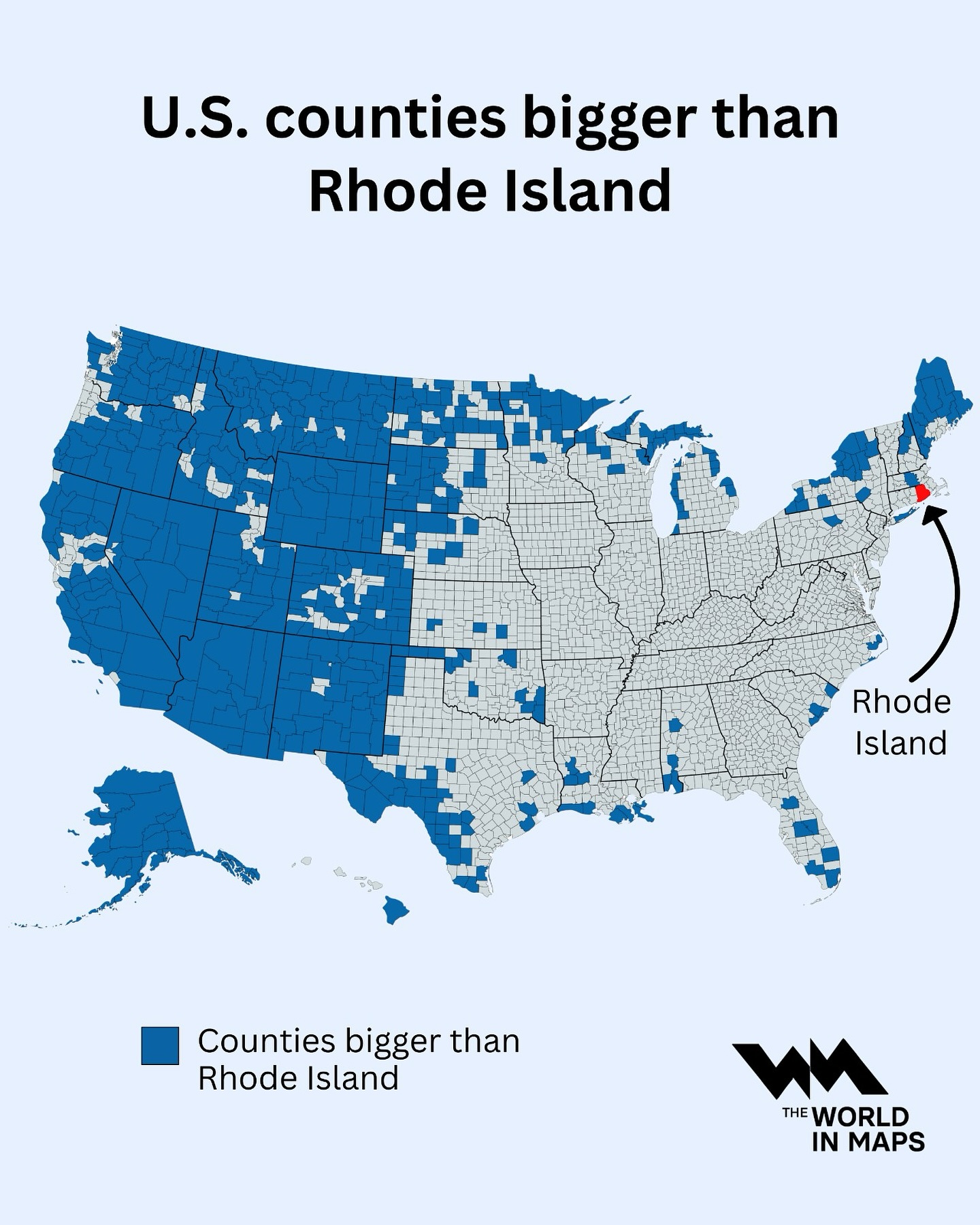
US Counties Bigger In Area Than Rhode Island