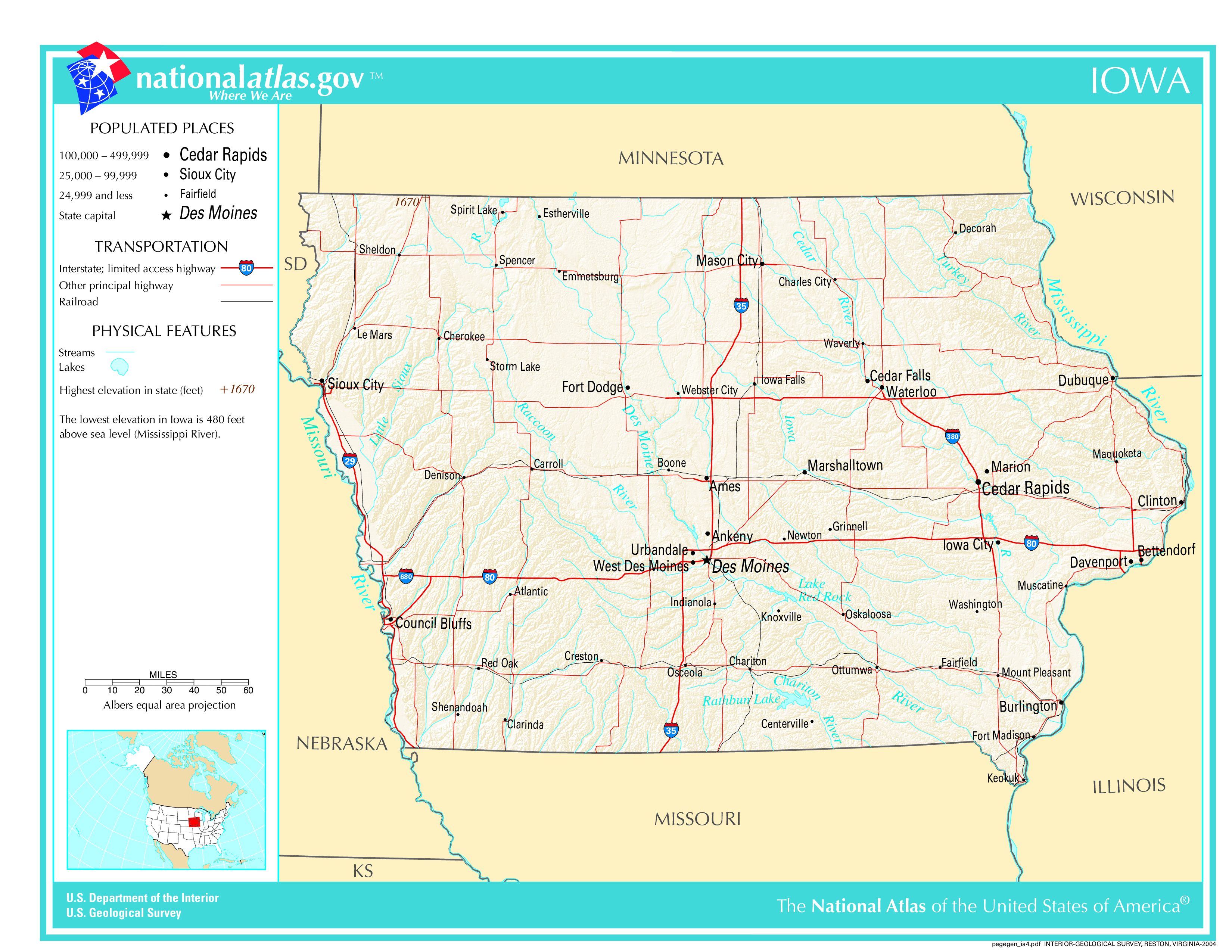
The map of Iowa above and the maps below are part of the US government’s now closed NationalAtlas.gov project.
However, they are too good to be lost forever so I’ve preserved them here.
You can learn more about the project and why it was closed down here.
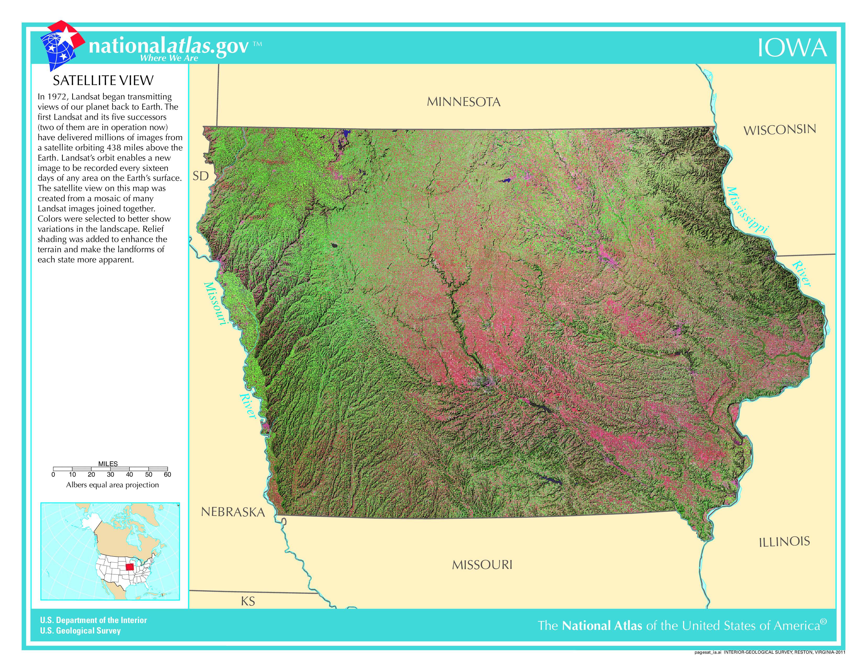
Satellite Map Of Iowa
General Iowa State Facts
Demonym: Iowan
State Abbreviation: IA
Year Admitted To US: 1846
State Number (Out of 50): 29th
State Capital: Des Moines
Total Area: 56,273 sq mi (145,746 km2)
State Area Ranking (Out of 50): 26th
Highest Point: Hawkeye Point – 1,671 ft (509 m)
Lowest Point: 480 ft (146 m)
State Website: https://www.iowa.gov/
List of Interstate Highways In Iowa
- I-29
- I-35
- I-74
- I-80
- I-129
- I-235
- I-280
- I-380
- I-480
- I-680
- |
- I-880
List of US Highways In Iowa
- US 151
- US 161
- US 163
- US 218
- US 32
- US 55
- US 67
- US 77
List of Toll Roads In Iowa
No
Did you known Highway 3 is the longest road in Iowa at 326.163 mi (524.908 km).
Iowa County Map
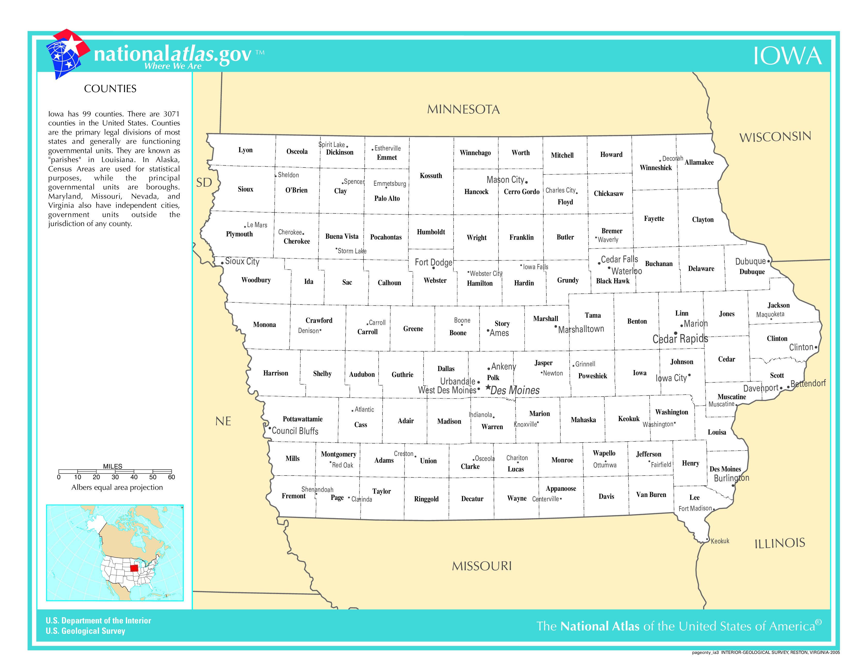
Iowa County Map With Important Cities & Towns
You can see more Iowa county maps here.
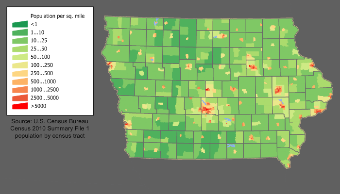
Iowa Population Density Map
Iowa Population Facts
State Population: 3,207,004
State Population Rank (out of 50): 31st
Population Density: 57/sq mi (22/km2)
Population Density Rank (out of 50): 36th
Top 10 Cities In Iowa
- Des Moines: 210,381
- Cedar Rapids: 135,958
- Davenport: 100,354
- Sioux City: 85,727
- Iowa City: 75,678
- Ankeny: 74,458
- West Des Moines: 72,205
- Waterloo: 66,606
- Ames: 65,686
- Council Bluffs: 62,399
Iowa Income & Taxes
Median Household Income: 76,320
Household Income Rank (out of 50): 20th
Top Marginal State Income Tax Rate: 5.70%
Average Sales Tax Rate*: 6.94%
Average Property Tax Rate*: 1.52%
* Note theses vary from city to city within the state.
Map of Iowa Lakes & Rivers
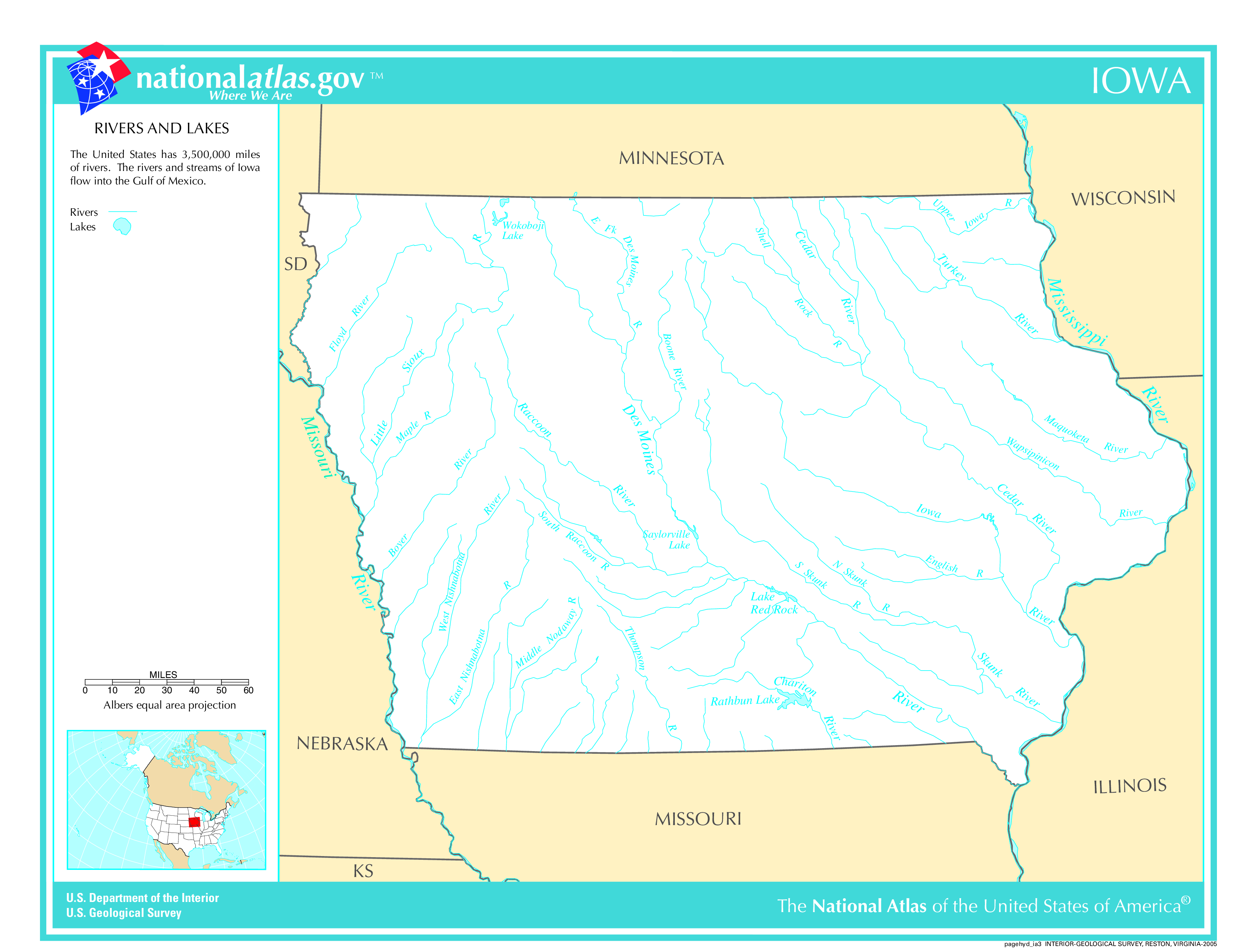
Largest Lake In Iowa: Lake Red Rock 25 (sq mi)
Longest River In Iowa: Missouri River 2,340 miles (3,770 km)
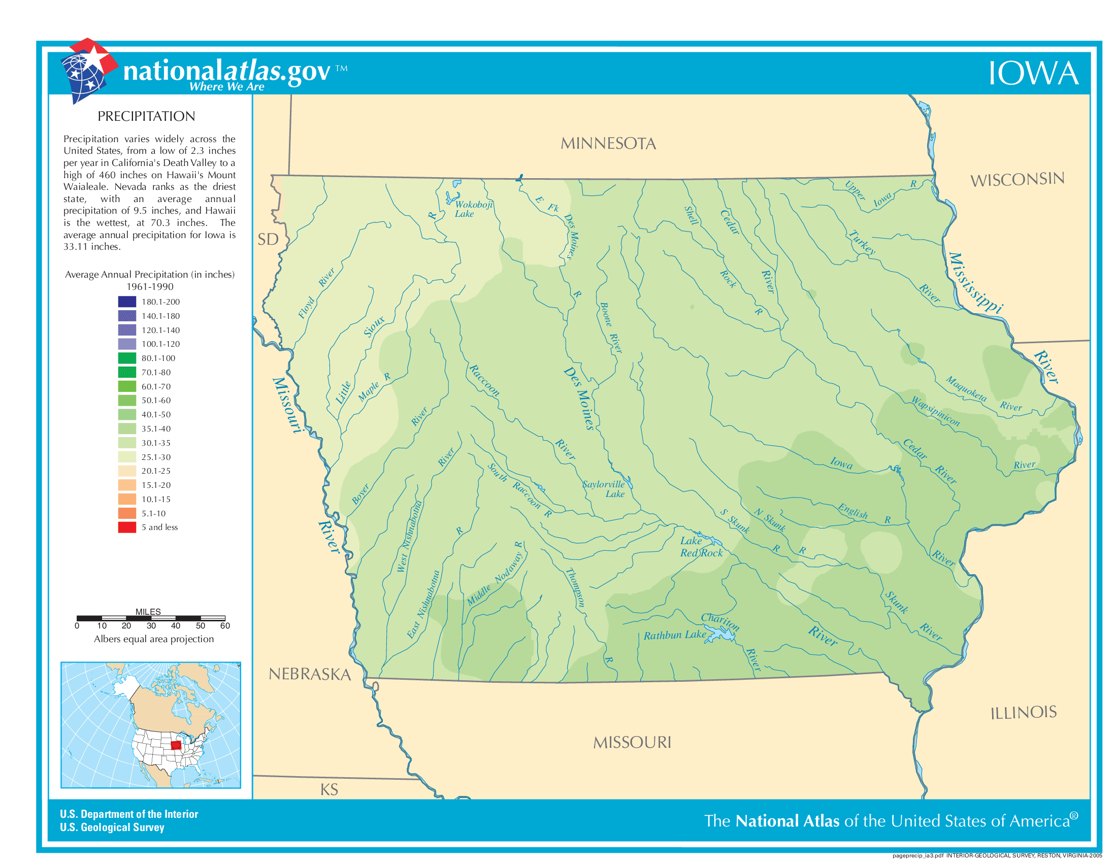
Iowa Annual Precipitation Map
Iowa Köppen Climate Map
