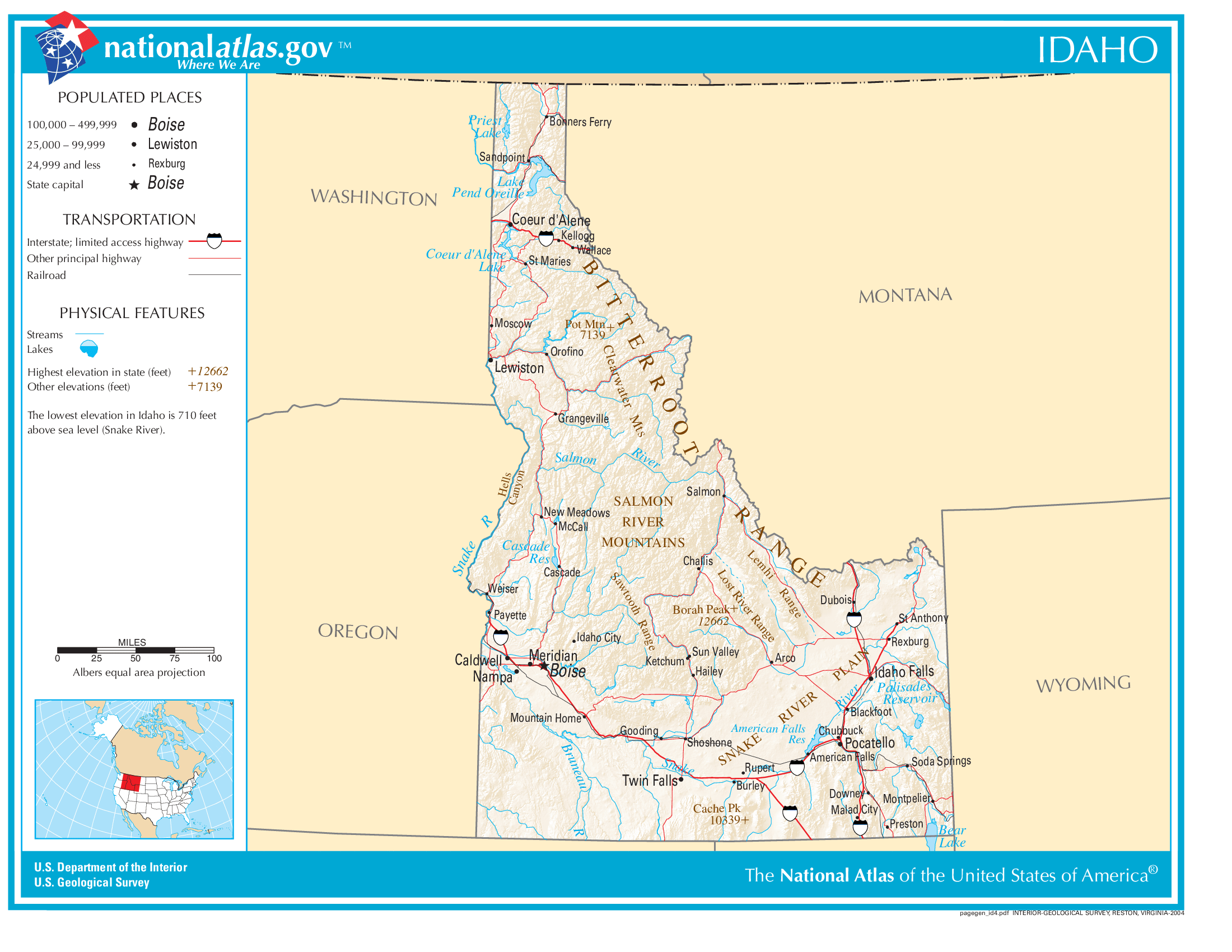
The map of Idaho above and the maps below are part of the US government’s now closed NationalAtlas.gov project.
However, they are too good to be lost forever so I’ve preserved them here.
You can learn more about the project and why it was closed down here.
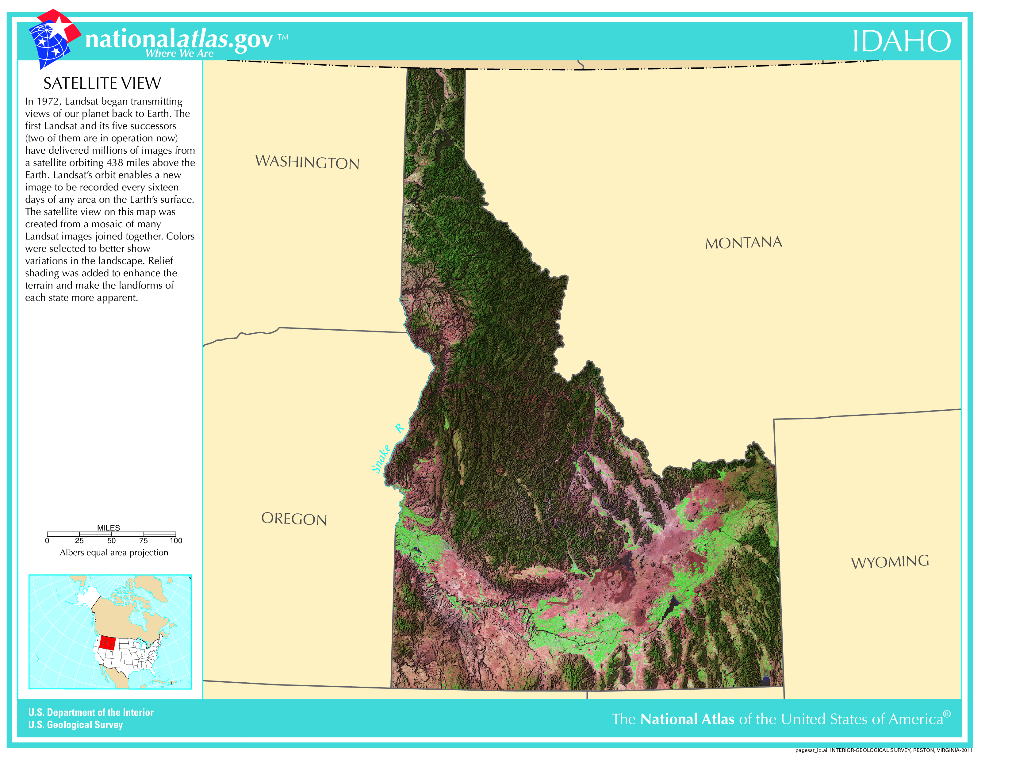
Satellite Map Of Idaho
General Idaho State Facts
Demonym: Idahoan
State Abbreviation: ID
Year Admitted To US: 1890
State Number (Out of 50): 43rd
State Capital: Boise
Total Area: 83,569 sq mi (216,443 km2)
State Area Ranking (Out of 50): 14th
Highest Point: Borah Peak – 12,668 ft (3861.2 m)
Lowest Point: 710 ft (216 m)
State Website: https://www.idaho.gov/
List of Interstate Highways In Idaho
- I-15
- I-84
- I-86
- I-90
- I-184
List of US Highways In Idaho
- US 195
- US 410
- US 630
- US 91
- US 95
List of Toll Roads In Idaho
No
Did you known State Highway 75 is the longest road in Idaho at 170.666 mi (274.66 km).
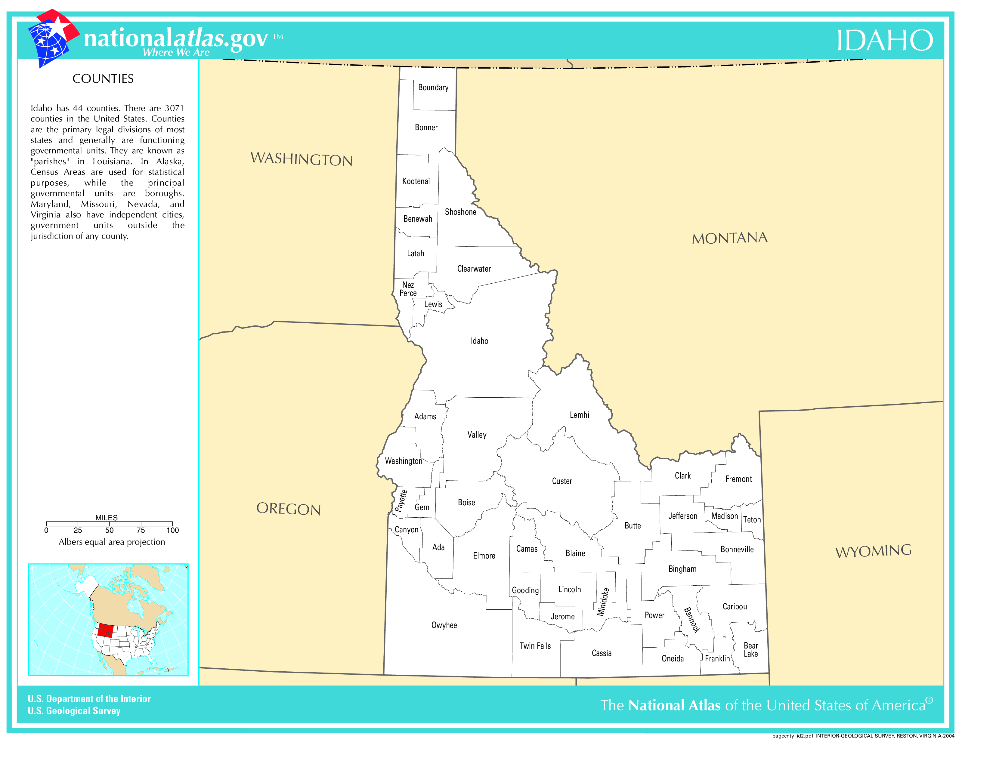
Idaho County Map
Idaho County Map With Important Cities & Towns
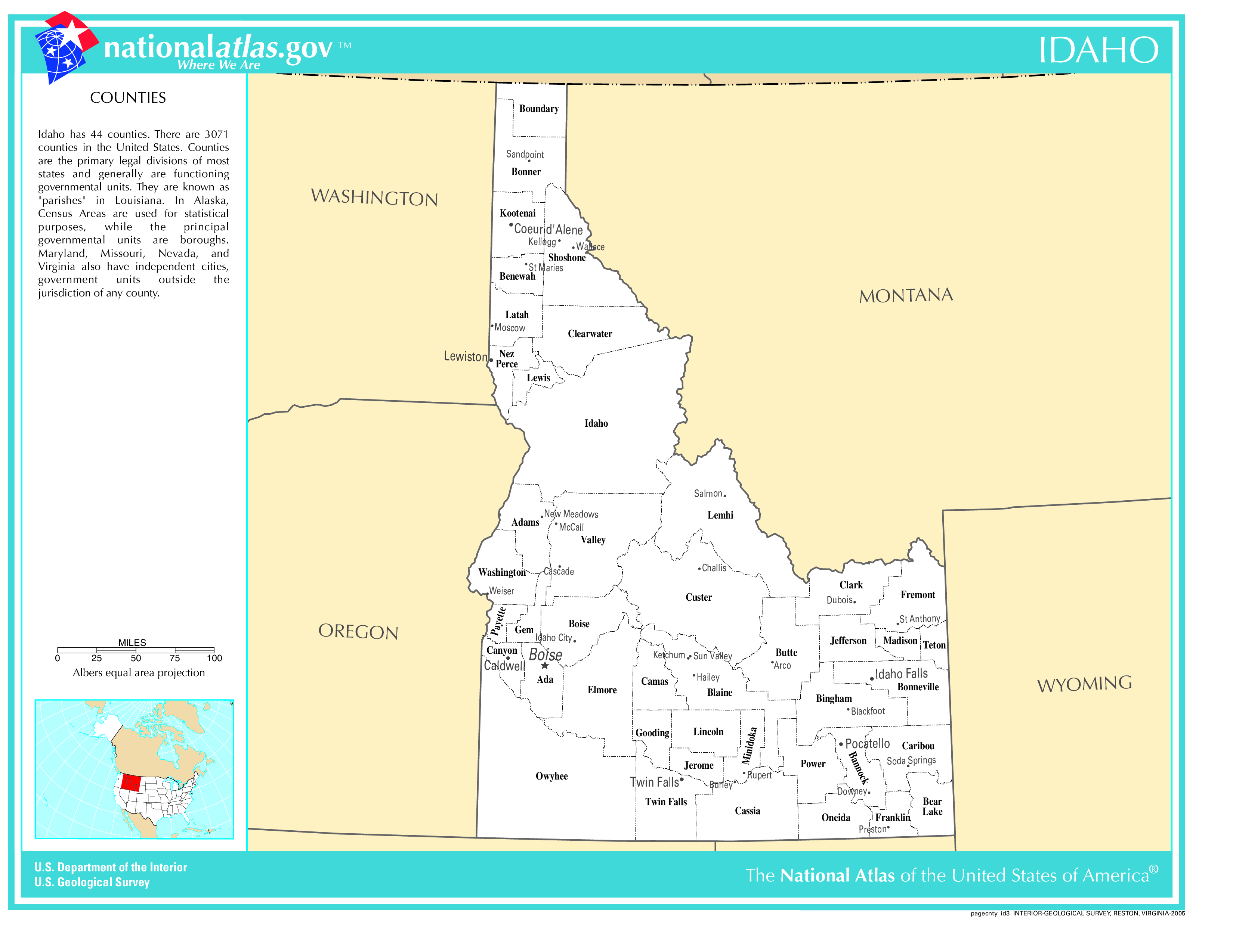
You can see more Idaho county maps here.
Idaho Population Density Map
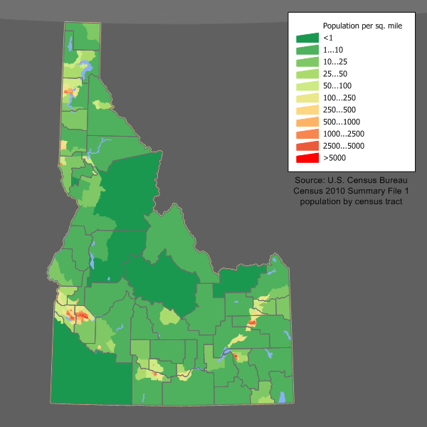
Idaho Population Facts
State Population: 1,964,726
State Population Rank (out of 50): 38th
Population Density: 24/sq mi (9.2/km2)
Population Density Rank (out of 50): 44th
Top 10 Cities In Idaho
- Boise City: 235,421
- Meridian: 134,801
- Nampa: 114,268
- Caldwell: 68,336
- Idaho Falls: 68,001
- Pocatello: 58,064
- Coeur d’Alene: 56,894
- Twin Falls: 54,943
- Post Falls: 44,798
- Rexburg: 39,975
Idaho Income & Taxes
Median Household Income: 72,580
Household Income Rank (out of 50): 29th
Top Marginal State Income Tax Rate: 5.80%
Average Sales Tax Rate*: 6.03%
Average Property Tax Rate*: 0.67%
* Note theses vary from city to city within the state.
Map of Idaho Lakes & Rivers
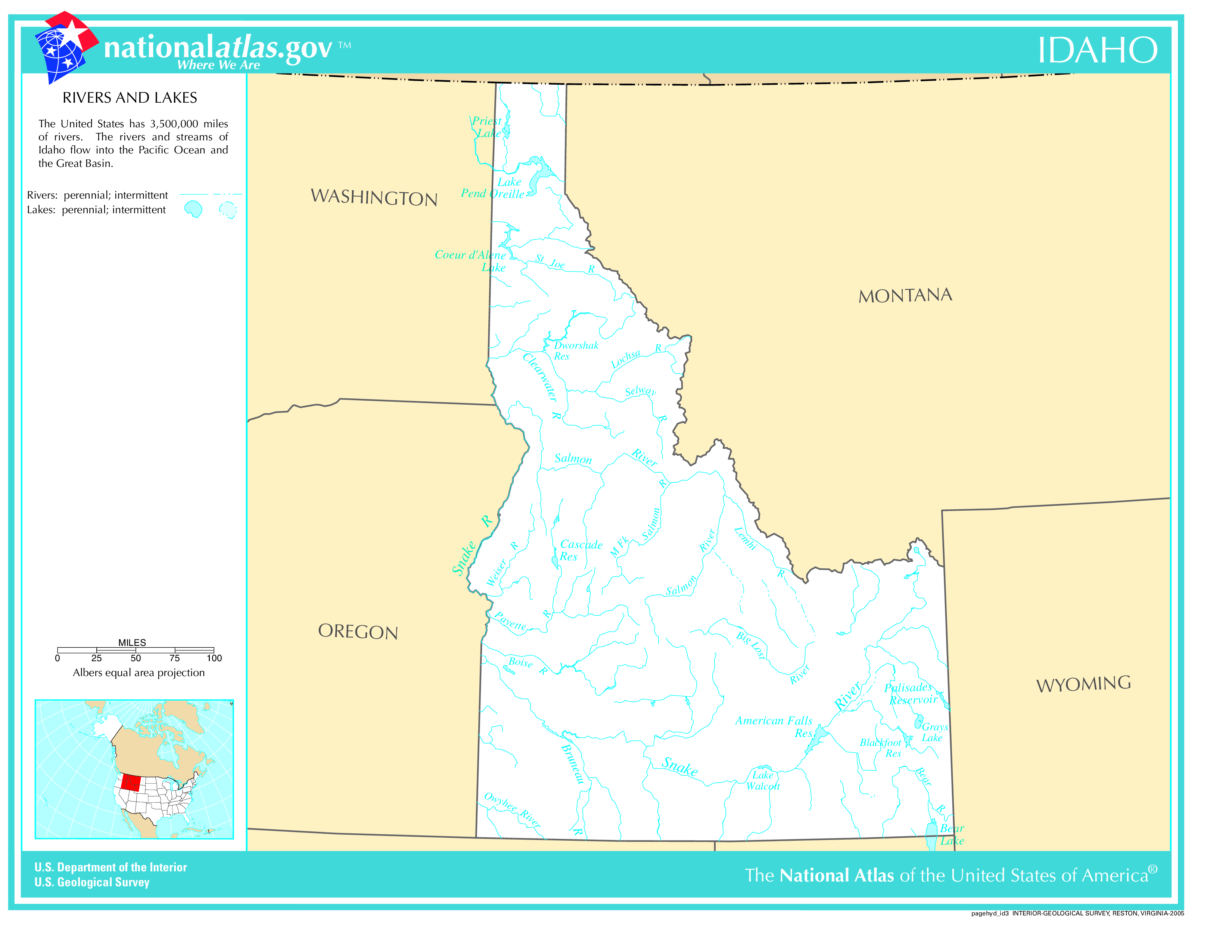
Largest Lake In Idaho: Lake Pend Oreille 148 (sq mi)
Longest River In Idaho: Snake River 1,078 miles (1,735 km)
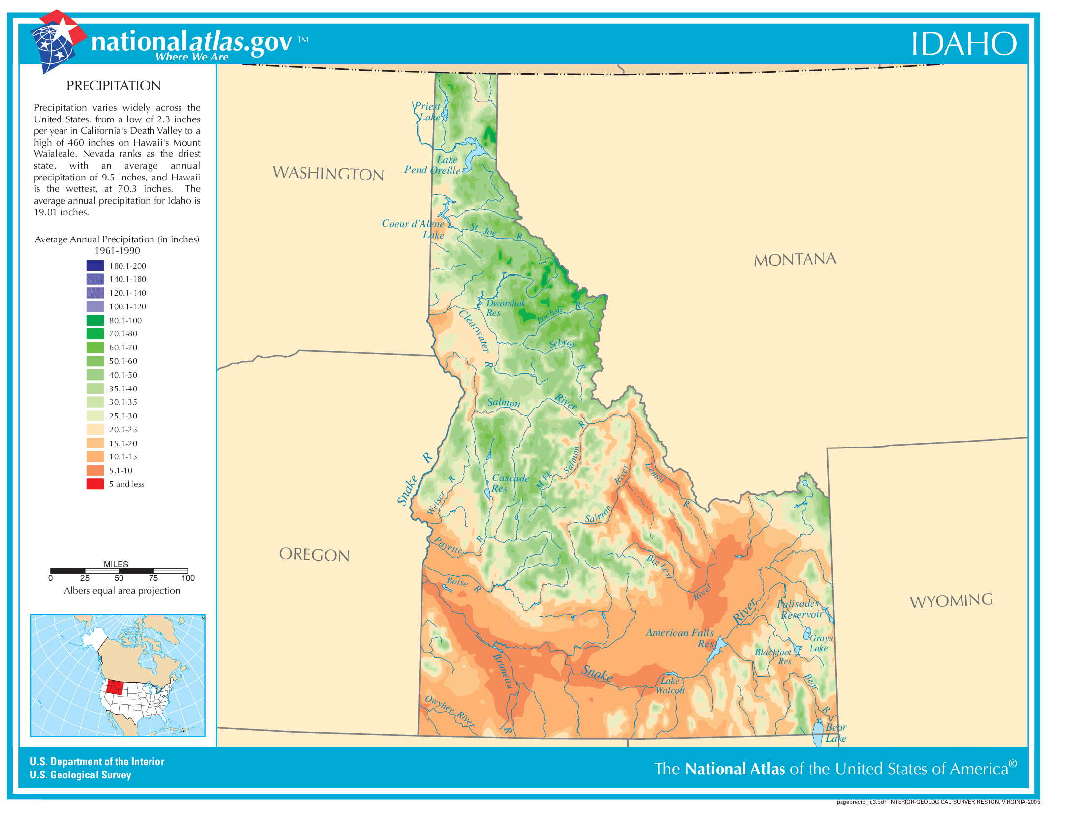
Idaho Annual Precipitation Map
Idaho Köppen Climate Map
