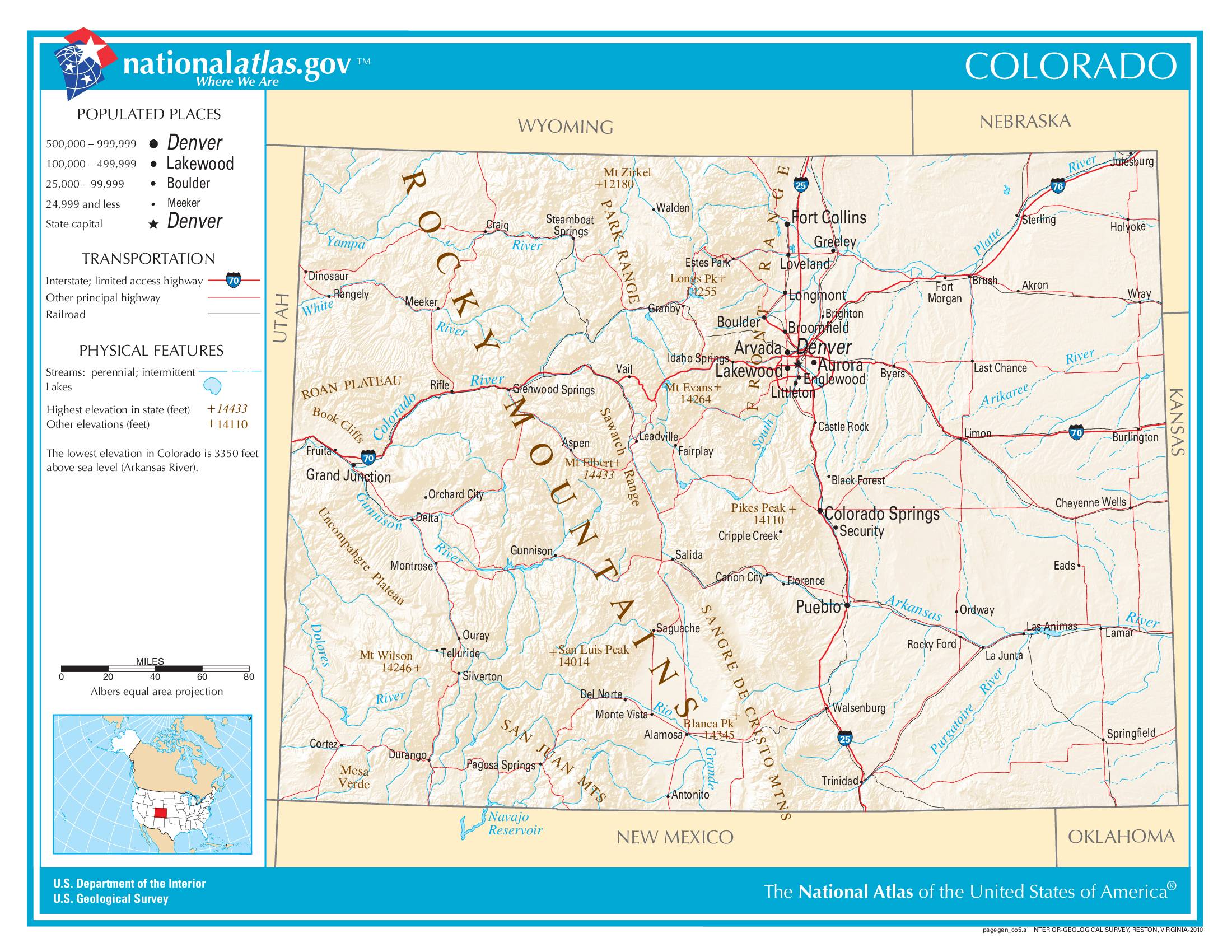
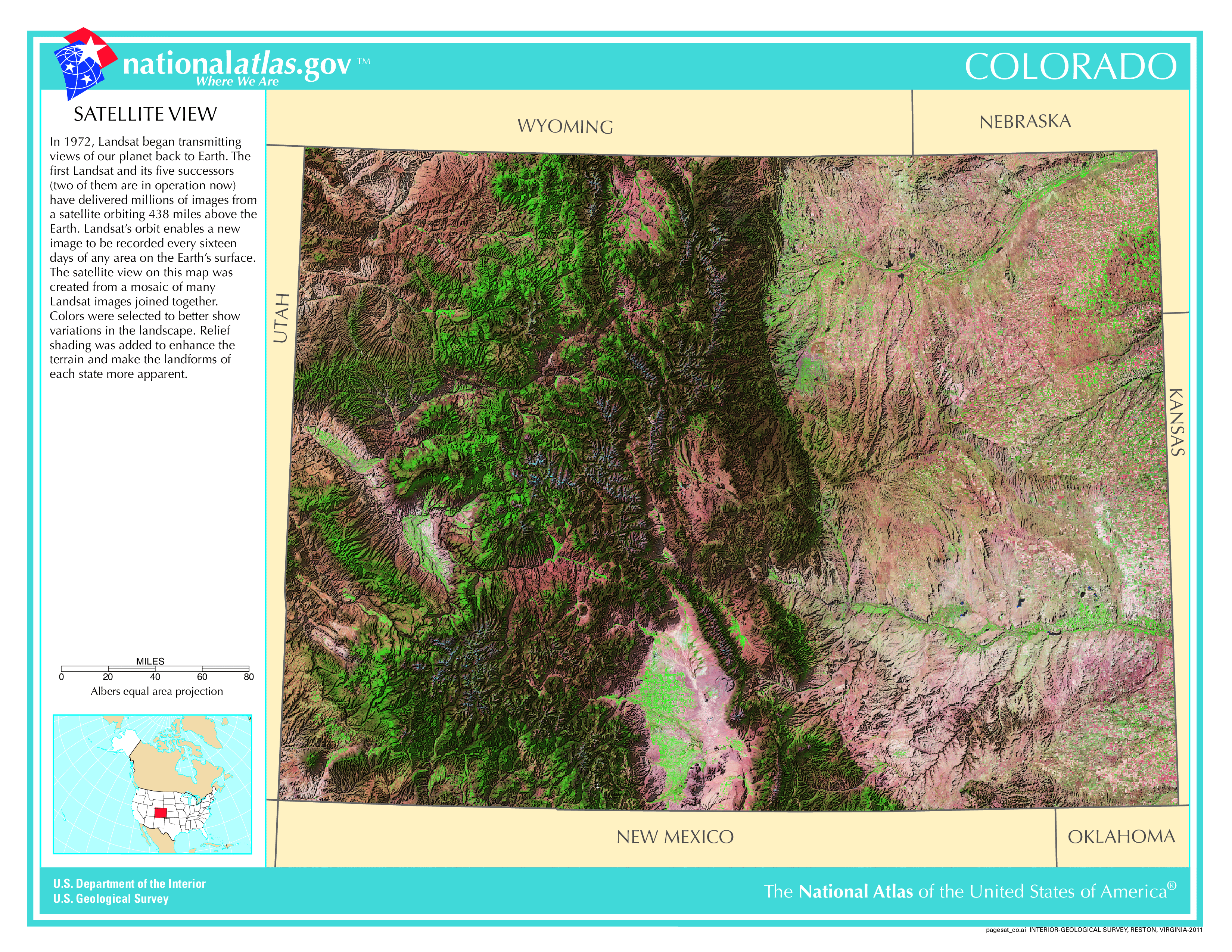
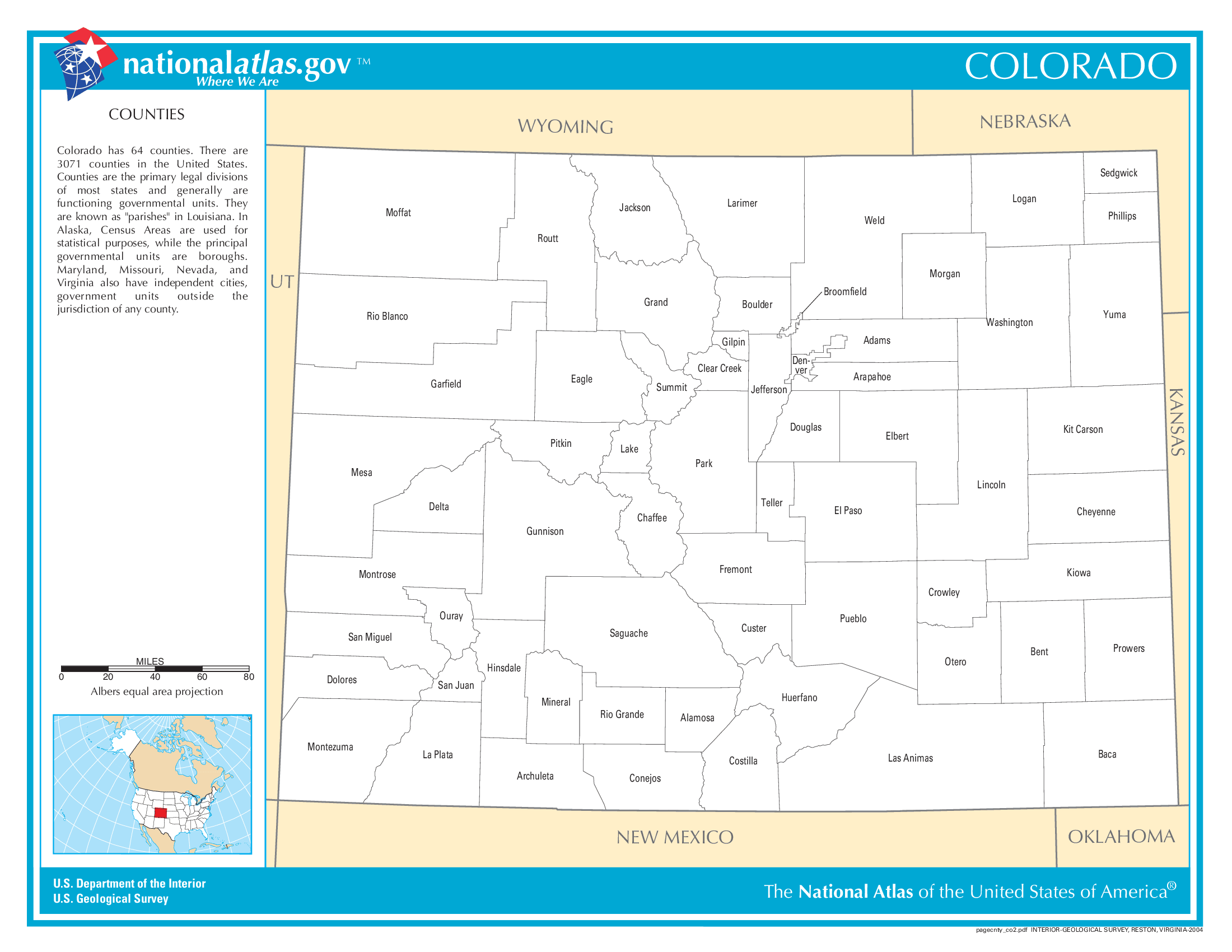
The map of Colorado above and the maps below are part of the US government’s now closed NationalAtlas.gov project.
However, they are too good to be lost forever so I’ve preserved them here.
You can learn more about the project and why it was closed down here.
Satellite Map Of Colorado
General Colorado State Facts
Demonym: Coloradan
State Abbreviation: CO
Year Admitted To US: 1876
State Number (Out of 50): 38th
State Capital: Denver
Total Area: 104,094 sq mi (269,601 km2)
State Area Ranking (Out of 50): 8th
Highest Point: Mount Elbert – 14,440 ft (4401.2 m)
Lowest Point: 3,317 ft (1011 m)
State Website: https://www.colorado.gov/
List of Interstate Highways In Colorado
- I-25
- I-70
- I-76
- I-225
- I-270
- I-470
List of US Highways In Colorado
- US 138
- US 164
- US 24
- US 285
- US 34
- US 350
- US 36
- US 38
- US 400
- US 450
- US 550
- US 650
- US 84
List of Toll Roads In Colorado
- E-470
- Northwest Parkway
- Pikes Peak Highway
- US 34 (Trail Ridge Road)
- I-25 (Express Lanes)
- I-25 (North Express Lanes)
- I-25 (South Express Lanes)
- I-70 (Mountain Express Lanes)
- I-70 (Central Express Lanes)
- US 36 (Express Lanes)
- SH 470 (Express Lanes)
Did you known State Highway 14 is the longest road in Colorado at 236.92 mi (381.29 km).
Colorado County Map
Colorado County Map With Important Cities & Towns
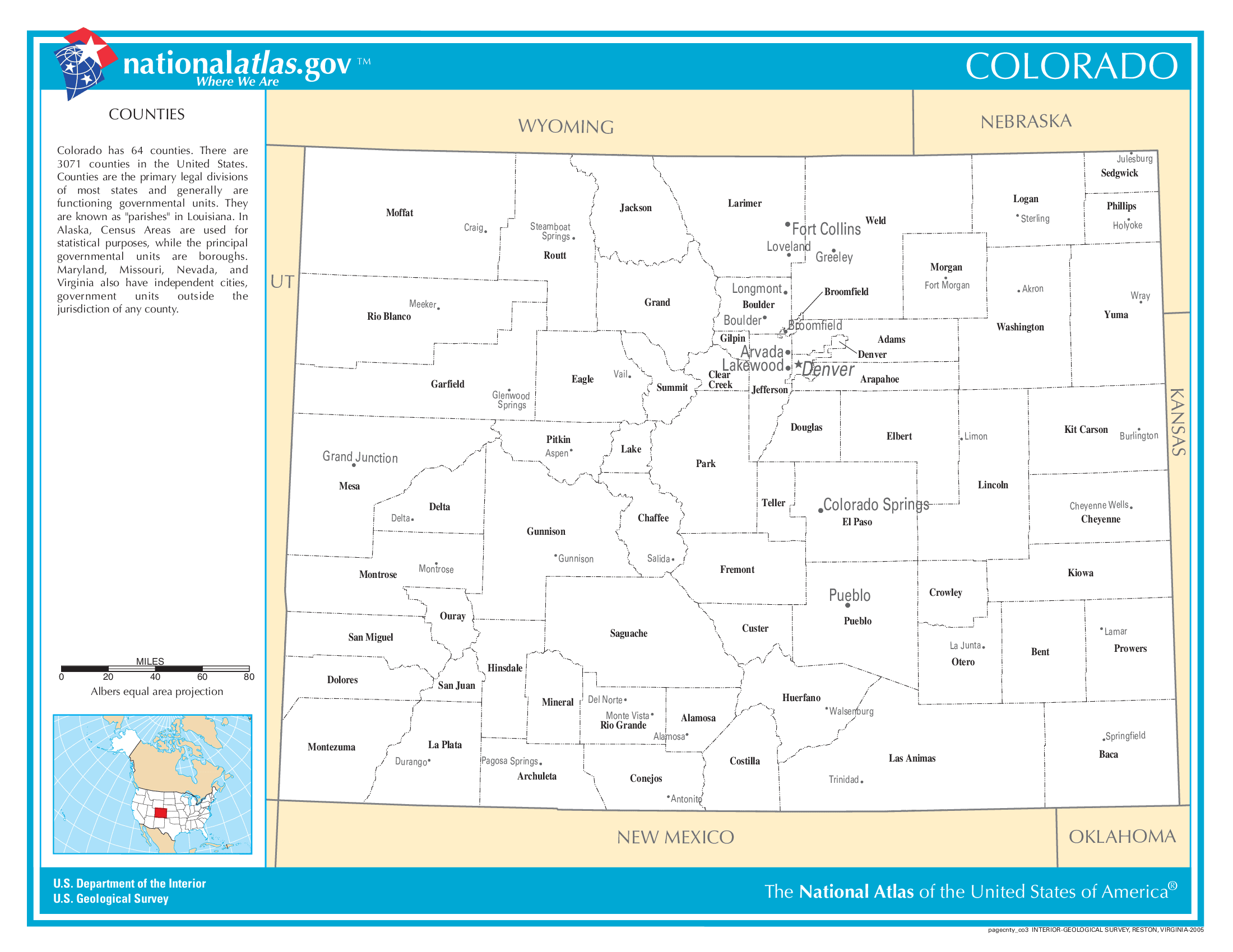
You can see more Colorado county maps here.
Colorado Population Density Map
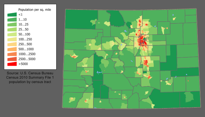
Colorado Population Facts
State Population: 5,877,610
State Population Rank (out of 50): 21st
Population Density: 57/sq mi (22/km2)
Population Density Rank (out of 50): 37th
Top 10 Cities In Colorado
- Denver: 716,577
- Colorado Springs: 488,664
- Aurora: 395,052
- Fort Collins: 170,376
- Lakewood: 155,961
- Thornton: 144,922
- Arvada: 121,414
- Westminster: 114,875
- Greeley: 112,609
- Pueblo: 111,077
Colorado Income & Taxes
Median Household Income: 89,930
Household Income Rank (out of 50): 8th
Top Marginal State Income Tax Rate: 4.40%
Average Sales Tax Rate*: 7.81%
Average Property Tax Rate*: 0.55%
* Note theses vary from city to city within the state.
Map of Colorado Lakes & Rivers
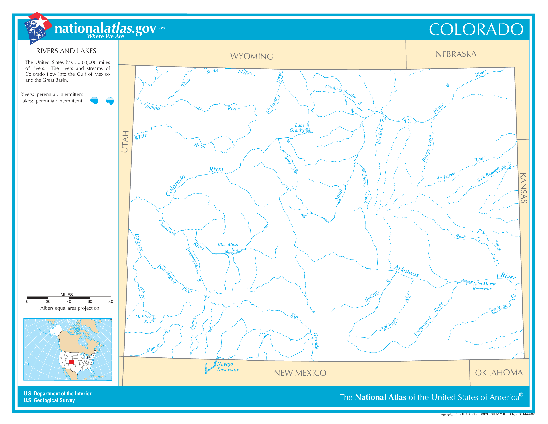
Largest Lake In Colorado: John Martin Reservoir 18 (sq mi)
Longest River In Colorado: Rio Grande 1,896 miles (3,051 km)
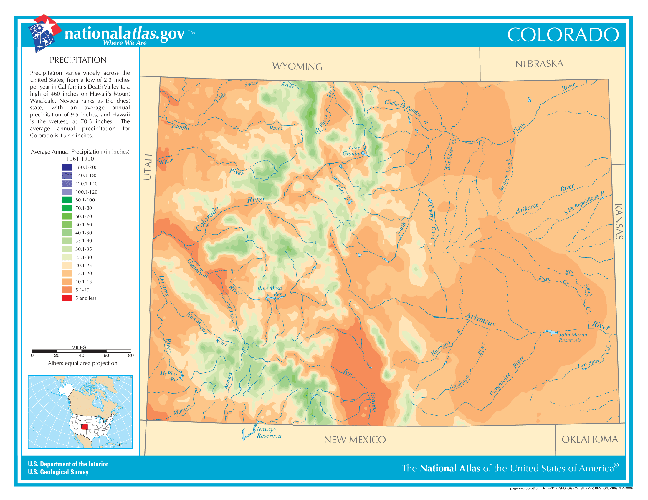
Colorado Annual Precipitation Map
Colorado Köppen Climate Map
