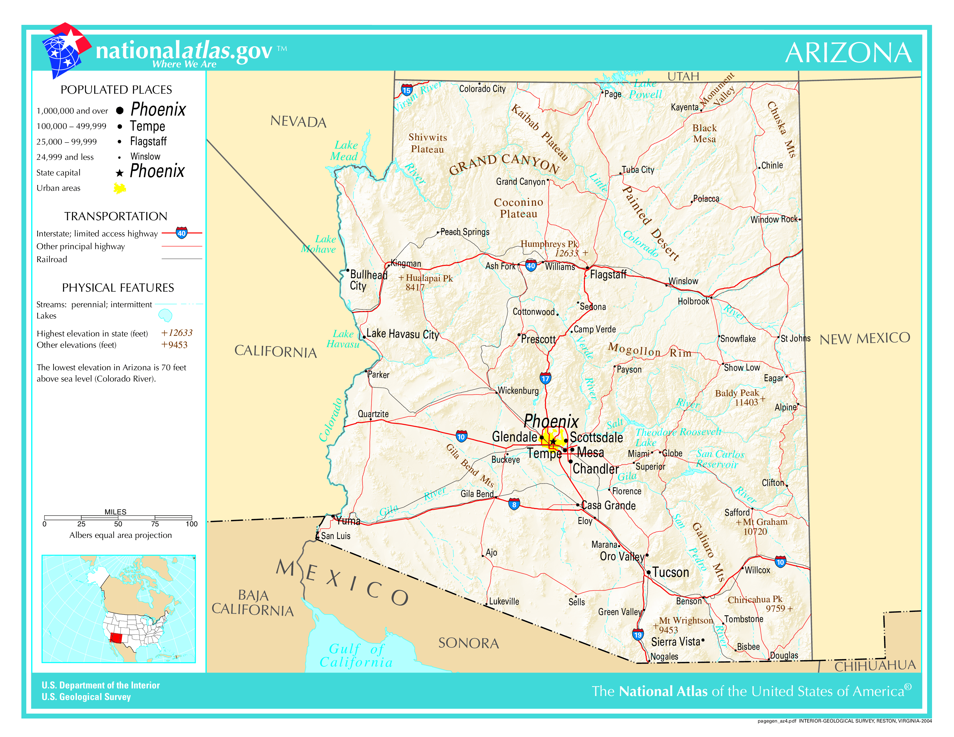
The map of Arizona above and the maps below are part of the US government’s now closed NationalAtlas.gov project.
However, they are too good to be lost forever so I’ve preserved them here.
You can learn more about the project and why it was closed down here.
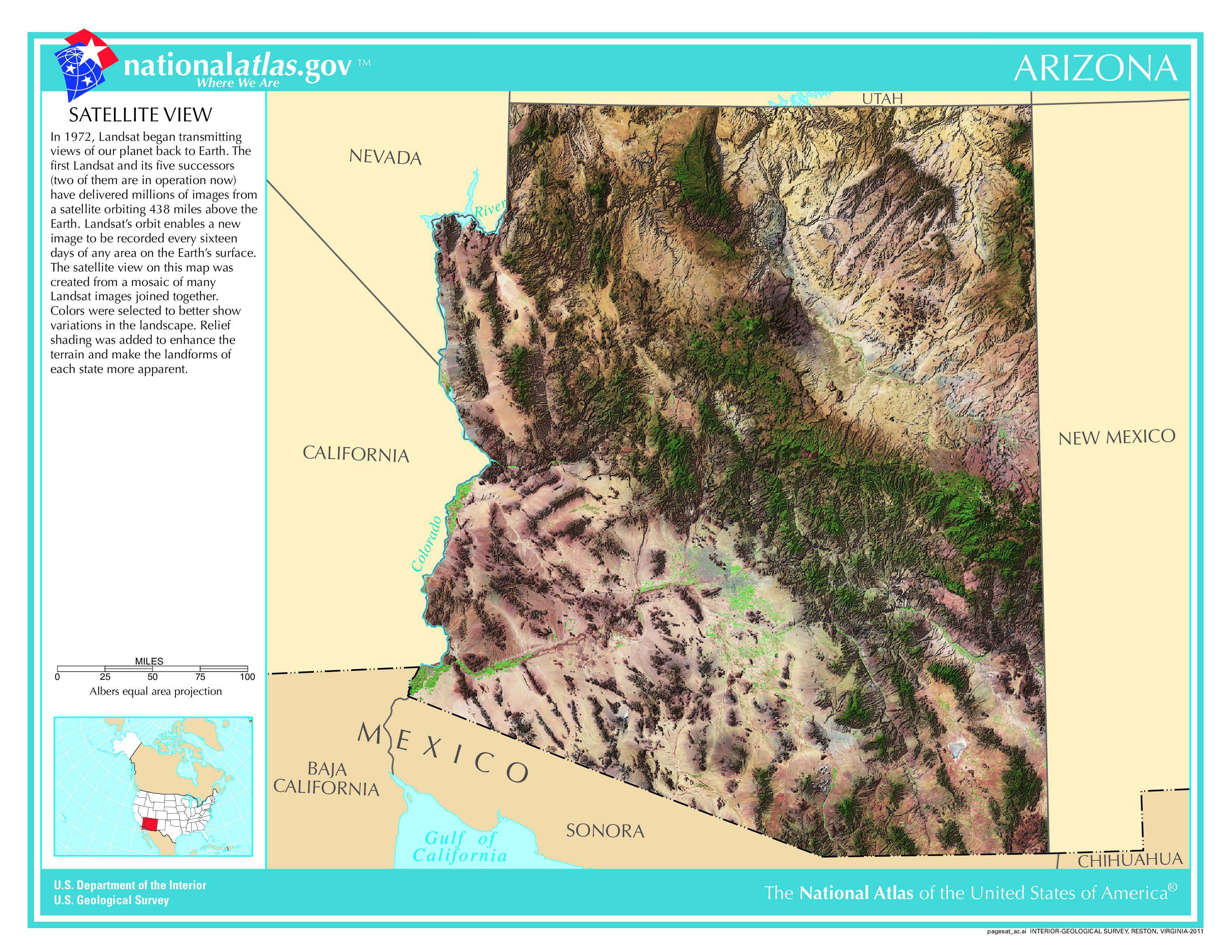
Satellite Map Of Arizona
General Arizona State Facts
Demonym: Arizonan
State Abbreviation: AZ
Year Admitted To US: 1912
State Number (Out of 50): 48th
State Capital: Phoenix
Total Area: 113,990 sq mi (295,234 km2)
State Area Ranking (Out of 50): 6th
Highest Point: Humphreys Peak – 12,637 ft (3851.8 m)
Lowest Point: 70 ft (21 m)
State Website: https://az.gov/
List of Interstate Highways In Arizona
- I-8
- I-10
- I-11
- I-15
- I-17
- I-19
- I-40
List of US Highways In Arizona
- US 160
- US 163
- US 164
- US 180
- US 191
- US 260
- US 466
- US 60
- US 64
- US 666
- US 70
- US 89
- US 93
- US 95
List of Toll Roads In Arizona
No
Did you known State Route 87 is the longest road in Arizona at 272.66 mi (438.8 km).
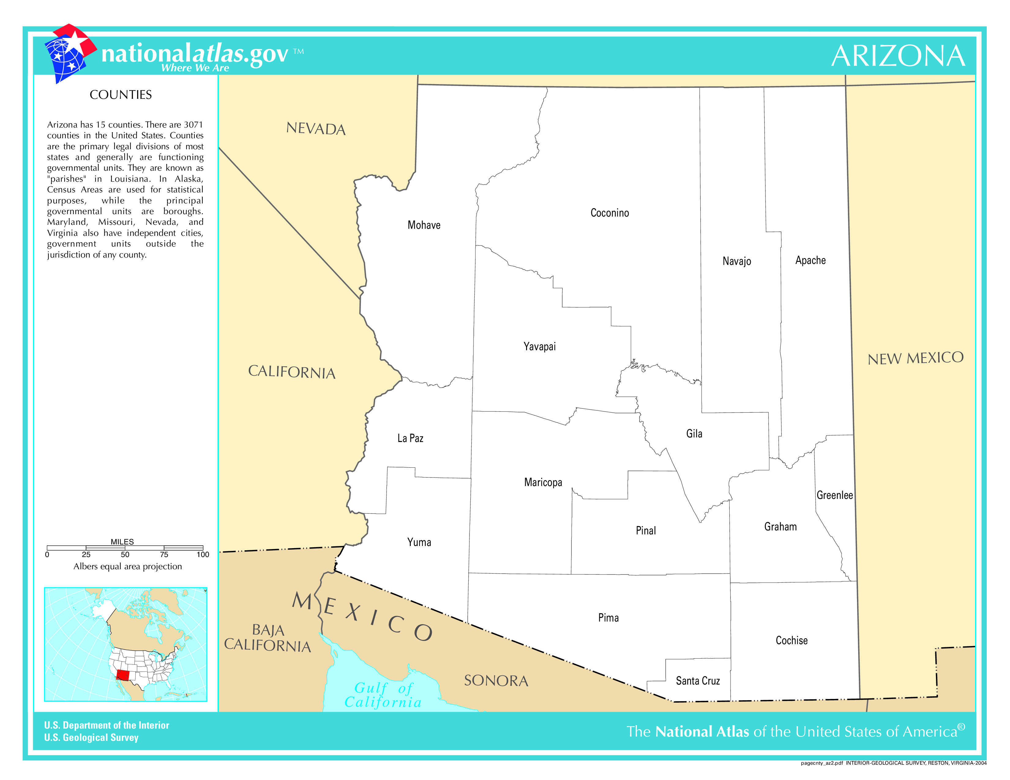
Arizona County Map
Arizona County Map With Important Cities & Towns
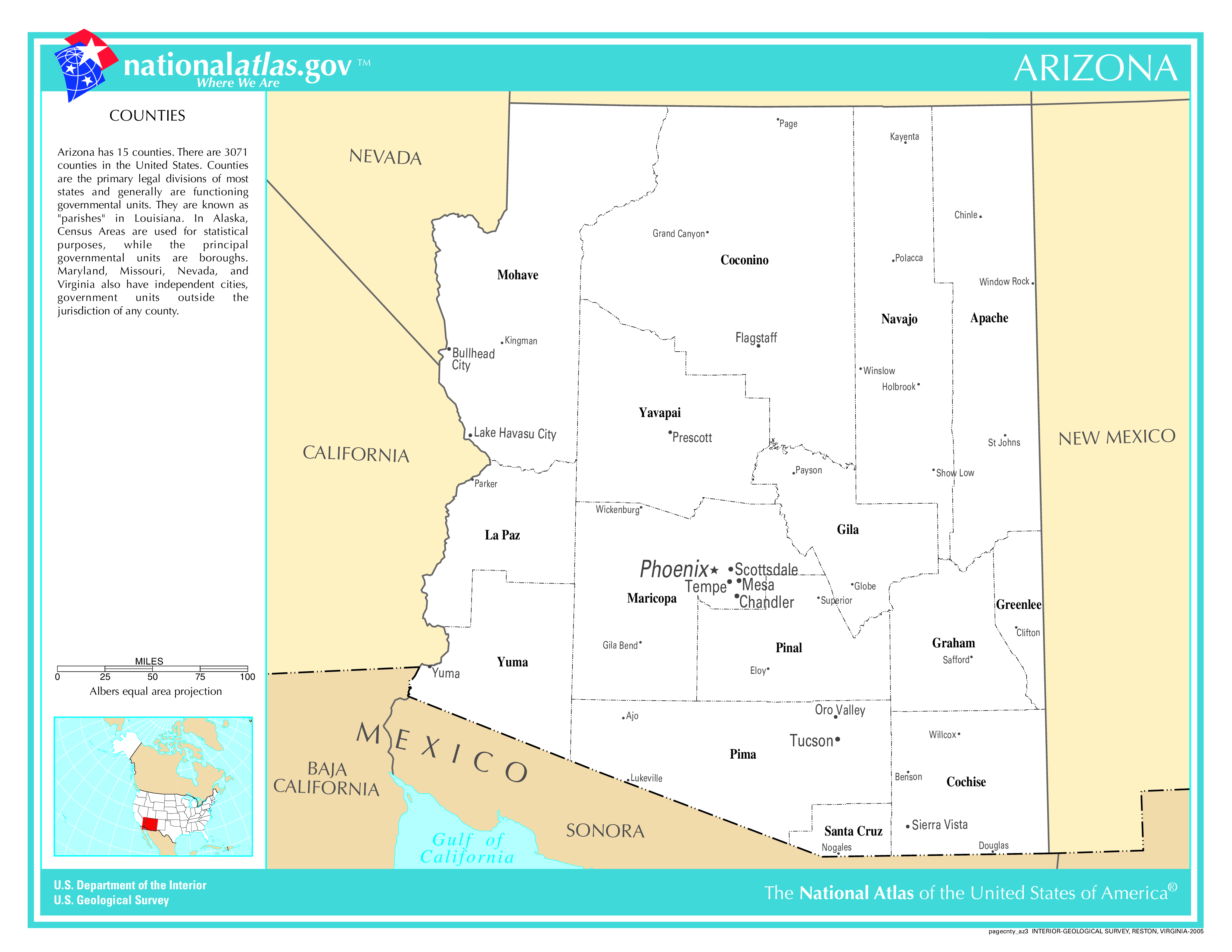
You can see more Arizona county maps here.
Arizona Population Density Map
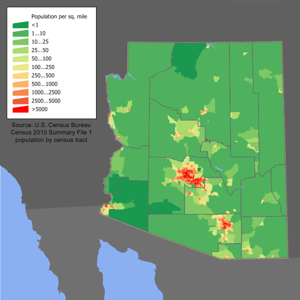
Arizona Population Facts
State Population: 7,431,344
State Population Rank (out of 50): 14th
Population Density: 65/sq mi (25/km2)
Population Density Rank (out of 50): 32nd
Top 10 Cities In Arizona
- Phoenix: 1,650,070
- Tucson: 547,239
- Mesa: 511,648
- Chandler: 280,167
- Gilbert: 275,411
- Glendale: 253,855
- Scottsdale: 244,394
- Peoria: 198,750
- Tempe: 189,834
- Surprise: 158,285
Arizona Income & Taxes
Median Household Income: 73,450
Household Income Rank (out of 50): 24th
Top Marginal State Income Tax Rate: 2.50%
Average Sales Tax Rate*: 8.38%
Average Property Tax Rate*: 0.63%
* Note theses vary from city to city within the state.
Map of Arizona Lakes & Rivers
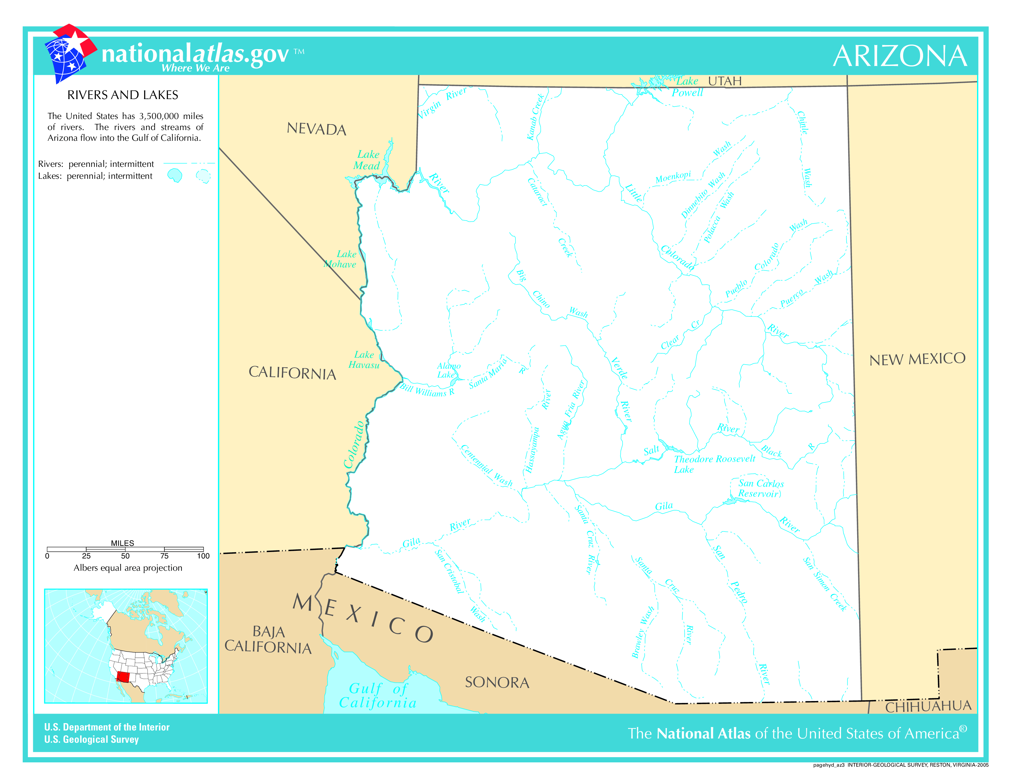
Largest Lake In Arizona: Theodore Roosevelt Lake 34 (sq mi)
Longest River In Arizona: Colorado River 1,450 miles (2,330 km)
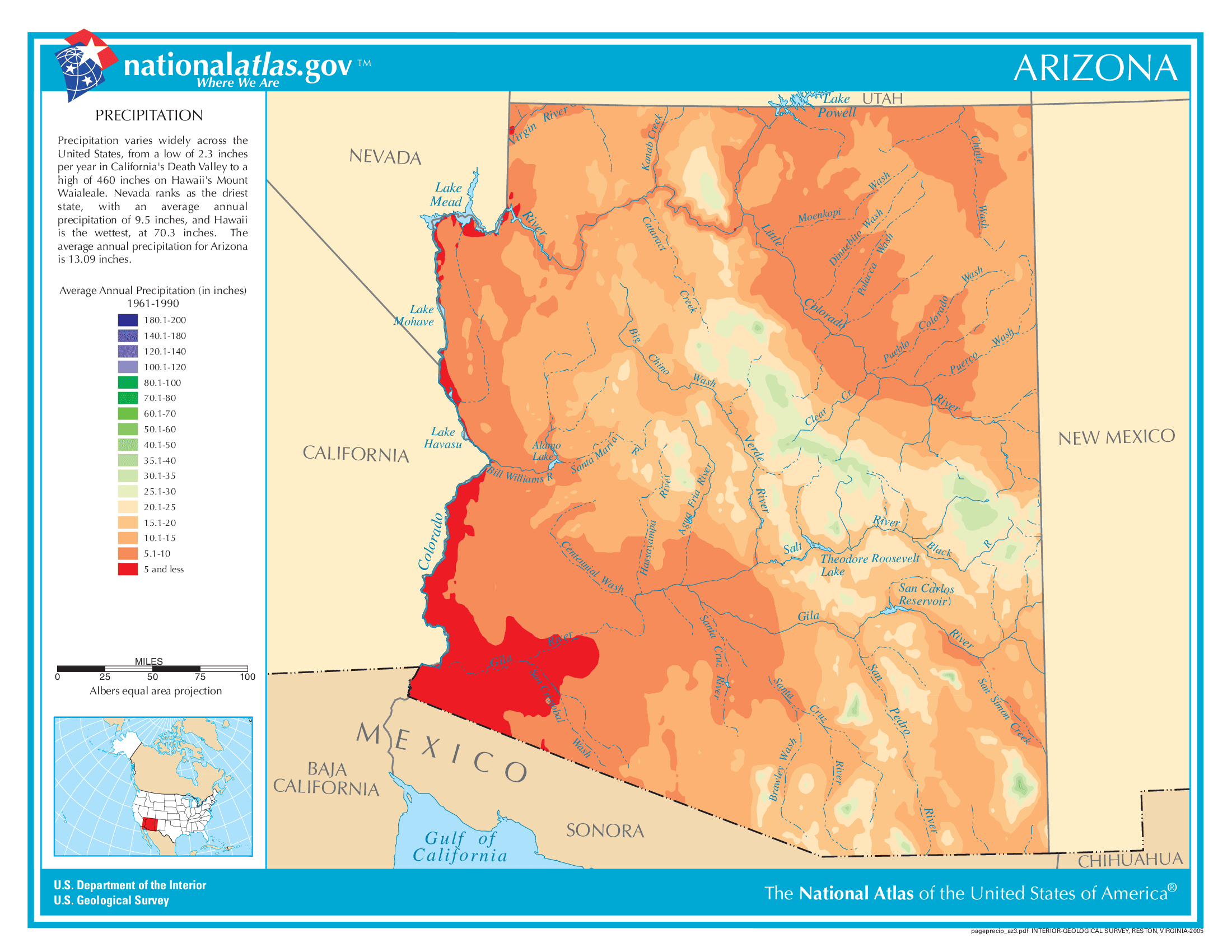
Arizona Annual Precipitation Map
Arizona Köppen Climate Map

What States Does Arizona Border?
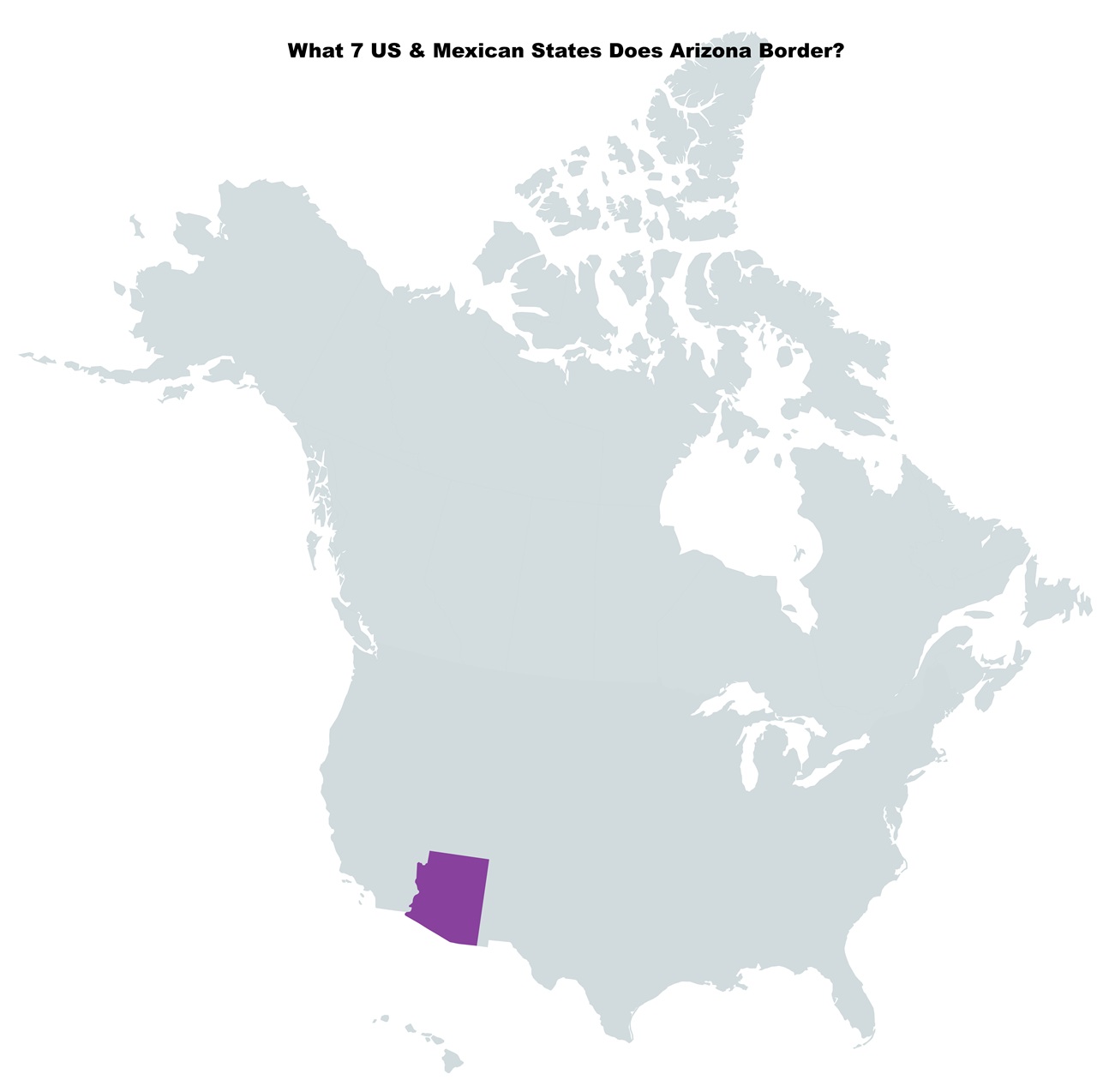
Arizona borders the following 5 US states:
- California
- Colorado
- Nevada
- New Mexico
- Utah
It also borders the 2 Mexican states of:
- Sonora
- Baja California