
The map of Maine above and the maps below are part of the US government’s now closed NationalAtlas.gov project.
However, they are too good to be lost forever so I’ve preserved them here.
You can learn more about the project and why it was closed down here.
Satellite Map Of Maine

General Maine State Facts
Demonym: Mainer
State Abbreviation: ME
Year Admitted To US: 1820
State Number (Out of 50): 23rd
State Capital: Augusta
Total Area: 35,380 sq mi (91,633 km2)
State Area Ranking (Out of 50): 39th
Highest Point: Mount Katahdin – 5,270 ft (1606.4 m)
Lowest Point: 0 ft (0 m)
State Website: https://www.maine.gov/
List of Interstate Highways In Maine
- I-95
- I-195
- I-295
- I-395
- I-495
List of US Highways In Maine
- US 1
- US 2
- US 201
- US 202
- US 302
List of Toll Roads In Maine
- I-95 / Maine Turnpike
- I-495 (Falmouth Spur)
- Park Loop Road
Did you known State Route 11 is the longest road in Maine at 401.2 mi (645.7 km).
Maine County Map

Maine County Map With Important Cities & Towns

You can see more Maine county maps here.
Maine Population Density Map

Maine Population Facts
State Population: 1,395,722
State Population Rank (out of 50): 42nd
Population Density: 45/sq mi (17/km2)
Population Density Rank (out of 50): 38th
Top 10 Cities In Maine
- Portland: 69,104
- Lewiston: 38,404
- Bangor: 31,628
- South Portland: 26,840
- Auburn: 24,793
- Biddeford: 22,367
- Sanford: 22,251
- Saco: 20,960
- Westbrook: 20,564
- Augusta: 19,102
Maine Income & Taxes
Median Household Income: 75,160
Household Income Rank (out of 50): 22nd
Top Marginal State Income Tax Rate: 7.15%
Average Sales Tax Rate*: 5.50%
Average Property Tax Rate*: 1.24%
* Note theses vary from city to city within the state.
Map of Maine Lakes & Rivers

Largest Lake In Maine: Moosehead Lake 117 (sq mi)
Longest River In Maine: Saint John River 418 miles (673 km)
Maine Annual Precipitation Map

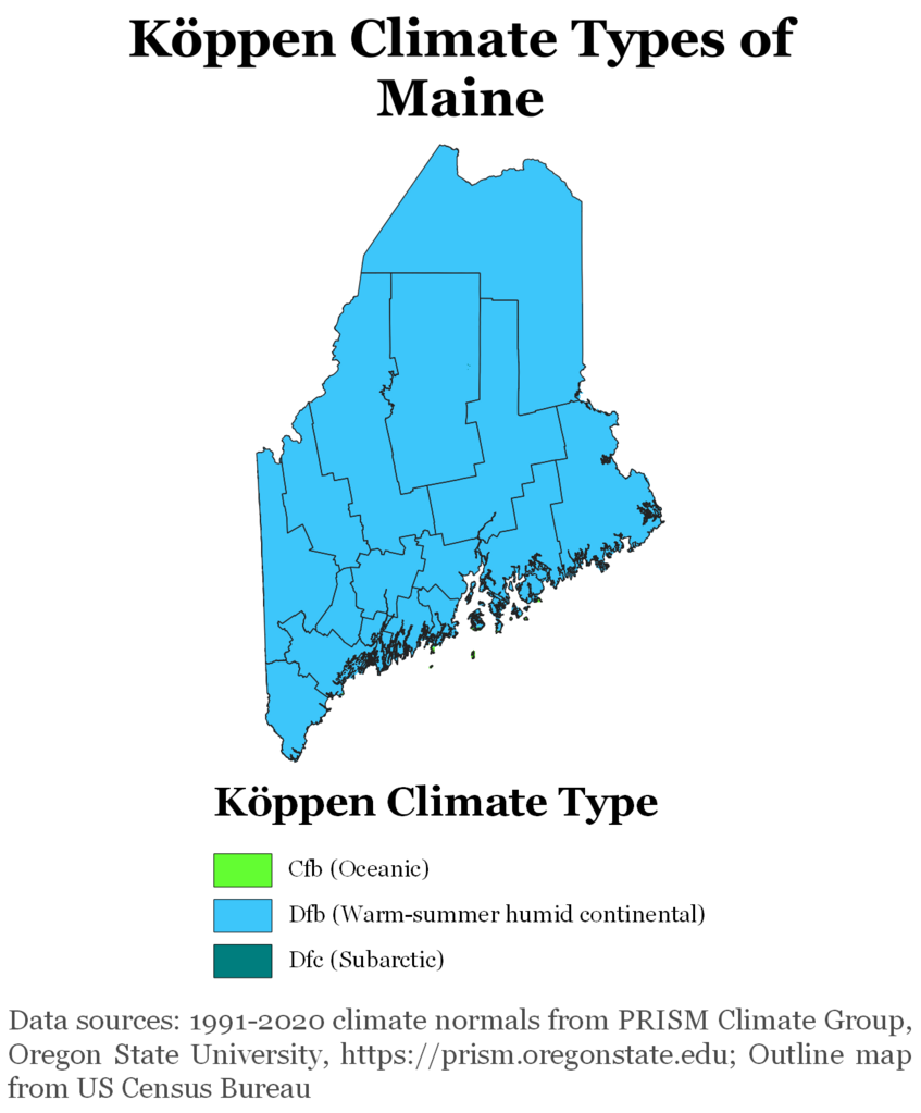
Maine Köppen Climate Map
More Maps Of US States The Government Doesn’t Want You To See
Finally see our Free Moving To Maine (ME) Cost Calculator.