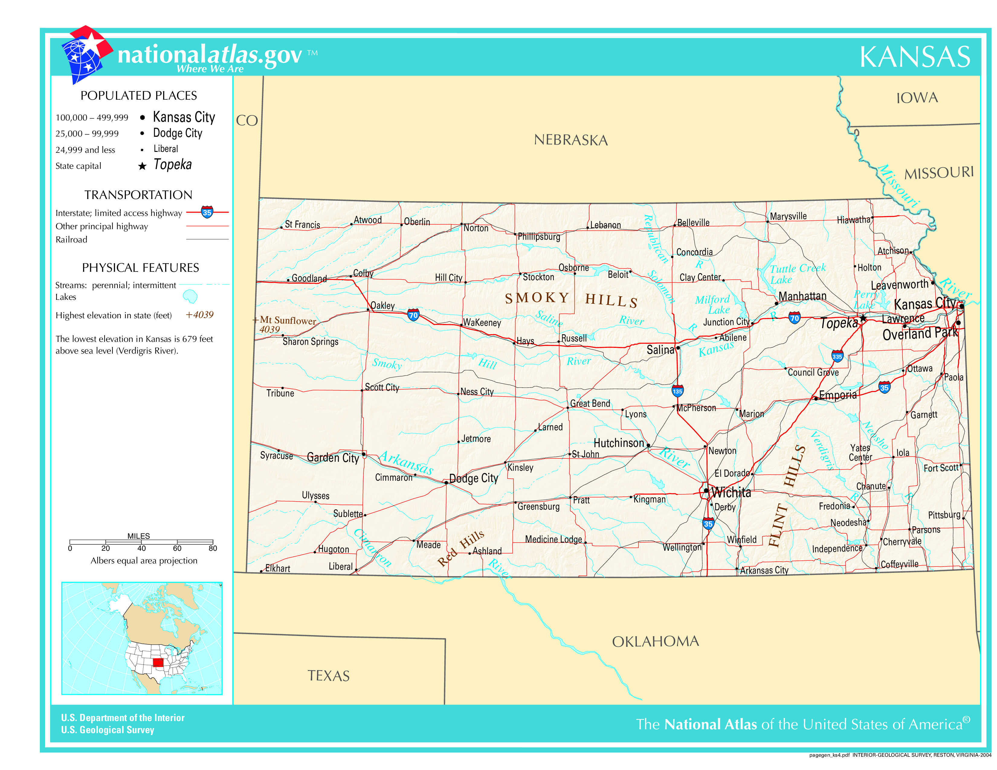
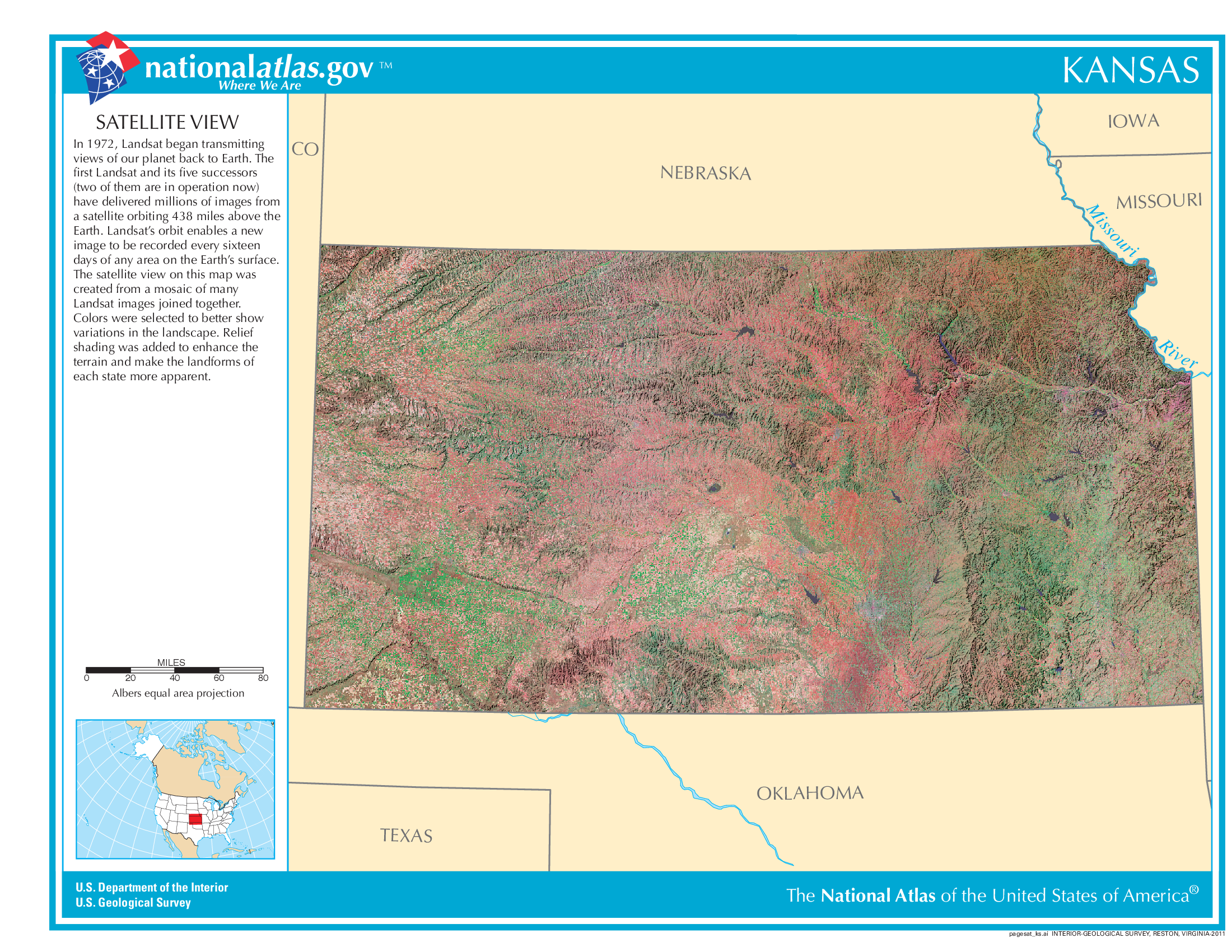
The map of Kansas above and the maps below are part of the US government’s now closed NationalAtlas.gov project.
However, they are too good to be lost forever so I’ve preserved them here.
You can learn more about the project and why it was closed down here.
Satellite Map Of Kansas
General Kansas State Facts
Demonym: Kansan
State Abbreviation: KS
Year Admitted To US: 1861
State Number (Out of 50): 34th
State Capital: Topeka
Total Area: 82,278 sq mi (213,100 km2)
State Area Ranking (Out of 50): 15th
Highest Point: Mount Sunflower – 4,041 ft (1232 m)
Lowest Point: 679 ft (207 m)
State Website: https://www.kansas.gov/
List of Interstate Highways In Kansas
- I-35
- I-70
- I-135
- I-235
- I-335
- I-435
- I-635
- I-470
- I-670
List of US Highways In Kansas
- US 154
- US 156
- US 159
- US 166
- US 177
- US 270
- US 383
- US 73
List of Toll Roads In Kansas
- I-35 / I-70 / I-335 / I-470 / Kansas Turnpike
Did you known K-4 is the longest road in Kansas at 367 mi (591 km).
Kansas County Map
Kansas County Map With Important Cities & Towns
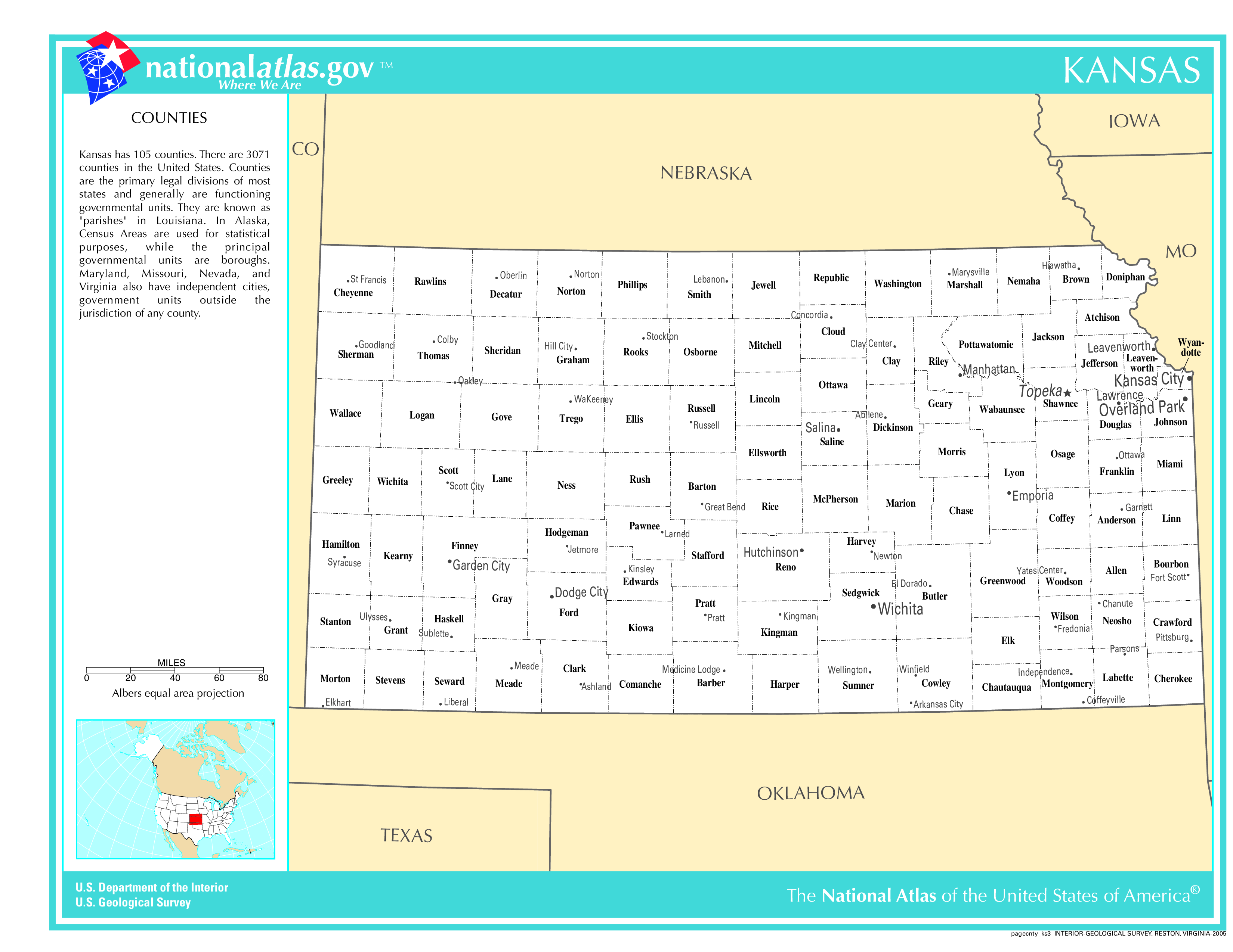
You can see more Kansas county maps here.
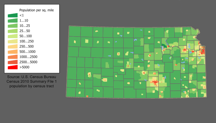
Kansas Population Density Map
Kansas Population Facts
State Population: 2,940,546
State Population Rank (out of 50): 34th
Population Density: 36/sq mi (14/km2)
Population Density Rank (out of 50): 41st
Top 10 Cities In Kansas
- Wichita: 396,119
- Overland Park: 197,089
- Kansas City: 152,933
- Olathe: 147,461
- Topeka: 125,475
- Lawrence: 96,207
- Shawnee: 69,417
- Lenexa: 58,536
- Manhattan: 53,682
- Salina: 45,792
Kansas Income & Taxes
Median Household Income: 73,040
Household Income Rank (out of 50): 27th
Top Marginal State Income Tax Rate: 5.70%
Average Sales Tax Rate*: 8.65%
Average Property Tax Rate*: 1.34%
* Note theses vary from city to city within the state.
Map of Kansas Lakes & Rivers
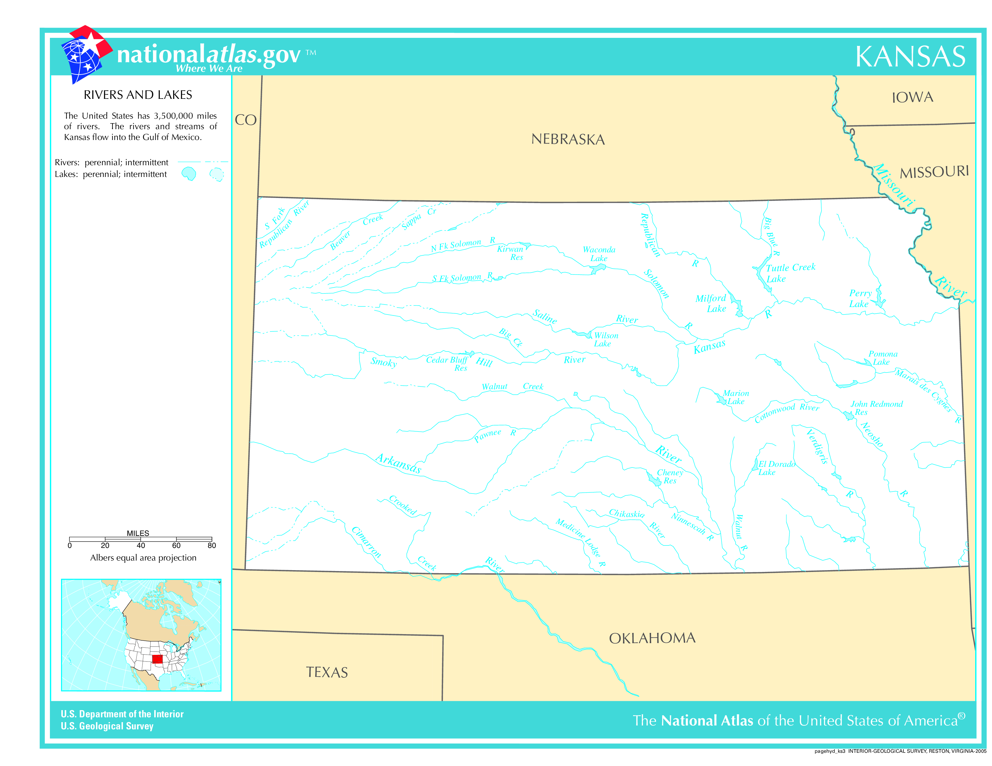
Largest Lake In Kansas: Milford Lake 25 (sq mi)
Longest River In Kansas: Missouri River 2,340 miles (3,770 km)
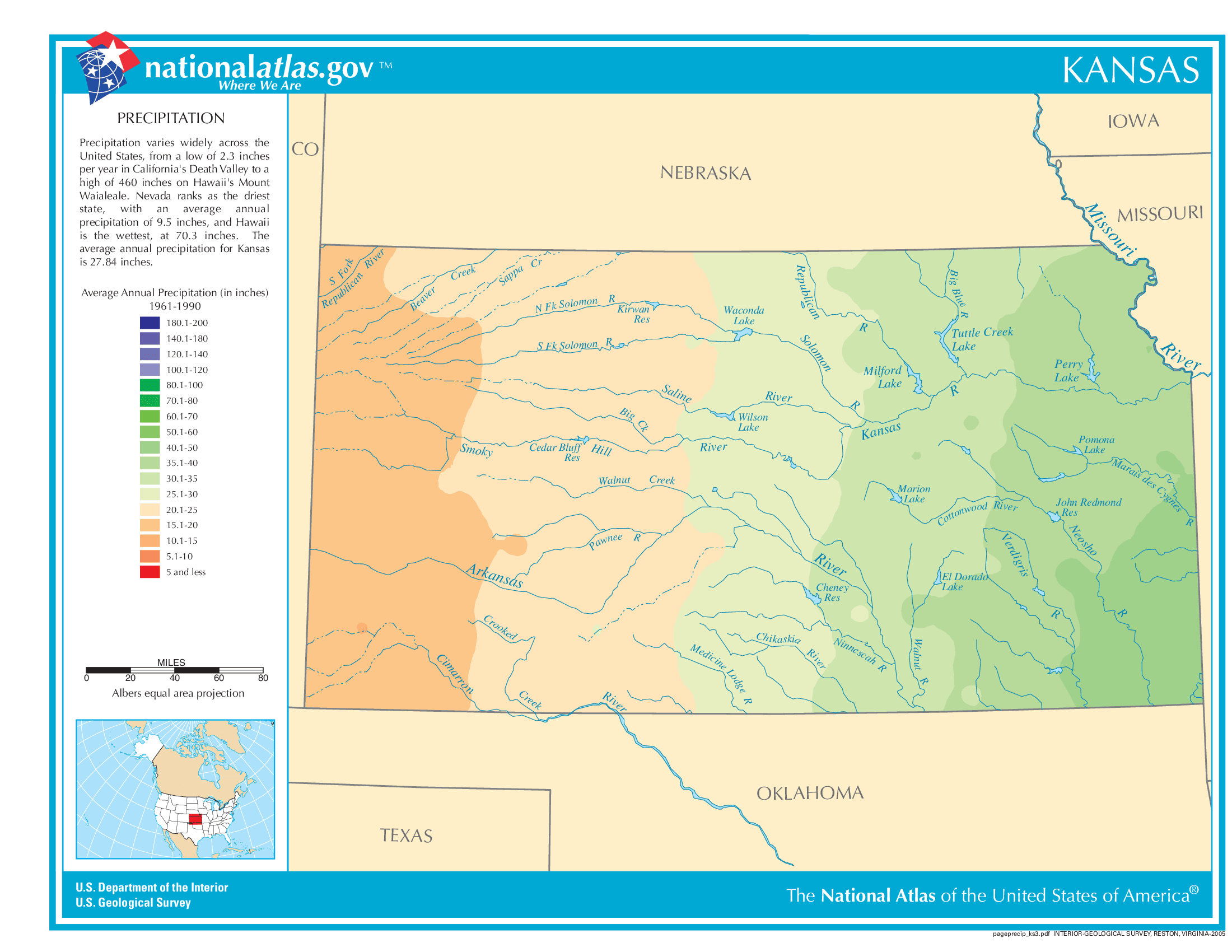
Kansas Annual Precipitation Map
Kansas Köppen Climate Map
