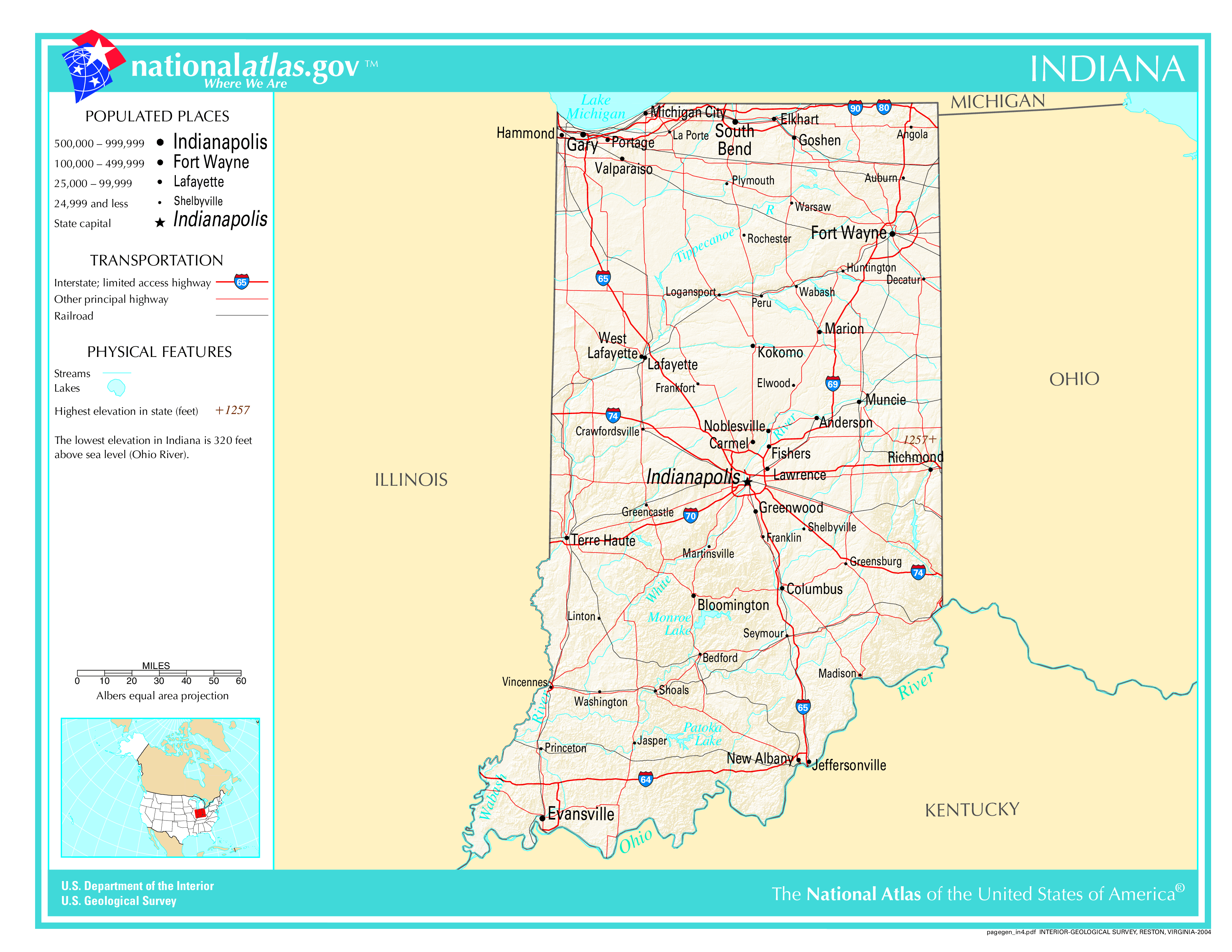
The map of Indiana above and the maps below are part of the US government’s now closed NationalAtlas.gov project.
However, they are too good to be lost forever so I’ve preserved them here.
You can learn more about the project and why it was closed down here.
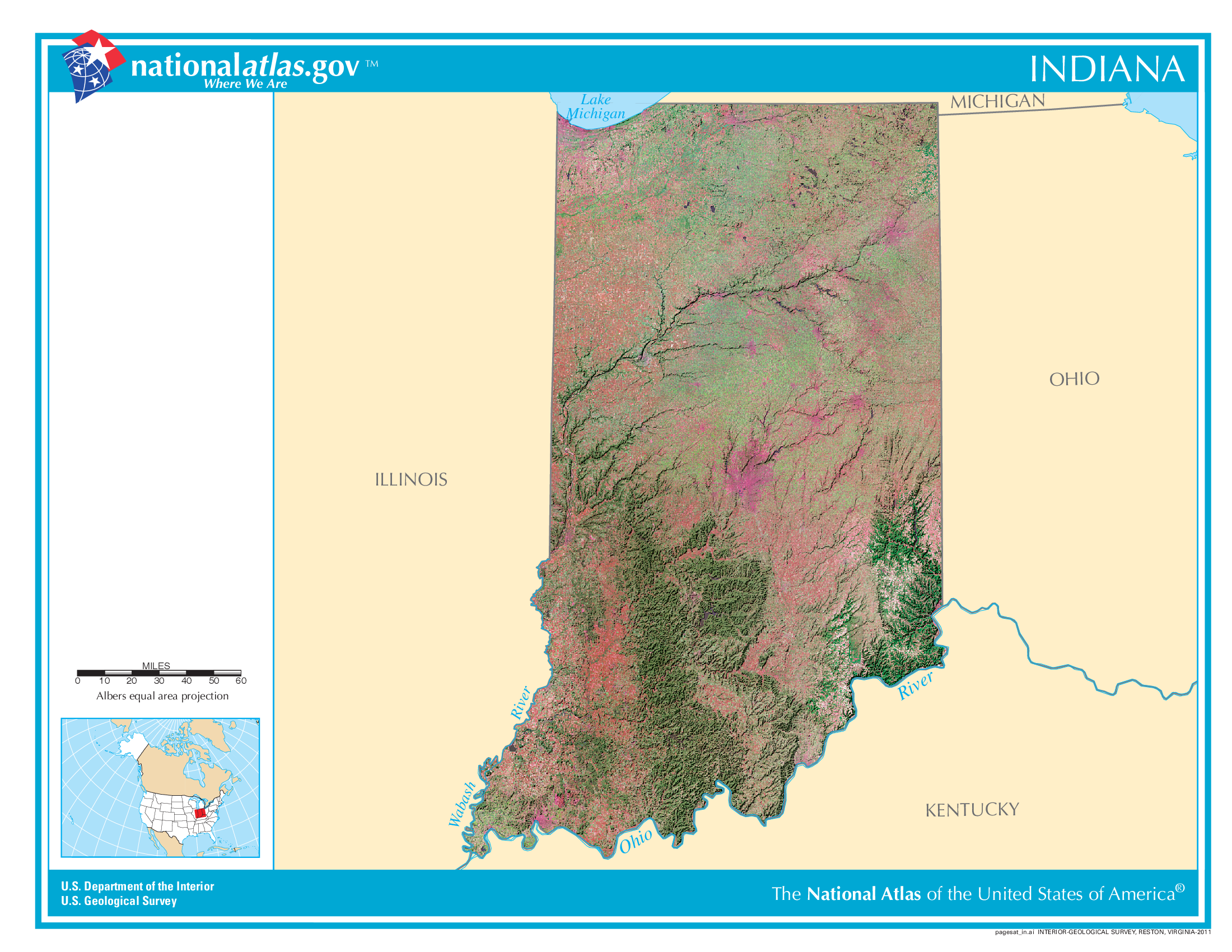
Satellite Map Of Indiana
General Indiana State Facts
Demonym: Hoosier
State Abbreviation: IN
Year Admitted To US: 1816
State Number (Out of 50): 19th
State Capital: Indianapolis
Total Area: 36,420 sq mi (94,326 km2)
State Area Ranking (Out of 50): 38th
Highest Point: Hoosier Hill – 1,257 ft (383 m)
Lowest Point: 320 ft (98 m)
State Website: https://www.in.gov/
List of Interstate Highways In Indiana
- I-64
- I-65
- I-69
- I-70
- I-74
- I-80
- I-90
- I-94
- I-164
- I-469
- I-265
- I-465
- I-865
- I-275
List of US Highways In Indiana
- US 131
- US 136
- US 152
- US 224
- US 231
- US 27
- US 33
- US 35
- US 37
- US 421
List of Toll Roads In Indiana
- I-80 / I-90 / Indiana Toll Road
Did you known State Road 37 is the longest road in Indiana at 229.4 mi (369.2 km).
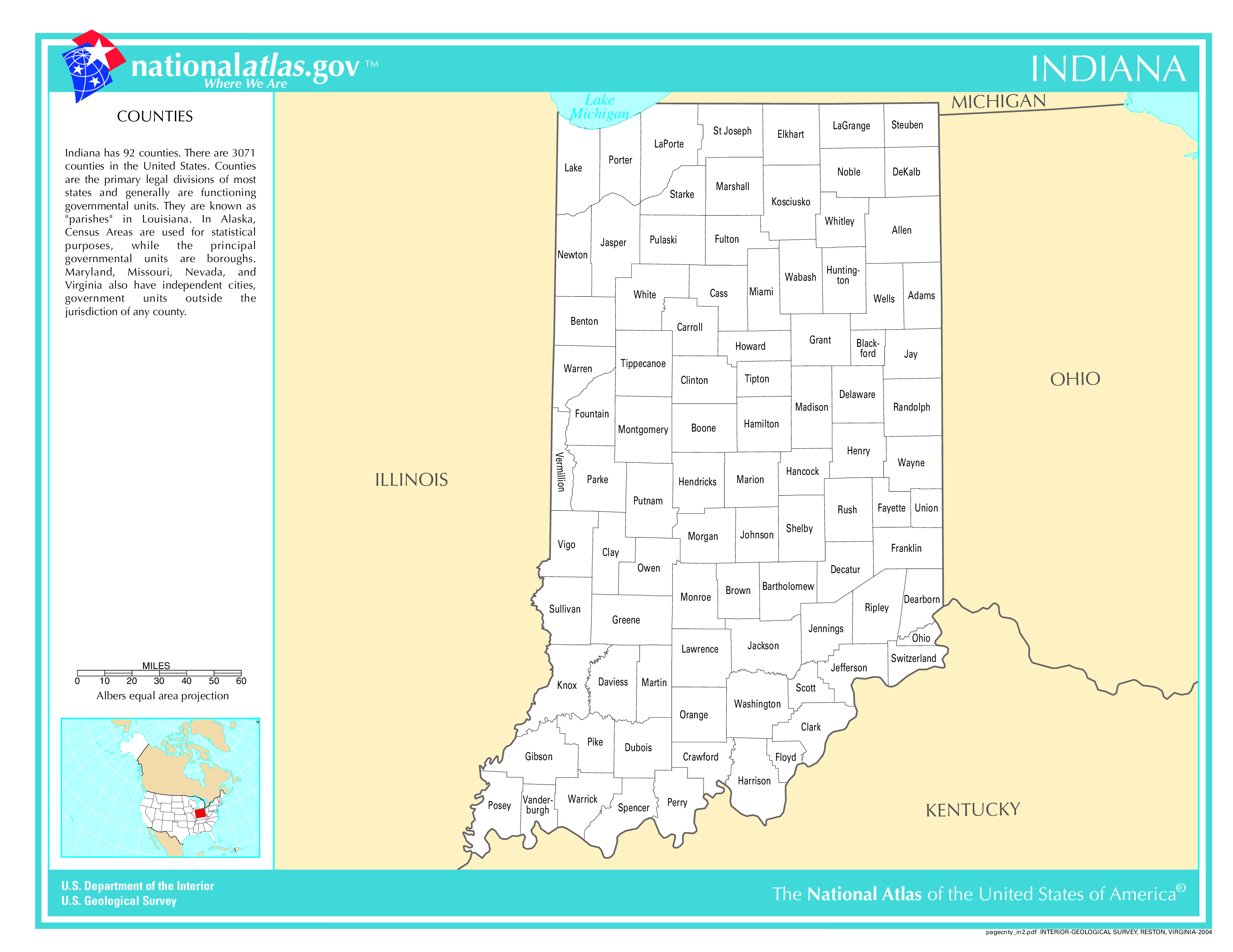
Indiana County Map
Indiana County Map With Important Cities & Towns
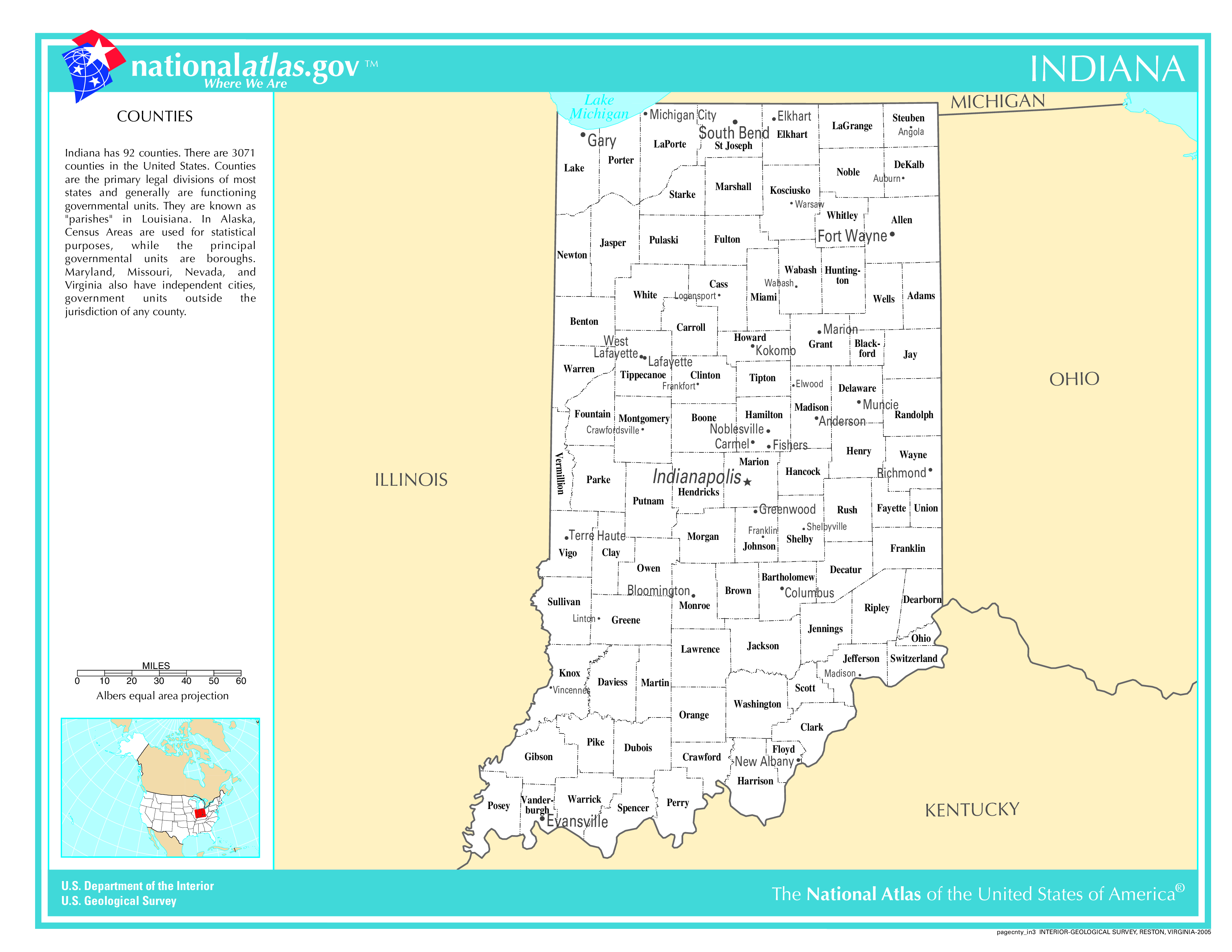
You can see more Indiana county maps here.
Indiana Population Density Map
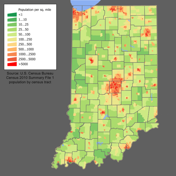
Indiana Population Facts
State Population: 6,862,199
State Population Rank (out of 50): 17th
Population Density: 192/sq mi (74/km2)
Population Density Rank (out of 50): 17th
Top 10 Cities In Indiana
- Indianapolis: 879,293
- Fort Wayne: 269,994
- Evansville: 115,332
- Fishers: 104,094
- South Bend: 103,395
- Carmel: 102,296
- Bloomington: 78,840
- Hammond: 76,193
- Noblesville: 73,916
- Lafayette: 71,216
Indiana Income & Taxes
Median Household Income: 70,030
Household Income Rank (out of 50): 34th
Top Marginal State Income Tax Rate: 3.05%
Average Sales Tax Rate*: 7.00%
Average Property Tax Rate*: 0.84%
* Note theses vary from city to city within the state.
Map of Indiana Lakes & Rivers
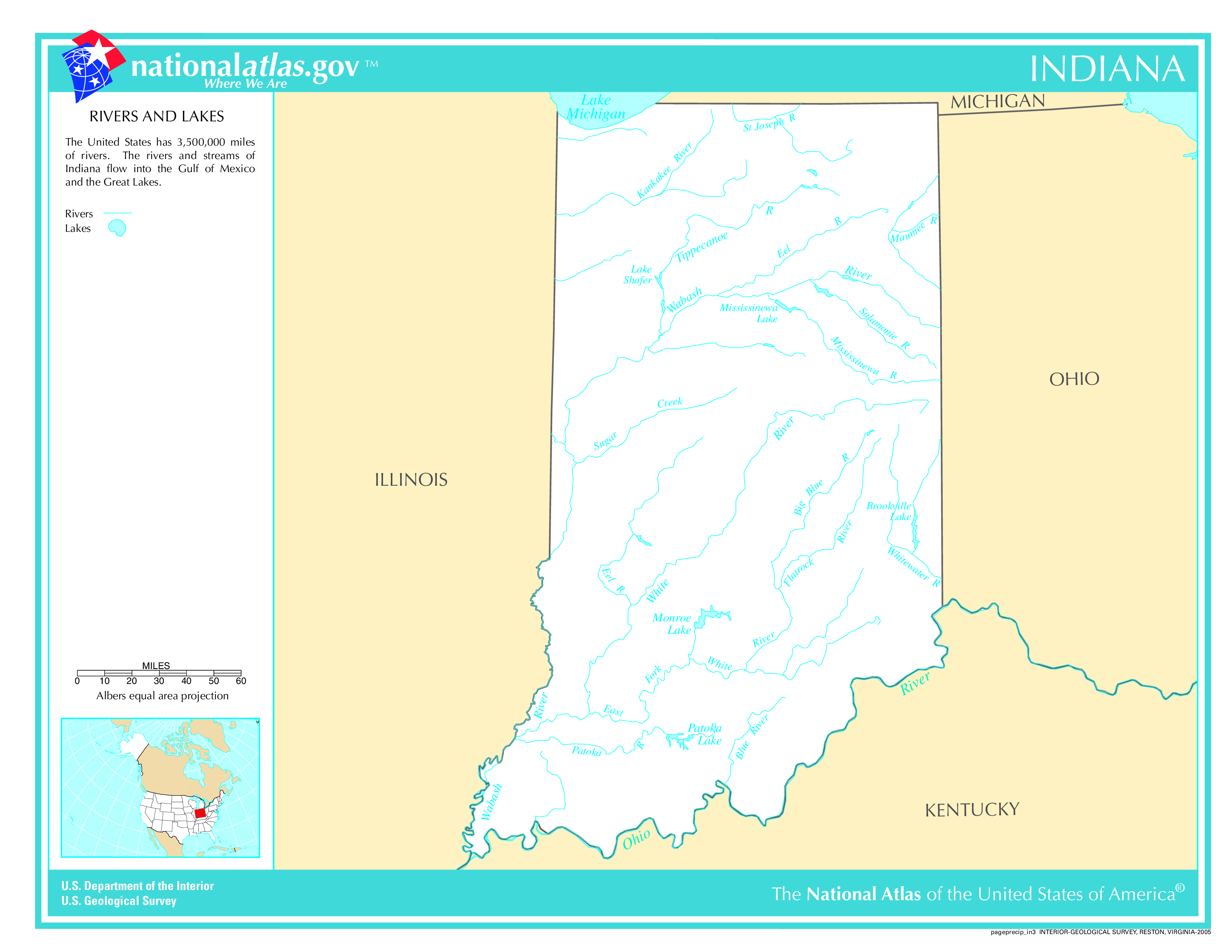
Largest Lake In Indiana: Lake Monroe 17 (sq mi)
Longest River In Indiana: Ohio River 981 miles (1,579 km)
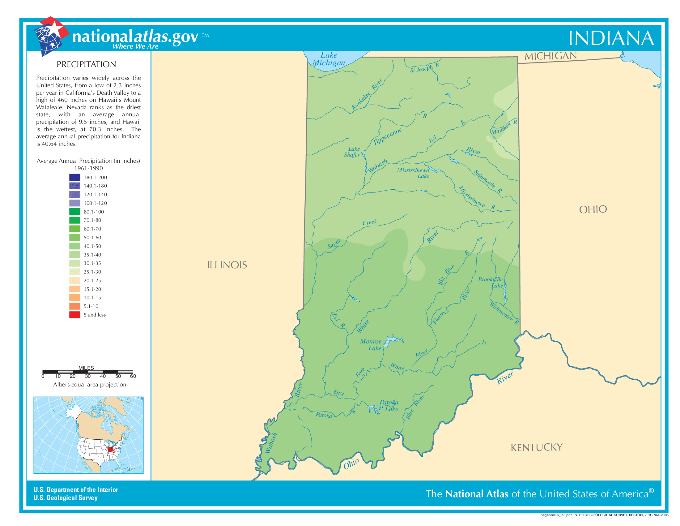
Indiana Annual Precipitation Map
Indiana Köppen Climate Map
