
The map of South Dakota above and the maps below are part of the US government’s now closed NationalAtlas.gov project.
However, they are too good to be lost forever so I’ve preserved them here.
You can learn more about the project and why it was closed down here.
Satellite Map Of South Dakota

General South Dakota State Facts
Demonym: South Dakotan
State Abbreviation: SD
Year Admitted To US: 1889
State Number (Out of 50): 40th
State Capital: Pierre
Total Area: 77,116 sq mi (199,729 km2)
State Area Ranking (Out of 50): 17th
Highest Point: Black Elk Peak – 7,244 ft (2208 m)
Lowest Point: 966 ft (294 m)
State Website: https://www.sd.gov/
List of Interstate Highways In South Dakota
- I-29
- I-90
- I-229
- I-190
List of US Highways In South Dakota
- US 16
- US 183
- US 216
- US 385
List of Toll Roads In South Dakota
None
Did you known Highway 34 is the longest road in South Dakota at 419.01 mi (674.33 km).
South Dakota County Map

South Dakota County Map With Important Cities & Towns

You can see more South Dakota county maps here.
South Dakota Population Density Map

South Dakota Population Facts
State Population: 919,318
State Population Rank (out of 50): 46th
Population Density: 12/sq mi (4.7/km2)
Population Density Rank (out of 50): 46th
Top 10 Cities In South Dakota
- Sioux Falls: 206,410
- Rapid City: 79,404
- Aberdeen: 28,110
- Brookings: 24,312
- Watertown: 23,230
- Yankton: 15,630
- Mitchell: 15,621
- Huron: 14,618
- Pierre: 13,880
- Box Elder: 13,868
South Dakota Income & Taxes
Median Household Income: 67,180
Household Income Rank (out of 50): 38th
Top Marginal State Income Tax Rate: none
Average Sales Tax Rate*: 6.11%
Average Property Tax Rate*: 1.17%
* Note theses vary from city to city within the state.
Map of South Dakota Lakes & Rivers

Largest Lake In South Dakota: Lake Francis Case 158 (sq mi)
Longest River In South Dakota: Missouri River 2,340 miles (3,770 km)
South Dakota Annual Precipitation Map

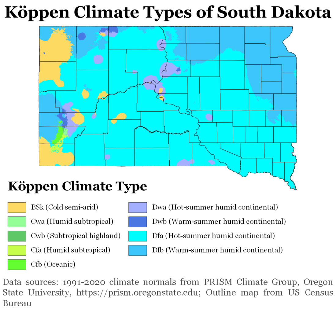
South Dakota Köppen Climate Map
More Maps Of US States The Government Doesn’t Want You To See
Finally see our Free Moving To South Dakota (SD) Cost Calculator.