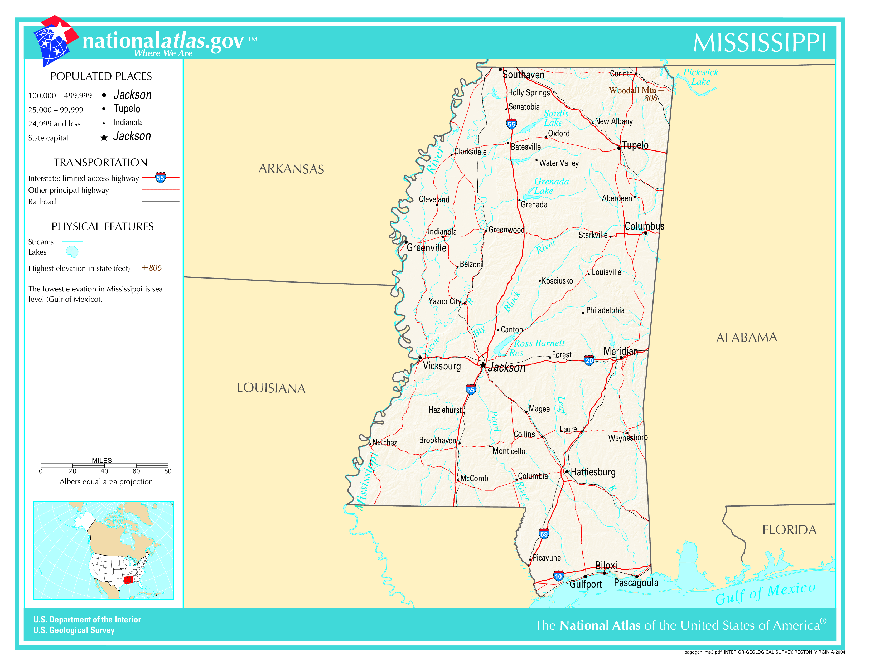
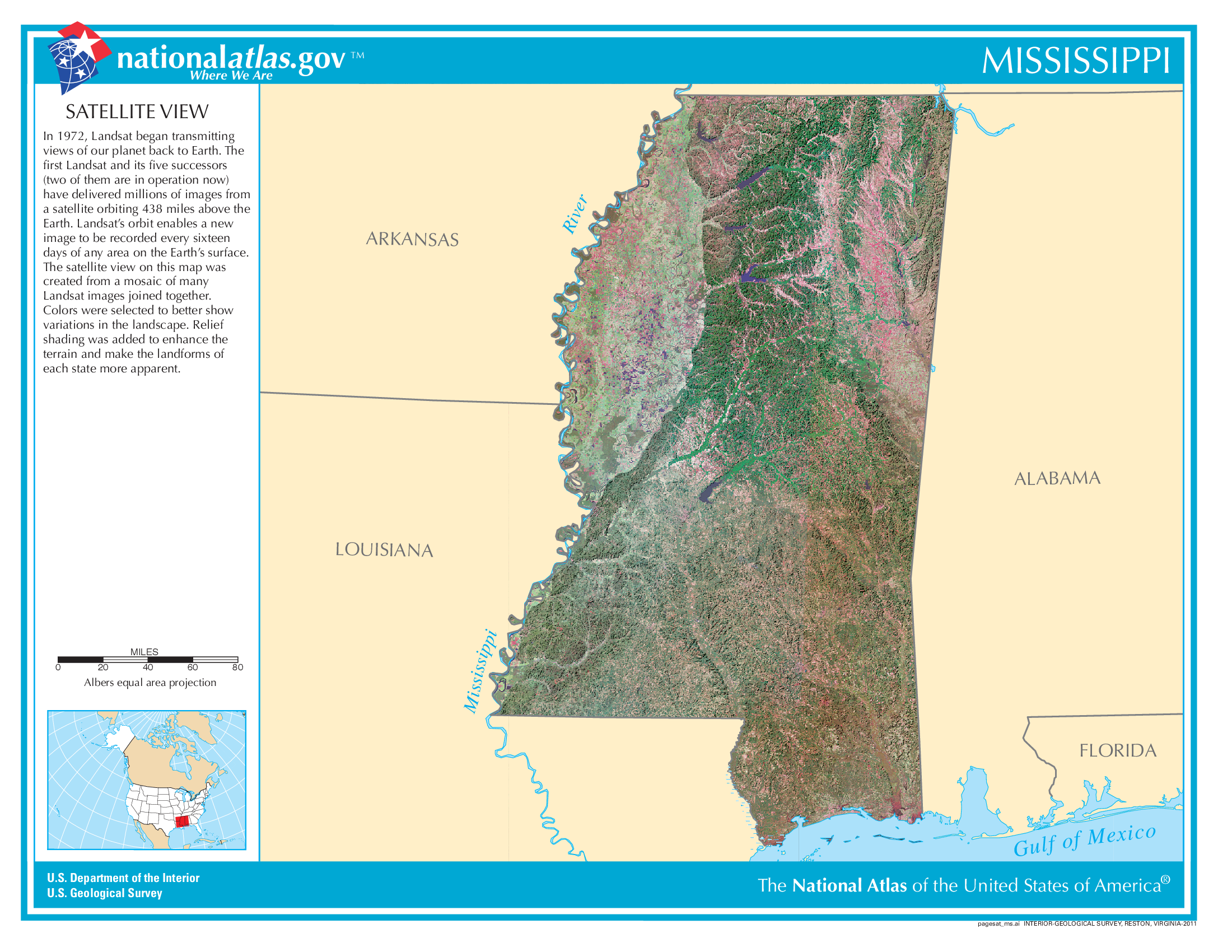
The map of Mississippi above and the maps below are part of the US government’s now closed NationalAtlas.gov project.
However, they are too good to be lost forever so I’ve preserved them here.
You can learn more about the project and why it was closed down here.
Satellite Map Of Mississippi
General Mississippi State Facts
Demonym: Mississippian
State Abbreviation: MS
Year Admitted To US: 1817
State Number (Out of 50): 20th
State Capital: Jackson
Total Area: 48,432 sq mi (125,438 km2)
State Area Ranking (Out of 50): 32nd
Highest Point: Woodall Mountain – 807 ft (246.0 m)
Lowest Point: 0 ft (0 m)
State Website: https://www.ms.gov/
List of Interstate Highways In Mississippi
- I-10
- I-20
- I-22
- I-55
- I-59
- I-69
- I-110
- I-310
- I-220
- I-269
- I-755
List of US Highways In Mississippi
- US 425
- US 49
- US 98
List of Toll Roads In Mississippi
No
Did you known Highway 15 is the longest road in Mississippi at 344.305 mi (554.105 km).
Mississippi County Map
Mississippi County Map With Important Cities & Towns
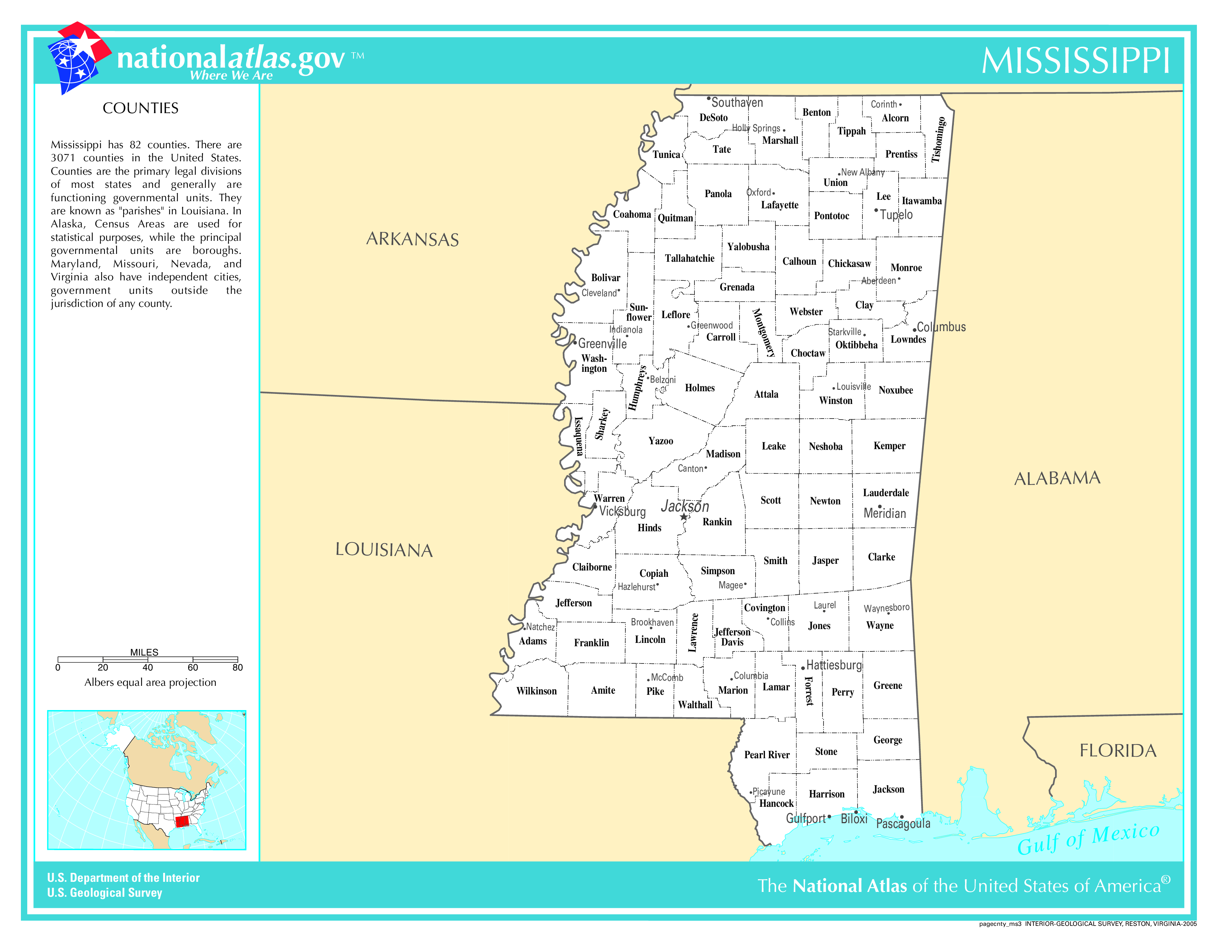
You can see more Mississippi county maps here.
Mississippi Population Density Map
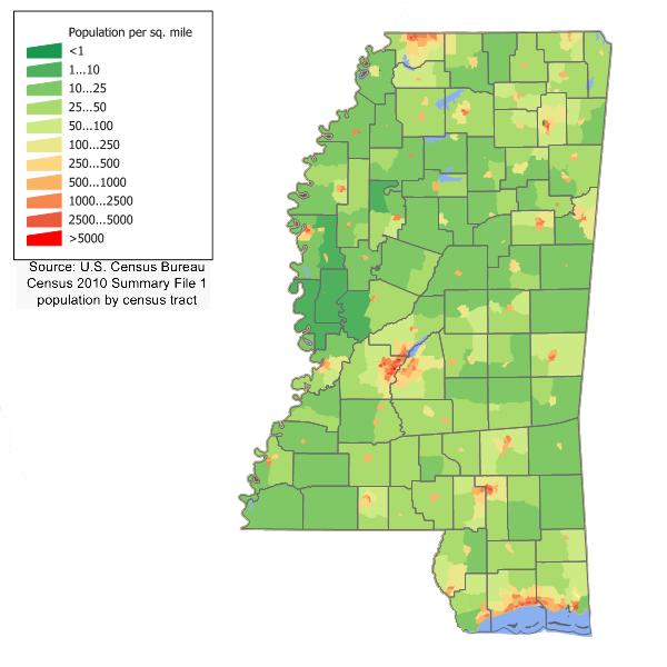
Mississippi Population Facts
State Population: 2,939,690
State Population Rank (out of 50): 35th
Population Density: 63/sq mi (24/km2)
Population Density Rank (out of 50): 33rd
Top 10 Cities In Mississippi
- Jackson: 143,709
- Gulfport: 72,823
- Southaven: 56,851
- Hattiesburg: 48,414
- Biloxi: 48,235
- Olive Branch: 47,029
- Tupelo: 37,675
- Meridian: 33,551
- Pearl: 28,117
- Madison: 27,987
Mississippi Income & Taxes
Median Household Income: 48,610
Household Income Rank (out of 50): 50th
Top Marginal State Income Tax Rate: 4.70%
Average Sales Tax Rate*: 7.06%
Average Property Tax Rate*: 0.67%
* Note theses vary from city to city within the state.
Map of Mississippi Lakes & Rivers

Largest Lake In Mississippi: Grenada Lake 55 (sq mi)
Longest River In Mississippi: Mississippi River 2,320 miles (3,730 km)
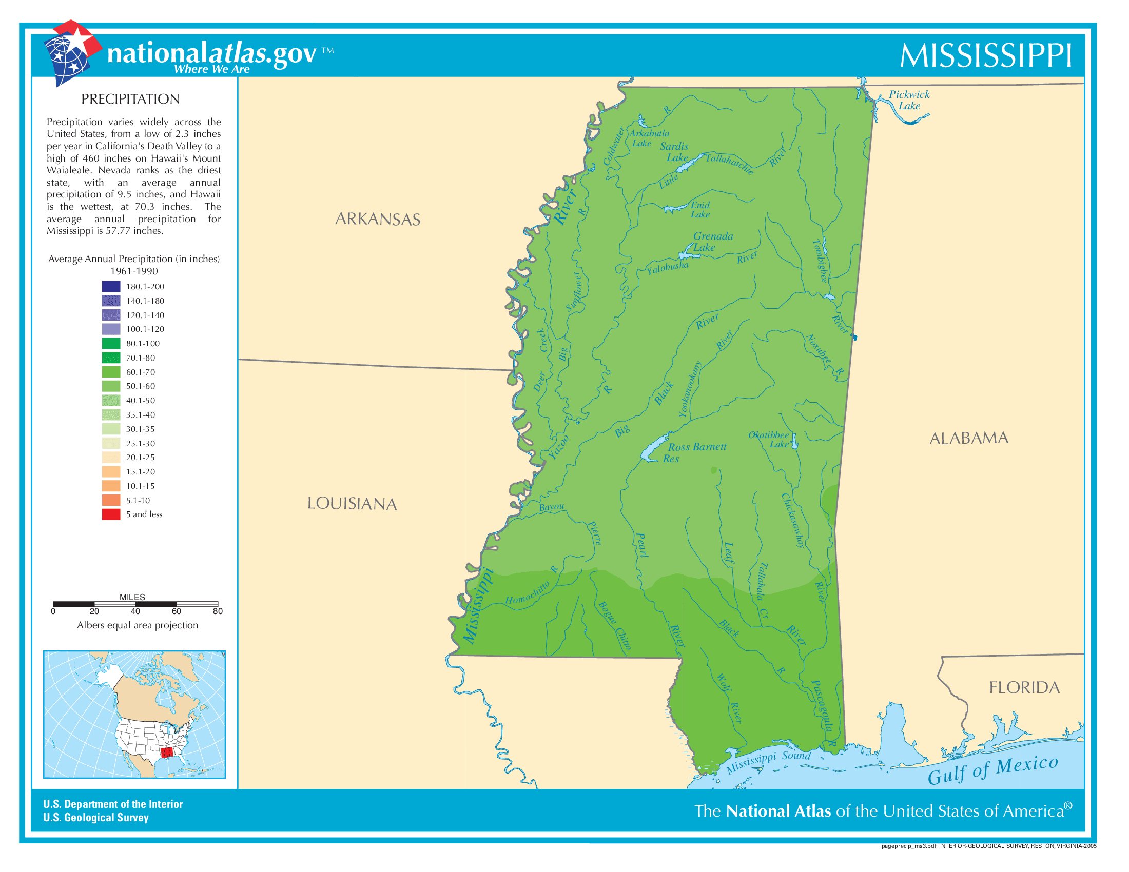
Mississippi Annual Precipitation Map
Mississippi Köppen Climate Map
