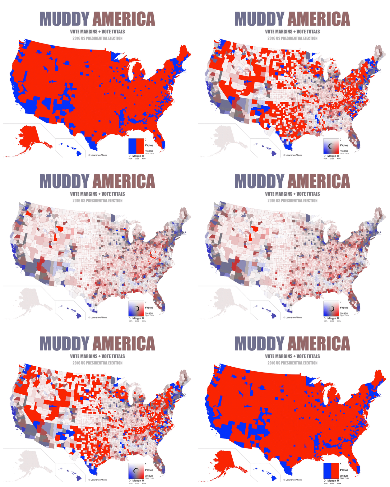
The map above is one of several attempts to improve on the somewhat famous 2016 US Presidential Election Map which you can see below.
Making Sense Of The World, One Map At A Time
The map above is one of several attempts to improve on the somewhat famous 2016 US Presidential Election Map which you can see below.

The map above shows which countries/US states don’t require you to have a permit to buy a gun or other firearm. Yemen is allegedly the only country in the world where don’t need a permit to buy a gun no matter where you live.
This is followed closely by the United States where the majority of people live in states which don’t require a permit.

Here is a list of mythical creature by state:
The map above shows the percentage of voters in each state who voted in the 2016 presidential election but didn’t vote for either Hillary or Trump.
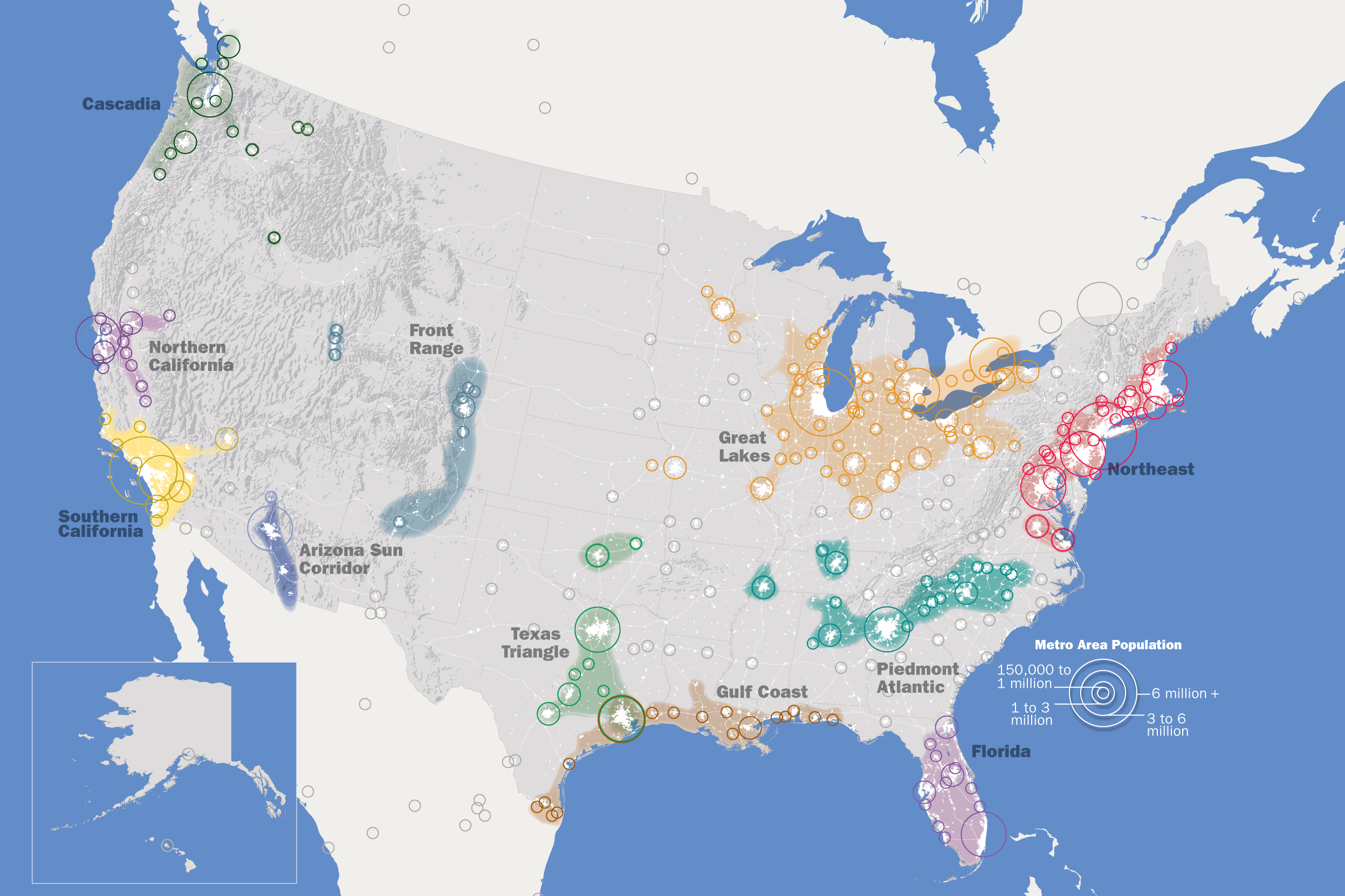
The map above shows the Regional Plan Association’s list of 11 Mega-Regions of the United States as part of their America 2050 project.
The map above shows just how big the United States is or just how big the Mediterranean Sea is, depending on your perspective.
And it should not be confused with the existing American Mediterranean Sea which is the the combined water body of the Caribbean Sea and the Gulf of Mexico.

The map above shows the different highway route marker shield designs used by each US state for their own state highways.
While Interstate and US Numbered Highways use standard designs across the country, but the same can not be said of state highway markers.

The map above shows how long it takes to drive to the centerline of the total solar eclipse that will occur on August 21, 2017. This of course assumes normal driving conditions on the day.
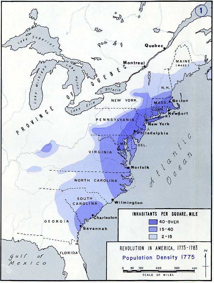
The map above shows the population density of the original thirteen American colonies, the year before they declared independence. Even back then, what would become the Boston–Washington Corridor was clearly evident.
The map above shows the best selling singer, musical artist or band from each of the 50 US states. While many expected names make the list such as Elvis, Prince, Madonna, etc. there are quite a few surprises.
Keep reading below for the complete list by state: