Now that 2016 is finally over, we thought it would be fun to look back at our most popular maps from last year.
(We did the same thing for the Top 15 Maps of 2015 last year.)
The maps below are ranked on the number of visitors each received in 2016. As you’ll see some are older posts that got a second lease on life, while most are brand new to 2016.
Enjoy:
16. 2016 US Presidential Election Map By County & Vote Share
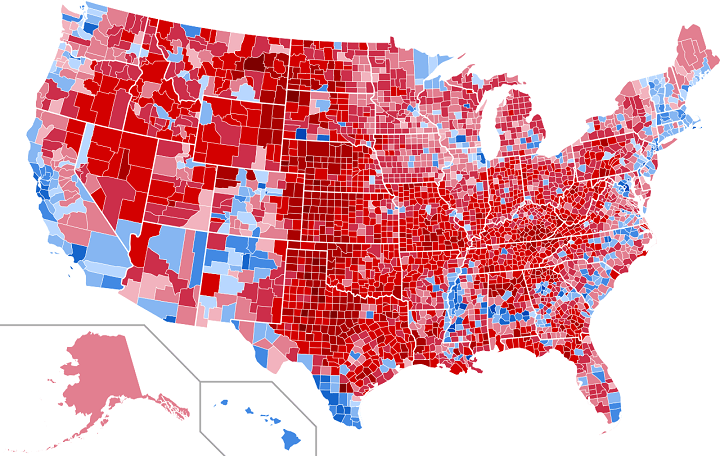
First Published: November 29, 2016
Comments: The surprise US election result proved to be an especially popular topic in 2016.
15. Holland Is Not A Dense Country, But An Empty City
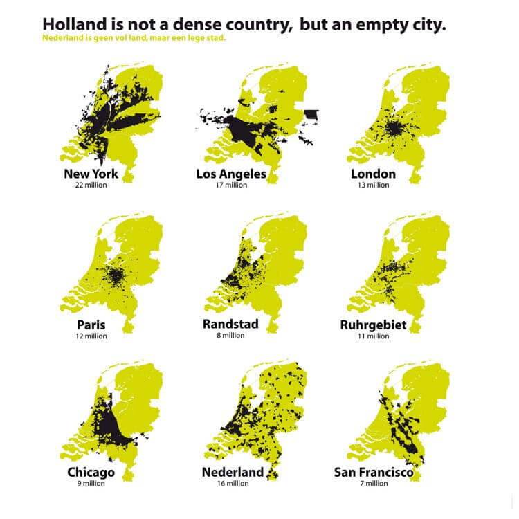
First Published: September 2, 2015
Comments: This was our 8th most popular map in 2015, but it continues to strike a chord with many users in the Netherlands.
14. Incredibly Detailed Map Of The World’s Religions
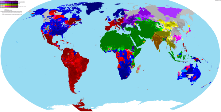
First Published: April 21, 2015
Comments: This map actually became relatively more popular in 2016 compared to 2015 where it was ranked as our 15th most popular map.
13. The Pan American Highway: The Longest Road In The World
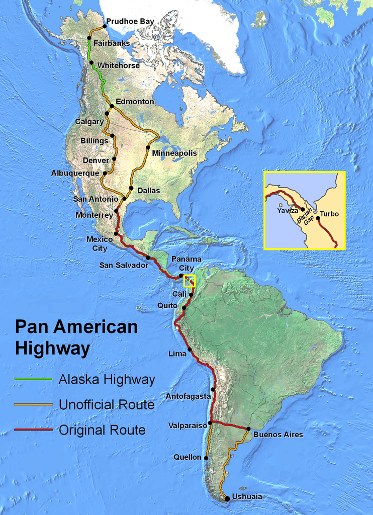
First Published: April 5, 2016
Comments: One of our more in-depth posts about the world’s longest road.
12. Fastest Growing Religion In Each Country Around The World
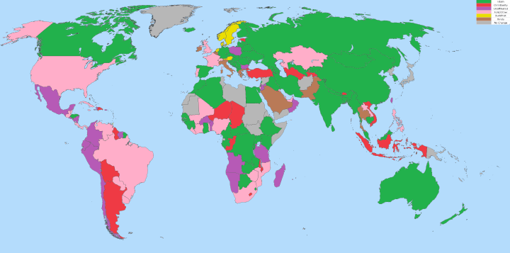
First Published: June 10, 2015
Comments: Another map that became relatively more popular in 2016 compared to 2015, where it as ranked number 13. Religion remains a popular map topic.
11. How North Londoners View The Rest Of The UK Or Why The Rest of The UK Hates London
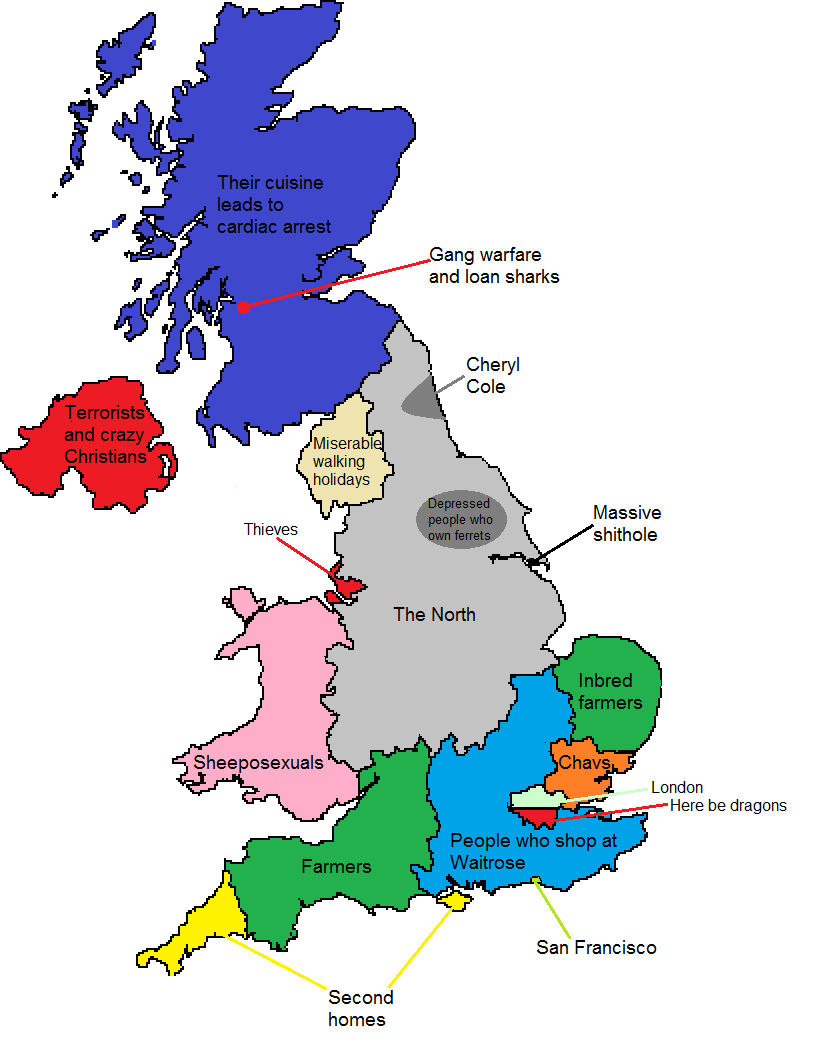
First Published: February 10, 2015
Comments: This was our second most popular map of 2015 and remains a popular choice among visitors from the UK. As recent transplants from North to South London, it is still one of our favourite humorous maps.
10. 2016 US Presidential Electoral Map If Only [X] Voted
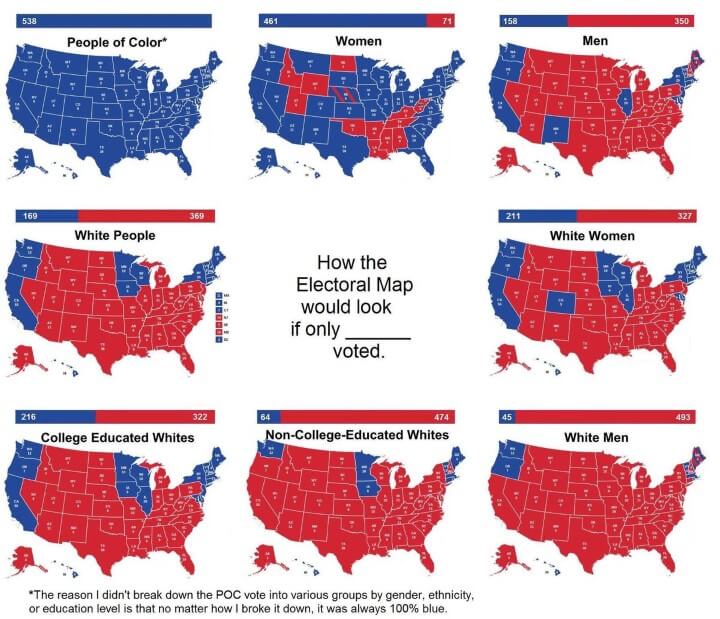
First Published: October 31, 2016
Comments: This is the second of our 2016 US Presidential election maps to make the list. It should be noted that this map was created before the 2016 election results were known and was based on 2012 election behaviour.
9. Game of Thrones’ Westeros Is Really Just Britain & An Inverted Ireland

First Published: March 7, 2015
Comments: Although it first was published in 2015, it did not find much popularity until the return of the show in 2016. Also be sure to check out 6 Best Game of Thrones Board Games & Expansions Reviewed & Ranked.
8. Which European Country Has The Lowest Drinking Age?

First Published: January 6, 2015
Comments: One of our very first posts that also only really became popular in 2016. Seems there are a lot of Americans are looking to drink in Europe.
7. The 99 Countries Americans Can Visit Visa-Free
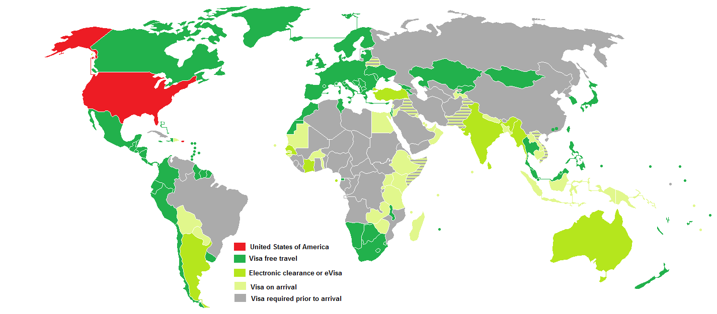
First Published: March 23, 2015
Comments: Looks like a lot of Americans don’t want the hassle of getting a VISA, despite that fact it requires citizens from all foreign countries (expect Canada) to either get one or apply for the electronic Visa Waiver Program (ESTA [Electronic System for Travel Authorization]) when visiting the United States.
6. An Incredibly Detailed Map of the Roman Empire At Its Height in 211AD
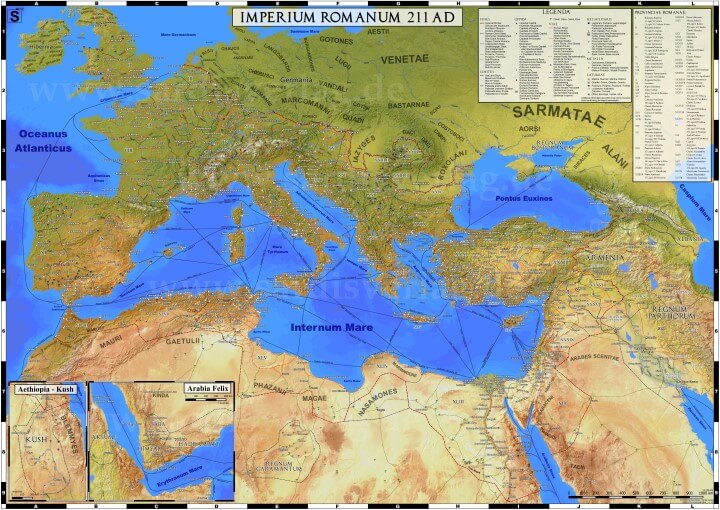
First Published: September 24, 2015
Comments: Quite possibly the best map we’ve ever published, certainly one our favourites.
5. Top 100 International Tourist Destination Cities By Country
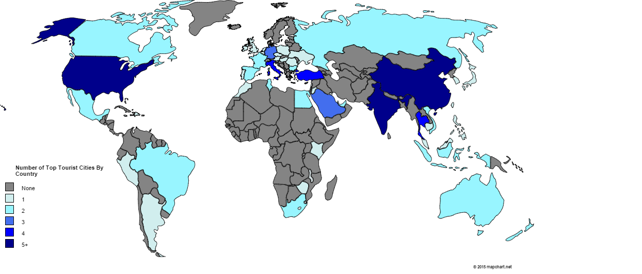
First Published: January 24, 2015
Comments: Not really a great map, but a popular topic. You can read the post here for the full list.
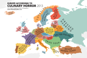
4. European Food According to Italians
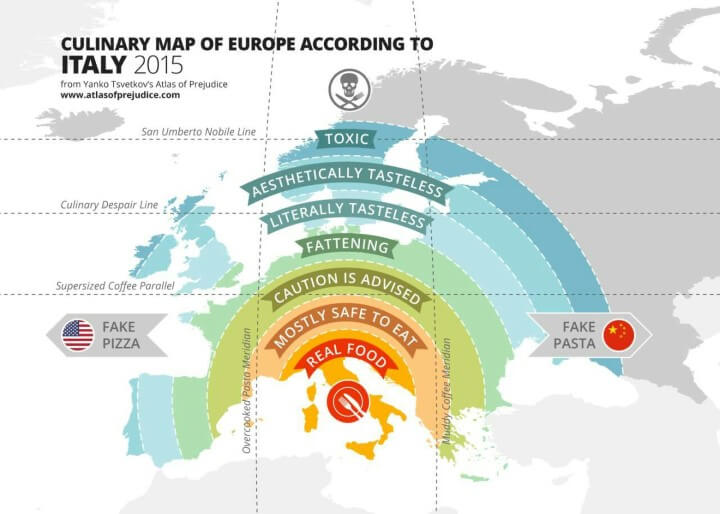
First Published: September 7, 2015
Comments: Our most popular humorous map should not be taken too seriously.
3. The Genetic Map Of Europe
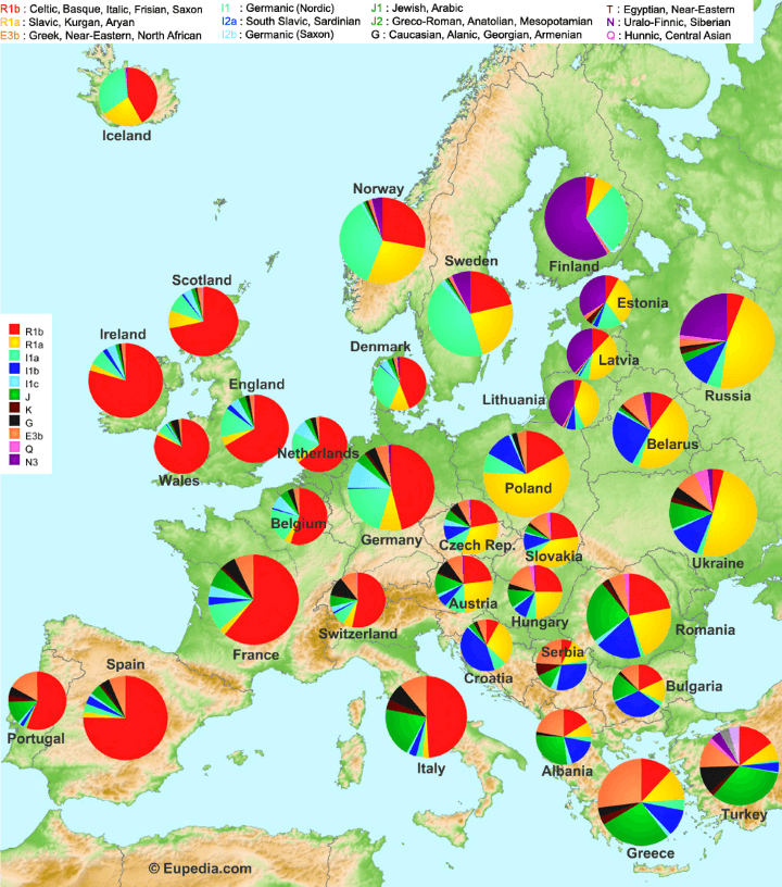
First Published: April 21, 2015
Comments: Always a very controversial map, yet one that seems to keep striking a chord.
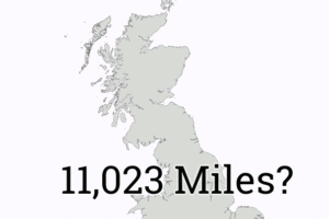
2. England vs Great Britain vs United Kingdom Explained
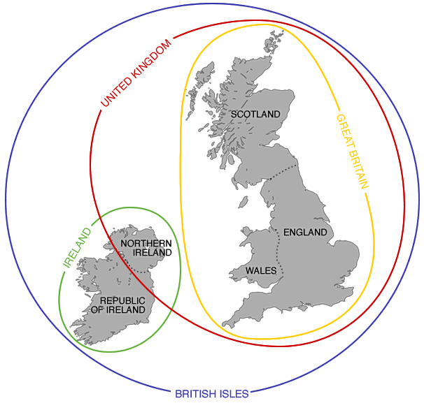
First Published: April 10, 2016
Comments: A very simple map, but one that solves a very common question people have about the different between England, Britain and the UK.
1. If “Did Not Vote” Had Been A Candidate In The 2016 US Presidential Election, It Would Have Won By a Landslide

First Published: November 13, 2016
Comments: By far our most popular map from last year. Published in the immediate aftermath of the US election result, it resonated with people still shocked and wondering how Trump won the election.
Other popular posts:
- The 28 Best Map Based Strategy Board Games You’ve Probably Never Played
- What If Nazi Germany Won World War II? Fictional & Historical Scenarios
- 13 Best Scratch Maps For Your 2017 Travel Adventures
- 32 Best Catan Expansions, Editions & Extensions – Reviewed & Ranked Best To Worst
- 27 Best World Atlases For Map Lovers In 2017
- 37 Eye-Catching World Map Posters You Should Hang On Your Walls


Leave a Reply