
Here are the details for each one:
Making Sense Of The World, One Map At A Time
Here are the details for each one:

The world’s largest commercially available puzzle called What a Wonderful World is an 8′ (2.4m) tall by 29′ (8.8m) long 60,000 piece world map.
You can buy a copy here directly from Americana Art Enterprises, but at $749.99 USD it might also be the world’s most expensive puzzle too.
That said just look at the level of detail included:

Here is a detailed explanation:

Y-DNA, or Y-chromosomal DNA, is inherited paternally and can provide insights into male lineage and ancestry.
Key points about the map:

Each country is labeled with a particular debate or preference that causes division among its people.

The map above highlighting the locations lighthouses around the islands of Great Britain and Ireland. The lighthouses are represented by small points of light, giving the impression of stars dotting the coastlines.
The map effectively uses a dark background to contrast with the illuminated points, emphasizing the network of lighthouses surrounding the islands.
Click here to see the rest for other countries.
What do you think?
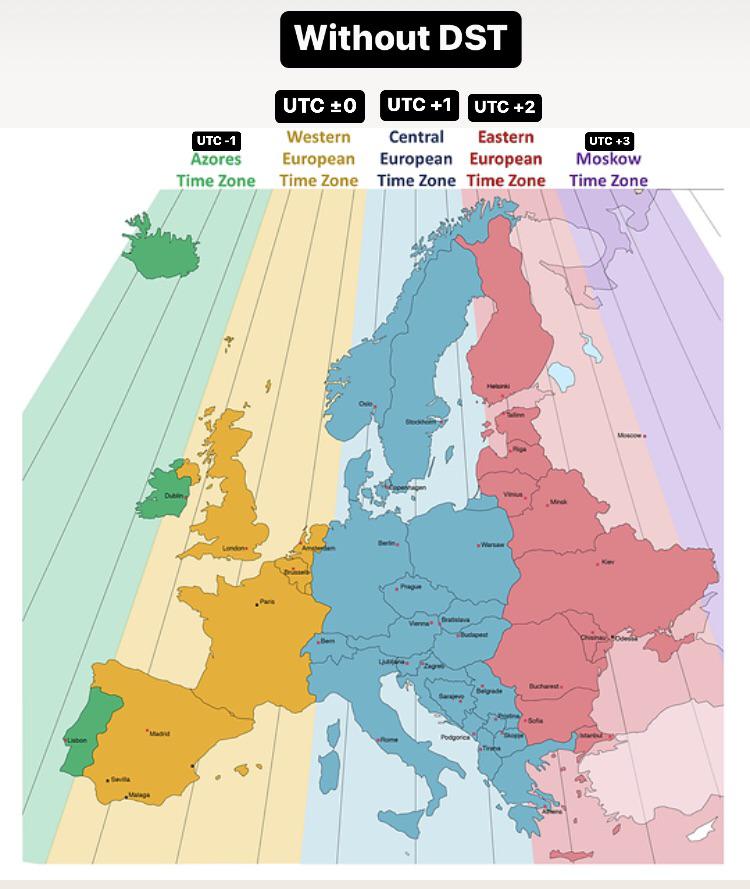
Here’s a breakdown of the map:
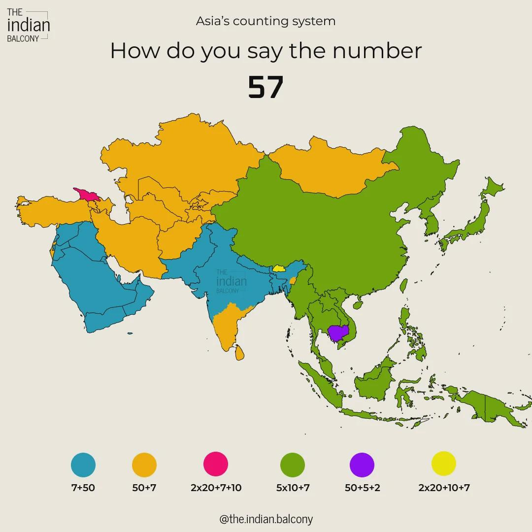

Here’s a description of the terms included in the image, organized by region:
