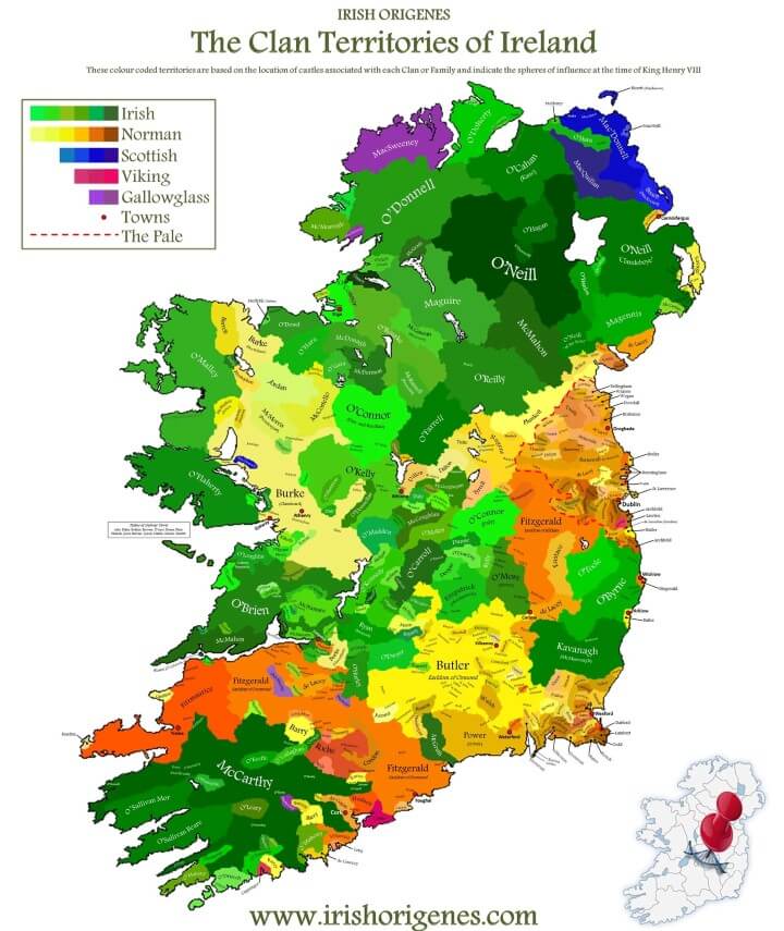
The map above shows the location of over 400 of the most prominent historic clans and families in Ireland. And it includes whether they had an Irish, Scottish, Gallowglass, Norman, or Viking historical association.
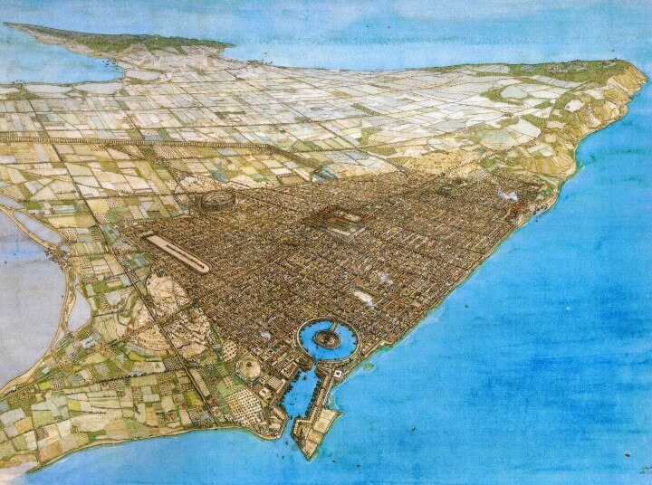
A View Of Roman Carthage, Built on the Site of the Previously Destroyed Punic Capital
The map above shows what Roman Carthage may have looked like sometime in the 3rd century AD, when it was one of the leading cities of the Roman Empire and could have had a population into the hundreds of thousands.
The Underground City of Derinkuyu Could Shelter As Many As 20,000 People & Reached A Depth of 60m
The cutaway map above shows part of the underground city of Derinkuyu as it would have appeared at its peak during the Byzantine era.
The city is the largest of of over 200 underground cities discovered so far in Cappadocia, Turkey.
Historic vs Present Geographical Distribution of Lions
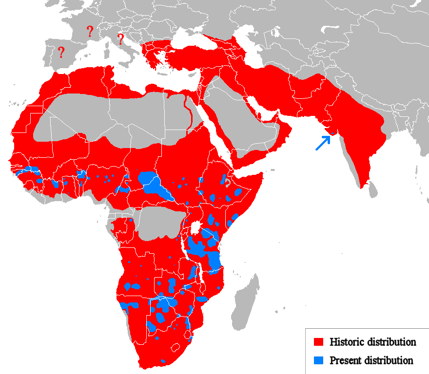
The lion (Panthera leo), once widely distributed across most of Africa and parts of Europe and Asia, is now confined to a number of isolated areas as shown on the map, amounting to only about 20% of its historic range.
Canada’s Forgotten Prohibition Plebiscite of 1898
The map above shows the outcome of a federal plebiscite on the prohibition of alcohol that was held in Canada on September 29, 1898.
It was the first national referendum in the history of the country. It followed agitation over many decades by the temperance movement, which had succeeded introducing prohibition at the local (county) level in some areas, but wanted it extended nationally.
Byzantine Empire’s Linguistic Divisions Under Justinian I c.560CE
The map above shows the Byzantine linguistic divisions of the Byzantine (Eastern Roman) Empire during the rule of Justinian I around 560 CE (AD).
Poland’s Territorial Changes 1635-Present – Life, Death & Rebirth
Poland has not been one of Europe’s luckiest countries.
It’s gone from being the largest country in Europe to being wiped off the map, not once but several times.
The map below traces the history of Poland’s borders from 1635 right through to the present day.
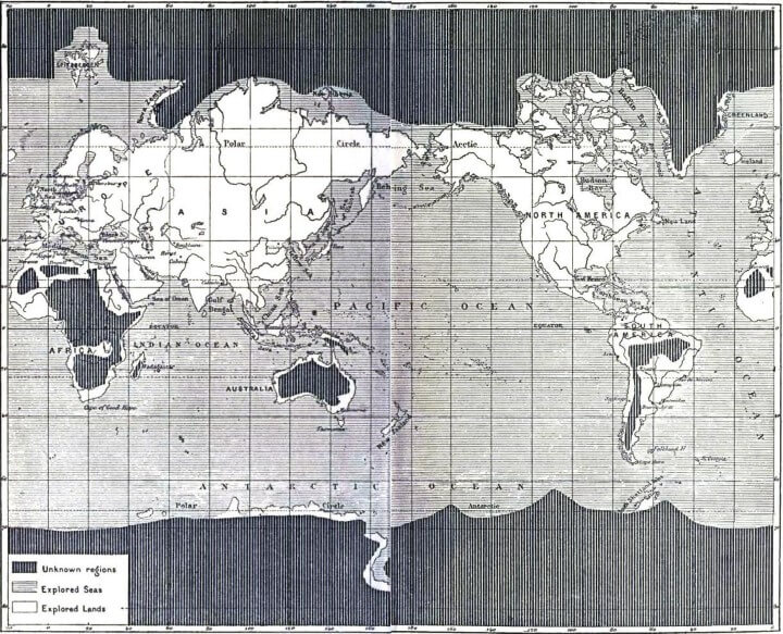
Map of The Unexplored World From 1881
The map above appeared in Jules Verne’s The Great Explorers of the Nineteenth Century and shows the areas of the world that remained unexplored (to Westerners) in 1881.
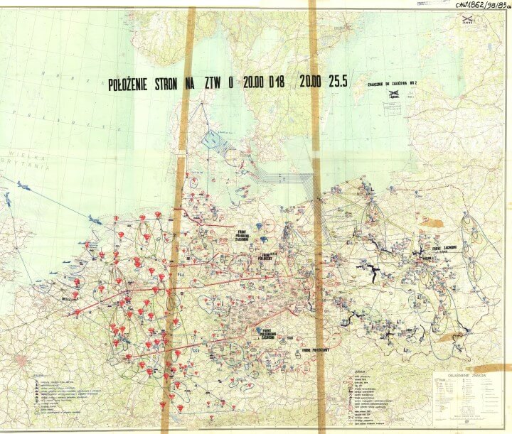
Soviet World War 3 Plans For Europe
The map above shows how the Soviet Union thought World War 3 might play out in Europe.
The red mushroom clouds represent planned nuclear strikes on cities and targets in central Europe and the blue mushroom clouds represent the anticipated NATO response.
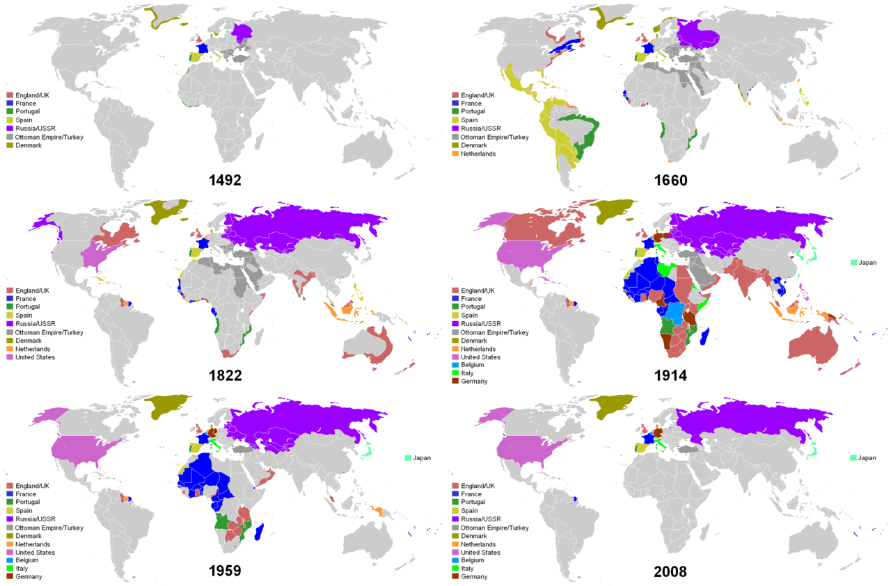
Short History of Colonialism Since 1492 In One GIF
The map above presents a very short history of colonialism around the world from 1492-2008 in one simple GIF. Interestingly, it doesn’t limit itself to European colonialism but also includes the colonial empires of the United States, Russia/Soviet Union and Japan.
