
Depending on where you live, football and soccer can refer to completely different games. For example, in America football refers to American football whereas in the UK it refers to association football, which in America would be called soccer.
Making Sense Of The World, One Map At A Time
Depending on where you live, football and soccer can refer to completely different games. For example, in America football refers to American football whereas in the UK it refers to association football, which in America would be called soccer.
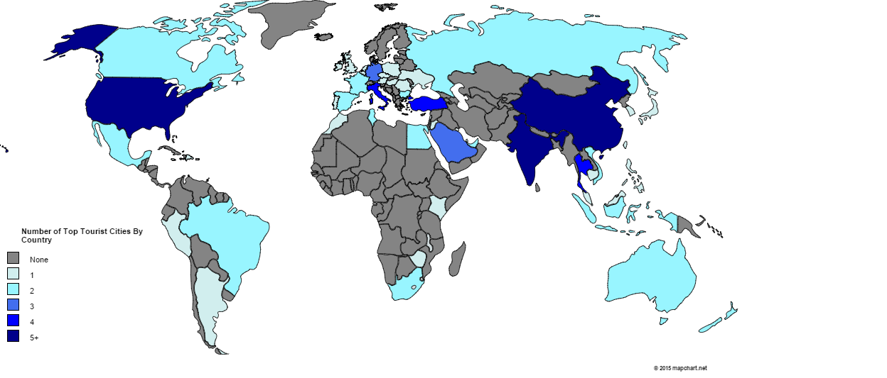
Which city is the most popular international tourist destination? Surprisingly, it’s not Paris, London or New York.
[Read more…]
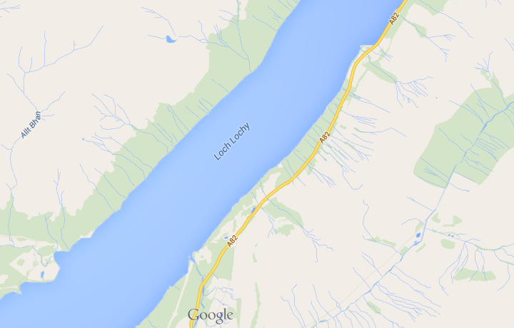
As unoriginal place names go, Loch Lochy (in Lochaber) has to be at the top of the list. I imagine whoever named it was at the end of a long day of loch naming and said to himself, “fuck it, I’m off to the pub.”

While we tend to think of the Vikings as being based in and around Scandinavia, their activities took them a lot far further afield than that. The map above shows just how far.

The map above shows the world’s military camouflages. It’s based on the country’s primary camo and does not taken into account different branches of the military in each country. Moreover, the original map creators are aware that there are a few inaccuracies and out-of-date designs included.

I’ve seen a lot of bad maps in my time, but the one above has to be among the worst. Vexillology or flag maps can be a beautiful thing when done right. The map above, on the other hand, is hilarious in its randomness.

The cartogram above is an updated version of this one from 10 years ago. Since that time a few things have changed.
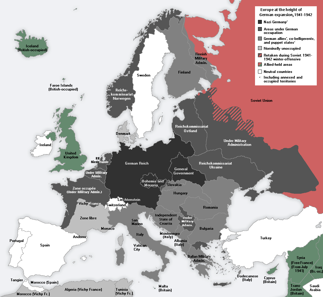
This has led both novelists and historians to speculate about might have happened if Germany had won the war and how they might have done so. Below we’ll look at a few fictional scenarios (with maps) where they do win and what that means for the rest of the world. This will be followed by some historical speculation about whether or not Germany really could have won.

Why is America so fat? Well as this faux Time magazine cover created by Ricky Linn shows, it may be because the country looks like a man gorging himself on an Alaskan-sized burger.

As difficult as it may be to believe, the The Nineteenth Amendment to the United States Constitution was ratified on August 18th, 1920, less than 100 years ago. It stated that: “The right of citizens of the United States to vote shall not be denied or abridged by the United States or by any State on account of sex.” In plain English, it gave the vote to all women of voting age.
However, before its passage, not all women had been denied the vote as the map above demonstrates.
[Read more…]