
The map draws parallels between the breakup of the Soviet Union into independent republics and a hypothetical disintegration of the U.S. into regional states.
Making Sense Of The World, One Map At A Time
The map draws parallels between the breakup of the Soviet Union into independent republics and a hypothetical disintegration of the U.S. into regional states.

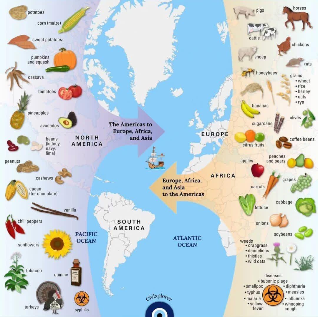
The exchange represents the widespread transfer of plants, animals, culture, human populations, technology, and diseases between the Americas, Europe, Africa, and Asia.
Key Points in the Graphic:
The Columbian Exchange profoundly transformed food and cuisine across all continents, leading to significant changes in diets, agriculture, and culinary traditions.
Here’s how it affected each continent:
General Impact Across Continents:
Here’s another map showing the process:

This is part of a movement known as the “Greater Idaho” movement. The map highlights counties where residents voted on this issue, with shades indicating the level of support for leaving Oregon.
Here’s a video explaining it:

Key observations:

The map color-codes different countries according to the price range of beer, with the following categories:

The two maps here were created by The World Maps. The one above looks at percentage of people who believe in life after death around the world. Data comes from the World Values Survey conducted between 2017 and 2022.
The countries are color-coded according to the percentage range of people who hold this belief:
In this visualization, NASA instruments show the seasonal cycle of vegetation and the concentration of carbon dioxide in the atmosphere.

The colors represent different rates of population growth or decline, with green shades indicating growth and red shades indicating decline.

Here are a few key regions and states featured in the map:
