
Also see: Which States Make Up The US South?
The US census defines the region as the following 12 states:
- Illinois
- Indiana
- Iowa
- Kansas
- Michigan
- Minnesota
- Missouri
- Nebraska
- North Dakota
- Ohio
- South Dakota
- Wisconsin
But what do people who live there think about whether or not the states belong in the Midwest?
So that’s what Walt Hickey set out to find:
We ran a national survey that targeted the Midwest from March 12 to March 17, with 2,778 respondents. Of those, 1,357 respondents identified “a lot” or “some” as a Midwesterner. We then asked this group to identify the states they consider part of the Midwest.
And although they didn’t publish the full data in the article, they did publish it on Github, which you see below:
Is X State In The Midwest?
Percent that agree:
| State | Midwesterners | All Respondents |
|---|---|---|
| Illinois | 80.7% | 70.3% |
| Indiana | 71.6% | 65.7% |
| Iowa | 75.2% | 71.5% |
| Kansas | 50.5% | 58.4% |
| Michigan | 62.0% | 51.4% |
| Minnesota | 60.9% | 54.0% |
| Missouri | 54.5% | 54.8% |
| Nebraska | 49.0% | 56.9% |
| North Dakota | 35.1% | 37.1% |
| Ohio | 60.6% | 53.8% |
| South Dakota | 36.3% | 38.7% |
| Wisconsin | 67.7% | 59.4% |
| Arkansas | 15.0% | 19.5% |
| Colorado | 11.6% | 18.8% |
| Kentucky | 18.7% | 17.7% |
| Oklahoma | 25.6% | 35.7% |
| Pennsylvania | 6.0% | 4.3% |
| West Virginia | 4.6% | 4.1% |
| Montana | 9.3% | 16.7% |
| Wyoming | 10.2% | 18.8% |
9 states have over 50% for being in the Midwest by Midwesterners, and 10 states have over 50% support being in Midwest according to all respondents (Nebraska being the one extra state).
Why is it so hard to define the Midwest?
The “Midwest” is surprisingly tricky to pin down, and that’s because it’s more of a cultural and historical idea than a strict geographic region.
Here are the main reasons it’s hard to define:
No one official definition:
The Census Bureau’s “Midwest Region” is just one of several definitions and includes many states people don’t think belong.
Historical shifts:
In the 1800s, “mid-west” literally meant the western middle of the country, which was then Ohio, Indiana, and Illinois. As the U.S. expanded westward, the meaning drifted. Today, those states are no longer near the “west,” but the name stuck.
Cultural vs. geographic identity:
The Midwest is often defined by shared culture, economy, and history (e.g., agriculture, industry, “heartland” values) rather than strict borders. States like Missouri, Kentucky, and even parts of Pennsylvania sometimes get included or excluded depending on who’s talking.
Transitional regions:
Several states straddle multiple identities:
- Missouri feels Southern in the Bootheel, Plains-like in the north, and urban-Midwestern around St. Louis/Kansas City.
- Kentucky is often claimed by the South, but its northern areas share more with Ohio/Indiana.
- Oklahoma and Arkansas are sometimes culturally “Midwestern” in their northern parts, but more often classed as Southern or Plains states.
Subjective “vibe.”:
People often define the Midwest based on stereotypes, flat farmland, friendly people, tornados, Big Ten football, which are fuzzy and vary across states.
So, the “Midwest” is less a fixed geographic region and more a blend of history, economy, culture, and perception, which explains why lists of “Midwestern states” can range from 8 to 13 states depending on the source.
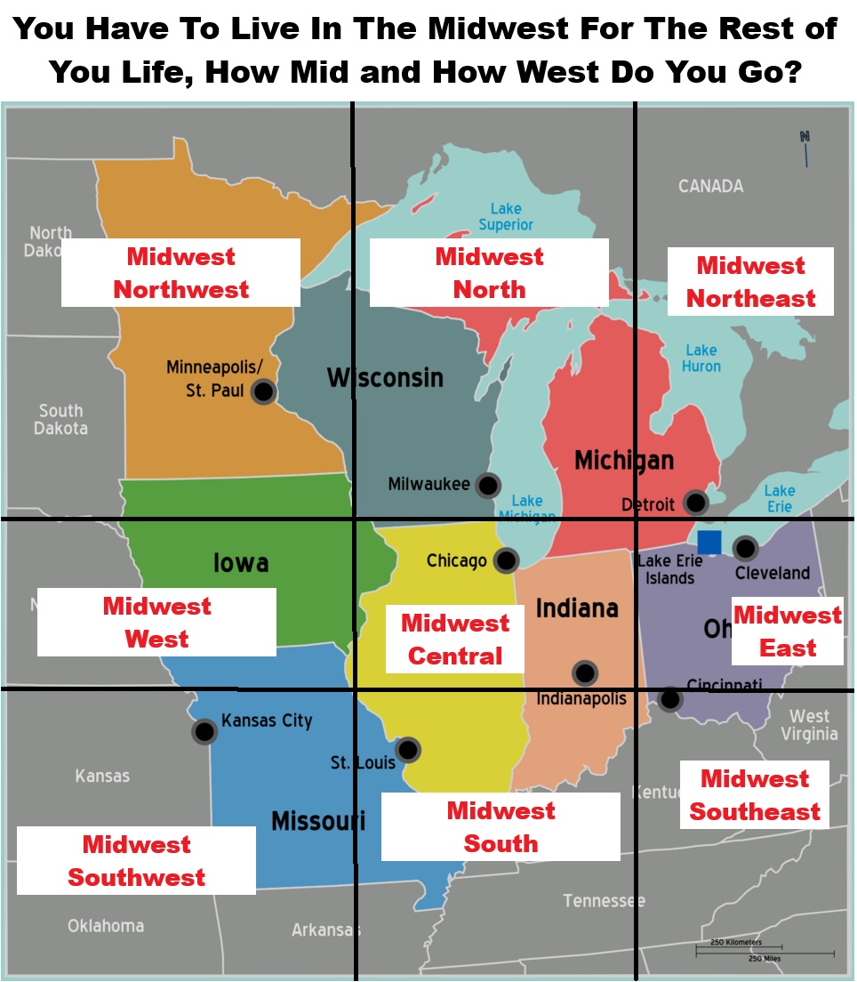
Finally, the fact that the majority of the states are in the East, rather than the West has always sort of bothered me.

Also what if the US was set-up like a grid?

And finally which Midwest region would you choose to live in?
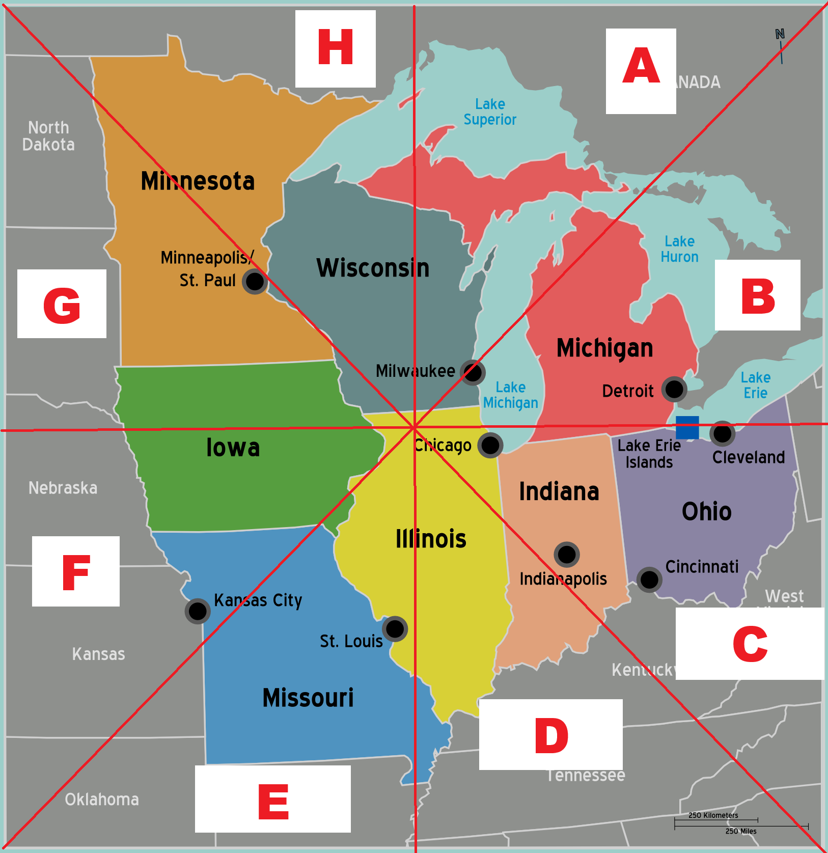
and an alternative version:





Y.D. Robinson says
I’m a little surprised that New York State doesn’t show up at all even in the lightest (less than 10% category), especially considering that Western New York – like Buffalo or perhaps Rochester – has more in common with northern Ohio or southern Michigan or southern Wisconsin than with eastern New York and certainly than with the New York City area. Western New York is part of the Great Lakes region (if not the Midwest as a whole) exponentially more than of the East Coast itself.
David says
UPDATED
Traditionally, and in my lifetime growing up in Michigan, there are only five Midwestern states, and they all are east of the Mississippi: Wisconsin, Illinois, Indiana, Michigan, and Ohio. Kentucky is a southern state, and the states west of the Mississippi are Plain states with the exception of the southern states in that area and until you get to the Mountain, etc. states.
Peter B. Ives says
When I spent a few weeks in Wichita Falls, Texas long ago, there was a college called Midwestern University. So, not even in Oklahoma. That conception of region definitely tells you what the locals thought. A county map of the Midwest such as you did for The South would have given us a more detailed map of The Midwest.
When I was a geography major at University of New Mexico, debating names of regions was a fun parlor game. It worked for any American state or nation; they all have their own regions.