
The 12 maps above are a tongue-in-cheek look at the various ways the UK is divided besides Brexit or how to pronounce scone.
And before anyone complains, they are meant to be humorous and should not be taken too seriously.
You can see each map in more detail below:
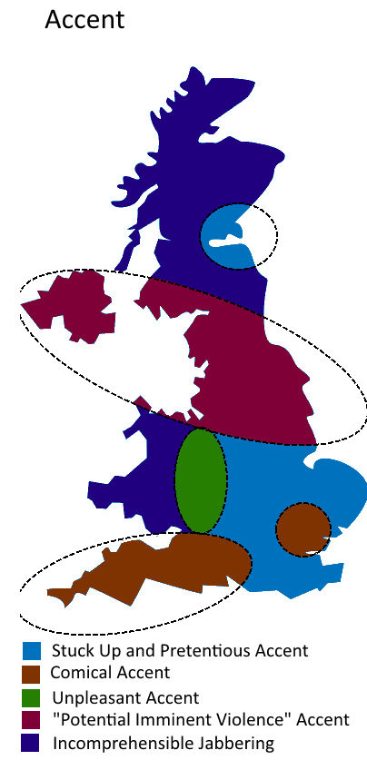
1. UK Divided By Accent
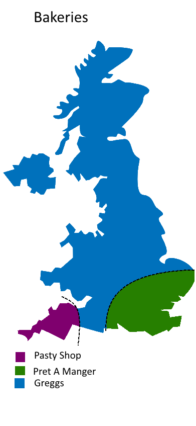
2. UK Divided By Bakeries
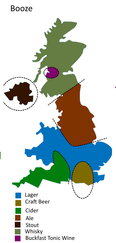
3. UK Divided By Booze
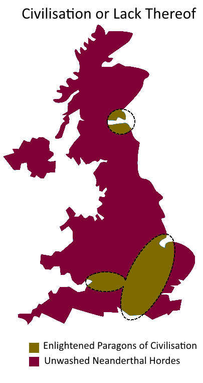
4. UK Divided By Civilisation (Or Lack Thereof)
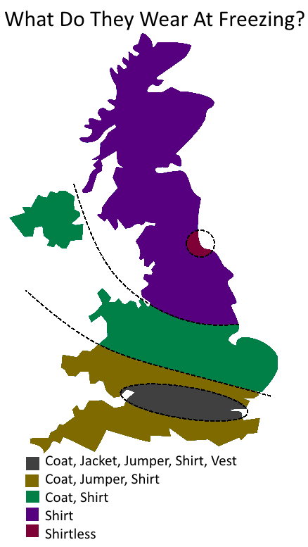
5. UK Divided By What People Wear When It’s Freezing Outside
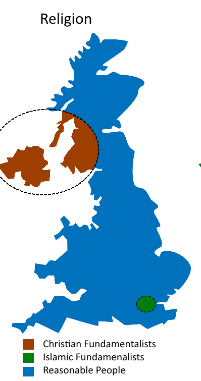
6. UK Divided By Religion
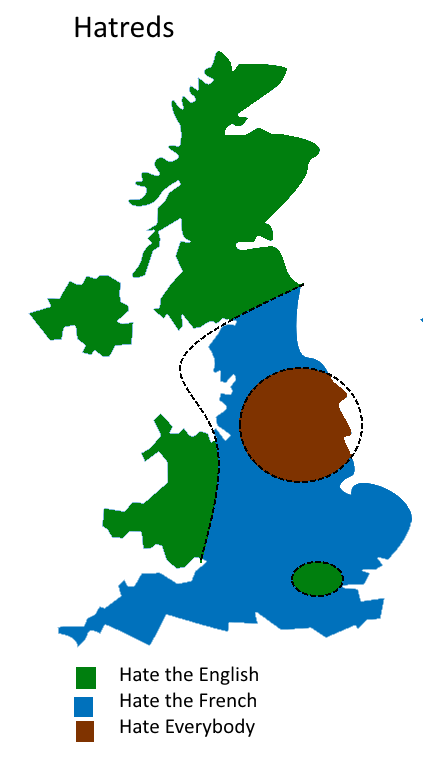
7. UK Divided By Hatreds
8. UK Divided By Horses

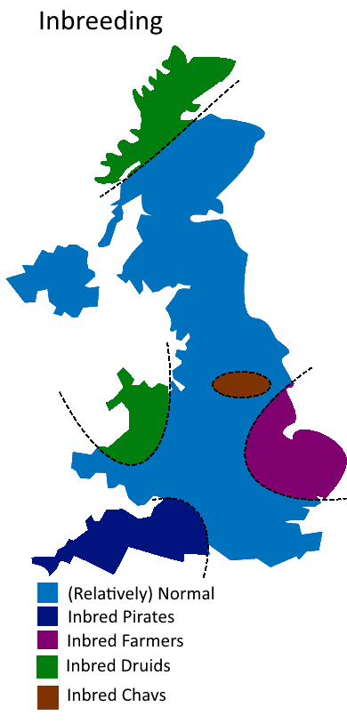
9. UK Divided By Inbreeding
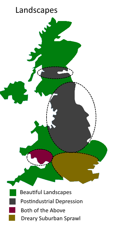
10. UK Divided By Landscapes
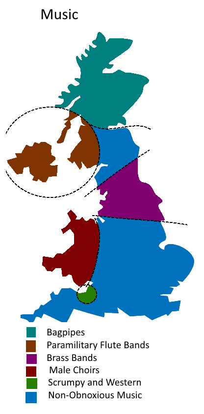
11. UK Divided By Music
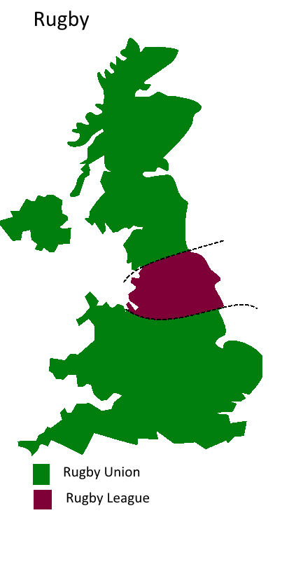
12. UK Divided By Rugby
The maps were inspired by the Atlas of Prejudice maps:
- Atlas of Prejudice: Mapping Stereotypes, Vol. 1
- Atlas of Prejudice 2: Chasing Horizons, Vol. 2
- Atlas of Prejudice: The Complete Stereotype Map Collection
What do you think about the maps? Please leave your comments below and share with a friend:


Drunken Sailor says
I thoroughly enjoyed your “12 ways to divide the UK”. I shudder to think what you could do to the USA!
Utterances says
Barrow, Whitehaven & Workington are rugby league towns.
Nicholas says
You could extend the chav bit in inbreeding to include most of the western M62 corridor!
Eric says
Wow. Just when I thought the UK couldn’t be more unfair and snobbish, you surprised me. I wonder if you would have posted this had your family been held back from getting jobs and alienated at college because they faced this kind of rampant prejudice, the way mine have?
Hugh says
lmaooo
Hugh says
bro theyre just jokes bro
Tom Barry says
No isle of wight?
Jimmy says
Wars is a haven for paramilitary flute bands? (Map 11) Don’t tell any of the BRASS BANDS that famously are the main welsh music stuff.
Jack says
Seriously, they’ve descriebd the landscape of “T’ North” as all “postindustrial depression”, have they forgotten that the huge grey section includes (from south end to north end of the region): Lincolnshire wolds, peak district (white limestone peak), shropshire hills, peak district (dark millstone grit peak), south pennines, lincolnshire wolds, yorkshire wolds, yorkshire dales, yorkshire moors, north pennines, lake district, northumberland forests, northumbria coast, cumbria coast and cheviot hills? And the “dreary suburban sprawl” ought to be expanded to take in norfolk and peterborough?
J says
The grey section is basically where all the best scenery in England is!
Liz says
It is tongue in cheek, or did you miss that? I speak as an ‘inbred farmer’!
Mr Luke Faichney says
You can see this was clearly written by some southern twat. We don’t punch horses in Robin Hood’s Bay. Cock.
Mark b says
Very good. Available as a poster?
Wraith says
Its a joke ffs. Wtf is wrong with some of you???
Alan says
Nothing but ill-informed (mostly negative) stereotypes. A font of ignorance.
Bobbo says
It’s funny until, the bit about South West England being inbred pirates. From Bob Plymouth (South West England).
Archfarchnad says
When it’s cold, the Welsh come out in shorts and flip-flops for some reason. I’ve never understood it. Normal clothes in the summer. Shorts and flip-flops to go shopping at McGlen in the winter!