
The map above shows the 10 most overworked countries in the World based on Average annual hours worked by employees in 2023.
One big country missing from the list is the United States (and even more notably China).
Making Sense Of The World, One Map At A Time
The map above shows the 10 most overworked countries in the World based on Average annual hours worked by employees in 2023.
One big country missing from the list is the United States (and even more notably China).
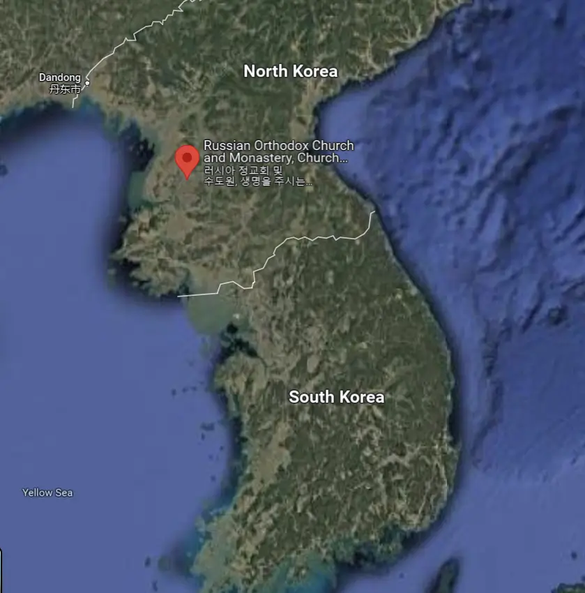
The Church of the Life-Giving Trinity (Pyongyang) is presently the only Russian Orthodox Church in all of North Korea.
Here’s more about it:

And the answer of course is the DMZ (The Demilitarized Zone), and as the ABC (Australian Broadcasting Corporation) states:

In total, Iain Mullan estimates Cash travelled 174,493 km between the 92 cities mentioned in the song.
He starts the song by saying: “I was totin’ my pack along the dusty Winnemucca (NV) road” then goes on to list:

The map above shows the extent of the Vatican City’s railway system (Holy See railway). With just two 300 metre sets of tracks and two freight sidings measuring a total of 1.27km (0.79 miles), it’s the shortest railway system in the world.

On October 3rd 2024, the UK agreed to return the Chagos Islands to Mauritius ending years of dispute.
This means at some point in 2025 the sun will set (or have set if you’re reading this after) on the British Empire.
From the map author:

The map above is another fantastic map from Perrin Remonté. It shows what Europe might look like if all the glaciers (by which he means Ice) on Earth melted.
Here’s what he says about the map:

In most cases, it comes down to historical animosity and/or (lack of) political recognition.
The banned matchups are:

The map above comes from Life magazine and was published on February 10th, 1916.
It’s titled: My Country ‘Tis of Thee – New Prussia
But it’s important to note, that it was before the United States entered the war on the side of the UK and France.
As Reddit user Pjpjpjpjpj further states:
