Brilliant Maps

Making Sense Of The World, One Map At A Time

  • BOOK!
  • Newsletter
  • Games & Quizes
  • Map Based Polls
  • Map Tools

Map of Europe: What if all the glaciers melted?

Last Updated: October 3, 2024 2 Comments

Click To Get My 10 Best Brilliant Maps For Free:

Map of Europe: What if all the glaciers melted?

The map above is another fantastic map from Perrin Remonté. It shows what Europe might look like if all the glaciers (by which he means Ice) on Earth melted.

Here’s what he says about the map:

What if all the glaciers melted?

Even if the scenario is highly improbable, it is more fiction than reality, this map offers an unprecedented level of detail to imagine and explore a new Europe, a geography of the future, in which the sea level is 70 meters higher than today: new coastlines, submerged or displaced cities. , new routes, bays and archipelagos, the economy and demographics are undergoing radical changes to overcome rising seas.

Even airliners gave way to seaplanes and a new golden age of sailing began!

I strongly recommend you visit his site here to get a close up look at the image. You can even by a print of the map.

Here’s an example what the UK & Ireland might look like:

Uk and Ireland if all ice melted

Filed Under: Other

Click To Get My 10 Best Brilliant Maps For Free:


Other Popular Maps

  • You Can Travel South From Arkansas & Get Into Every State It Borders

    You Can Travel South From Arkansas & Get Into Every State It Borders

  • Map of Austria Immediately After WW1

    Map of Austria Immediately After WW1

  • Map Of Trump’s Peace Plan For Israel & Palestine aka Peace to Prosperity: A Vision to Improve the Lives of the Palestinian and Israeli People

    Map Of Trump’s Peace Plan For Israel & Palestine aka Peace to Prosperity: A Vision to Improve the Lives of the Palestinian and Israeli People

  • Countries Mentioned or Alluded To In The Hungarian National Anthem

    Countries Mentioned or Alluded To In The Hungarian National Anthem

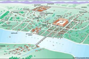
  • Roman City of Londinium Around AD 200

    Roman City of Londinium Around AD 200

  • The Map That Shows Why Microsoft Is Killing Off Internet Explorer (2015)

    The Map That Shows Why Microsoft Is Killing Off Internet Explorer (2015)

  • The 10 Largest Cities in Europe in 2025 (Based On 30km Population Circles)

    The 10 Largest Cities in Europe in 2025 (Based On 30km Population Circles)

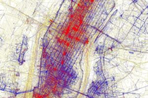
  • Tourists Vs Locals: 20 Cities Based On Where People Take Photos

    Tourists Vs Locals: 20 Cities Based On Where People Take Photos

Comments

  1. Anton Sherwood says

    June 21, 2026 at 2:56 am

    I want to see a map in which the sea rises just enough (113m) that Everest and Mont Blanc are no longer on the same continent.

    Reply
    • Vandy Beth Glenn says

      June 26, 2026 at 1:48 pm

      Why?

      Reply

Leave a Reply Cancel reply

Your email address will not be published. Required fields are marked *

This site uses Akismet to reduce spam. Learn how your comment data is processed.


Product Reviews · World Atlas · Map Posters · Settlers of Catan · Risk · Game of Thrones · Coloring Books · Globes · Monopoly · Star Wars · Game of Life · Pandemic · Ticket To Ride · Drinks Cabinets
Size Comparisons · US Locations · Flight Maps · Fleet Management
Copyright © 2026 · Privacy Policy · Fair Use, Attribution & Copyright · Contact Us
Follow Us: Newsletter · Facebook · Youtube · Twitter · Threads · BlueSky · LinkedIn · Instagram · Pinterest · Flipboard