A Face Made From African Heads of State (Bonus Maps For Asia & America)
The map above shows a face combined from pictures of each of Africa’s Heads of State.
You can similar maps for Asia’s Heads of State below, along with a map of North America made from the faces from Mexican and American Governors and Canadian Premiers.
Maps and the 20th Century: Drawing the Line Review

If you’re in London at some point before 1 March 2017, you need to head over to the British Library and check out Maps and the 20th Century: Drawing the Line. (and if not you should buy the book instead).
It is quite simply the best map exhibit I’ve ever seen.
16 Best Maps of 2016
Now that 2016 is finally over, we thought it would be fun to look back at our most popular maps from last year.
(We did the same thing for the Top 15 Maps of 2015 last year.)
The maps below are ranked on the number of visitors each received in 2016. As you’ll see some are older posts that got a second lease on life, while most are brand new to 2016.
Enjoy:
How Far Could You See From The Top of Mount Everest?

The map above shows how far you theoretically could see from the top of Mt. Everest on perfectly clear day, with perfect vision and without any obstacles.
Map of Countries Where Pokemon GO is Available
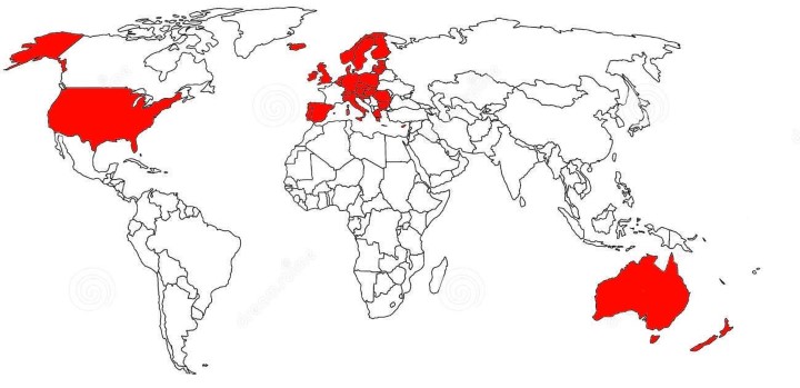
The map above shows countries where the world’s most viral app ever, Pokemon GO, is available.
What If Kamchatka Was an Independent Country?

The map shows what an independent Republic of Kamchatka, (best known as a territory in Risk) might look like.
The Incredible Shrinking Aral Sea 1960-2014
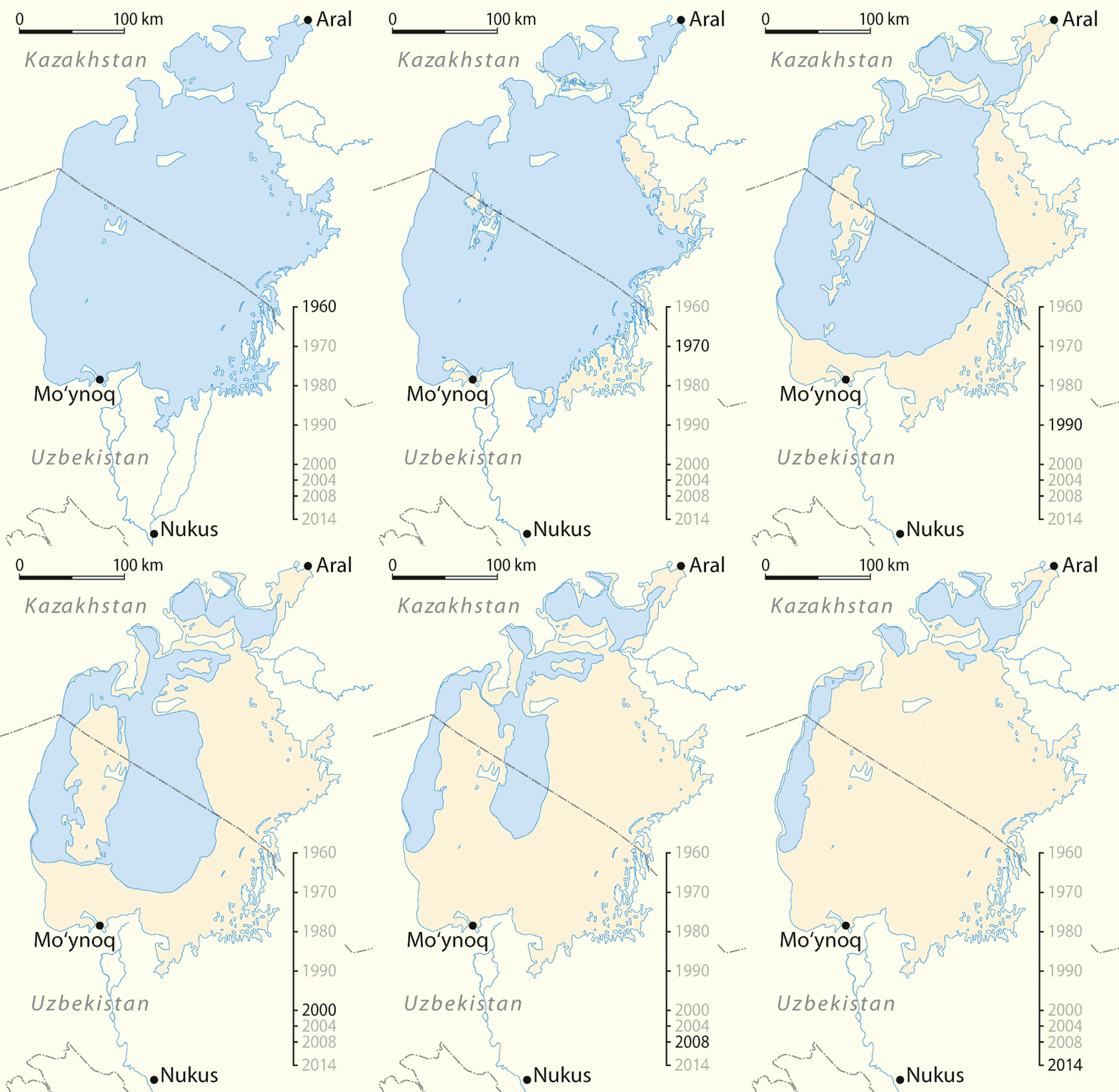
The Aral Sea was once the fourth largest body of inland water in the world with an area of 68,000 km2 but, as the map dramatically illustrates, it has now shrunk and fragmented to a mere shadow of its former self.
It lies between Kazakhstan to the north and Uzbekistan to the south. Its drainage basin also includes parts of Tajikistan, Turkmenistan, Kyrgyzstan and Afghanistan.
Magnificent Ordnance Survey Map of Mars

The map above shows the Western Arabia Terra region of Mars. It was created by the Ordnance Survey, Britain’s official mapping agency.
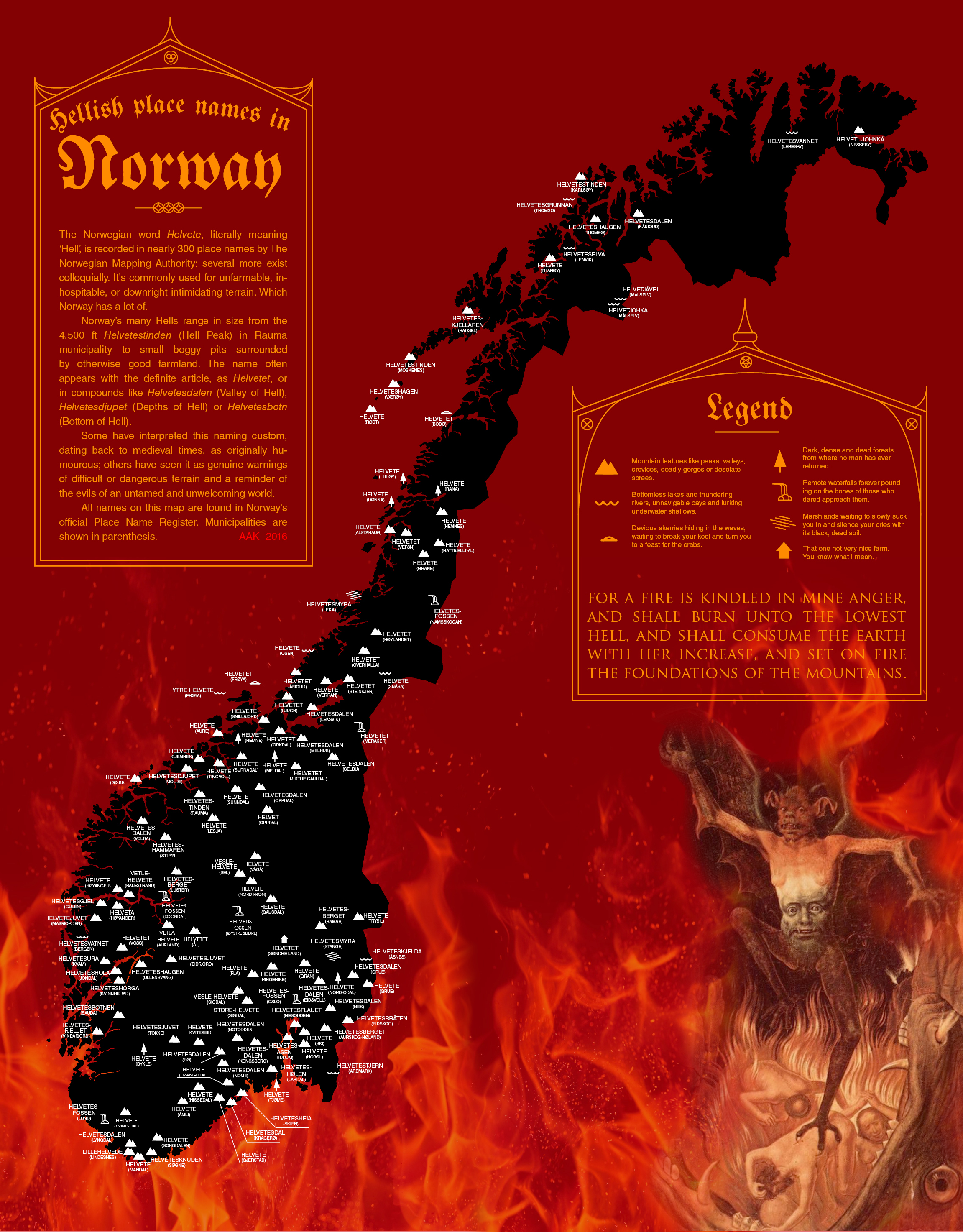
Places in Norway Literally Named After Hell