The maps below are all the work of the work of the amazing geo.universe and show the differences in the population of Canada and the US from 1850 all the way up until 2025.
The 12 US States Where Good Friday Is A Holiday
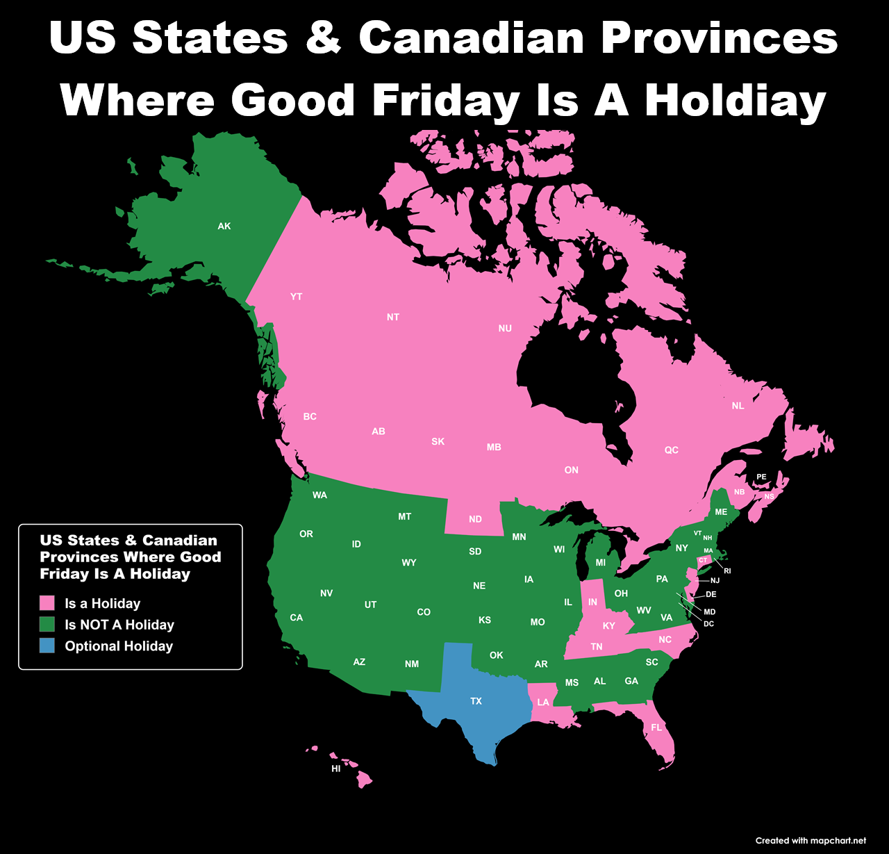
The map above shows the 12 states where Good Friday is a state holiday as well as being holiday in all 10 Canadians provinces and 3 territories.
The 12 states are:
Where 19 Different Types of Berries Native to North America Grow
The video above was created by quite adept shows where 19 Different Types of Berries Native to North America Grow.
It’s part of a much longer video you can watch below:
5 Maps Showing Why Republicans Should Oppose Trump’s Attempt to Annex Canada
The inspiration for these maps comes from Donald Trump’s repeated stated desire to make Canada a part of the United States.
Yet, a poll from 2024 showed 82% of Canadians oppose any such the plan!
And that was before the whole boycott US movement and elbows up campaigns got going.
Moreover, before continuing I will state I’m a proud Canadian who has zero interest in seeing the US annex Canada.
However, I’m sure that doesn’t matter to Trump or his MAGA supporters.
Map Of The Venezuelan Diaspora In The World
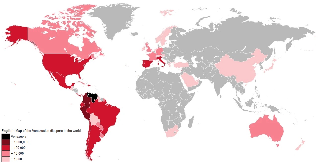
The map above shows the estimated number of Venezuelan’s living in other countries around the world. The table below gives an estimate by country:
South North America vs North South America

The map above is just a friendly reminder that South North America is different from North South America. Here’s a little bit more about each:
Chlamydia Cases Per 100K People by State & Province

Full data below:
25 Largest Cities In The Americas By Population (Residing Within City Limits)

Full list below:
South American License & Number Plate Designs

Animated Timeline Map Of The Growth & Evolution Of Brazil’s Territory & States
Reddit user LustfulBellyButton, created a super detailed timeline of the various important events in Brazilian history based off the video and maps above:
- 1
- 2
- 3
- 4
- Next Page »