Brilliant Maps

Making Sense Of The World, One Map At A Time

  • BOOK!
  • Newsletter
  • Board Games
  • Posters
  • Scratch Maps

If European Borders Were Drawn By DNA Instead Of Ethnicity

Last Updated: March 3, 2023 74 Comments

Click To Get My 10 Best Brilliant Maps For Free:

If European Borders Were Drawn By DNA Instead Of Ethnicity

Map originally found on reddit

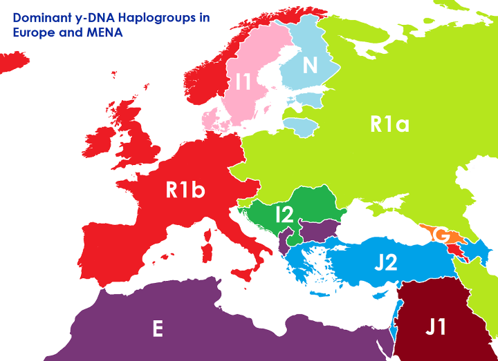
The map above shows what the borders of Europe, the Middle East and North Africa might look like if they were based on the dominant Y-DNA haplogroup rather than ethnicity and/or any other political considerations.

[Read more…]

Filed Under: Border, Europe

The Border Between Belgium & The Netherlands at Baarle-Hertog/Baarle-Nassau

Last Updated: March 3, 2023 3 Comments

Click To Get My 10 Best Brilliant Maps For Free:

The Border Between Belgium & The Netherlands at Baarle-Hertog/Baarle-Nassau

The map above shows the incredibly strange and complex border between Belgium and the Netherlands at Baarle-Hertog (Belgium) / Baarle-Nassau (Netherlands).

[Read more…]

Filed Under: Border, Europe Tagged With: Belgium, Netherlands

European Borders In 1914 vs Borders Today

Last Updated: March 3, 2023 9 Comments

Click To Get My 10 Best Brilliant Maps For Free:

European Borders In 1914 vs European Borders Today

Map found via reddit user Areat

The map above shows what Europe’s borders looked on the eve of World War One in 1914, overlaid on top of the borders of European countries today. The first thing that jumps out at you is how many fewer countries there were.

[Read more…]

Filed Under: Border, Europe Tagged With: 1914

Saint Martin – The Smallest Inhabited Island Divided Between Two Countries

Last Updated: March 3, 2023 Leave a Comment

Click To Get My 10 Best Brilliant Maps For Free:

Saint_martin_map

Map from Wikimedia

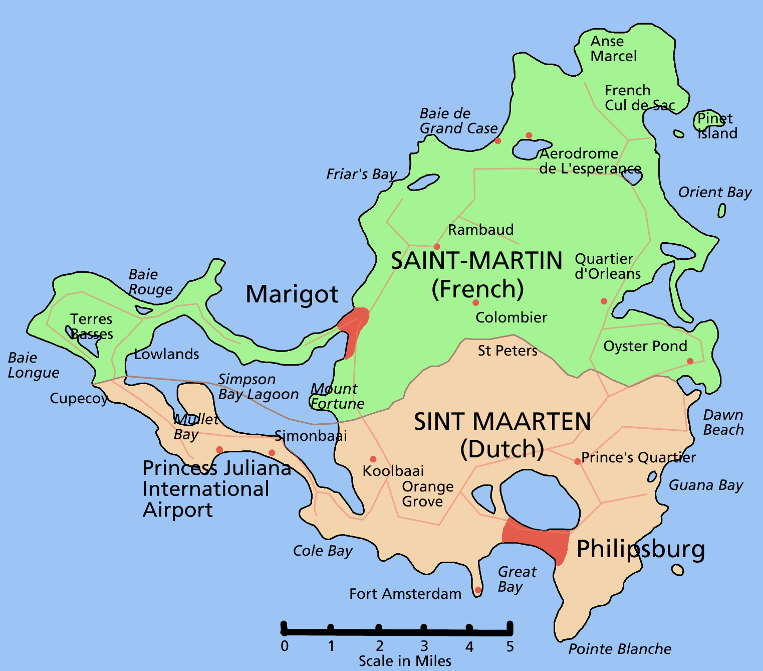
Saint Martin (French: Saint-Martin; Dutch: Sint Maarten) is one of the Renaissance Islands (along with Anguilla and Saint Barthélemy) situated at the northern end of the Leeward Island chain in the northeast Caribbean.

Fact: With an area of only 87 square kilometres (34 square miles), it has the distinction of being the smallest inhabited island that is divided between two nations.

[Read more…]

Filed Under: Americas, Border

The Amur River: Dividing Deserted Russian Siberia From Populous Chinese Manchuria

Last Updated: March 3, 2023 6 Comments

Click To Get My 10 Best Brilliant Maps For Free:

Amur river

Google Map of the divide between Russia and China along the Amur river created by reddit user jagosinga

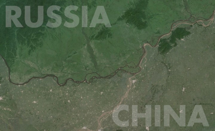
The Amur River (called the Heilong Jiang in Chinese) separates Russia’s Far East from Northeast China. And as the map shows, the contrast could not be much more striking.

[Read more…]

Filed Under: Border Tagged With: population


Product Reviews · World Atlas · Settlers of Catan · Risk · Game of Thrones · Coloring Books
Globes · Monopoly · Star Wars · Game of Life · Pandemic · Ticket To Ride · Drinks Cabinets
US Locations · UK Locations· Fleet Management
Copyright © 2026 · Privacy Policy · Fair Use, Attribution & Copyright · Contact Us
Follow Us: Newsletter · Facebook · Youtube · Twitter · Threads · BlueSky · LinkedIn · Instagram · Pinterest · Flipboard