
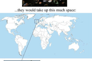
In regions such as Africa and parts of Asia, colonial administrators carved out territories to suit their own interests (access to resources, political balance, or simple convenience), creating borders that cut across peoples and landscapes arbitrarily, often just using a ruler to draw a straight line.
When you apply that same mindset to Europe itself, you end up with the same sort of illogical partitioning—lines that splice countries in odd ways and ignore natural or historical boundaries.
This makes fun of the idea that Europeans were making “rational” or “civilizing” decisions in their colonial holdings; the humor comes from forcing Europe to experience the same haphazard division it once imposed on others.
That said the Welsh and Scots might be happy about getting their own states in this scenario, while if I was Belarus I’d be pretty worried about that panhandle stretching into Russia.
European Colonial Legacy On Boarders Today
The legacy of European colonialism is still very much visible today, and one of the most often discussed aspects is how European powers drew borders in regions outside Europe—borders that frequently ignored local cultural, ethnic, and linguistic realities.
Many historians and political analysts point to several examples where these arbitrarily drawn borders have had long-lasting, often devastating, impacts:
1. The Scramble for Africa (Late 19th–Early 20th Century)
What happened:
At the Berlin Conference of 1884–1885, European nations met to divide Africa among themselves with little regard for the continent’s existing ethnic or cultural divisions. This led to borders that:
- Ignored indigenous boundaries: Ethnic groups and communities that had lived together for centuries were suddenly split into different territories.
- Grouped diverse groups together: Different communities with distinct identities were forced into single political entities.
Long-term effects:
- Ethnic Tensions & Conflict: Many post-colonial conflicts can trace their origins to these arbitrary borders. For example, countries like Nigeria and the Democratic Republic of Congo have faced internal strife partly because colonial borders grouped rival groups together or split coherent groups across states.
- Governance Challenges: The lack of alignment between colonial borders and indigenous social structures has complicated nation-building and state legitimacy in many parts of Africa.
- Related Maps: Colonial Africa On The Eve of World War I, Short History of Colonialism Since 1492 In One GIF, African Countries Never Colonized By Europeans
2. The Sykes-Picot Agreement (1916) in the Middle East
What happened:
During World War I, Britain and France secretly negotiated the Sykes-Picot Agreement, which proposed dividing the Ottoman Empire’s territories in the Middle East into zones of influence. The resulting borders:
- Were largely arbitrary: They did not take into account the complex tapestry of ethnic and religious communities living in the region.
- Laid the groundwork for modern nation-states: Countries like Iraq, Syria, and Jordan were carved out based on European interests rather than local realities.
Long-term effects:
- Sectarian and Ethnic Strife: The disregard for existing divisions contributed to ongoing conflicts. In Iraq, for instance, tensions among various ethnic and sectarian groups have been a persistent source of instability.
- Political Instability: The modern borders have made it challenging for many Middle Eastern states to develop unified national identities, contributing to regional instability and conflict.
- Related Map: French Mandate for Syria and The Lebanon In 1922
3. The Durand Line (1893) Between Afghanistan and Pakistan
What happened:
The British established the Durand Line to demarcate the border between Afghanistan and British India (now Pakistan). This line:
- Divided historically unified groups: The border split the Pashtun tribes, who had long maintained cross-border cultural and familial ties.
- Lacked local consultation: The local populations were neither involved in nor considered during the border’s creation.
Long-term effects:
- Persistent Tensions: The arbitrary division has fueled conflicts between Afghanistan and Pakistan, and the divided Pashtun communities have often found themselves caught in broader regional disputes.
- Impact on Regional Security: The border has been a source of friction and has contributed to ongoing security issues in the region.
4. The Congo under Belgian Colonial Rule
What happened:
In the 1880s, King Leopold II of Belgium claimed the Congo Free State as his personal possession, later transforming it into the Belgian Congo.
The colonial borders drawn during this period:
- Ignored local diversity: The borders were imposed without considering the region’s intricate mosaic of ethnic, cultural, and political affiliations.
- Enabled brutal exploitation: Under Leopold’s regime, the focus was on resource extraction (notably rubber and ivory), enforced through systems of forced labor and widespread violence.
Long-term effects:
- Legacy of Exploitation and Abuse: The severe exploitation and human rights abuses under Leopold’s rule left deep scars, contributing to a legacy of mistrust in governance and institutions.
- Fragmented Social Structures: The arbitrary borders disrupted existing social and political networks, making it difficult to forge a unified national identity after independence.
- Persistent Instability: These historical divisions have contributed to ongoing internal conflicts, including the Congo Wars, as various groups vie for control over resources and political power.
- Resource Curse: The pattern of resource extraction has contributed to corruption and conflict, with abundant natural resources often becoming a source of contention rather than national wealth.
- Related Maps: Why Are There Two Congos? Republic of the Congo vs Democratic Republic of the Congo, Conflict in Eastern Congo Mapped
5. The Partition of British India (1947)
What happened:
When British India was divided into two independent states—India and Pakistan—the process was rushed and poorly planned:
- Rapid Redrawing of Borders: The boundary was drawn with minimal consultation of local communities, largely based on religious demographics.
- Displacement and Violence: The partition led to one of the largest mass migrations in history and unleashed widespread communal violence.
Long-term effects:
- Enduring Conflict: Disputes over regions such as Kashmir continue to cause tension between India and Pakistan.
- Deep Societal Scars: The traumatic legacy of partition still affects inter-community relations and national identities in the region.
- Related Maps: The First Proposed Map of Pakistan & The Partition of India, Indian Borders According To Google Maps India vs USA
Which new European country would you most want to live in?


Leave a Reply