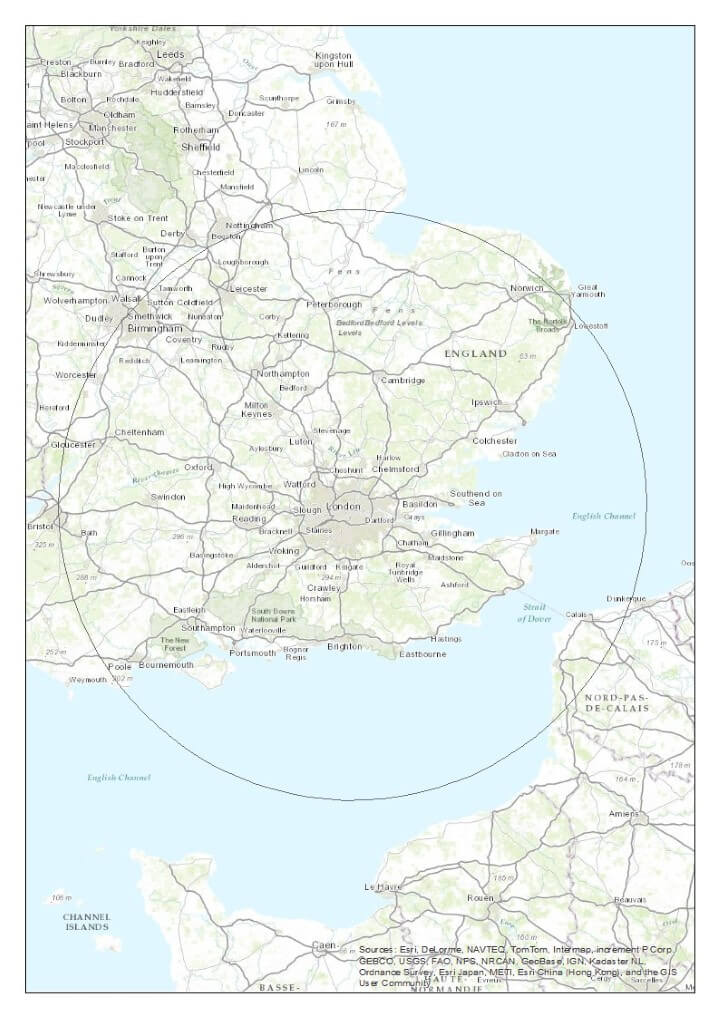
The map above shows how far out from London you have to go before you get 50% of the UK population (not including the French of course).
Making Sense Of The World, One Map At A Time
The map above shows how far out from London you have to go before you get 50% of the UK population (not including the French of course).

The 12 maps above are a tongue-in-cheek look at the various ways the UK is divided besides Brexit or how to pronounce scone.
And before anyone complains, they are meant to be humorous and should not be taken too seriously.
You can see each map in more detail below:
If you’re not British, or spent much time in the United Kingdom, you may never have heard of the Ordnance Survey.
The Ordnance Survey is Britain’s national mapping agency and has been producing maps for the public since 1801 (For a complete history have a look at: Map of a Nation: A Biography of the Ordnance Survey)

The map above, titled An Entirely New & Accurate Survey Of The County Of Kent, With Part Of The County Of Essex was created by William Mudge in 1801 and is regarded at the first official Ordnance Survey map.

The map above shows the “border” between North and South in England and Wales (Scotland is even further North) based on a 2007 study by the University of Sheffield.
From Giggleswick to Dull the UK has many weird, silly, odd and rude place names, which you can see in the map above.
The full list of places can be found below:
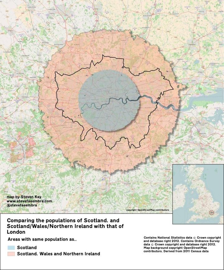
The map above shows just how many people live in London. The blue area above has the same population as Scotland, 5.3 million people.
And the pink area contains the same population as Scotland, Wales and Northern Ireland combined, a little over 10 million people.

According the Ordnance Survey: “The coastline length around mainland Great Britain is 11,072.76 miles [17,819.88 km].”
However, as the map above shows it’s not really that simple.
The map above shows the counties of Great Britain (not including Northern Ireland) that voted to remain in the EU following the UK’s referendum on 23 June 2016 as physical islands; islands of remain in the Brexit Sea.
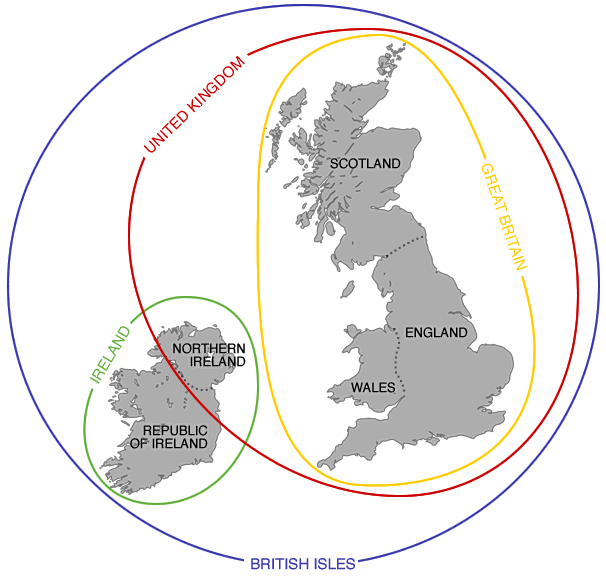
The map above demonstrates the difference between the British Isles, United Kingdom, Great Britain, and England. While the terms are often used interchangeably they actually mean different things.