
The map above comes from bustimes.org (click for interactive map) and shows the different colours of buses across the UK and Ireland.
Heres’ why:
Making Sense Of The World, One Map At A Time
The map above comes from bustimes.org (click for interactive map) and shows the different colours of buses across the UK and Ireland.
Heres’ why:

The map above looks at the change in demographics on the island of Ireland in 1841 (just before the Great potatoes famine) and 2021/22 the date of the last censuses for the two parts of the island today.
In 1841 the island was firmly part of the United Kingdom of Great Britain and Ireland. Today the island is divided between the Republic of Ireland and Northern Ireland (part of the United Kingdom).
More about the comparison below:

The map above shows the location of 3,554 Shipwrecks Around Ireland where the location is known going all the way back to 1530. About their database:


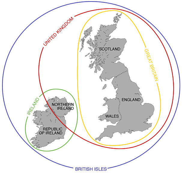
The North of Ireland (aka The North of The Republic of Ireland) extends further North than any part of Northern Ireland (one of the 4 countries of the UK).
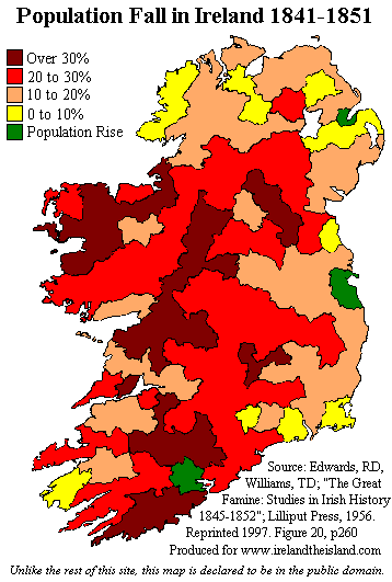
This map shows the catastrophic decline in the population of Ireland during the decade from 1841 to 1851. The census taken in 1841 recorded a population of 8,175,124, while the 1851 census counted 6,552,385, a drop of over 1.5 million in 10 years.