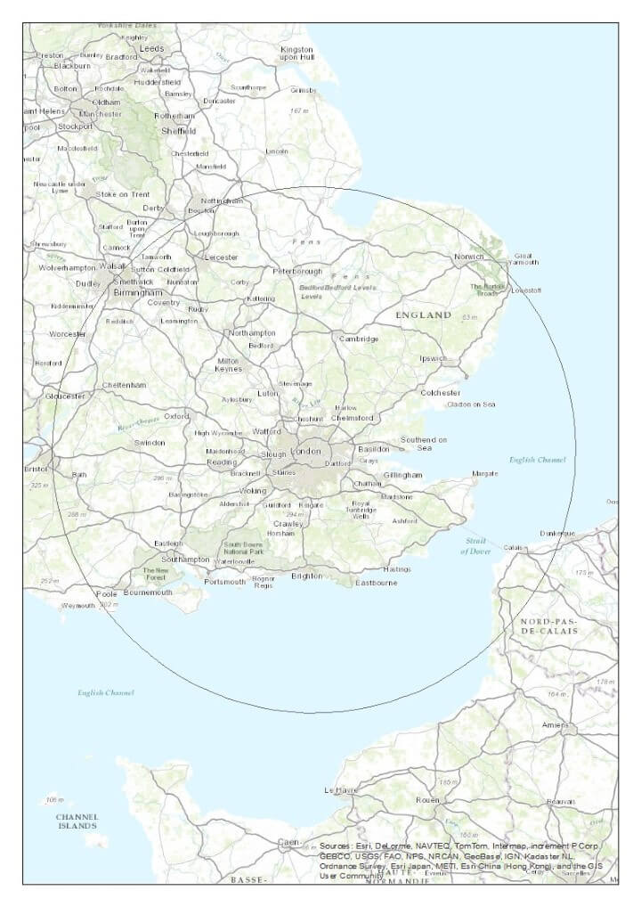
The map above shows how far out from London you have to go before you get 50% of the UK population (not including the French of course).
The map was created by @election_data who state that:
There so some sensitivity depending on where the line cuts across Birmingham and Bristol but 10km either side of this line gets 49-51% roughly
Moreover, 20% of UK population live within 50 km of London and 33% within 100 km.
Enjoy this map? Please help by sharing it below:


charlie says
Ok. So what is the circles radius please.
Dave Spaniel says
The Radius is the distance from the centre outwards. Hope that helps.
Adrian Brown says
Fascinating. From this it follows that if you moved the circle NW to centre on, say, Luton, you ‘d get more than half; and you would therefore make it smaller to get exactly 50%.
Which leads towards what the relevant ‘optimisation’ question would be. How about, Find the smallest possible circle which would enclose precisely 50% of UK population; state its centre and radius?
Zed Lawrence says
Maps.ie have a really good radius tool, I use it to find out population for events I advertise… 200km from Northampton gives about 53 million, and you can edit it to find 50% of the population
ian clegg says
literally just put this comment on youtube, hit return and thought ‘i wish i had checked first’:
“would work great in britain where we got 30 million people all wanting to be in the same 100 sq mile corner of the country.”
well i checked afterwards and it seems i wasn’t so far off.
thank you for your map and website.
i’ve added it as a bookmark,
ian