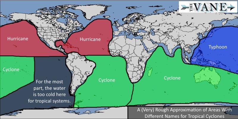
Did you know that hurricanes, typhoons, and tropical cyclones are basically just different names for the same weather event.
The map above shows where each name is used around the world.
Making Sense Of The World, One Map At A Time
Did you know that hurricanes, typhoons, and tropical cyclones are basically just different names for the same weather event.
The map above shows where each name is used around the world.

Given how popular the Probability of a White Christmas Across Europe map turned out to be, we were happy to find that the National Oceanic and Atmospheric Administration has created a similar map for the United States.

The map above shows the probability of a white Christmas, defined as having snow on the ground on December 25th, across Europe. The map was created by Finish reddit user Haayoaie who states that:

The map above shows how bad winters are around the United States using the The Accumulated Winter Season Severity Index. The circles on the map represent the weather stations used to collect the data.