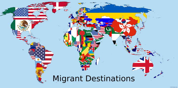
The map above shows the flag of the country people who move abroad are most likely to move to. So for example, Australians are most likely to move to the United Kingdom (and vice versa), Canadians are most likely to move to the United States, Mainland Chinese to Hong Kong, etc.
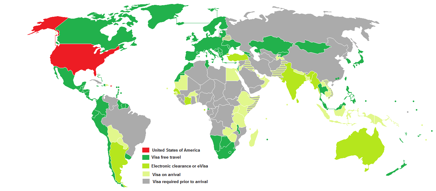
The 99 Countries Americans Can Visit Visa-Free (2015)
The map above shows the 99 countries American passport holders can travel to visa-free. What this means in practice is that you don’t need prior permission to enter any of the countries listed. However, be aware that virtually all countries impose time limits on how long Americans can stay, generally anywhere between 14 and 90 days.
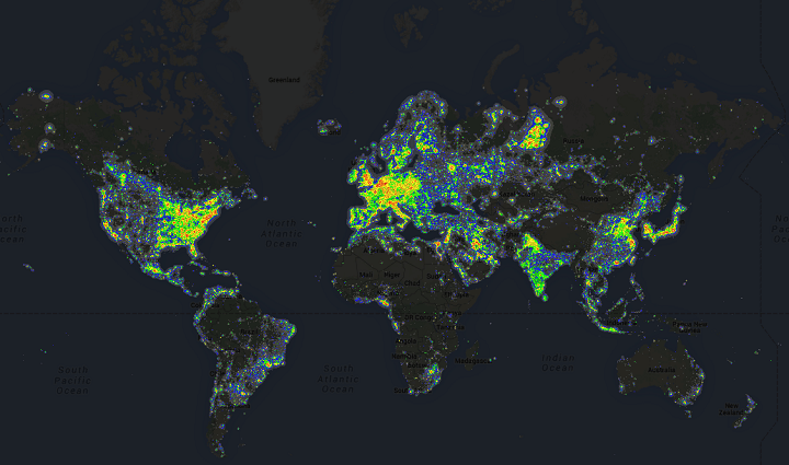
Light Pollution Around The World
While the map above is now a few years out of date (data from 2006) it shows the amount of light pollution around the world. Not surprisingly, densely populated areas tend to have far more light pollution than sparsely populated ones.
Moreover, wealthy areas tend to have more than poorer ones, which can be clearly seen in some of the more detailed maps below.
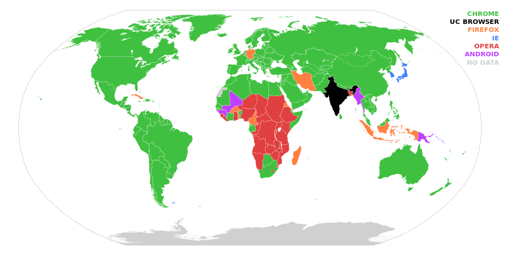
The Map That Shows Why Microsoft Is Killing Off Internet Explorer (2015)
News this week that Microsoft is killing off the Internet Explorer brand and one look at the map above will show you why.
The Largest Source Of Imports By Country
Who imports the most from whom? The map above shows the flag of the country that is the largest source of imports for each other country. For example, the United States imports more good from China than any other.
China is also the biggest source of imports from countries as diverse as Russia, Australia, South Africa, Saudi Arabia, Madagascar, Sudan and North & South Korea among others.
Amiantedeluxe used statistics from The Observatory of Economic Complexity, statistiques-mondiales.com and Wikipedia to make the map.
So what country does China import the most from?
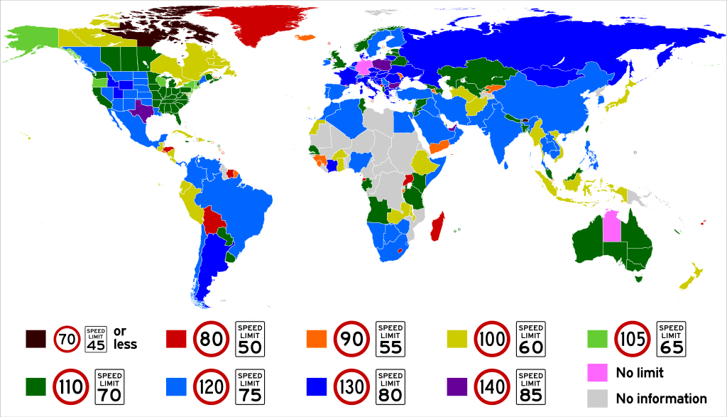
Who Are The World’s Speed Demons? The Highest Speed Limits Around The World
As the map above shows, Germany’s famous Autobahns are some of the only roads in the world without a speed limit. However, there are two other places where drivers can drive as quickly as they’d like.
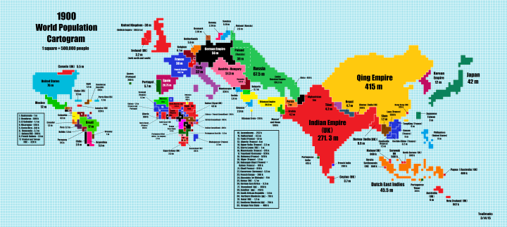
The World’s Population In 1900 Looked Very Different Than Today
Reddit user Teadranks is back with another amazing cartogram, a type of distorted map around one variable, in this case world population in 1900. To see how much it’s changed you can jump to the 2015 cartogram post, or scroll below.
Punny Maps of The Foodnited States of America

Chris Durso and his 8 year-old son have created a punny series maps collectively titled The Foodnited States of America.
Each map takes one food item that can be worked into the name of the state. So far they’ve created 25 maps with new ones being released regularly via the Foodiggity.com instagram account.
While not all the states are created from a food item you’d associate with them, they’re all quite clever.
Below are a few of my favourites:
Which City Has The World’s Worst Air Pollution? Hint, It’s In China
As the map above shows, China is home to many of the world’s most polluted cities. The map was created by AQICN, a Chinese website that tracks global air pollution stats.
Ulf Troeng, who told me about the map, clarifies that:
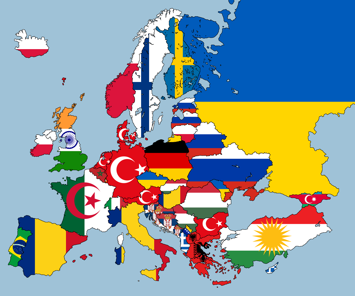
2nd Largest Nationality Living In Each European Country
The map above shows the flag of the 2nd largest nationality, by country of birth, living in each European country. Thus, it may include citizens and those who have moved temporarily for work. Nevertheless, there are many surprises, such as:
- « Previous Page
- 1
- …
- 32
- 33
- 34
- 35
- 36
- …
- 39
- Next Page »
