
Let’s break it down:
1. Geographical Centre of Vietnam is in Laos
- Vietnam is a long and narrow S-shaped country stretching along the eastern coast of the Indochina Peninsula.
- Because it is asymmetrically shaped, its geographical center is not within its own territory but falls outside in Laos.
- This happens when calculating the geographical center (centroid) based purely on landmass shape rather than political boundaries.
2. Geographical Centre of Laos is in Thailand
- Similarly, Laos has an irregular shape and extends in a way that its calculated centroid falls outside its borders, specifically in Thailand.
- Laos is a landlocked country with a narrow, elongated shape in some regions, causing its centroid to shift westward into Thailand.
Why Does This Happen?
- The centroid (or geographical center) of a country is determined mathematically by averaging all points of landmass.
- When a country has an irregular shape—like Vietnam’s long coastal stretch or Laos’s uneven distribution—this calculation may result in the centroid falling outside its own borders.
Is This Common?
- Yes, similar phenomena occur in other countries:
- The centroid of United States (on a Mercator map) is in Canada.
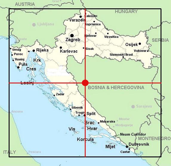
- The centre of Croatia is located in Bosnia and Herzegovina
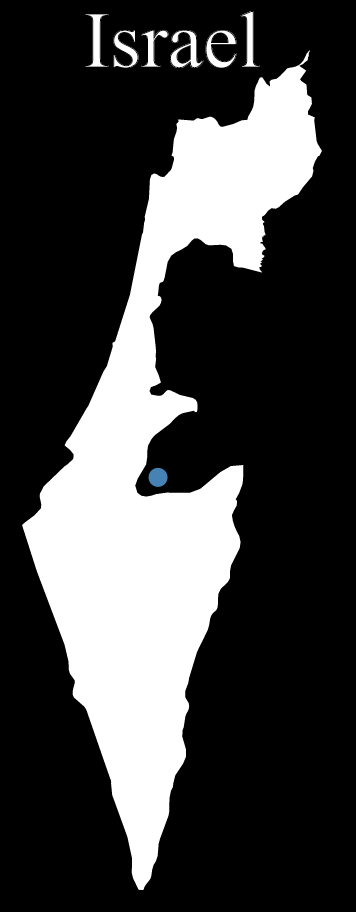
- Israel’s,center lies near Hebron
Here are some maps for them:
Due to its unique shape, the geographic centre of Croatia is actually located in Bosnia and Herzegovina
They computed it by taking the center of the minimal bounding rectangle.
To me a more natural approach would be to take centroid of the country, i.e. its center of mass.
So I set out to download all borders from Natural Earth, that provide 10 meter approximations to country borders as polygon(s).
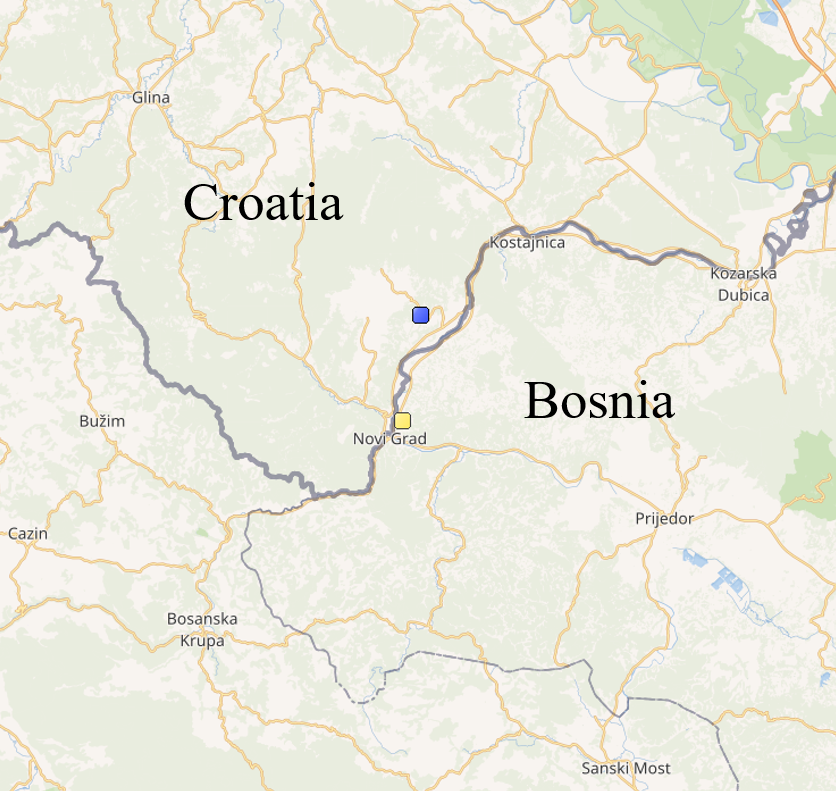
As it turns, Croatia’s mainland’s center (below in blue) is located inside Croatia, but if we include enclaves and islands, it pushes the center (yellow) a few kilometers south, to Bosnia.
He also calculated that, Israel’s center lies near Hebron:
And finally:
There’s a somewhat interesting issue concerning locating the centroid of a large country, especially near a pole.
At first I just located the centroid of the resulting Mercator projection of the borders (i.e. x = lon, y = log(tan(PI/4 + lat/2))).
This projection distorts areas — the closer you are to either poles, the larger you seem to be.
A more accurate approach would be to calculate the centroid of spherical polygons; I used this result.
The difference between the two approaches can be huge when countries include areas near the pole.
An example to that would be the US; after 2D projection, Alaska’s area explodes disproportionally and pushes the centroid away (below, red); the true spherical centroid (blue) is somewhere around South Dakota.

Can you think of any other good examples?
![What Time Do Europeans Typically Wake Up? [With Data]](https://brilliantmaps.com/wp-content/uploads/Wake-up-times-300x200.jpg)


Leave a Reply