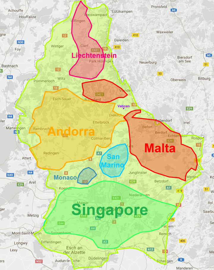
The map above shows how big Luxembourg is compared to Singapore, Andorra, Malta, Liechtenstein, San Marino, Monaco, and the Vatican.
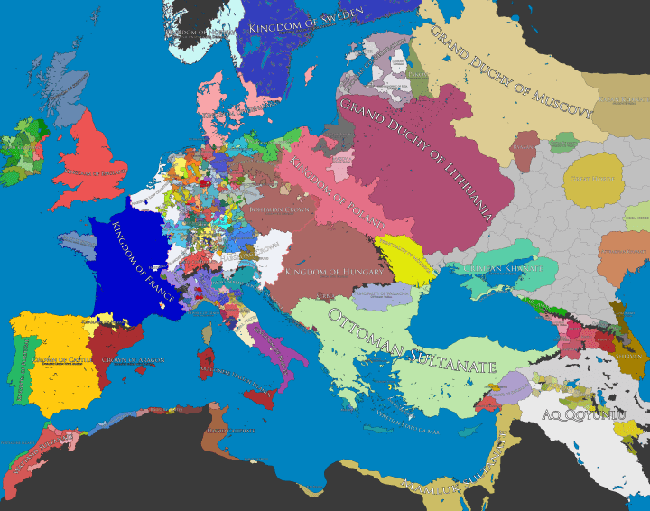
Map of Europe, 1500 AD
The map above shows the patchwork of kingdoms, principalities, bishoprics, duchies, republics, cities, sultanates, etc. in and around Europe in 1500 CE/AD.
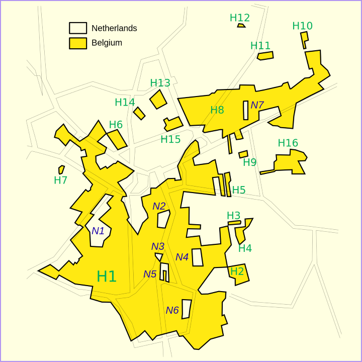
The Border Between Belgium & The Netherlands at Baarle-Hertog/Baarle-Nassau
The map above shows the incredibly strange and complex border between Belgium and the Netherlands at Baarle-Hertog (Belgium) / Baarle-Nassau (Netherlands).
Travel Time from Ancient Rome

The map above is an Isochrone map which shows how long it would have taken someone to travel from Rome to the farthest reaches of the Roman Empire at its peak (roughly 200 CE/AD).
Travelling within the core of the Empire could have be done in under a week, but travelling all the way to the fringes would have taken someone more than a month.
European Places With “Saint” or “Holy” In Their Names
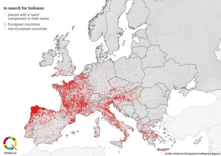
The map above shows European cities, towns and villages that have the term “saint” or “holy” in their names. The data comes from the US National Geospatial-Intelligence Agency (NGA).
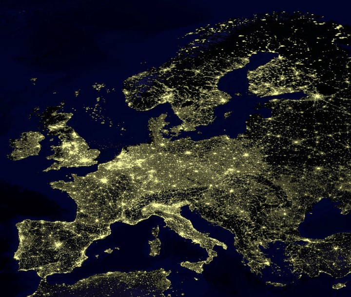
Europe At Night
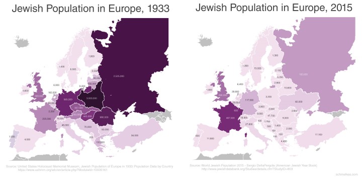
Jewish Population of Europe in 1933 and 2015
The map above shows the Jewish population of Europe in both 1933 and 2015 by country. Most countries still had much lower Jewish populations in 2015 compared to 1933.
This is largely due to the long lasting effects of The Holocaust, when over six million European Jews were systematically murdered by Hitler and the Nazis.
Emigration to both Israel and the United States after World War 2 and again after the collapse of Communism in Eastern Europe in 1989, also contributed somewhat to the decline.
However, not all countries saw their Jewish population decrease.
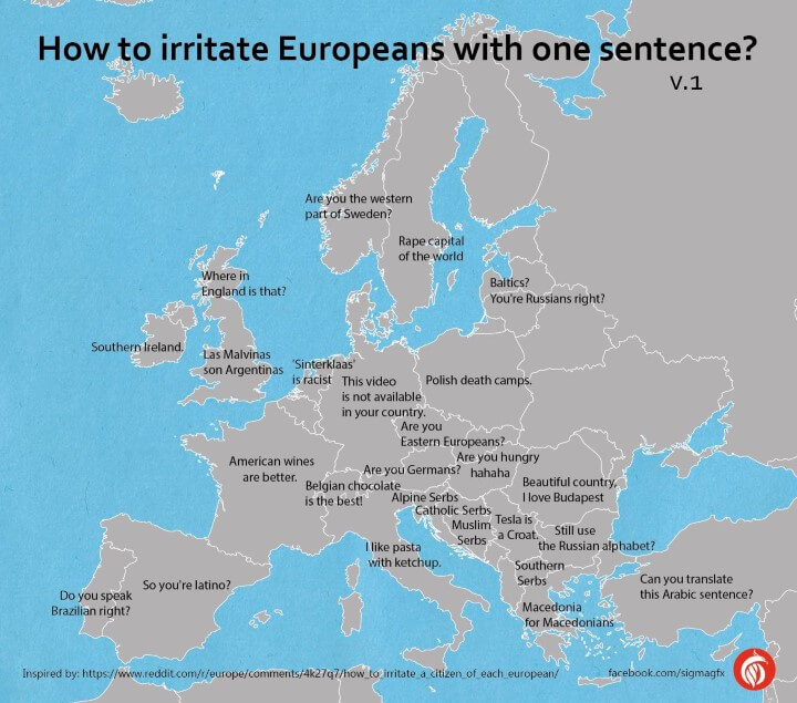
How To Irritate Europeans In Just One Sentence
The map above shows how you can easily irritate various Europeans in just one sentence. These include:
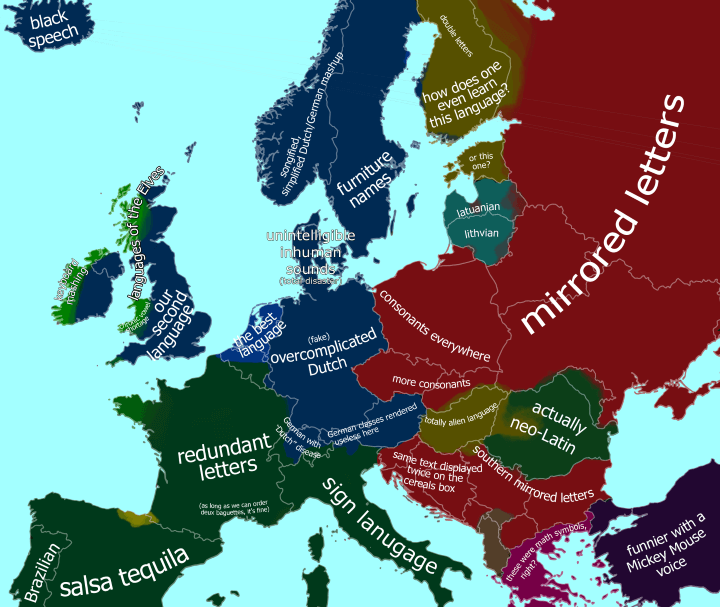
European Languages According To The Dutch
The map above is a humours look at how the Dutch view other European languages.
Of course Dutch itself is view as the best language, with English being their second language since over 90% of people in the Netherlands can speak it.
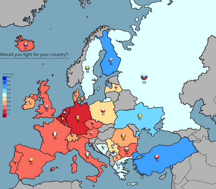
Percentage of Europeans Who Are Willing To Fight A War For Their Country
The map above shows the percentage of residents in various European countries who are willing to fight and go to war for their country.
Full results below:
