
More about it:
It’s known as Graham Island or Isola Ferdinandea in Italian or Île Julia in French.
What it is & how it forms
The island is the summit of a shallow submarine volcano (part of the “Graham Volcanic Field” within the larger Empedocles edifice) that sometimes erupts in very shallow water.
These are Surtseyan-style eruptions: hot magma hits seawater, shatters into ash and lapilli, and builds a loose tephra cone that can briefly rise above sea level.
Size at maximum extent (best estimates)
Measurements from 1831 accounts and later reconstructions disagree a bit, but they consistently put the island at roughly:
- Height: ~60–65 m above sea level at peak, before erosion began.
- Horizontal size: perimeter ~1-2 km (giving an area on the order of ~0.08–0.3 km²). Contemporary Italian summaries describe a cone “just under 300 m wide” with “almost 1 km” perimeter; others report ~2 km circumference. The variance reflects how quickly waves reworked the unconsolidated cone.
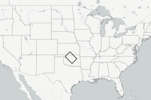
Today the summit sits ~8–9 m below sea level, so it’s a charted shoal and a navigation hazard.
When it has appeared
According to the New York Times: “Over the centuries, the island has emerged four times, with underwater volcanic eruptions first recorded during the first Punic War of 264-241 B.C.”
By far the most famous emergence was July-December 1831, when it burst up, grew rapidly, then vanished within months. (More on that below)
The 1831 Eruption & Island Life Cycle
Precursors
- In June 1831, fishermen and sailors reported bubbling, foul-smelling water and floating dead fish in the Sicilian Channel south of Sciacca (southwestern Sicily).
- These were signs of submarine volcanic activity starting to reach very shallow depths.
Emergence
- On July 17, 1831, explosions breached the surface, and within days an island appeared.
- The eruption built a classic Surtseyan tuff cone, ash, cinders, and lapilli piled above the sea.
Maximum extent
- By late July–early August the island reached ~60–65 m high, with a circumference of ~1–2 km.
- It had a central crater, steaming and emitting gases. At its peak it could be walked on, and visitors left flags and markers.
Sovereignty Scramble
- July 24, 1831 – British claim:
Captain Humphrey Fleming Senhouse of HMS St Vincent landed, raised the Union Jack, and named it Graham Island after Sir James Graham, First Lord of the Admiralty. - August 1831 – Two Sicilies claim:
King Ferdinand II’s government (ruler of the Kingdom of the Two Sicilies, which included Sicily) protested and named it Isola Ferdinandea. - French claim:
French ships also landed, calling it Île Julia (as it arose in July). - Spanish interest:
Spain briefly voiced interest due to historic claims in the region.
It became a four-way contest, with Britain, France, Spain, and the Kingdom of the Two Sicilies all planting flags within weeks.
Disappearance
- The eruption stopped in August 1831. Without new material, waves eroded the loose volcanic tuff.
- By December 1831, the island was gone, reduced to a shoal just under the water’s surface.
- The international dispute literally sank with it.
Scientific Significance
- The episode is a classic case study in ephemeral volcanic islands.
- It foreshadowed Iceland’s Surtsey (1963–67), which lasted because it erupted longer and produced more consolidated lava flows.
It has not repapered since, although there has been low-level ongoing speculation that it might.
Why it doesn’t last
Because it’s made of loose, glassy ash and cinders laid down in shallow, storm-beaten water.
Once the eruption quits, waves and currents attack the unconsolidated tephra, planing the cone down within months.
Only a hard central plug (lava neck) remains, now a few meters below the surface.
Who would own it if it reappears?
In 1831, four flags were raised in quick succession, Kingdom of the Two Sicilies (naming it Ferdinandea), Britain (“Graham Island”), France, and Spain, before the island vanished and the dispute evaporated with it.
If it re-emerged today: it sits on Italy’s continental shelf in the Sicilian Channel, just outside the old 12-nm territorial sea but within waters Italy now actively administers (and in practice claims).
Italy even pre-positioned a plaque and flag on the shoal in 2000 to signal sovereignty should it surface again.
Most observers expect Italy would assert (and likely secure) title if it became permanent, though any sudden island has the potential to rekindle diplomatic posturing.
Who do you think should own it?


Leave a Reply