Brilliant Maps

Making Sense Of The World, One Map At A Time

  • BOOK!
  • Newsletter
  • Board Games
  • Posters
  • Scratch Maps

How The World Might Look In 250 Million Years With Current International Borders

March 3, 2023 9 Comments

How The World Might Look In 250 Million Years With Current International Borders

Map created by Reddit user Coffete

The map is a fun look at what the world might look like in 250 million years time assuming no international borders change between now and then.
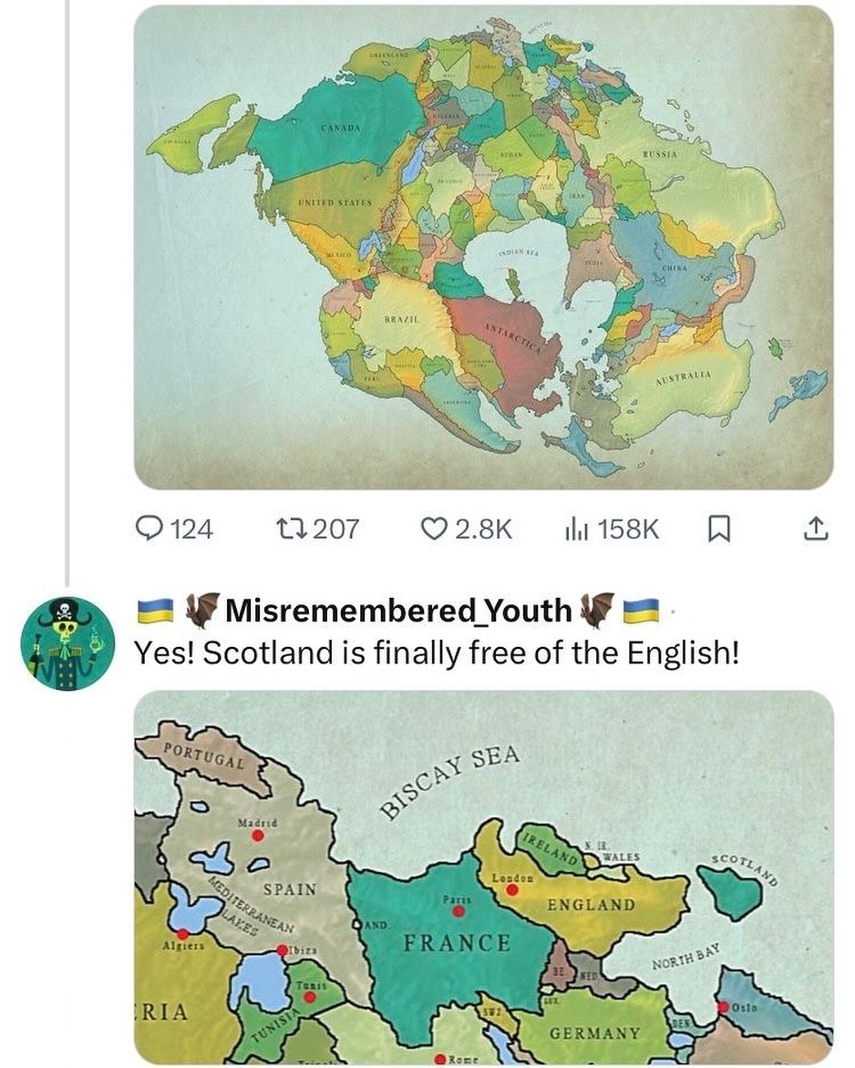
You can also what the world would have looked like 300 million years ago on these maps of Pangaea With Current International Borders and Interactive Pangaea Map With Modern International Borders.

For more on the future of earth see:

  • Apocalyptic Planet: Field Guide to the Future of the Earth
  • Earth in Human Hands: Shaping Our Planet’s Future
  • Frozen Earth: The Once and Future Story of Ice Ages

Filed Under: World Maps

Other Popular Maps

  • Noise Level From Natural Sources in the United States

    Noise Level From Natural Sources in the United States

  • The Shade of Red Each Country Has On Its Flag

    The Shade of Red Each Country Has On Its Flag

  • Where You Don’t Need A Permit To Buy A Gun

    Where You Don’t Need A Permit To Buy A Gun

  • How North Londoners View The Rest Of The UK Or Why The Rest of The UK Hates London

    How North Londoners View The Rest Of The UK Or Why The Rest of The UK Hates London

  • 21 Unique Monopoly Board Game Versions You Can Buy Online

    21 Unique Monopoly Board Game Versions You Can Buy Online

  • 14 Best Ticket To Ride Board Game Versions & Expansions

    14 Best Ticket To Ride Board Game Versions & Expansions

  • 4 Colour Theorem: All The World’s Countries Can Be Coloured Using Only 4 Colours, So That No Two Adjacent Countries Share The Same Colour

    4 Colour Theorem: All The World’s Countries Can Be Coloured Using Only 4 Colours, So That No Two Adjacent Countries Share The Same Colour

  • 2nd Largest Nationality Living In Each European Country

    2nd Largest Nationality Living In Each European Country

Comments

  1. Anonymous says

    June 13, 2020 at 6:40 pm

    So this map is showing a flat earth!! Lmfao

    Reply
    • Samantha says

      June 13, 2020 at 6:41 pm

      So Britain shrinks and the rest of the other continents grow in size?

      Reply
      • Barrett says

        July 29, 2022 at 10:52 pm

        your Mercator bias is showing

        Reply
  2. Norman says

    June 16, 2020 at 6:25 pm

    Looks like Scotland will finally be independent.

    Reply
  3. Marojejy says

    August 30, 2020 at 10:48 am

    At this time, India was still part of Africa with Antarctica & Madagascar. I don’t know if other things are wrong but this is a quite big mistake according to the sources I have.

    Reply
    • Dan says

      October 3, 2020 at 7:45 pm

      This map is about 250 million years in the future, not any point in the past

      Reply
      • Kevin says

        November 25, 2020 at 9:27 pm

        I still think it’s wrong though. The Atlantic Ocean is getting bigger and the Pacific is getting smaller; which means that the western coast of North America should be against the eastern coast of Asia… and Africa should not be touching the eastern coast of North America, it should just be ocean.

        Reply
  4. Duane Bright says

    November 5, 2020 at 5:41 pm

    When is the 2020 county vote for president due?

    Reply
    • Bryan says

      July 24, 2022 at 11:16 am

      Whis won’t happen until November of 2024, IF the Progressives haven’t eliminated the US Constitution??? 😡

      Reply

Leave a Reply Cancel reply

Your email address will not be published. Required fields are marked *

This site uses Akismet to reduce spam. Learn how your comment data is processed.


World Atlas · Settlers of Catan · Risk · Game of Thrones · Coloring Books · Globes
Monopoly · Star Wars · Game of Life · Pandemic · Ticket To Ride · Drinks Cabinets
Copyright © 2023 · Privacy Policy · Fair Use, Attribution & Copyright · Contact Us
Follow Us: E-mail · Twitter · Facebook · Pinterest · Flipboard