Brilliant Maps

Making Sense Of The World, One Map At A Time

  • BOOK!
  • Newsletter
  • Board Games
  • Posters
  • Scratch Maps

Spanish & Portuguese Empires in 1790

Last Updated: October 8, 2024 1 Comment

Click To Get My 10 Best Brilliant Maps For Free:

Spanish Portugal Empires 1790

Map created by Nagihuin
The map above shows just how big both the Spanish and Portuguese Empires were in 1790. This was just 1 year after the start of the French Revolution and 14 years after the declaration of Independence.

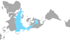
Spanish Empire (marked in dark blue):

  • The vast majority of the Americas are under Spanish control, with major viceroyalties, including:
    • Viceroyalty of New Spain (encompassing much of present-day Mexico, Central America, and parts of the United States)
    • Viceroyalty of Peru (covering most of western South America)
    • Viceroyalty of New Granada (encompassing northern South America, including present-day Colombia, Venezuela, Ecuador)
    • Viceroyalty of the Río de la Plata (covering parts of Argentina, Paraguay, Bolivia, and Uruguay)

    Spain also held territories in the Caribbean (Cuba, Santo Domingo, Puerto Rico), the Philippines (shown in the inset), and parts of Africa and Asia.

Portuguese Empire (marked in green):

  • The Portuguese empire’s primary territory in the Americas is Brazil. By 1790, the Portuguese had expanded control over most of what is now modern Brazil.
  • The map also highlights Portuguese colonies in Africa and Asia:
    • Estado da Índia, which includes colonies such as Goa and Macao.
    • Angola, Mozambique, and parts of the Indian Ocean are shown as Portuguese territories.

Find this map interesting? Please help by sharing it:

Filed Under: History

Click To Get My 10 Best Brilliant Maps For Free:


Other Popular Maps

  • Map Of Hadrian’s Wall With Important Towns & Forts

    Map Of Hadrian’s Wall With Important Towns & Forts

  • Minority Languages in France

    Minority Languages in France

  • Which Of The 10 Largest Cities By Population Are You Closest To?

    Which Of The 10 Largest Cities By Population Are You Closest To?

  • Map Showing Which Countries Have Been Female Led

    Map Showing Which Countries Have Been Female Led

  • Military Camouflages Of The World

    Military Camouflages Of The World

  • America’s Drunkest & Driest Counties Based On Excessive Drinking

    America’s Drunkest & Driest Counties Based On Excessive Drinking

  • Countries Where Politicians & Public Figures Have Been Implicated in the Panama Papers So Far

    Countries Where Politicians & Public Figures Have Been Implicated in the Panama Papers So Far

  • Map Of The Nearest Major U.S. City To Europe, Asia, Africa & Australia

    Map Of The Nearest Major U.S. City To Europe, Asia, Africa & Australia

Comments

  1. Ken says

    July 11, 2025 at 7:56 pm

    The vast majority of the territory CLAIMED by those empires was not actually under their control nor even accurately mapped. The hubris is stunning.

    Reply

Leave a Reply Cancel reply

Your email address will not be published. Required fields are marked *

This site uses Akismet to reduce spam. Learn how your comment data is processed.


Product Reviews · World Atlas · Settlers of Catan · Risk · Game of Thrones · Coloring Books
Globes · Monopoly · Star Wars · Game of Life · Pandemic · Ticket To Ride · Drinks Cabinets
US Locations · UK Locations· Fleet Management
Copyright © 2026 · Privacy Policy · Fair Use, Attribution & Copyright · Contact Us
Follow Us: Newsletter · Facebook · Youtube · Twitter · Threads · BlueSky · LinkedIn · Instagram · Pinterest · Flipboard