
The map above shows International waters in dark blue and Exclusive Economic Zones in light blue. Territorial waters would all fall within the EEZs.
Also have a look at: Territorial Waters & Exclusive Economic Zones (EEZ) Of The World
Here’s a breakdown of what these terms mean and how they differ:
1. International Waters (High Seas)
- Definition: International waters, also known as the high seas, refer to areas of the ocean that are not included in any state’s territorial sea, internal waters, or exclusive economic zone (EEZ). These are beyond any nation’s jurisdiction.
- Extent: Begin beyond 200 nautical miles (about 370 kilometers) from the coast of any country, extending outward.
- Legal Status: Governed by the principle of freedom of the seas, meaning no state may claim sovereignty over these waters.
- Rights and Activities:
- All nations, whether coastal or landlocked, have the right to navigate, fly over, fish, lay submarine cables and pipelines, and conduct scientific research.
- Activities like piracy, human trafficking, and unauthorized broadcasting are illegal under international law in international waters.
2. Territorial Waters
- Definition: Territorial waters are the waters adjacent to a state’s coast, extending up to 12 nautical miles (about 22 kilometers) from the baseline (usually the low-water mark).
- Extent: Up to 12 nautical miles from the coast.
- Legal Status: The coastal state has full sovereignty over these waters, similar to its land territory.
- Rights and Activities:
- The coastal state has exclusive rights to regulate navigation, fishing, resource exploitation, environmental protection, and more.
- Foreign vessels have the right to innocent passage through territorial waters, provided they do not threaten the peace, security, or environment of the coastal state.
3. Exclusive Economic Zones (EEZs)
- Definition: An Exclusive Economic Zone (EEZ) is an area beyond and adjacent to the territorial sea, extending up to 200 nautical miles (about 370 kilometers) from a country’s baseline.
- Extent: From the edge of the territorial sea (12 nautical miles) to 200 nautical miles from the baseline.
- Legal Status: In the EEZ, the coastal state has sovereign rights for the purpose of exploring, exploiting, conserving, and managing natural resources, whether living or non-living, in the waters, seabed, and subsoil.
- Rights and Activities:
- The coastal state controls economic activities, such as fishing, drilling for oil and gas, mining, and marine scientific research.
- Other states have the freedom of navigation and overflight and the laying of submarine cables and pipelines, as long as they do not interfere with the coastal state’s rights.
- EEZs do not grant full sovereignty like territorial waters but provide exclusive rights to the resources.
Summary of Key Differences Between International Waters, Territorial Waters, and Exclusive Economic Zones
| Aspect | International Waters | Territorial Waters | Exclusive Economic Zones (EEZs) |
|---|---|---|---|
| Definition | Waters outside any nation’s jurisdiction | Waters under the jurisdiction of a coastal state | Waters extending up to 200 nautical miles from the baseline of a coastal state |
| Extent | Beyond 200 nautical miles from the coast | Up to 12 nautical miles from the baseline of a coast | From 12 to 200 nautical miles from the baseline |
| Legal Authority | No state has sovereignty; governed by international law | Coastal state has full sovereignty | Coastal state has sovereign rights for resources and economic activities |
| Freedom of Access | Open to all states (freedom of navigation, fishing, etc.) | Regulated by the coastal state; innocent passage allowed | Freedom of navigation and overflight allowed, but economic activities are controlled by the coastal state |
| Resource Rights | Shared resources; subject to international agreements | Exclusive rights to resources within the 12-mile limit | Exclusive rights to natural resources, both living and non-living, up to 200 nautical miles |
How These Zones Fit Together
- 0 to 12 Nautical Miles: Territorial Waters where the coastal state has full sovereignty.
- 12 to 200 Nautical Miles: Exclusive Economic Zone (EEZ) where the coastal state has exclusive rights to resources and certain economic activities, but not full sovereignty.
- Beyond 200 Nautical Miles: International Waters (High Seas) where no state has sovereignty, and all states have the freedom to use the waters under international law.
These maritime zones are defined by the United Nations Convention on the Law of the Sea (UNCLOS), which is the key legal framework for maritime governance.
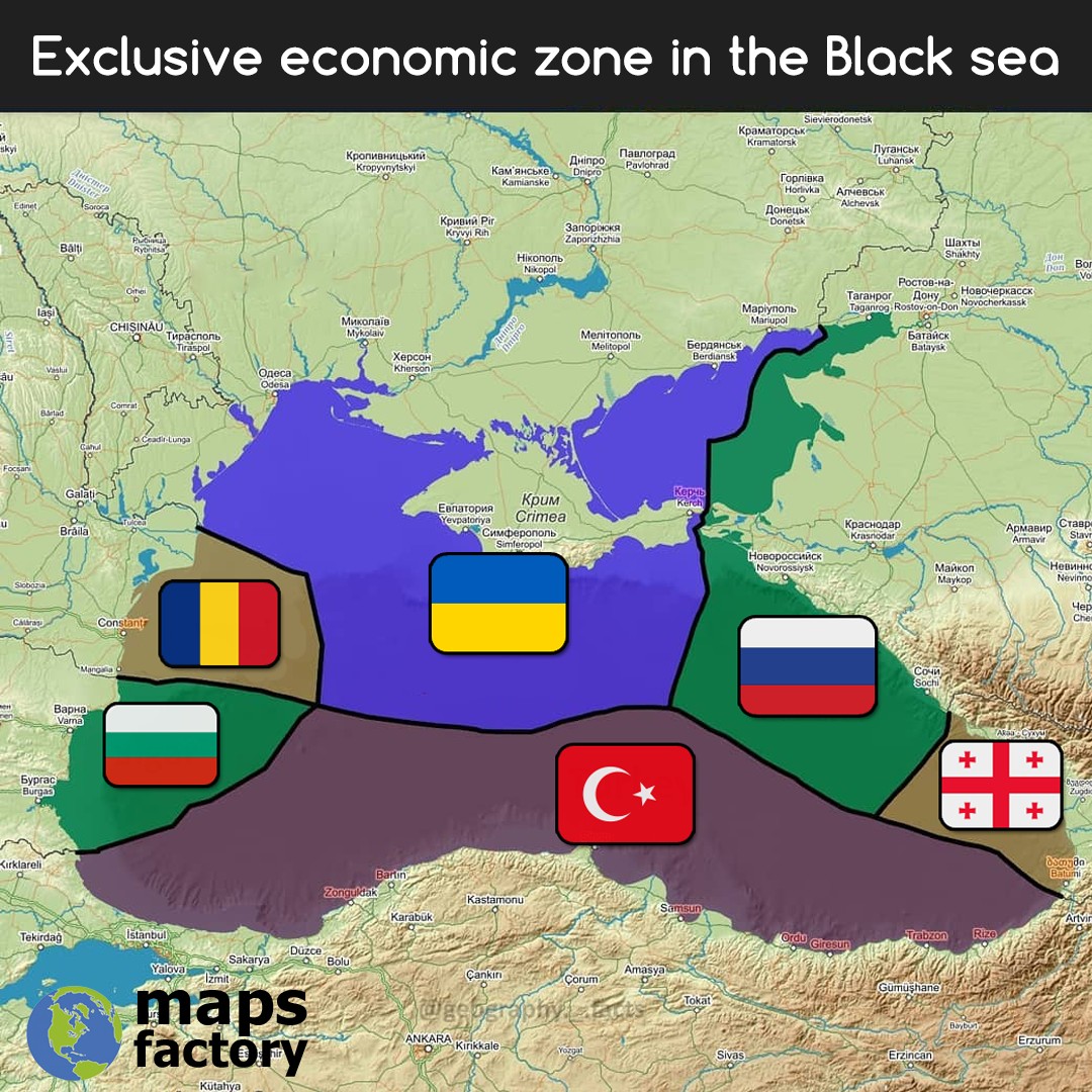
Here’s the De jure EEZ situation in the Black Sea:
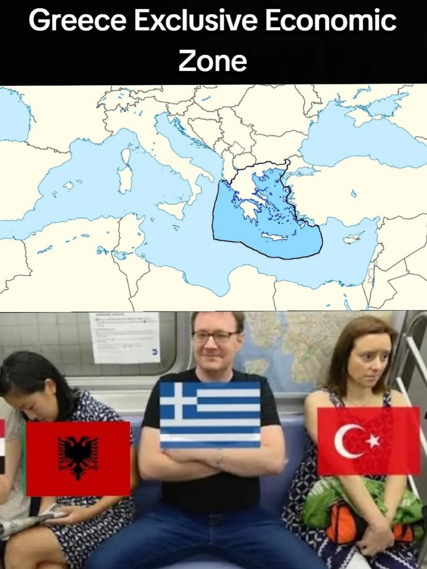
Also this joke:


Leave a Reply