The two maps above show the impact sectarian violence had on Baghdad’s neighbourhoods in terms of ethnic composition between 2006 and 2007.
The Situation in Syria

While the Jackson Pollock style map of The Situation in Syria above is obviously not meant to be taken literally, it does a illustrates just how chaotic the situation remains.
French Mandate for Syria and The Lebanon In 1922

The map above shows the initial 6 states created by the French Mandate for Syria and the Lebanon granted by the League of Nations in 1922.
CENTO: One of The Cold War’s Weirdest & Least Successful Alliances
The Central Treaty Organization (CENTO), also known as the Baghdad Pact or the Middle East Treaty Organization (METO), was one of Cold War’s weirdest and ultimately least successful alliances. This was largely the result of the improbable quintet of nations making up the Organization: Iran, Iraq, Pakistan, Turkey, and the United Kingdom.
Yet an alliance made up of these unlikely allies is not the only interesting thing to note about CENTO.
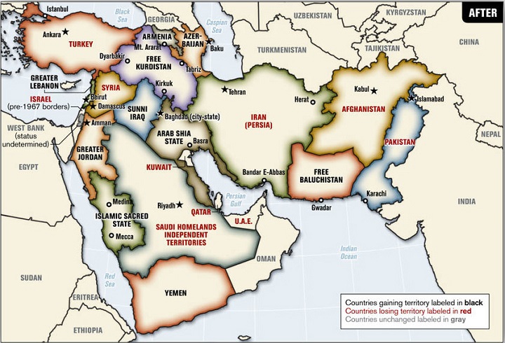
Blood Borders: A Proposal To Redraw A “New Middle East”

The map above is a 2006 proposed plan to redrawn the borders of the Middle East by Ralph Peters, a retired United States Army lieutenant colonel, author, and Fox News commentator. It was original published in the Armed Forces journal in an article titled Blood borders: How a better Middle East would look.
The map would make sweeping changes throughout the region such as:
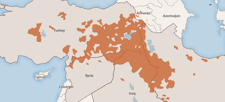
The State Of The Kurds

The map above shows the parts of the Middle East with Kurdish populations and which could make up some or all of a future state of Kurdistan. In a recent article titled The Time of the Kurds, the Council on Foreign Relations explains that:

