Brilliant Maps

Making Sense Of The World, One Map At A Time

  • BOOK!
  • Newsletter
  • Games & Quizes
  • Map Based Polls
  • Map Tools

The World Divided Into 4 Equal Parts Based On Population

Last Updated: December 13, 2024 Leave a Comment

Click To Get My 10 Best Brilliant Maps For Free:

The World Divided Into 4 Equal Parts Based On Population

Map created by justforstev24
The map above shows how crazy world population distribution is. It divides the world into 4 areas of 2 billion people each.

  • India is the centre for one region based in Southern Asia.
  • China is the centre for another region based in and around East Asia.
  • Then you have all of Africa, the Middle East and Oceania (including Indonesia, the world’s 4th most populous country)
  • And finally you have the rest of world including, the US, Europe, Russia and Türkiye. This would also be by far the richest region.

Does the map above surprise you?
Filed Under: World Maps

Click To Get My 10 Best Brilliant Maps For Free:


Other Popular Maps

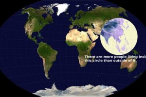
  • More People Live Inside This Circle Than Outside Of It

    More People Live Inside This Circle Than Outside Of It

  • Share Of World GDP By Continent (Nominal & PPP $)

    Share Of World GDP By Continent (Nominal & PPP $)

  • Could Terrible Maps Brilliantly Awful Two State Solution Map Work?

    Could Terrible Maps Brilliantly Awful Two State Solution Map Work?

  • A Beautiful Hand-Drawn Map Of The British Isles during the First War of Scottish Independence

    A Beautiful Hand-Drawn Map Of The British Isles during the First War of Scottish Independence

  • Map of The 19 EuroVelo Routes In Europe

    Map of The 19 EuroVelo Routes In Europe

  • Hitler, Stalin, Trotsky, Freud & Franz Joseph All Lived Within A Couple Of Miles Of Each Other On The Eve Of WW1

    Hitler, Stalin, Trotsky, Freud & Franz Joseph All Lived Within A Couple Of Miles Of Each Other On The Eve Of WW1

  • 2016 US Presidential Election Map By County & Vote Share

    2016 US Presidential Election Map By County & Vote Share

  • Political Map of 48 Hypothetical US states Centered Around The 48 Largest Urban Areas

    Political Map of 48 Hypothetical US states Centered Around The 48 Largest Urban Areas

Leave a Reply Cancel reply

Your email address will not be published. Required fields are marked *

This site uses Akismet to reduce spam. Learn how your comment data is processed.


Product Reviews · World Atlas · Map Posters · Settlers of Catan · Risk · Game of Thrones · Coloring Books · Globes · Monopoly · Star Wars · Game of Life · Pandemic · Ticket To Ride · Drinks Cabinets
Size Comparisons · US Locations · Flight Maps · Fleet Management
Copyright © 2026 · Privacy Policy · Fair Use, Attribution & Copyright · Contact Us
Follow Us: Newsletter · Facebook · Youtube · Twitter · Threads · BlueSky · LinkedIn · Instagram · Pinterest · Flipboard