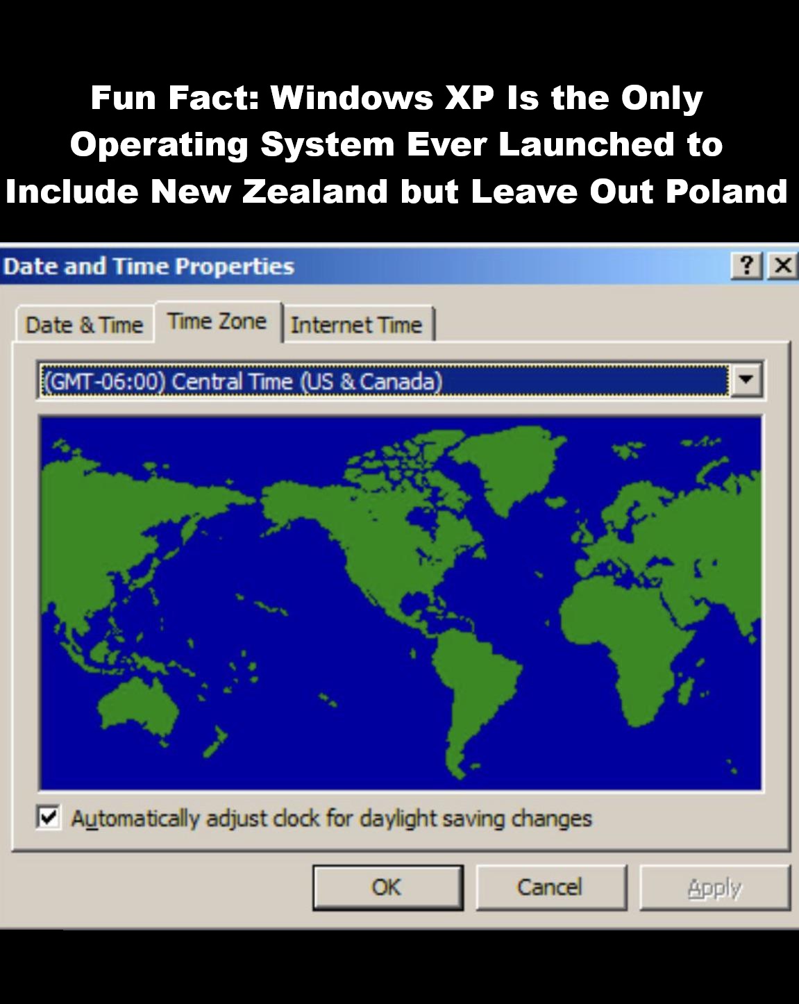
The map above shows an odd fact, it includes New Zealand (frequently left off maps) BUT removes Poland for some bizarre reason.
Here’s the story from redditor Derisiak:
I was quite surprised to hear this, so I went and tried to understand in detail how this could have happened, and it’s pretty interesting.
It’s because of a glitch involving time zones. In the 1990s until the early 2000s, the different versions of Microsoft Windows had an interactive World map (just as above) that the computer users could use to select their time zone. The countries of each time zone would then show up on the screen.
Poland and Western/Central Europe both are in the same time zone (GMT+1) and both enter daylight saving time in spring, until autumn. But, back in the 1980-1990s, both didn’t change the clocks at the same time. So, in order to perfectly harmonize the clocks of Polish computers, Microsoft had a separate entry for the country : the Warsaw Time.
Therefore there were two entries, one for Western/Central Europe, one specifically for Poland which would be the only country to show on the map if its time zone was chosen.
In 1996 Poland eventually changed its daylight saving time rules to harmonize with the rest of Europe, so Poland was entering daylight saving time at the same time as the other European countries.
When Windows XP was developed, the engineers noticed Poland’s change regarding time zones, so they aimed to group Poland with the rest of Western and Central Europe, and deleted the Warsaw time entry… But ? They forgot to update Poland on the Interactive map! So when Warsaw Time was deleted, so was Poland on the map.
And that’s how the “Polish Sea” came into existence.
(TLDR : In 1996 Poland updated its time zone rules and Microsoft failed to update their software’s data properly, so they accidentally deleted Poland from Windows XP’s interactive time zones map)
PS : Later on the glitch was fixed.




Leave a Reply