The 11 maps below show the evolution of Prussia using NASA’s Blue Marble Satellite Map.
I hope you enjoy!
Duchy of Prussia: 1525
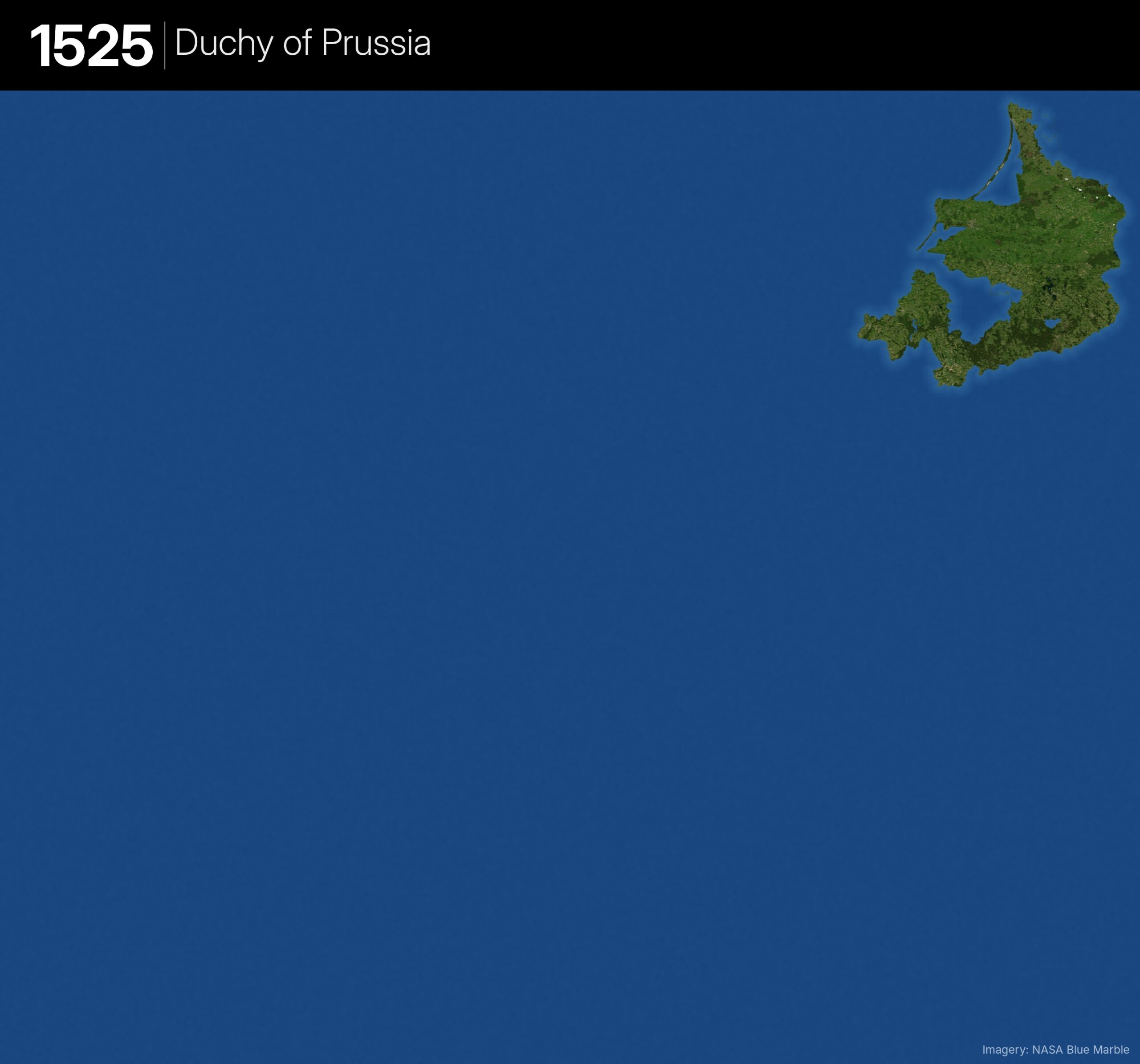
- Albert of Brandenburg-Ansbach secularises the Teutonic Order’s state and becomes Duke of Prussia, a vassal of the Polish crown
- Land: Samland, Natangen, Masuria, the Oberland, Soldau and Memelland
- Water: Warmia (a prince-bishopric) and Royal Prussia (Elbing, Marienburg, Culmerland, Pomerelia), all under Poland
Brandenburg-Prussia: 1618
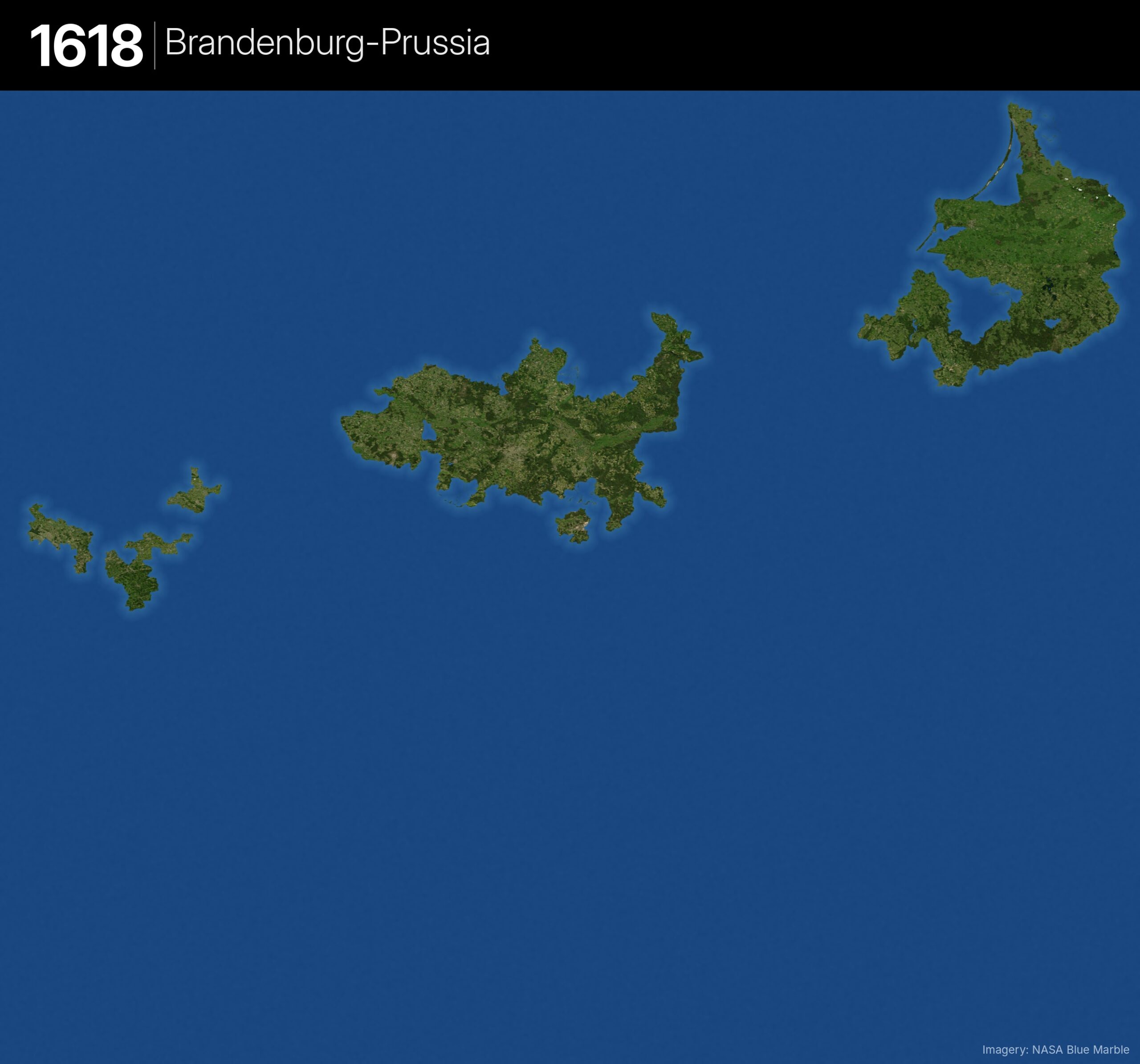
- The Hohenzollern Electors of Brandenburg inherit the Duchy of Prussia, uniting the two in personal union
- Prussia is still a Polish fief and is not physically connected to Brandenburg
Change from previous
- + Brandenburg: Kurmark, Altmark, Neumark and Cottbus-Peitz
- + Cleves, Mark and Ravensberg in the far west (Jülich-Cleves inheritance, 1614)
- + Gimborn (part of Mark 1614–31)
- Saxon and Lusatian enclaves inside Brandenburg (Jüterbog, Belzig, Lower Lusatia) stay as water
Kingdom of Prussia: 1701
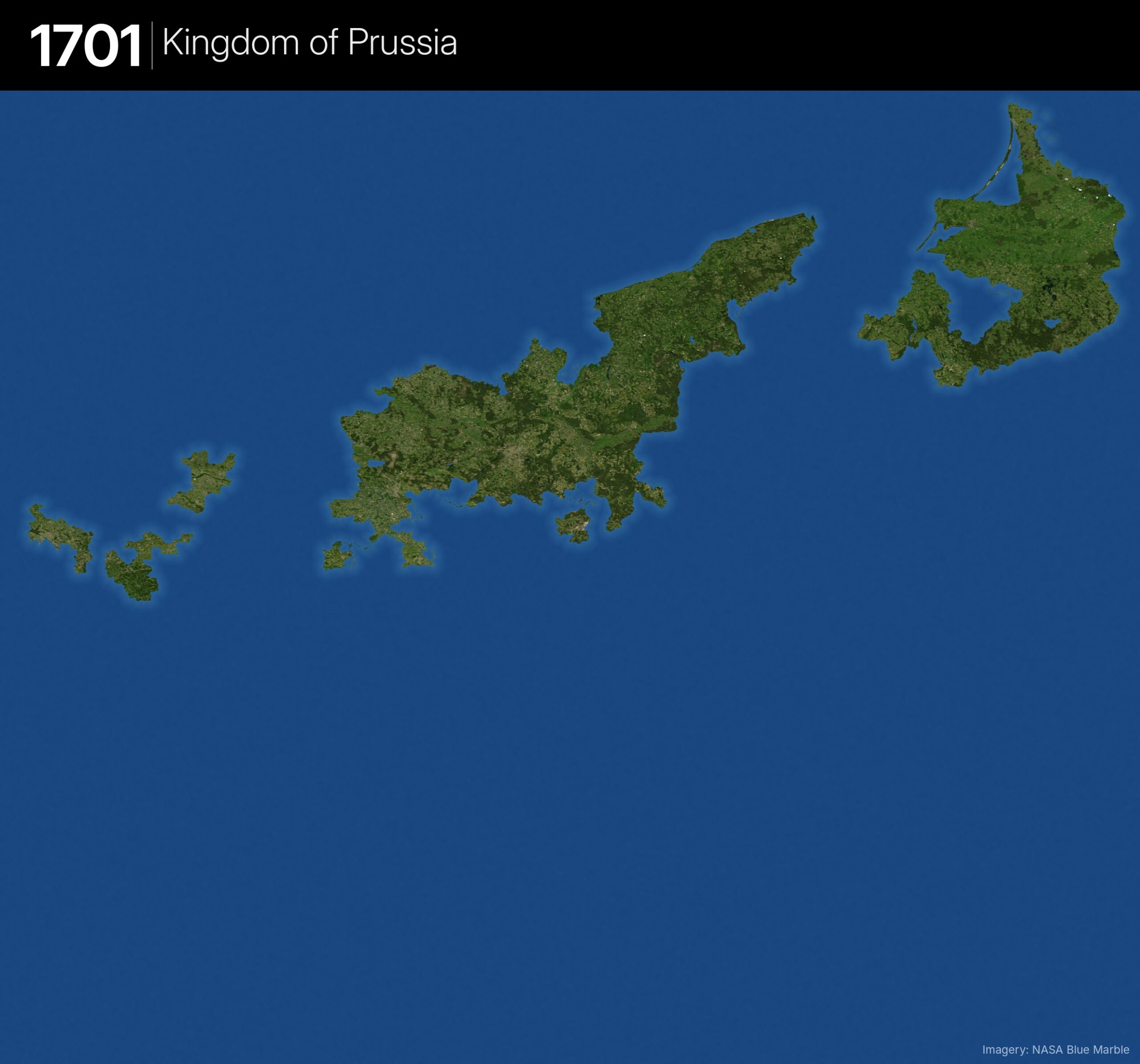
- Elector Frederick III crowns himself King Frederick I in Königsberg
- Prussia is now fully sovereign, free of Polish overlordship since 1657
Change from previous
- + Farther Pomerania, Minden and Halberstadt (Peace of Westphalia, 1648)
- + Magdeburg (1680) and Hohnstein
- + Lauenburg-Bütow and Draheim (from Poland, 1657)
- + The strip east of the Oder around Gryfino (1679)
- Calvörde stays as a hole (Brunswick). Lingen and Moers came in 1702, so are not yet shown
Prussia At The Death of Frederick the Great: 1786
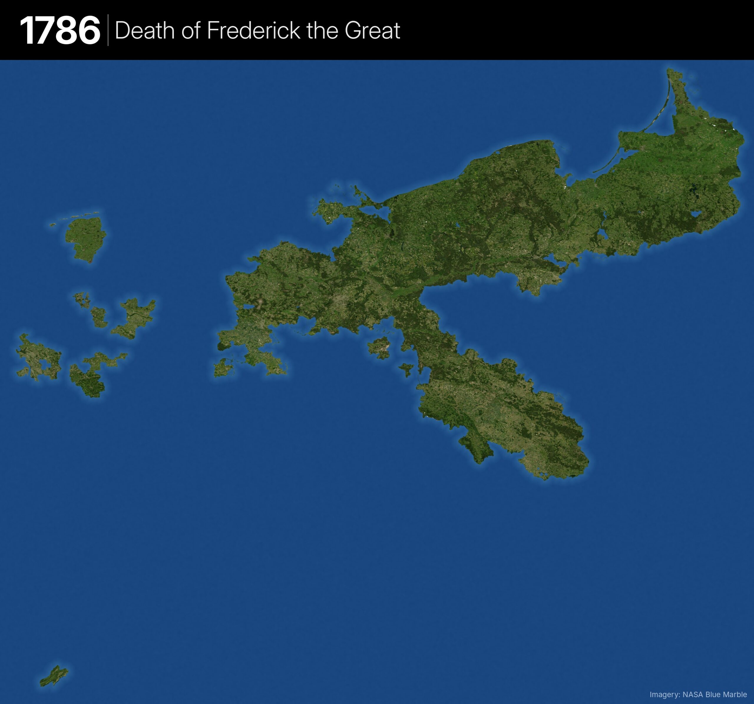
- Frederick the Great’s conquests and the First Partition of Poland finally link East Prussia to Brandenburg
Change from previous
- + Silesia and Glatz (taken from Austria, 1742)
- + West Prussia, Warmia and the Netze District (First Partition of Poland, 1772)
- + Swedish Pomerania up to the Peene, including Stettin (1720)
- + East Frisia (1744)
- + Moers, Lingen, Tecklenburg, Upper Guelders, Wernigerode and a share of Mansfeld
- + Neuchâtel in Switzerland (1707)
- Danzig and Thorn still water (Prussian only from 1793)
Prussia After the Treaty of Tilsit: 1807
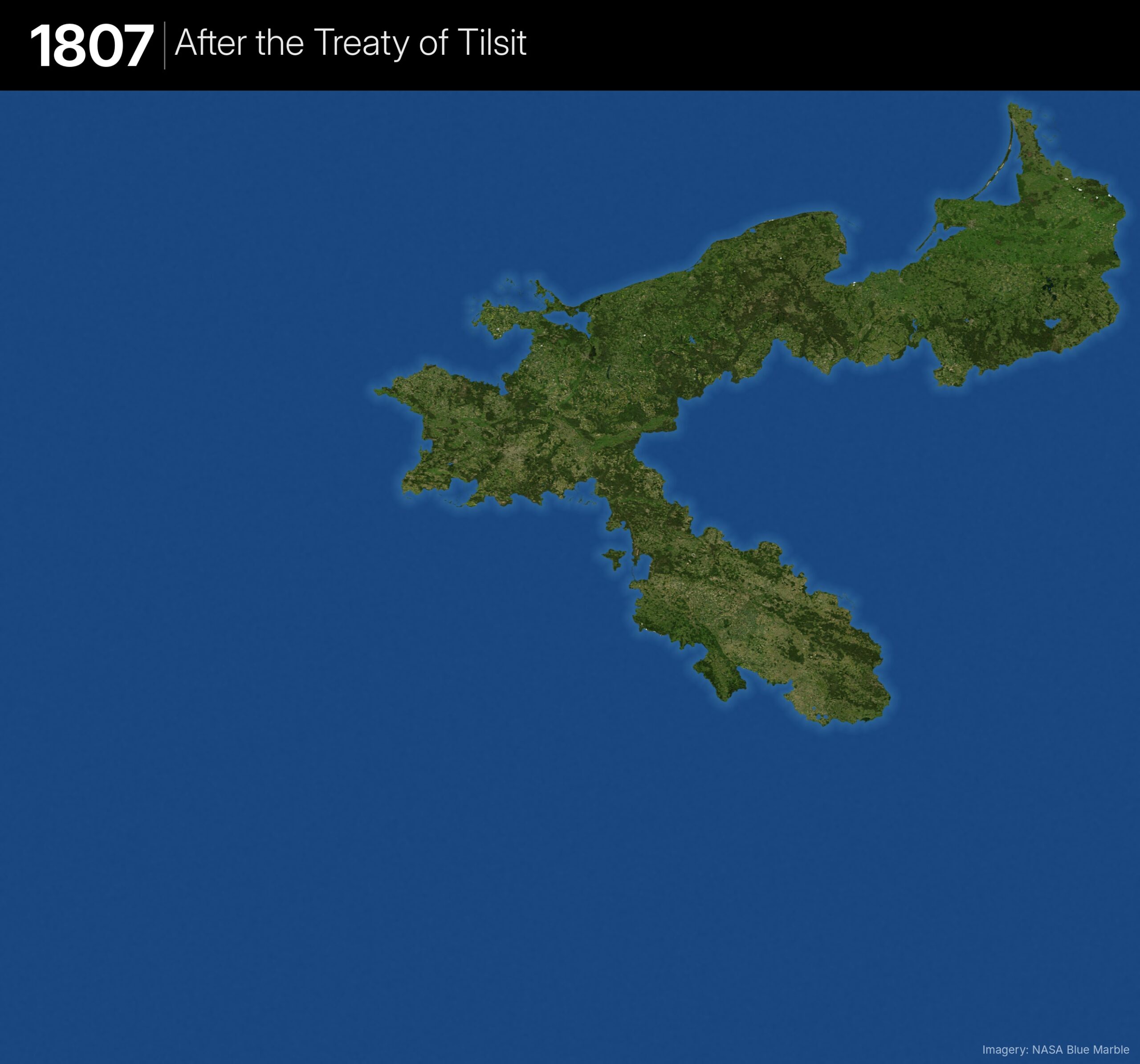
- Napoleon strips Prussia back to roughly the lands east of the Elbe
Change from previous
- − Every territory west of the Elbe (Cleves, Mark, Ravensberg, Minden, East Frisia, Lingen, Halberstadt, western Magdeburg, etc.)
- − Neuchâtel (lost 1806)
- − Culmerland, Thorn area and the southern Netze District (to the Duchy of Warsaw)
- − Cottbus (to Saxony)
- What remains: East Prussia, a reduced West Prussia, Pomerania, Brandenburg, Silesia and part of the Netze.
Prussia After the Congress of Vienna: 1815
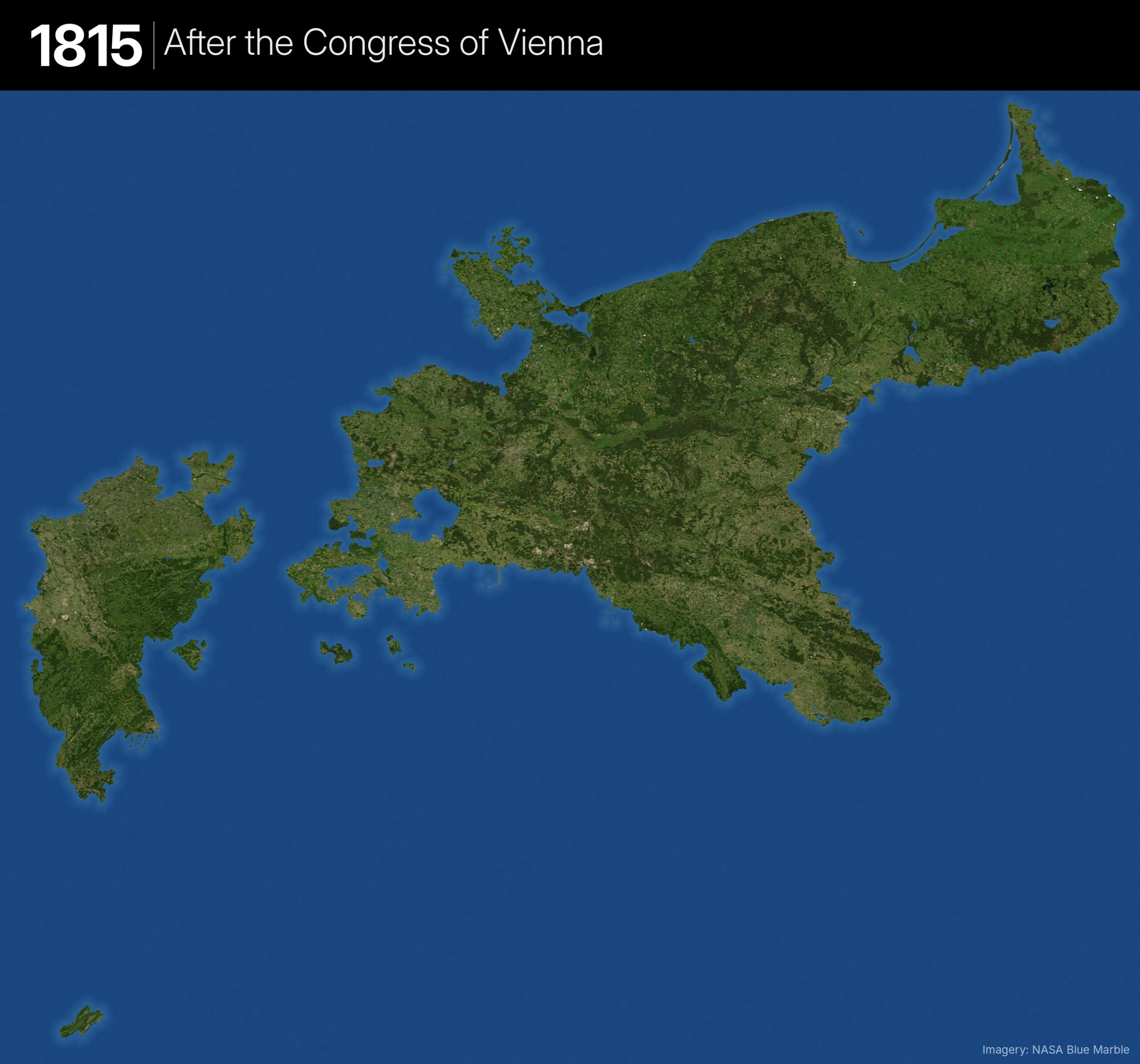
- Prussia re-emerges larger than ever, split into an eastern block and a western block on the Rhine
- Organised into provinces: East & West Prussia, Posen, Silesia, Pomerania, Brandenburg, Saxony, Westphalia and the Rhine Province
Change from previous
- + Posen, Danzig and Thorn, plus the lands lost to the Duchy of Warsaw
- + Swedish Pomerania and Rügen
- + Northern Saxony (Province of Saxony), Upper and Lower Lusatia, Cottbus back
- + Westphalia and the Rhine Province (the big new western block)
- + Neuchâtel restored
- Saarbrücken and Saarlouis included, though they only came in November 1815
Prussia after the war with Denmark: 1865
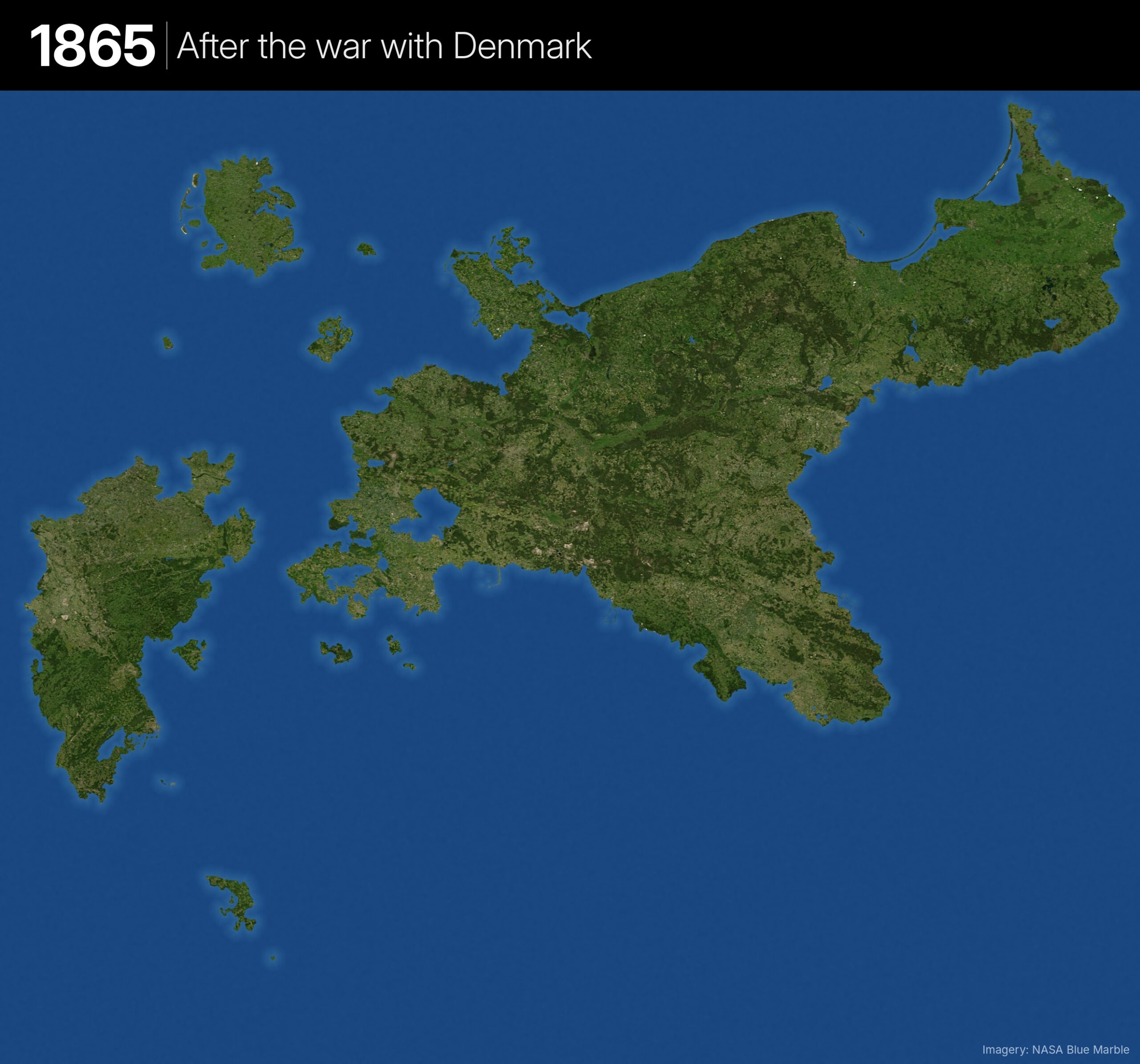
- Prussia and Austria have taken the Elbe duchies from Denmark; under the Gastein Convention Prussia runs Schleswig and Austria runs Holstein
Change from previous
- + Schleswig (Prussian-administered)
- + Lauenburg (bought 1865)
- + Hohenzollern-Hechingen and Sigmaringen in the south (1850)
- + Lichtenberg (1834) and the Jade territory, future Wilhelmshaven (1853)
- − Neuchâtel (given up 1857)
- Holstein stays water. The Jade territory is drawn as all of Wilhelmshaven, which overstates it
Prussia In the North German Confederation: 1867
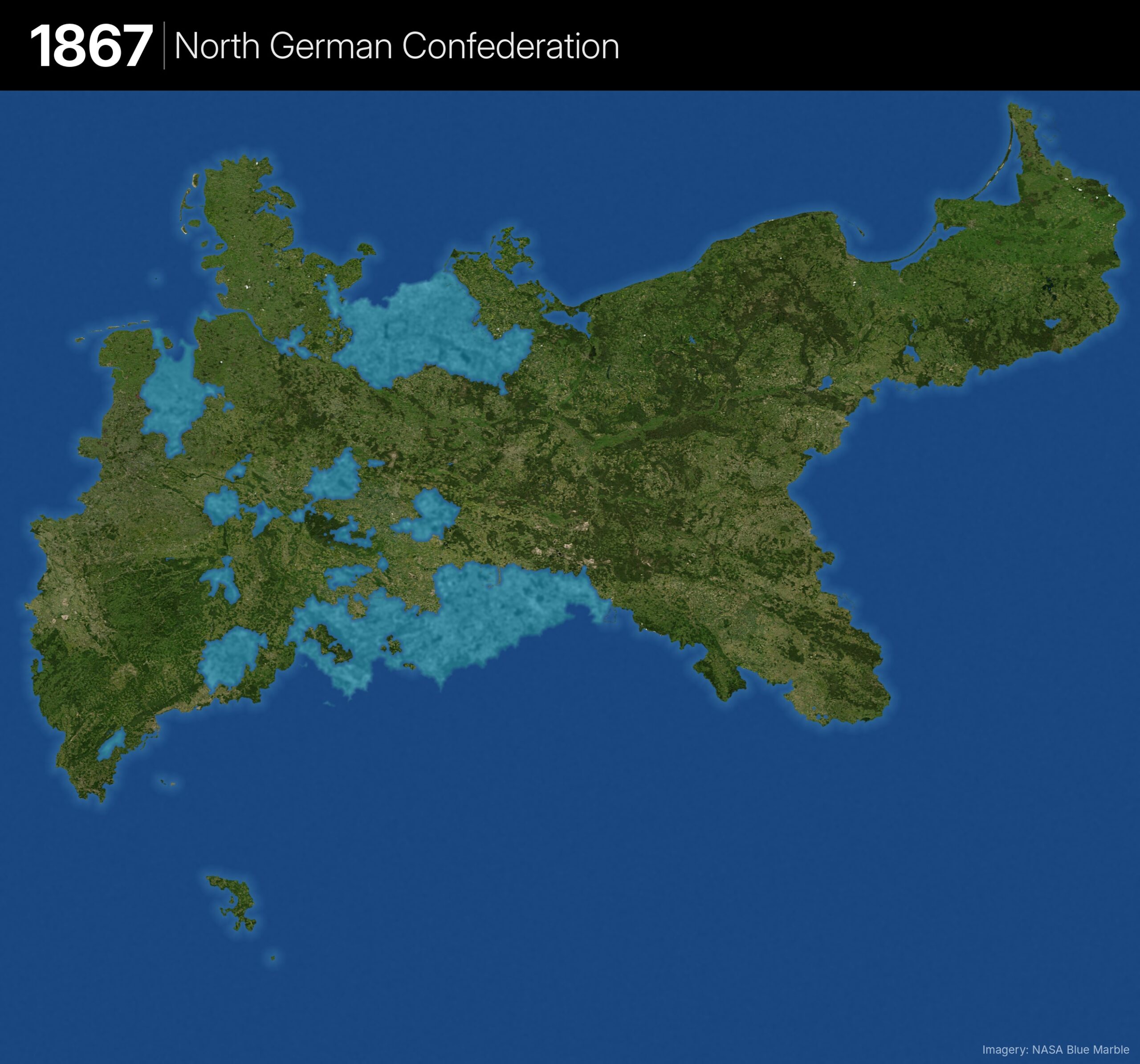
- After defeating Austria, Prussia annexes much of northern Germany and leads the new North German Confederation
- Prussia is land; other Confederation members are a shallow lagoon; southern Germany is deep water
Change from previous
- + Holstein
- + Kingdom of Hanover — finally joining the eastern and western blocks
- + Hesse-Kassel, Nassau, Frankfurt and Hesse-Homburg
- − Ahrensbök (to Oldenburg, 1867)
- New lagoon layer: Saxony, Mecklenburg, Oldenburg, Brunswick, the Thuringian states, northern Hesse and the other members
- Bavaria, Württemberg, Baden and southern Hesse remain deep water
Prussia in the German Empire: 1871
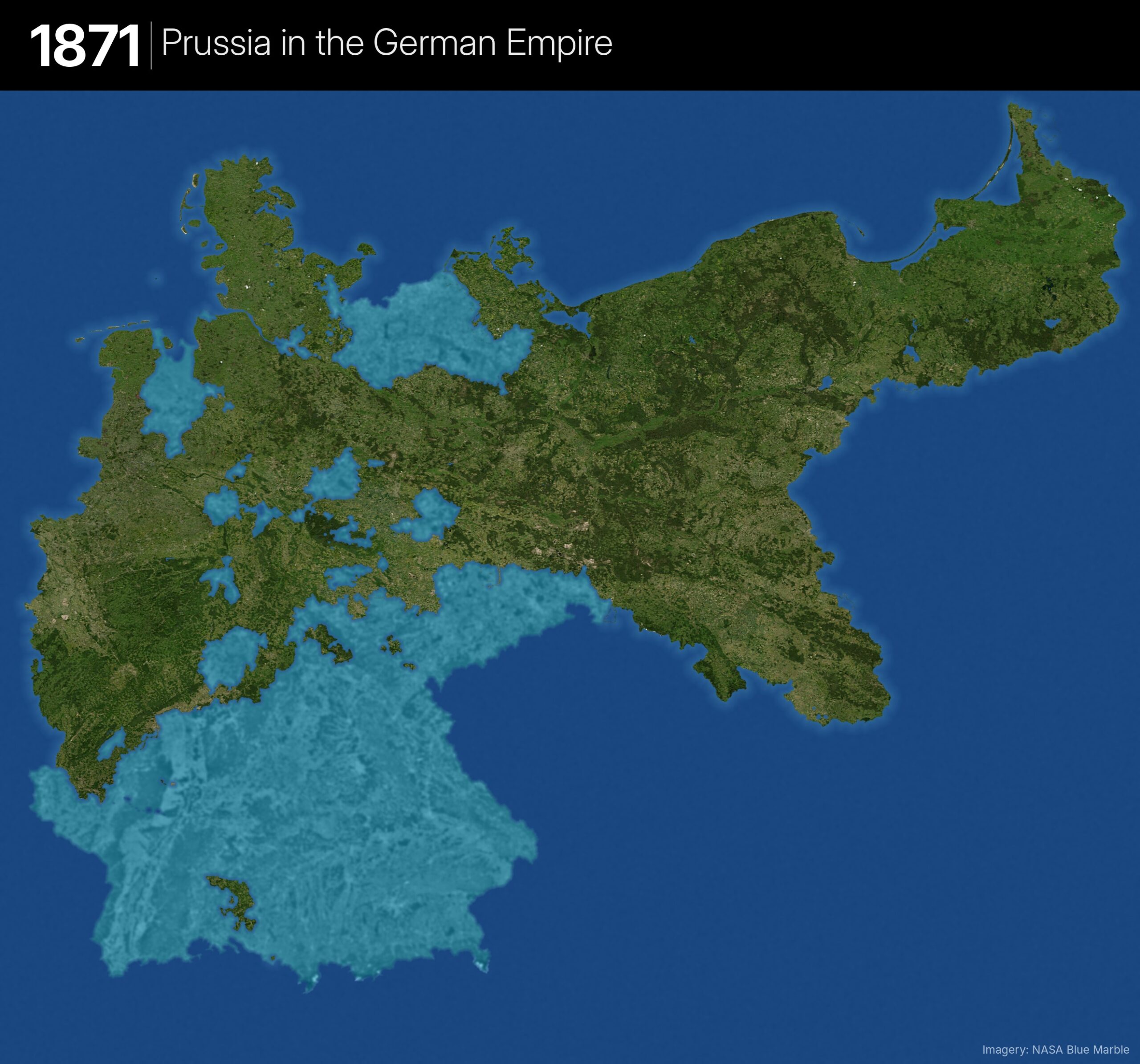
- Prussia as the dominant state within the new German Empire
Change from previous
- Prussia itself is unchanged
- Bavaria, Württemberg, Baden, southern Hesse and the new Alsace-Lorraine switch from deep water to lagoon
Satellite Map of The German Empire In 1871
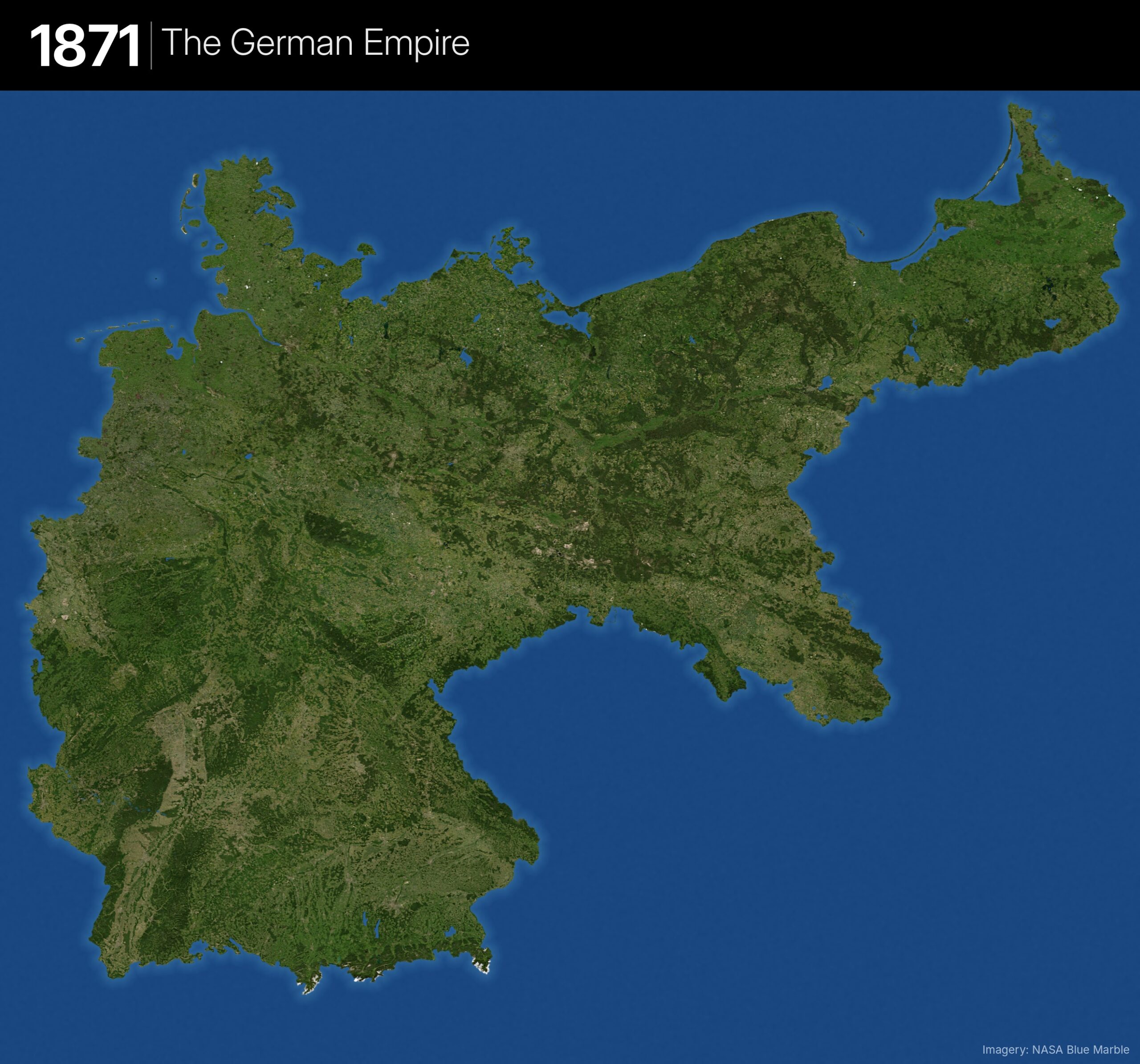
- The whole German Empire shown as land, for comparison with Prussia’s share
Change from previous
- All lagoon states become land: the whole Empire, including Alsace-Lorraine, North Schleswig, Memel and Posen
Free State of Prussia in 1918
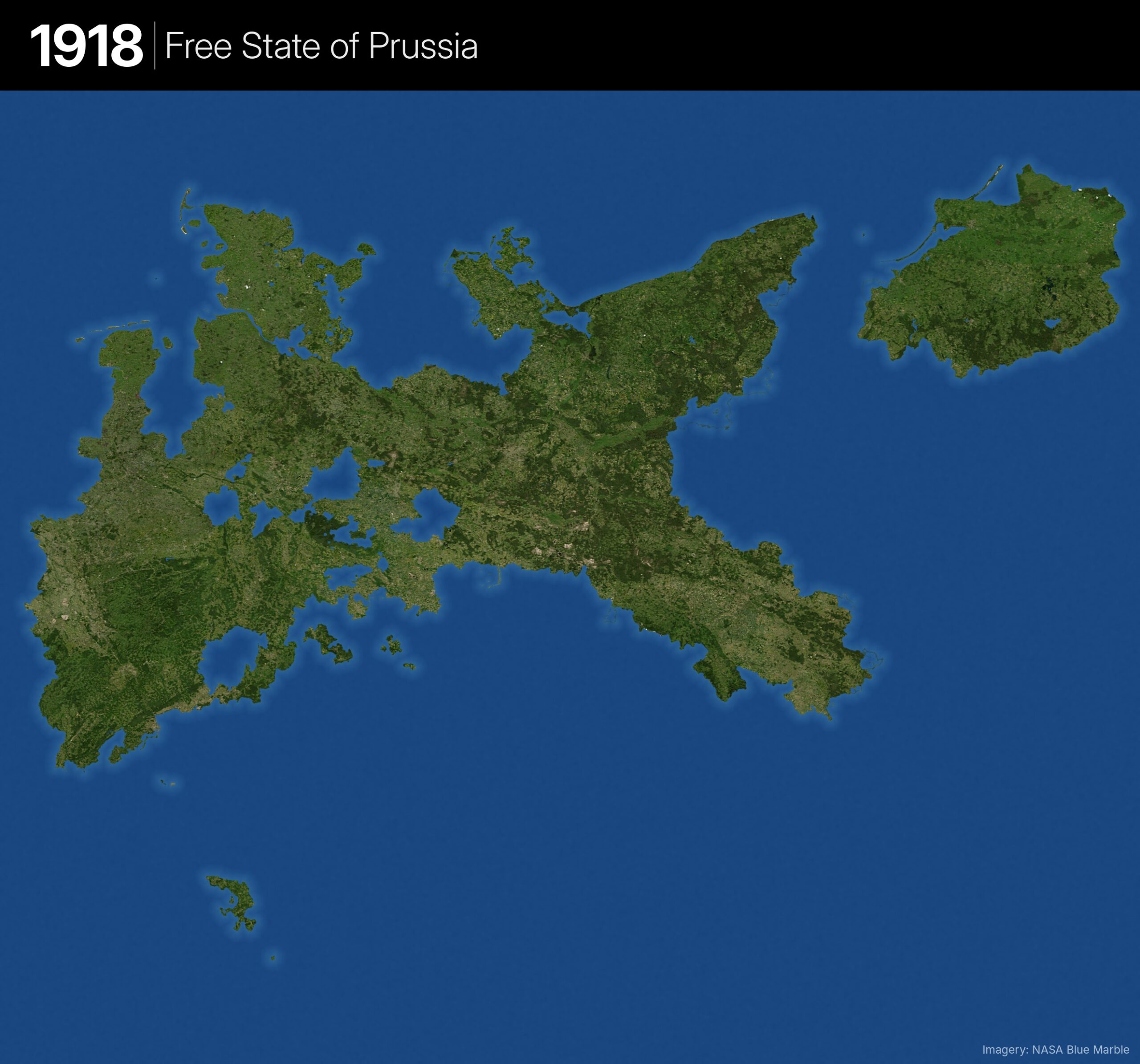
- The monarchy falls and Prussia becomes a republic within Weimar Germany
- Back to a Prussia-only view (other German states are water again)
- Drawn with its 1920s borders, after the Treaty of Versailles took effect
Change from previous (vs. 1867/1871 Prussia)
- − The Polish Corridor and most of Posen
- − Danzig (Free City) and Memelland
- − East Upper Silesia (to Poland) and Hlučín (to Czechoslovakia)
- − North Schleswig (to Denmark) and Eupen-Malmedy (to Belgium)
- − The Saar (League of Nations mandate)
- + Pyrmont (1922) and Waldeck (1929)
- East Prussia is once again cut off from the rest of Prussia, echoing the 1618 map
The Free State of Prussia will nominally live on under the Nazis throughout World War 2. It was finally disbanded in 1947 bringing Prussian history to an end over 400 years after its founding.




Leave a Reply