
All of these stunning elevation maps of the world’s continents (except Australia and Antarctica) are the brain child of cstats1 who you can follow on X/Twitter here and Instagram here.
And if you’d like to support them you buy something from their Amazon shop here.
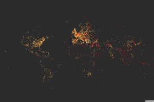
The first map above is an elevation map of Europe. Here are the highest and lowest points in Europe:
- Highest Point In Europe: Mount Elbrus, Russia (5,642 m / 18,510 ft)
- Lowest Point In Europe: Caspian Sea, Russia (−28 m / −92 ft)
- Difference Between Highest and Lowest Points: 5,670 m (18,602 ft)
Elevation Map of North America

- Highest Point In North America: Denali, Alaska, United States (6,190.5 m / 20,310 ft)
- Lowest Point In North America: Badwater Basin, California, United States (−85.0 m / −279 ft)
- Difference Between Highest and Lowest Points: 6,275.5 m (20,589 ft)
Elevation Map of the Contiguous United States

- Highest Point in the Contiguous United States: Mount Whitney, California (4,421 m / 14,505 feet)
- Lowest Point in the Contiguous United States: Badwater Basin, California, United States (−85.0 m / −279 ft)
- Difference Between Highest and Lowest Points: 4,506 m (14,784 ft)
Elevation Map of South America

- Highest Point In South America: Aconcagua, Argentina (6,960 m / 22,835 ft)
- Lowest Point In South America: Laguna del Carbón, Argentina (−105 m / −344 ft)
- Difference Between Highest and Lowest Points: 7,065 m (23,179 ft)
Elevation Map of Africa

- Highest Point In Africa: Kilimanjaro, Tanzania (5,892 m / 19,331 ft)
- Lowest Point In Africa: Lake Assal, Djibouti (−155 m / −509 ft)
- Difference Between Highest and Lowest Points: 6,047 m (19,839 ft)
Elevation Map of Asia

And last but certainly not least is Asia, where both the highest and lowest points on earth can be found.
- Highest Point In Asia: Mount Everest, China and Nepal (8,848 m 29,029 ft)
- Lowest Point In Asia: Dead Sea, Israel, Jordan, and Palestine (−428 m / −1,404 ft)
- Difference Between Highest and Lowest Points: 9,276 m (30,433 ft)
Finally, in case you’re curious here are the highest and lowest points in Australia/Australasia and Antarctica restrictively.
Australasia:
- Highest Point In Australasia: Aoraki / Mount Cook, New Zealand (3,724 m 12,218 ft)
- Lowest Point In Australasia: Lake Eyre, Australia (−15 m / −49 ft)
- Difference Between Highest and Lowest Points: 3,739 m (12,267 ft)
Antarctica:
- Highest Point In Antarctica: Mount Vinson, Antarctica (4,892 m / 16,050 ft)
- Lowest Point In Antarctica: Southern Ocean (sea level)
- Difference Between Highest and Lowest Points: 4,892 m (16,050 ft)
Enjoy these maps? Then please share them:


Leave a Reply