
One of CIA’s oldest and most recognizable intelligence publications, The World Factbook, has sunset. The World Factbook served the Intelligence Community and the general public as a longstanding, one-stop basic reference about countries and communities around the globe.
Link to the History of The World Factbook.
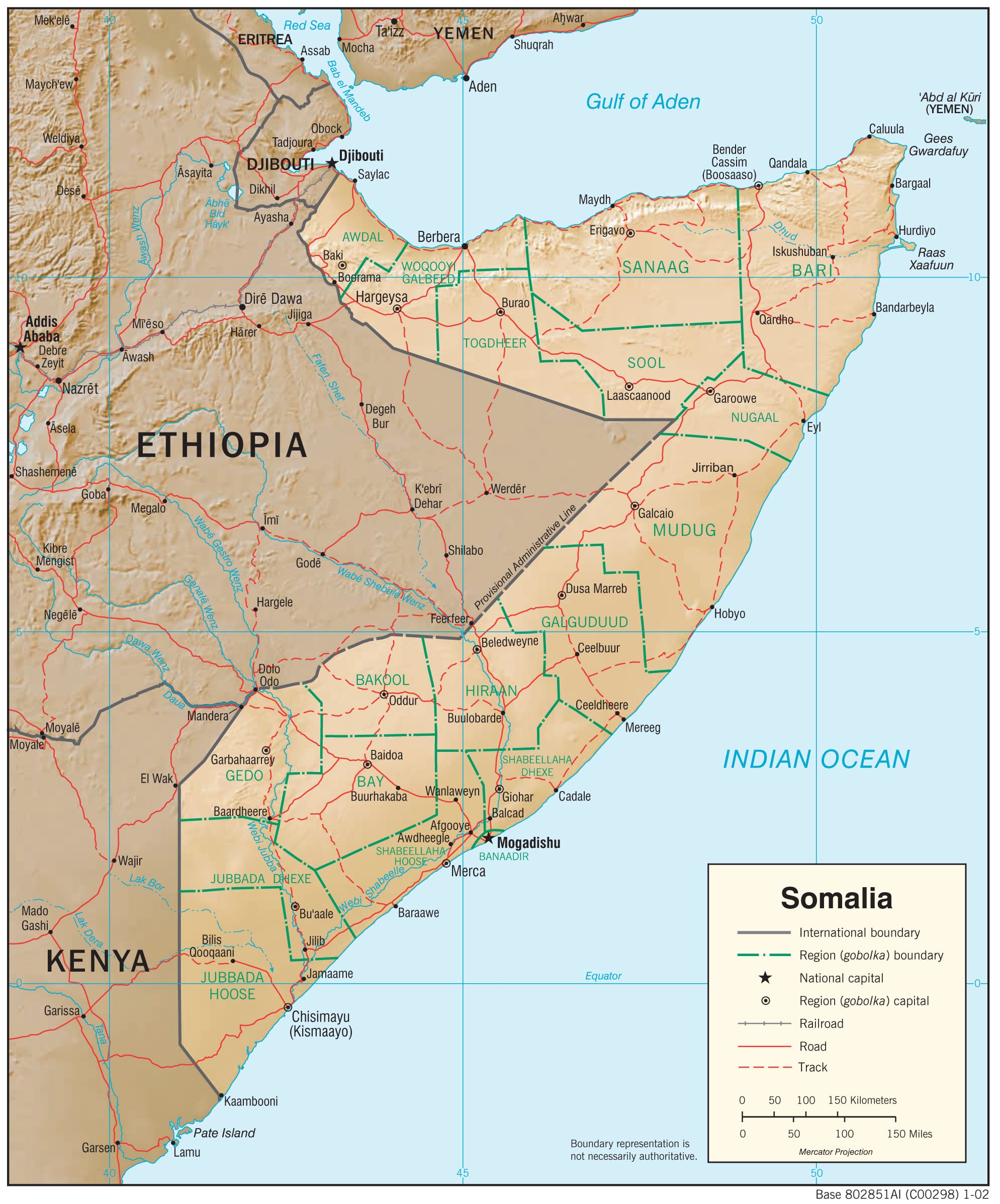
Where is Somalia? Location Map

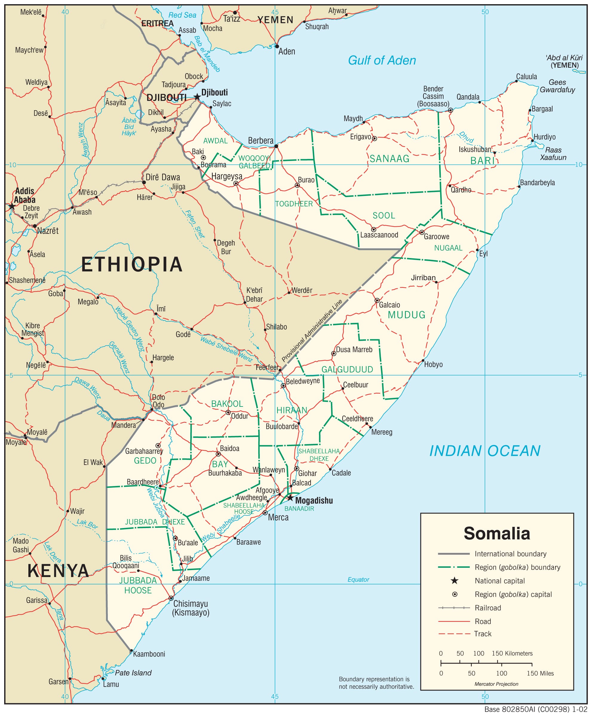
Other Maps of Somalia from the CIA (2008):
Somalia Physiography Map
Somalia Transportation Map
Somalia Facts
Full Official Name: Federal Republic of Somalia
Demonym: Somali
Flag:

Area
Total Area: 637,657 km²
Total Land Area: 627,337 km²
Total Water Area: 10,320 km²
Demographics
Population: 13,017,273
Population Growth Rate: 2.55% (2024 est.)
Largest City: Mogadishu (Population: 2,726,815)
Ethnic Groups: predominantly Somali with lesser numbers of Arabs, Bantus, and others
Languages: Somali (official), Arabic (official), Italian, English
Religions: Muslim 99.9% (Sunni Muslim 98.1%, Shia Muslim 1.2%, Islamic schismatic 0.6%), ethnic religionist 0.1% (2020 est.)
Economy
Currency: Somali shilling
Real GDP at Purchasing Power Parity ($ PPP): $26.351 billion (2023 est.)
GDP per capita (PPP): $1,500 (2023 est.)
Exports Value Per Year: $819 million (2014 est.)
Biggest Export Partners: UAE 50%, Oman 30%, Bulgaria 3%, India 3%, Kuwait 2% (2022)
Imports Value Per Year: $94.43 billion (2018 est.)
Biggest Import Partners: UAE 33%, China 19%, India 16%, Turkey 7%, Ethiopia 5% (2022)
Government
Type: federal parliamentary republic
Capital City: Mogadishu (Population: 2,726,815)
Other Facts
Time Zone: UTC+3 (EAT)
Country Code: SO
Internet TLD: .so
Climate Map of Somalia

Topographic Map of Somalia

Flag Map of Somalia

Odd Shape?
Somalia was included in my list of The 17 Oddest Shaped Countries In The World & How They Came To Be.
Somalia’s shape is famously odd because it resembles a large “number 7” or a horn protruding sharply into the Indian Ocean.
This distinctive shape has earned it the nickname “Horn of Africa.”
Here’s a clear explanation of why Somalia’s shape is odd and how it came to be:
What’s Odd About Somalia’s Shape?
- Somalia has a striking, elongated horn-like appearance, extending sharply eastward into the Indian Ocean.
- Its shape is unlike most countries, featuring an abrupt angle that makes it easily recognizable on any map.
- This horn creates the easternmost projection of Africa, giving Somalia strategic importance historically and geographically.
How Did Somalia Get Its Odd Shape?
Tectonic Plate Movement:
- Somalia sits at the edge of the East African Rift Valley, a geological region where the African Plate is splitting apart.
- Over millions of years, this rift has caused the continent to slowly separate, pulling Somalia away from mainland Africa and creating a pronounced “horn.”
Geological Activity and Erosion:
- Geological uplift, combined with erosion from wind, ocean currents, and rivers, sculpted the coastline sharply outward.
- Erosion and geological forces further defined the angular coastline, shaping the protrusion clearly visible today.
Colonial History and Boundary Drawing:
- While the basic shape was geological, modern political boundaries were defined during the European colonial period (late 19th century to mid-20th century).
- Britain, Italy, and France drew straight lines and negotiated borders arbitrarily, solidifying the shape into the political boundaries we recognize today.
Effects of Somalia’s Odd Shape:
- Strategic location: Control over critical shipping routes along the Indian Ocean and Red Sea, historically important for trade.
- Climate diversity: Long coastline results in diverse climate zones—from dry deserts to coastal areas influenced by monsoon winds.
- Political and economic impacts: Its shape has influenced conflicts and competition for control over strategic points (e.g., Gulf of Aden, piracy issues).
Read More About Somalia
- Official Somalia Website
- Somalia On The CIA World Factbook
- Somalia On Wikipedia
- Somalia On Britannica
See other country maps here.