
One of CIA’s oldest and most recognizable intelligence publications, The World Factbook, has sunset. The World Factbook served the Intelligence Community and the general public as a longstanding, one-stop basic reference about countries and communities around the globe.
Link to the History of The World Factbook.
Where Is Cameroon? Location Map

List of Land & Sea Borders For Cameroon
- Nigeria (Land + Sea): 1,975 km (1,227 miles) land / 111 km (69.0 miles) sea
- Chad (Land): 1,116 km (693 miles)
- Central African Republic (Land): 901 km (560 miles)
- Equatorial Guinea (Land + Sea): 183 km (114 miles) land / 363 km (226 miles) sea
- Republic of the Congo (Land): 494 km (307 miles)
- Gabon (Land): 349 km (217 miles)
Cameroon Facts
Full Official Name: Republic of Cameroon
Demonym: Cameroonian
Flag:

Area
Total Area: 475,440 km²
Total Land Area: 472,710 km²
Total Water Area: 2730 km²
Demographics
Population: 30,966,105
Population Growth Rate: 2.71% (2024 est.)
Largest City: Douala (Population: 5,066,000)
Ethnic Groups: Bamileke-Bamu 22.2%, Biu-Mandara 16.4%, Arab-Choa/Hausa/Kanuri 13.5%, Beti/Bassa, Mbam 13.1%, Grassfields 9.9%, Adamawa-Ubangi, 9.8%, Cotier/Ngoe/Oroko 4.6%, Southwestern Bantu 4.3%, Kako/Meka 2.3%, foreign/other ethnic group 3.8% (2022 est.)
Languages: 24 major African language groups, English (official), French (official)
Religions: Roman Catholic 33.1%, Muslim 30.6%, Protestant 27.1% other Christian 6.1%, animist 1.3%, other 0.7%, none 1.2% (2022 est.)
Economy
Currency: Central African CFA franc
Real GDP at Purchasing Power Parity ($ PPP): $138.925 billion (2023 est.)
GDP per capita (PPP): $4,800 (2023 est.)
Exports Value Per Year: $8.641 billion (2022 est.)
Biggest Export Partners: Netherlands 19%, France 15%, India 14%, Spain 10%, China 8% (2022)
Imports Value Per Year: $9.759 billion (2022 est.)
Biggest Import Partners: China 39%, France 8%, India 6%, Belgium 4%, UAE 4% (2022)
Government
Type: presidential republic
Capital City: Yaounde (Population: 2,765,600)
Other Facts
Time Zone: UTC+1 (WAT)
Country Code: CM
Internet TLD: .cm
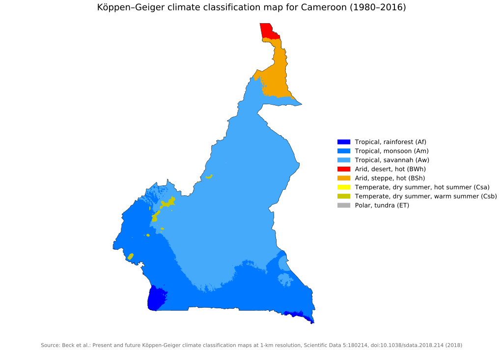
Climate Map of Cameroon
Topographic Map of Cameroon
